- Bryans Road, Maryland
Infobox Settlement
official_name = Bryans Road, Maryland
settlement_type = CDP
nickname =
motto =
imagesize =
image_caption =
image_
imagesize =
image_caption =
image_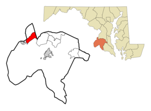
mapsize = 250x200px
map_caption = Location of Bryans Road, Maryland
mapsize1 =
map_caption1 =subdivision_type = Country
subdivision_name =United States
subdivision_type1 = State
subdivision_name1 =Maryland
subdivision_type2 = County
subdivision_name2 = Charles
government_footnotes =
government_type =
leader_title =
leader_name =
leader_title1 =
leader_name1 =
established_title =
established_date =unit_pref = Imperial
area_footnotes =area_magnitude =
area_total_km2 = 21.4
area_land_km2 = 21.4
area_water_km2 = 0.0
area_total_sq_mi = 8.3
area_land_sq_mi = 8.3
area_water_sq_mi = 0.0population_as_of = 2000
population_footnotes =
population_total = 4912
population_density_km2 = 229.4
population_density_sq_mi = 594.3timezone = Eastern (EST)
utc_offset = -5
timezone_DST = EDT
utc_offset_DST = -4
elevation_footnotes =
elevation_m = 54
elevation_ft = 177
latd = 38 |latm = 37 |lats = 41 |latNS = N
longd = 77 |longm = 4 |longs = 54 |longEW = Wpostal_code_type =
ZIP code
postal_code = 20616
area_code = 301
blank_name = FIPS code
blank_info = 24-10925
blank1_name = GNIS feature ID
blank1_info = 0589840
website =
footnotes =Bryans Road is a
census-designated place (CDP) in Charles County,Maryland ,United States named after Oliver Norris Bryan, a nineteenth century farmer and scientist who owned and operated Locust Grove Farm nearMarshall Hall, Maryland .Bryans Road Indian Head Sub-Area Plan, Chapter 2.] The area was mostly tobacco farms until the establishment of the Naval Proving Grounds atIndian Head, Maryland in 1890. There were some commercial establishments by the early 1920s, when the name "Bryans Road" first appeared on maps. The construction ofMaryland Route 210 (Indian Head Highway) duringWorld War Two brought new traffic. By the early 1960s, Bryans Road was established as abedroom community for both Indian Head andWashington, D.C. .Bryans Road Indian Head Sub-Area Plan, Appendix B.]The population was 4,912 at the 2000 census. The Lund family owns much of the land at the main intersection of Bryans Road, which contains a shopping center with 2 supermarkets, a small movie complex, and other businesses.Fact|date=October 2007 Some area residents work at the
Indian Head Naval Surface Weapons Center , while others commute within theWashington, D.C. area. The small Marshall Hall Amusement Park operated beside a cruise boat landing on thePotomac River shore for 80 years, closing in the 1970s. The Marshall Hall colonial manor home, next to it, burned down in1981 . Plans for a massive "Chapman's Landing" housing development in the 1990s were thwarted by the state government buying the property to preserve green space under its "smart growth" policy.Fact|date=October 2007Geography
Bryans Road is located at coor dms|38|37|41|N|77|4|54|W|city (38.627983, -77.081707)GR|1.
According to the
United States Census Bureau , the CDP has a total area of 8.3square mile s (21.4km² ), all of it land. The central part of the community is now dominated by a large water tower behind the fire department.Billingsley Road is fast on its way to becoming a cross county connector road.Fact|date=October 2007Demographics
As of the
census GR|2 of 2000, there were 4,912 people, 1,815 households, and 1,352 families residing in the CDP. Thepopulation density was 594.3 people per square mile (229.3/km²). There were 1,903 housing units at an average density of 230.2/sq mi (88.8/km²). The racial makeup of the CDP was 52.16% White, 42.41% African American, 1.43% Native American, 1.43% Asian, 0.04% Pacific Islander, 0.69% from other races, and 1.85% from two or more races. Hispanic or Latino of any race were 2.34% of the population.There were 1,815 households out of which 38.0% had children under the age of 18 living with them, 51.0% were married couples living together, 18.6% had a female householder with no husband present, and 25.5% were non-families. 20.7% of all households were made up of individuals and 6.8% had someone living alone who was 65 years of age or older. The average household size was 2.70 and the average family size was 3.11.
In the CDP the population was spread out with 28.2% under the age of 18, 6.4% from 18 to 24, 34.6% from 25 to 44, 20.7% from 45 to 64, and 10.2% who were 65 years of age or older. The median age was 34 years. For every 100 females there were 88.4 males. For every 100 females age 18 and over, there were 83.7 males.
The median income for a household in the CDP was $57,228, and the median income for a family was $63,793. Males had a median income of $40,636 versus $35,137 for females. The
per capita income for the CDP was $24,830. About 3.3% of families and 4.5% of the population were below thepoverty line , including 5.4% of those under age 18 and 3.6% of those age 65 or over.chools
The community of Bryans Road is served by the
Charles County Public Schools district for students in kindergarten and grades 1 through grade 12. Public schools that serve Bryans Road include J.C Parks Elementary School, General Smallwood Middle School, Matthew Henson Middle School and Henry E. Lackey High School.References
External links
*cite web
url=http://www.charlescounty.org/pgm/planning/plans/commplanning/bryansroad/default.htm
title=Bryans Road Indian Head Sub-Area Plan
publisher=Charles County, Maryland — Department Of Planning & Growth Management
accessdate=2007-10-14
*cite book
url=http://books.google.com/books?id=qssEAAAAQAAJ&pg=PA187&lpg=PA187&dq=%22oliver+norris+bryan%22&source=web&ots=O49c8Ubaz9&sig=4NXrpTim_GppOuE2ctSK0pw3_Zc
title=Proceedings of the Academy of Natural Sciences of Philadelphia
publisher=Academy of Natural Sciences of Philadelphia
date=1868
accessdate=2007-10-14
pages=187
Wikimedia Foundation. 2010.