- Bennsville, Maryland
Infobox Settlement
official_name = Bennsville, Maryland
settlement_type = CDP
nickname =
motto =
imagesize =
image_caption =
image_
imagesize =
image_caption =
image_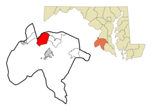
mapsize = 250x200px
map_caption = Location of Bensville, Maryland
mapsize1 =
map_caption1 =subdivision_type = Country
subdivision_name =United States
subdivision_type1 = State
subdivision_name1 =Maryland
subdivision_type2 = County
subdivision_name2 = Charles
government_footnotes =
government_type =
leader_title =
leader_name =
leader_title1 =
leader_name1 =
established_title =
established_date =unit_pref = Imperial
area_footnotes =area_magnitude =
area_total_km2 = 44.0
area_land_km2 = 44.0
area_water_km2 = 0.0
area_total_sq_mi = 17.0
area_land_sq_mi = 17.0
area_water_sq_mi = 0.0population_as_of = 2000
population_footnotes =
population_total = 7325
population_density_km2 = 166.7
population_density_sq_mi = 431.6timezone = Eastern (EST)
utc_offset = -5
timezone_DST = EDT
utc_offset_DST = -4
elevation_footnotes =
elevation_m = 56
elevation_ft = 184
latd = 38 |latm = 37 |lats = 24 |latNS = N
longd = 77 |longm = 0 |longs = 23 |longEW = Wpostal_code_type =
postal_code =
area_code =
blank_name = FIPS code
blank_info = 24-06615
blank1_name = GNIS feature ID
blank1_info = 0589738
website =
footnotes =Bennsville is a
census-designated place (CDP) in Charles County,Maryland ,United States . The population was 7,325 at the 2000 census. The area is not an official postal designation, but is part of the Waldorf orPomfret postal area. The Bennsville area is growing with new residential development, encouraged by the extension in the 1990s ofMaryland Route 228 providing quick access toMaryland Route 210 , the 2006 opening of the newNorth Point High School , and the straightening of Middletown Road, which is ongoing as of 2007.Geography
Bennsville is located at coor dms|38|37|24|N|77|0|23|W|city (38.623302, -77.006265)GR|1.
According to the
United States Census Bureau , the CDP has a total area of 17.0square mile s (44.0km² ), all of it land.Demographics
As of the
census GR|2 of 2000, there were 7,325 people, 2,429 households, and 2,071 families residing in the CDP. Thepopulation density was 431.6 people per square mile (166.7/km²). There were 2,493 housing units at an average density of 146.9/sq mi (56.7/km²). The racial makeup of the CDP was 76.46% White, 18.02% African American, 0.41% Native American, 2.32% Asian, 0.10% Pacific Islander, 0.55% from other races, and 2.14% from two or more races. Hispanic or Latino of any race were 2.20% of the population.There were 2,429 households out of which 43.4% had children under the age of 18 living with them, 74.9% were married couples living together, 7.5% had a female householder with no husband present, and 14.7% were non-families. 10.5% of all households were made up of individuals and 2.1% had someone living alone who was 65 years of age or older. The average household size was 3.01 and the average family size was 3.25.
In the CDP the population was spread out with 28.1% under the age of 18, 6.8% from 18 to 24, 32.5% from 25 to 44, 27.4% from 45 to 64, and 5.3% who were 65 years of age or older. The median age was 36 years. For every 100 females there were 97.5 males. For every 100 females age 18 and over, there were 97.3 males.
The median income for a household in the CDP was $83,388, and the median income for a family was $85,988. Males had a median income of $51,770 versus $39,797 for females. The
per capita income for the CDP was $29,677. About 0.4% of families and 1.5% of the population were below thepoverty line , including none of those under age 18 and 5.5% of those age 65 or over.References
External links
Wikimedia Foundation. 2010.