- Morgantown, Maryland
-
Morgantown — Unincorporated community — Location within the state of Maryland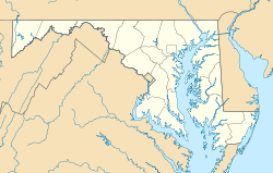
 Morgantown
Coordinates: 38°20′43″N 76°58′16″W / 38.34528°N 76.97111°WCoordinates: 38°20′43″N 76°58′16″W / 38.34528°N 76.97111°W Country United States State Maryland County Charles Time zone Eastern (EST) (UTC-5) – Summer (DST) EDT (UTC-4) ZIP codes FIPS code GNIS feature ID 590827 Morgantown is an unincorporated community in Charles County, Maryland.[1] It lies south of the Governor Harry W. Nice Memorial Bridge on the Potomac River at Lower Cedar Point. It is known for the Mirant Morgantown Generating Station smokestacks. In 2007, a controversial coal barge loading facility was under construction at the power plant on Popes Creek. Much later, the community had ferryboat service to Potomac Beach in Virginia before the present bridge opened in 1940.[2] Waverley was listed on the National Register of Historic Places in 1975.[3]
References
- ^ U.S. Geological Survey Geographic Names Information System: Morgantown, Maryland
- ^ "Old Maryland Landmarks" by Robert F.T. Pogue, 1972.
- ^ "National Register Information System". National Register of Historic Places. National Park Service. 2008-04-15. http://nrhp.focus.nps.gov/natreg/docs/All_Data.html.
External links
Municipalities and communities of Charles County, Maryland Towns 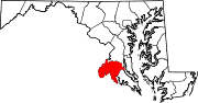
CDPs Other
communitiesBel Alton | Benedict | Bryantown | Cobb Island | Dentsville | Faulkner | Ironsides | Issue | Malcolm | Marbury | Masons | Morgantown | Mount Victoria | Nanjemoy | Newburg | Newport | Patuxent | Pisgah | Pomfret | Popes Creek | Pomonkey | Ripley | Rison | Riverside | Rock Point | Swan Point | Welcome | White Plains
Categories:- Maryland geography stubs
- Populated places in Charles County, Maryland
- Unincorporated communities in Maryland
- Populated places on the Potomac River


Wikimedia Foundation. 2010.