- Cobb Island (Maryland)
-
Cobb Island, Maryland — Populated place — Location of Cobb Island, Charles County, Maryland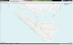
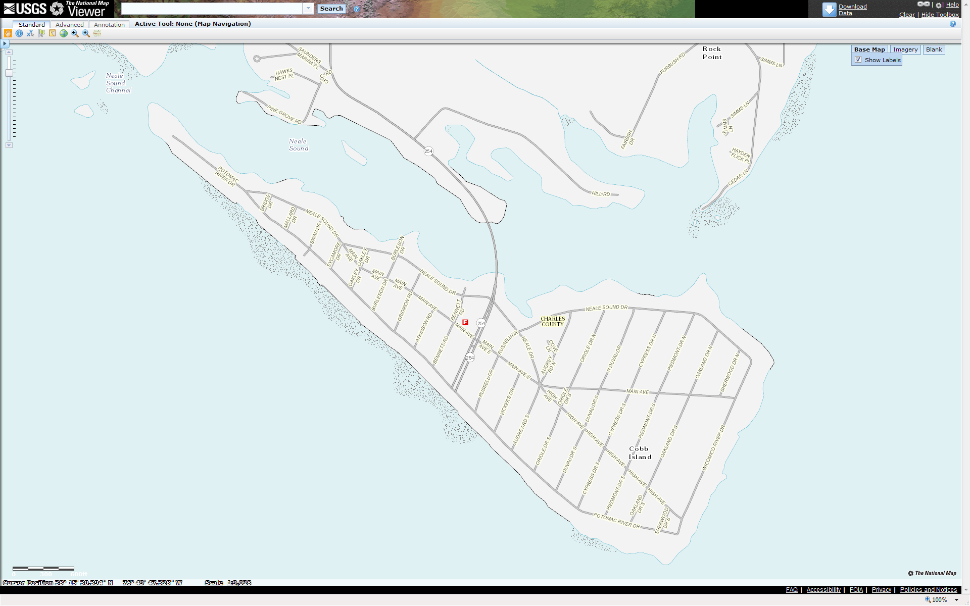
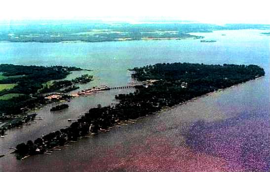
Coordinates: 38°15′30″N 76°50′38″W / 38.25833°N 76.84389°WCoordinates: 38°15′30″N 76°50′38″W / 38.25833°N 76.84389°W Country United States State Maryland County Charles Area - Total 0.4982 sq mi (1.3 km2) - Land 0.4982 sq mi (1.3 km2) Elevation[1] 10 ft (3 m) Population (2010) - Total 1,166 Time zone Eastern (EST) (UTC-5) - Summer (DST) EDT (UTC-4) Zip Code 20625 GNIS feature ID 1988529[1] Cobb Island is a small residential island located in at the junction of the Potomac River and the Wicomico River.[2] It is located approximately 45 miles south of Washington, DC in Charles County, Maryland. Cobb Island is separated from the mainland by Neale Sound, and connected by a 0.11-mile (180 m) long[3] fixed bridge.
Cobb Island has a small post office, a volunteer fire department and rescue squad[4], Baptist church, and small playground. Commercially, there are two seafood restaurants with marinas (Captain John's Crab House and Shymansky's Restaurant & Marina), a small bar and grill (The Scuttlebutt), a marina and bar/grill (Drift Away Bar & Grill at the Cobb Island Marina) and a small market (Cobb Island Market) with seasonal pizza parlor/ice cream store (Beaches and Cream).
Maryland Route 254 serves as the only route into and out of Cobb Island.

Historical Notes
On December 23rd, 1900, Reginald Aubrey Fessenden sent and received the first intelligible speech by electromagnetic waves on a pair of masts 50 feet (15 m) high and 1 mile (1.6 km) apart.[5]
References
- ^ a b "US Board on Geographic Names". United States Geological Survey. 2007-10-25. http://geonames.usgs.gov. Retrieved 2008-01-31.
- ^ U.S. Geological Survey Geographic Names Information System: Cobb Island (Maryland)
- ^ "Highway Location Reference: Charles County" (PDF). Maryland State Highway Administration. 2010. http://www.roads.maryland.gov/Location/2010_Charles.pdf. Retrieved 2011-10-03.
- ^ "Cobb Island Volunteer Fire Department & EMS - Charles County, Company 6". http://civfd.com/. Retrieved 3 October 2011.
- ^ Belrose, John S. (September 1994). "Fessenden and the Early History of Radio Science". The Radioscientist 5 (3). http://www.ieee.ca/millennium/radio/radio_radioscientist.html. Retrieved 3 October 2011.
External links
- Gaines, Patrice (August 20, 1994). "Cobb Island: The Water Offers An Everyday Escape". The Washington Post. http://www.washingtonpost.com/wp-srv/local/counties/charles/longterm/wwlive/cobb.htm. Retrieved 2008-10-17.
Municipalities and communities of Charles County, Maryland County seat: La Plata Towns 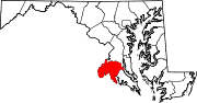
CDPs Other
communitiesBel Alton | Benedict | Bryantown | Cobb Island | Dentsville | Faulkner | Ironsides | Issue | Malcolm | Marbury | Masons | Morgantown | Mount Victoria | Nanjemoy | Newburg | Newport | Patuxent | Pisgah | Pomfret | Popes Creek | Pomonkey | Ripley | Rison | Riverside | Rock Point | Swan Point | Welcome | White Plains
Categories:- Unincorporated communities in Maryland
- Populated places in Charles County, Maryland
- Maryland geography stubs

Wikimedia Foundation. 2010.