- Maryland Route 712
-
Maryland Route 712
Forest Park Road Route information Maintained by MDSHA Length: 1.11 mi[1] (1.79 km) Major junctions South end:  MD 235 in Hermanville
North end: Entrance to NAS Patuxent River near Hermanville Location Counties: St. Mary's County Highway system Maryland highway system
Interstate • US • State • Minor • Former • Turnpikes←  MD 710
MD 713  →
→Maryland Route 712 (MD 712) is a state highway in the U.S. state of Maryland. Known as Forest Park Road, the state highway runs 1.11 miles (1.79 km) from MD 235 in Hermanville north to an entrance to Naval Air Station Patuxent River (NAS Patuxent River). MD 712 was constructed in the mid 1940s as a military access project.
Contents
Route description
MD 712 begins at an intersection with MD 235 (Three Notch Road) in Hermanville. The roadway continues on the opposite side of MD 235 as county-maintained Hermanville Road. MD 712 heads north through a forested area between residential subdivisions to the east and NAS Patuxent River to the west. The state highway parallels the military base's perimeter road for much of its length. Immediately after passing Pine Hill Run Road, the state highway reaches its northern terminus at an entrance to NAS Patuxent River.[1][2]
History
MD 712 was constructed as a military access project during World War II. The state highway was built as part of a 3-mile (4.8 km) project to improve MD 235 between Jarboesville (now Lexington Park) and Hermanville and provide access to the South Gate of NAS Patuxent River. MD 712 was constructed in 1944 and 1945.[3][4][5]
Junction list
The entire route is in Hermanville in St. Mary's County.
Mile
[1]Destinations Notes 0.00 MD 235 (Three Notch Road) / Hermanville Road west – Point Lookout, WaldorfSouthern terminus 1.11 Entrance to Naval Air Station Patuxent River Northern terminus 1.000 mi = 1.609 km; 1.000 km = 0.621 mi References
- ^ a b c "Highway Location Reference: St. Mary's County" (PDF). Maryland State Highway Administration. 2009. http://www.marylandroads.com/Location/2009_SAINTMARYS.pdf. Retrieved 2010-12-14.
- ^ Google, Inc. Google Maps – Maryland Route 712 (Map). Cartography by Google, Inc. http://maps.google.com/maps?f=d&source=s_d&saddr=Forest+Park+Rd%2FShaw+Rd&daddr=Shaw+Rd&hl=en&geocode=FTicRwIdaN9x-w%3BFczXRwIdgOlx-w&mra=ls&dirflg=w&sll=38.256515,-76.413388&sspn=0.015468,0.038581&ie=UTF8&ll=38.255099,-76.421156&spn=0.015468,0.038581&t=h&z=15. Retrieved 2010-08-03.
- ^ Report of the State Roads Commission of Maryland. 1943-1944. Baltimore: Maryland State Roads Commission. 1945-03-01. p. 97. http://www.archive.org/details/reportofstateroa1943mary. Retrieved 2010-12-14.
- ^ Report of the State Roads Commission of Maryland. 1945-1946. Baltimore: Maryland State Roads Commission. 1947-02-01. p. 103. http://www.archive.org/details/reportofstateroa1945mary. Retrieved 2010-12-14.
- ^ Maryland State Roads Commission. Maryland: Official Highway Map (Map) (1946-47 ed.).
External links
Roads in St. Mary's County, Maryland State highways 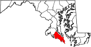 Categories:
- State highways in Maryland
- Roads in St. Mary's County, Maryland


Wikimedia Foundation. 2010.