- Maryland Route 246
-
Maryland Route 246
Great Mills Road, Cedar Point Road 
Route information Maintained by MDSHA Length: 3.35 mi[1] (5.39 km) Major junctions West end:  MD 5 in Great Mills
 MD 235 in Lexington Park
East end: Entrance to NAS Patuxent River in Lexington Park Location Counties: St. Mary's Highway system Maryland highway system
Interstate • US • State • Minor • Former • Turnpikes←  MD 245
MD 247  →
→Maryland Route 246 (MD 246) is a state highway in the U.S. state of Maryland. Known as Great Mills Road and Cedar Point Road, the state highway runs 3.35 miles (5.39 km) from MD 5 in Great Mills east to the entrance to Naval Air Station Patuxent River (NAS Patuxent River) just east of the highway intersection with MD 235 in Lexington Park. In conjunction with MD 5, MD 246 connects NAS Patuxent River and the suburban area surrounding the military base with Leonardtown. The state highway was originally constructed around 1920. MD 246 extended east onto land now occupied by NAS Patuxent River to serve a ferry from St. Mary's County to the southern end of Calvert County. The ferry was discontinued and the state highway's eastern terminus was rolled back to MD 235 when NAS Patuxent River was constructed during World War II; the remainder of MD 246 was upgraded as a military access project. MD 246 was expanded to a multi-lane highway in the 1990s.
Contents
Route description
MD 246 (Great Mills Road) begins at an intersection with MD 5 (Point Lookout Road) in Great Mills. The state highway intersects its old alignment, which is named Old Great Mills Road and designated MD 5A, before curving northeast as a five-lane road with center turn lane. MD 246 passes Great Mills High School before meeting the southern end of MD 237 (Chancellors Run Road) and entering the suburban community of Lexington Park, where the highway is lined with residential subdivisions, apartment complexes, office parks, and shopping centers. MD 246 intersects FDR Boulevard and Shangri La Drive before reaching MD 235 (Three Notch Road). Immediately east of the MD 235 intersection, MD 246 becomes Cedar Point Road and reaches its eastern terminus at the main entrance to NAS Patuxent River.[1][2]
History
MD 246 was constructed as a gravel road by 1921. The state highway originally extended east onto the Cedar Point peninsula from its present terminus in Lexington Park (previously known as Jarboesville) to the hamlet of Pearson's Corner, then north to Millstone Landing.[3] Millstone Landing was the location of a ferry across the Patuxent River to the southern terminus of MD 2 in Solomons in Calvert County between 1933 and at least 1940.[4][5] The highway connecting Pearson's Corner with Cedar Point, which was designated MD 248, was constructed in two sections.[6] The first section from Pearson's Corner was constructed as a gravel road in 1925 and 1926.[7][8] The second section to a point near the Cedar Point Golf Course was completed around 1930.[9]
Following the entry of the U.S. into World War II, the U.S. Navy seized much of the Cedar Point peninsula to construct NAS Patuxent River in 1942. All of MD 248 and the portion of MD 246 on the military base were removed from the state highway system.[10] The roads on which MD 246 was formerly assigned still exist within the military property, while MD 248 was mostly obliterated by the construction of runways. The remainder of MD 246 from the naval air station to Great Mills was reconstructed with a bituminous concrete surface in 1944 to better connect the military base with Leonardtown.[11] The state highway was reconstructed again from Great Mills to Lexington Park in 1954 and 1955.[12] MD 246 was expanded to a five-lane road between Forest Run Drive and MD 235 by 1993.[13] The remainder of the highway to Great Mills was widened to a five-lane road by 1999.[14]
Junction list
The entire route is in St. Mary's County.
Location Mile[1] Destinations Notes Leonardtown 0.00 MD 5 (Point Lookout Road) – Leonardtown, St. Mary's CityWestern terminus Lexington Park 0.97  MD 237 (Chancellors Run Road) – California
3.26 MD 235 (Three Notch Road) – Point Lookout, Waldorf3.35 Entrance to Naval Air Station Patuxent River Eastern terminus 1.000 mi = 1.609 km; 1.000 km = 0.621 mi References
- ^ a b c "Highway Location Reference: St. Mary's County" (PDF). Maryland State Highway Administration. 2009. http://www.marylandroads.com/Location/2009_SAINTMARYS.pdf. Retrieved 2010-12-14.
- ^ Google, Inc. Google Maps – Maryland Route 246 (Map). Cartography by Google, Inc. http://maps.google.com/maps?f=d&source=s_d&saddr=MD-246+E%2FGreat+Mills+Rd&daddr=Cedar+Point+Rd&geocode=FQhyRwIdisNw-w%3BFYvmRwIdPHJx-w&hl=en&mra=ls&sll=38.266375,-76.451261&sspn=0.000967,0.002411&ie=UTF8&ll=38.249775,-76.49231&spn=0.061877,0.154324&t=h&z=13. Retrieved 2010-12-14.
- ^ Maryland Geological Survey. Map of Maryland: Showing State Road System and State Aid Roads (Map) (1921 ed.).
- ^ Maryland Geological Survey. Map of Maryland Showing State Road System: State Aid Roads and Improved County Road Connections (Map) (1933 ed.).
- ^ Maryland State Roads Commission. Map of Maryland Showing Highways and Points of Interest (Map) (1940 ed.).
- ^ Maryland State Roads Commission. General Highway Map: State of Maryland (Map) (1939 ed.).
- ^ Report of the State Roads Commission of Maryland. 1924-1926. Baltimore: Maryland State Roads Commission. January 1927. pp. 36, 65. http://www.archive.org/details/annualreportsofs1924mary. Retrieved 2010-12-14.
- ^ Maryland Geological Survey. Map of Maryland: Showing State Road System and State Aid Roads (Map) (1927 ed.).
- ^ Report of the State Roads Commission of Maryland. 1927-1930. Baltimore: Maryland State Roads Commission. 1930-10-01. p. 227. http://www.archive.org/details/reportofstateroa1927mary. Retrieved 2010-12-14.
- ^ Maryland State Roads Commission. Maryland: Official Highway Map (Map) (1946-47 ed.).
- ^ Report of the State Roads Commission of Maryland. 1943-1944. Baltimore: Maryland State Roads Commission. 1945-03-01. p. 97. http://www.archive.org/details/reportofstateroa1943mary. Retrieved 2010-12-14.
- ^ Report of the State Roads Commission of Maryland. 1955-1956. Baltimore: Maryland State Roads Commission. 1956-11-02. p. 177. http://www.archive.org/details/reportofstateroa1955mary. Retrieved 2010-12-14.
- ^ United States Geological Survey (1993-04-08). Lexington Park, Maryland, United States (Map). Aerial Map. http://msrmaps.com/image.aspx?T=1&S=10&Z=18&X=1854&Y=21176&W=1&qs=. Retrieved 2010-12-14.
- ^ "Highway Location Reference: St. Mary's County" (PDF). Maryland State Highway Administration. 1999. http://www.marylandroads.com/Location/1999_SAINTMARYS.pdf. Retrieved 2010-12-14.
External links
Roads in St. Mary's County, Maryland State highways 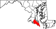 Categories:
- State highways in Maryland
- Roads in St. Mary's County, Maryland


Wikimedia Foundation. 2010.