- Maryland Route 237
-
Maryland Route 237
Chancellors Run Road 
Route information Maintained by MDSHA Length: 2.95 mi[1] (4.75 km) Major junctions South end:  MD 246 in Lexington Park
North end:  MD 235 in California
Location Counties: St. Mary's Highway system Maryland highway system
Interstate • US • State • Minor • Former • Turnpikes←  MD 236
MD 238  →
→Maryland Route 237 (MD 237) is a state highway in the U.S. state of Maryland. Known as Chancellors Run Road, the route runs 2.95 miles (4.75 km) from Maryland Route 246 in Lexington Park north to Maryland Route 235 in California. MD 237, which was designated in the mid 1980s, bypasses the center of Lexington Park through a suburban area related to Naval Air Station Patuxent River (NAS Patuxent River) and related industries. With growth expected to continue due to increased activity at the military installation, the state highway was expanded to a four-lane divided highway between 2008 and 2010.
Contents
Route description
MD 237 begins in Lexington Park at an intersection with MD 246 (Great Mills Road), which heads east to NAS Patuxent River, near Great Mills High School. The state highway heads north as a five-lane road with center turn lane through residential subdivisions. At Pegg Road, MD 237 becomes a four-lane divided highway. The state highway crosses Jarboesville Run in a forested area before continuing between residential subdivisions. MD 237 passes Chancellors Run Regional Park and the right-of-way of the former Washington, Brandywine and Point Lookout Railroad and future Three Notch Trail before reaching its northern terminus at MD 235 (Three Notch Road) in California.[1][2][3]
History
The original MD 237 roughly followed what is today MD 234 between Chaptico and MD 5 near Leonardtown via Clements.[4] Following a relocation of the highway between Chaptico and Clements, MD 234's eastern terminus was moved from MD 5 at Helen to near Leonardtown, assuming MD 237 in the process, in 1961. MD 238 was extended from Chaptico to Helen over MD 234's old routing.[5] The modern MD 237 was designated along Chancellors Run Road around 1987.[6] Between 2008 and 2010, MD 237 was expanded from a two-lane road to a four-lane divided highway from Pegg Road to MD 235.[3]
Junction list
The entire route is in St. Mary's County.
Location Mile[1] Destinations Notes Lexington Park 0.00 MD 246 (Great Mills Road) – Great Mills, NAS Patuxent RiverSouthern terminus California 2.95 MD 235 (Three Notch Road) – Lexington Park, Charlotte HallNorthern terminus 1.000 mi = 1.609 km; 1.000 km = 0.621 mi References
- ^ a b c "Highway Location Reference: St. Mary's County" (PDF). Maryland State Highway Administration. 2009. http://www.marylandroads.com/Location/2009_SAINTMARYS.pdf. Retrieved 2010-11-04.
- ^ Google, Inc. Google Maps – Maryland Route 237 (Map). Cartography by Google, Inc. http://maps.google.com/maps?f=d&source=s_d&saddr=MD-237+N%2FChancellors+Run+Rd&daddr=Chancellors+Run+Rd&hl=en&geocode=FfSjRwIdduFw-w%3BFWRHSAIdOs1w-w&mra=ls&sll=38.369285,-76.768942&sspn=0.015578,0.038581&ie=UTF8&ll=38.270667,-76.491795&spn=0.061859,0.154324&t=h&z=13. Retrieved 2010-11-04.
- ^ a b "State Reaches Major Milestone In $38 Million Project To Improve Safety On MD 237". Maryland State Highway Administration. 2010-10-21. http://www.marylandroads.com/Pages/release.aspx?newsId=771. Retrieved 2010-11-04.
- ^ Maryland State Roads Commission. Maryland: Official Highway Map (Map) (1960 ed.).
- ^ Maryland State Roads Commission. Maryland: Official Highway Map (Map) (1961 ed.).
- ^ Maryland State Highway Administration. Maryland: Official Highway Map (Map) (1987 ed.).
External links
Roads in St. Mary's County, Maryland State highways 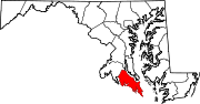 Categories:
- State highways in Maryland
- Roads in St. Mary's County, Maryland


Wikimedia Foundation. 2010.