- Maryland Route 627
-
Maryland Route 627
Oriole Road Route information Maintained by MDSHA Length: 2.48 mi[1] (3.99 km) Major junctions West end: Crab Island Road in Oriole East end:  MD 363 near Oriole
Location Counties: Somerset Highway system Maryland highway system
Interstate • US • State • Minor • Former • Turnpikes←  MD 625
MD 631  →
→Maryland Route 627 (MD 627) is a state highway in the U.S. state of Maryland. Known as Oriole Road, the state highway runs 2.48 miles (3.99 km) from the intersection of Oriole Back Road and Crab Island Road in Oriole east to MD 363 near Oriole. MD 627 was constructed and assigned in the mid 1930s.
Contents
Route description
MD 627 begins at the intersection of Crab Island Road and Oriole Back Road in the village of Oriole. Crab Island Road heads south toward the Manokin River, while Oriole Back Road heads northwest toward an intersection with MD 363 at Monie. MD 627 heads east through the village and makes a sharp turn to the south where Jerusalem Road heads north. The state highway curves east through forest. After passing Locust Point Road, which leads south to the Manokin Historic District, MD 627 veers northeast through farmland to its eastern terminus at MD 363 (Deal Island Road).[1][2]
History
Oriole Road was reconstructed by the Maryland State Roads Commission in 1934 when they took over maintenance of highways in Somerset County.[3] The highway was brought into the state system and designated MD 627 in 1938.[4][5]
Junction list
The entire route is in Oriole in Somerset County.
Mile[1] Destinations Notes 0.00 Crab Island Road south / Oriole Back Road west Western terminus 2.48 MD 363 (Deal Island Road) – Princess Anne, Deal IslandEastern terminus 1.000 mi = 1.609 km; 1.000 km = 0.621 mi References
- ^ a b c "Highway Location Reference: Somerset County" (PDF). Maryland State Highway Administration. 2009. http://www.marylandroads.com/Location/2009_SOMERSET.pdf. Retrieved 2010-10-23.
- ^ Google, Inc. Google Maps – Maryland Route 627 (Map). Cartography by Google, Inc. http://maps.google.com/maps?f=d&source=s_d&saddr=MD-627%2FOriole+Rd&daddr=MD-627%2FOriole+Rd&hl=en&geocode=FXZ4RgIdriF7-w%3BFbmvRgIdOZx7-w&mra=ls&sll=38.178527,-75.799527&sspn=0.015451,0.038581&ie=UTF8&ll=38.179202,-75.800858&spn=0.015451,0.038581&t=h&z=15. Retrieved 2010-05-04.
- ^ Report of the State Roads Commission of Maryland. 1931-1934. Baltimore: Maryland State Roads Commission. 1934-12-28. p. 102. http://www.archive.org/details/reportofstateroa1931mary. Retrieved 2010-05-04.
- ^ Maryland State Roads Commission. Map of Maryland Showing State Road System (Map) (1938 ed.).
- ^ Maryland State Roads Commission. General Highway Map: State of Maryland (Map) (1939 ed.).
External links
Roads in Somerset County, Maryland State highways 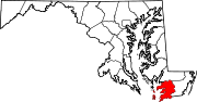
U.S. Highways Categories:- State highways in Maryland
- Roads in Somerset County, Maryland


Wikimedia Foundation. 2010.