- Maryland Route 363
-
Maryland Route 363
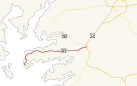
Maryland Route 363 highlighted in redRoute information Maintained by MDSHA Length: 18.30 mi[1] (29.45 km) Major junctions West end: Dead end on Deal Island  US 13 in Princess Anne
East end: Mansion Avenue in Princess Anne Location Counties: Somerset Highway system Maryland highway system
Interstate • US • State • Minor • Former • Turnpikes←  MD 362
MD 364  →
→Maryland Route 363 (MD 363) is a state highway in the U.S. state of Maryland. Known for almost all of its length as Deal Island Road, the state highway runs 18.30 miles (29.45 km) from a dead end in the community of Wenona at the southern end of Deal Island east to Mansion Avenue in Princess Anne just east of the highway's intersection with U.S. Route 13 (US 13). MD 363 connects Princess Anne with the communities of Deal Island, Chance, and Dames Quarter on Tangier Sound. The state highway was constructed starting around 1920 from Princess Anne. MD 363 reached Chance in the early 1930s. The state highway was extended to Deal Island when a modern bridge to the island was constructed in 1940. MD 363 was extended to its present terminus at Wenona in the late 1950s.
Contents
Route description
MD 363 begins at a dead end in the community of Wenona at the southern end of Deal Island.[2] The state highway heads north, passing through a sharp curve before crossing Middle Creek.[1][2] MD 363 runs through another series of sharp curves through marshland before passing St. John's Methodist Episcopal Church.[2] Beyond the church, the state highway straightens out, passing by the old post office building and a boat ramp accessed from Ralph Abbott Road before a high-level bridge carries the state highway over Upper Thoroughfare, a strait between Laws Cove and Tangier Sound. On the north side of the bridge, MD 363 passes MD 363A, the north approach to the previous bridge to Deal Island, before passing through the community of Chance, the site of Rock Creek Methodist Episcopal Church. After passing Haines Point Road, which leads to a large public boat ramp, the state highway continues northeast across the two branches of Rock Creek and through more marshland before entering Dames Quarter.[1][2] MD 363 traverses Dames Quarter Creek and passes through Deal Island Wildlife Management Area.[2]
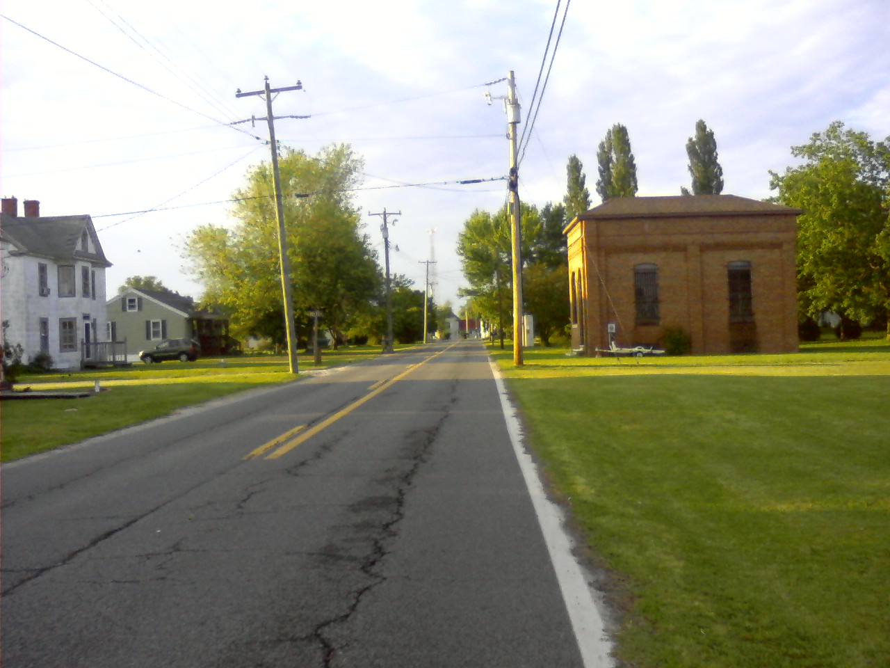
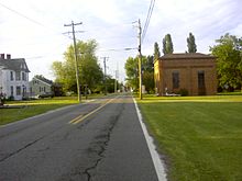 The old post office building along MD 363 on Deal Island.
After passing through the wildlife management area, MD 363 heads east on a 5-mile (8.0 km) straight through the very small hamlets of St. Stephens and Monie and bypassing the village of Oriole, which is accessed by Oriole Back Road from the west and MD 627 (Oriole Road) from the east.[1][2] After passing Venton Road, which leads to All Saints Church, the state highway traverses the Chesapeake Forest Lands. On the east edge of the forest, MD 363 curves northeast and then east toward Princess Anne, passing farmland, several residential subdivisions, and the Flying W Airport. Immediately after crossing the Manokin River, the state highway reaches its intersection with US 13 (Ocean Highway).[2] MD 363 continues east into the town of Princess Anne as Manokin Avenue, where the state highway reaches its eastern terminus at Mansion Avenue, named for the Teackle Mansion one block to the south.[1][2] The roadway continues east toward MD 675 (Somerset Avenue) in downtown Princess Anne.[2]
History
 A distant view of the bridge over the Upper Thoroughfare from the mainland side.
MD 363 was under construction as a modern highway by 1921, when the highway had been completed from Princess Anne to the eastern end of the 5-mile (8.0 km) straight.[3] The state highway reached Monie by 1923 and Dames Quarter in 1926.[4][5][6] MD 363 was under construction west to Chance in 1930 and completed by 1933.[7][8] The state highway's western terminus remained at Chance until 1940. MD 363 was extended to the other side of Upper Thoroughfare when a modern bridge replaced a causeway that had been in place since at least 1903.[9][10] The state highway was widened in stages from Princess Anne between 1950 and 1958, culminating in the extension of MD 363 to Wenona in 1958.[11][12][13][14] MD 363 originally continued east from its present terminus in Princess Anne along Mansion Avenue and Prince William Street to end at MD 675.[15] The state highway assumed its present eastern terminus around 1985.[16] The present bridge across Upper Thoroughfare was completed in 1987.[17]
Junction list
The entire route is in Somerset County.
Location Mile[1] Destinations Notes Deal Island 0.00 Dead end Western terminus Oriole 13.09  MD 627 west (Oriole Road)
Princess Anne 18.19 US 13 (Ocean Highway) – Salisbury, Pocomoke City18.30 Manokin Avenue east / Mansion Avenue south Eastern terminus 1.000 mi = 1.609 km; 1.000 km = 0.621 mi References
- ^ a b c d e f "Highway Location Reference: Somerset County" (PDF). Maryland State Highway Administration. 2009. http://www.marylandroads.com/Location/2009_SOMERSET.pdf. Retrieved 2010-10-23.
- ^ a b c d e f g h i Google, Inc. Google Maps – Maryland Route 363 (Map). Cartography by Google, Inc. http://maps.google.com/maps?f=d&source=s_d&saddr=Unknown+road&daddr=Manokin+Ave&hl=en&geocode=FZbHRQId-B95-w%3BFTLzRgIdqvZ8-w&mra=ls&sll=38.201514,-75.694041&sspn=0.007723,0.01929&ie=UTF8&t=h&z=12. Retrieved 2010-05-04.
- ^ Maryland Geological Survey. Map of Maryland: Showing State Road System and State Aid Roads (Map) (1921 ed.).
- ^ Maryland Geological Survey. Map of Maryland: Showing State Road System and State Aid Roads (Map) (1923 ed.).
- ^ Report of the State Roads Commission of Maryland. 1924-1926. Baltimore: Maryland State Roads Commission. January 1927. p. 27. http://www.archive.org/details/annualreportsofs1924mary. Retrieved 2010-05-04.
- ^ Maryland Geological Survey. Map of Maryland: Showing State Road System and State Aid Roads (Map) (1927 ed.).
- ^ Maryland Geological Survey. Map of Maryland Showing State Road System: State Aid Roads and Improved County Road Connections (Map) (1930 ed.).
- ^ Maryland Geological Survey. Map of Maryland Showing State Road System: State Aid Roads and Improved County Road Connections (Map) (1933 ed.).
- ^ Report of the State Roads Commission of Maryland. 1939-1940. Baltimore: Maryland State Roads Commission. 1941-03-15. p. 85. http://www.archive.org/details/reportofstateroa1939mary. Retrieved 2010-05-04.
- ^ United States Geological Survey. Deal Island, MD Quadrangle (Map). 1:48,000. 15 Minute Series (Topographic) (1903 ed.). http://historical.mytopo.com/quad.cfm?quadname=Deal%20Island&state=MD&series=15. Retrieved 2010-05-04.
- ^ Report of the State Roads Commission of Maryland. 1949-1950. Baltimore: Maryland State Roads Commission. 1950-12-20. pp. 98–99. http://www.archive.org/details/annualreportsofs1949mary. Retrieved 2010-05-04.
- ^ Report of the State Roads Commission of Maryland. 1953-1954. Baltimore: Maryland State Roads Commission. 1954-11-12. pp. 136–138. http://www.archive.org/details/reportofstateroa1953mary. Retrieved 2010-05-04.
- ^ Report of the State Roads Commission of Maryland. 1957-1958. Baltimore: Maryland State Roads Commission. 1958-12-15. p. 23. http://www.archive.org/details/annualreportsofs1957mary. Retrieved 2010-05-04.
- ^ Maryland State Roads Commission. Maryland: Official Highway Map (Map) (1958 ed.).
- ^ Maryland State Highway Administration. Maryland: Official Highway Map (Map) (1978 ed.).
- ^ Maryland State Highway Administration. Maryland: Official Highway Map (Map) (1985-86 ed.).
- ^ "NBI Structure Number: 100000190006010". National Bridge Inventory. http://nationalbridges.com/nbi_record.php?StateCode=24&struct=100000190006010. Retrieved 2010-10-23.
External links
Roads in Somerset County, Maryland State highways 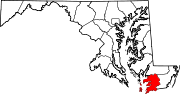
U.S. Highways Categories:- State highways in Maryland
- Roads in Somerset County, Maryland


Wikimedia Foundation. 2010.