- Deal Island, Maryland
-
Deal Island, Maryland — CDP — 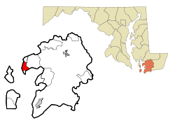
Coordinates: 38°9′16″N 75°56′44″W / 38.15444°N 75.94556°WCoordinates: 38°9′16″N 75°56′44″W / 38.15444°N 75.94556°W Country United States State Maryland County Somerset Area – Total 5.4 sq mi (13.9 km2) – Land 3.2 sq mi (8.4 km2) – Water 2.1 sq mi (5.5 km2) Elevation 3 ft (1 m) Population (2000) – Total 578 – Density 178.0/sq mi (68.7/km2) Time zone Eastern (EST) (UTC-5) – Summer (DST) EDT (UTC-4) ZIP codes 21821, 21870 Area code(s) 410 FIPS code 24-22100 GNIS feature ID 0590074 Deal Island is a census-designated place (CDP) in Somerset County, Maryland, United States. The population was 578 at the 2000 census. It is included in the Salisbury, Maryland Metropolitan Statistical Area. The small town was listed on the National Register of Historic Places as the Deal Island Historic District in 2006.[1]
Contents
Geography
Deal Island is located at 38°9′16″N 75°56′44″W / 38.15444°N 75.94556°W (38.154551, -75.945659)[2].
According to the United States Census Bureau, the CDP has a total area of 5.4 square miles (14 km2), of which, 3.2 square miles (8.3 km2) of it is land and 2.1 square miles (5.4 km2) of it (39.66%) is water.
Demographics
As of the census[3] of 2000, there were 578 people, 240 households, and 165 families residing in the CDP. The population density was 178.0 people per square mile (68.7/km²). There were 352 housing units at an average density of 108.4/sq mi (41.8/km²). The racial makeup of the CDP was 90.31% White, 7.96% African American, 0.87% Native American, 0.17% from other races, and 0.69% from two or more races. Hispanic or Latino of any race were 1.21% of the population.
There were 240 households out of which 20.0% had children under the age of 18 living with them, 57.1% were married couples living together, 7.9% had a female householder with no husband present, and 31.3% were non-families. 25.8% of all households were made up of individuals and 13.3% had someone living alone who was 65 years of age or older. The average household size was 2.41 and the average family size was 2.94.
In the CDP the population was spread out with 21.3% under the age of 18, 5.7% from 18 to 24, 20.6% from 25 to 44, 33.6% from 45 to 64, and 18.9% who were 65 years of age or older. The median age was 47 years. For every 100 females there were 100.0 males. For every 100 females age 18 and over, there were 97.8 males.
The median income for a household in the CDP was $33,490, and the median income for a family was $38,571. Males had a median income of $30,592 versus $24,219 for females. The per capita income for the CDP was $13,936. About 4.1% of families and 8.0% of the population were below the poverty line, including 7.7% of those under age 18 and 9.3% of those age 65 or over.
History
Deal Island was historically known as Devil's Island. Nearby Dames Quarters also had an unappealing name: Quarters of the Damned. At least one source also attributes these nicknames to the area's use by pirates.
Also the island is famous for Joshua Thomas who predicted the British defeat in the war of 1812. Thomas is buried alongside the Joshua Thomas Chapel.
Events
Since 1959, Deal Island has hosted an annual Labor Day weekend Skipjack Race. The race features skipjacks which are traditional wooden sailing vessels with triangular sails designed for dregging oysters. They are two-sail bateaux, and the term 'bateau' is still preferred by watermen. These vessels were operated extensively between the 1880s to the 1960s. Deal Island was once the home port for a large fleet of skipjacks and today has most of the few remaining skipjacks operating commercially for oystering on the Chesapeake Bay. Labor day of 2010 will be the fifty-first annual Skipjack Race.
Also, before Labor Day, there is the annual Deal Island (including towns north of Deal island but still on Rt. 363) yard sale. This will start the Saturday before and continue into Labor day (Monday).
Transportation
Deal Island's main drag is Maryland Route 363, Deal Island Road. It traverses the entire island and travels due east back to U.S. Route 13 in Princess Anne.
Deal Island's communities were once served by the Somerset Commuter (now Shore Transit), on Route 4, starting from Princess Anne's main transfer point. This route was removed in 2005.
References
- ^ "National Register Information System". National Register of Historic Places. National Park Service. 2008-04-15. http://nrhp.focus.nps.gov/natreg/docs/All_Data.html.
- ^ "US Gazetteer files: 2010, 2000, and 1990". United States Census Bureau. 2011-02-12. http://www.census.gov/geo/www/gazetteer/gazette.html. Retrieved 2011-04-23.
- ^ "American FactFinder". United States Census Bureau. http://factfinder.census.gov. Retrieved 2008-01-31.
External links
Municipalities and communities of Somerset County, Maryland City 
Town CDPs Chance | Dames Quarter | Deal Island | Eden | Fairmount | Frenchtown-Rumbly | Mount Vernon | Smith Island | West Pocomoke
Other
communitiesCokesbury | Ewell | Hopewell | Hudson's Corner | Kingston | Manokin | Marion Station | Oriole | Rehobeth | Rhodes Point | Shelltown | Tulls Corner | Tylerton | Upper Fairmount | Upper Falls | Venton | Wenona | Westover
Categories:- Populated places in Somerset County, Maryland
- Unincorporated communities in Maryland
- Census-designated places in Maryland
- Salisbury metropolitan area


Wikimedia Foundation. 2010.