- Manokin, Maryland
-
- For the historic Manokin Settlement, see Manokin Historic District.
Manokin is an unincorporated community in Somerset County, Maryland, United States.[1] It is located on Maryland Route 361 at the intersection of River Road.
References
Municipalities and communities of Somerset County, Maryland City 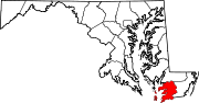
Town CDPs Other
communitiesCokesbury | Ewell | Hopewell | Hudson's Corner | Kingston | Manokin | Marion Station | Oriole | Rehobeth | Rhodes Point | Shelltown | Tulls Corner | Tylerton | Upper Fairmount | Upper Falls | Venton | Wenona | Westover
Categories:- Maryland geography stubs
- Populated places in Somerset County, Maryland
- Unincorporated communities in Maryland

Wikimedia Foundation. 2010.