- Maryland Route 380
-
Maryland Route 380

Route information Maintained by MDSHA Length: 1.56 mi[1] (2.51 km) Major junctions South end: Ape Hole Road in Lawsonia West end: Main Street in Crisfield Location Counties: Somerset Highway system Maryland highway system
Interstate • US • State • Minor • Former • Turnpikes←  MD 378
MD 381  →
→Maryland Route 380 (MD 380) is a state highway in the U.S. state of Maryland. The state highway runs 1.56 miles (2.51 km) from Ape Hole Road in Lawsonia, Maryland north to Main Street at the city limit of Crisfield in southwestern Somerset County. MD 380, which is the southernmost state highway in Maryland, provides access to a suburban area south of Crisfield. The state highway was built in the mid 1930s.
Contents
Route description
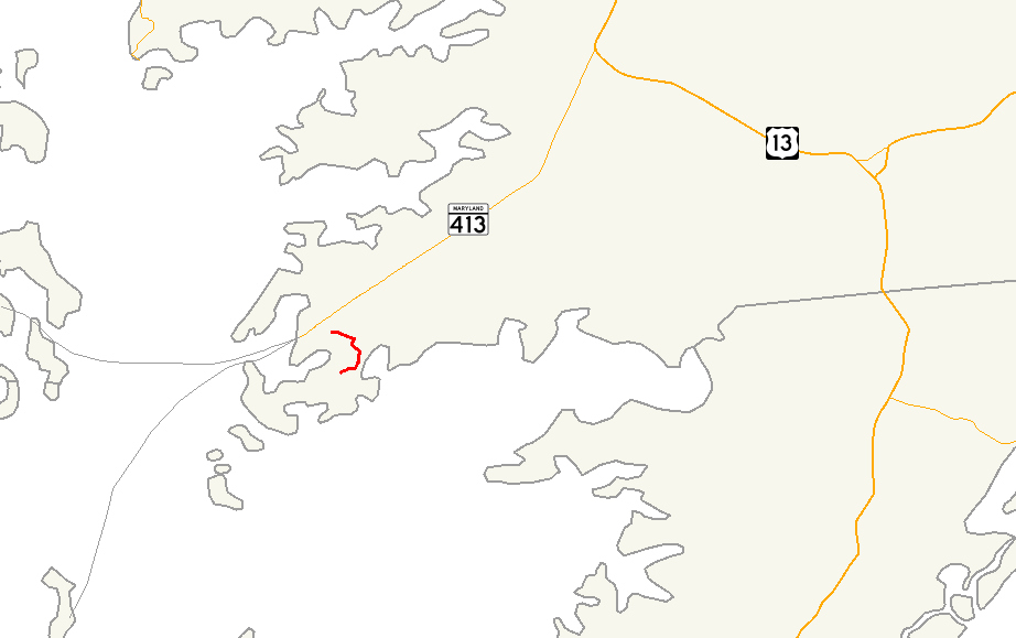
MD 380 begins at a three-way intersection with Byrdtown Road, which heads southwest, and Ape Hole Road, which heads southeast toward Ape Hole Creek, an inlet of the Pocomoke Sound. The state highway heads north as two-lane Lawsonia Road through a residential area. MD 380 passes Boone Road and Asbury Road, which were formerly MD 359 and MD 358, respectively, before reaching a four-way intersection with Walter Jones Road, Freedomtown Road, and Main Street Extended. MD 380 turns west onto Main Street Extended. The state highway reaches its northern terminus at the Crisfield city limits adjacent to the Crisfield Armory. Main Street heads west through the Crisfield Historic District, where the street intersects Somerset Avenue and MD 413.[1][2]
History
MD 380 was constructed east and south from the pre-existing concrete Main Street in Crisfield starting in 1934.[3] The state highway was completed and marked along its present route by 1939.[4] MD 380 extended west to Somerset Avenue, then part of MD 358, in the mid 1950s when the highway was widened, but was removed from the city of Crisfield by 1995.[5][6]
Junction list
The entire route is in Somerset County.
Location Mile[1] Destinations Notes Lawsonia 0.00 Ape Hole Road east / Byrdtown Road west Southern terminus 0.62 Boone Road south Former MD 359[4] 0.82 Asbury Road west Former MD 358[4] Crisfield 1.56 Main Street west Western terminus 1.000 mi = 1.609 km; 1.000 km = 0.621 mi References
- ^ a b c "Highway Location Reference: Somerset County" (PDF). Maryland State Highway Administration. 2009. http://www.marylandroads.com/Location/2009_SOMERSET.pdf. Retrieved 2010-10-25.
- ^ Google, Inc. Google Maps – Maryland Route 380 (Map). Cartography by Google, Inc. http://maps.google.com/maps?f=d&source=s_d&saddr=MD-380+W%2FLawsonia+Rd&daddr=MD-380+W%2FMain+Street+Exd&hl=en&geocode=FWpLQwIdtOl6-w%3BFbWMQwId2r56-w&mra=ls&sll=37.964769,-75.830906&sspn=0.000971,0.002411&ie=UTF8&t=h&z=14. Retrieved 2010-10-25.
- ^ Report of the State Roads Commission of Maryland. 1931-1934. Baltimore: Maryland State Roads Commission. 1934-12-28. p. 354. http://www.archive.org/details/reportofstateroa1931mary. Retrieved 2010-10-25.
- ^ a b c Maryland State Roads Commission. General Highway Map: State of Maryland (Map) (1939 ed.).
- ^ Report of the State Roads Commission of Maryland. 1953-1954. Baltimore: Maryland State Roads Commission. 1954-11-12. pp. 136–137. http://www.archive.org/details/reportofstateroa1953mary. Retrieved 2010-10-25.
- ^ Maryland State Highway Administration. Maryland: Official Highway Map (Map) (1995 ed.).
External links
Roads in Somerset County, Maryland State highways 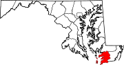
U.S. Highways Categories:- Crisfield, Maryland
- State highways in Maryland
- Roads in Somerset County, Maryland


Wikimedia Foundation. 2010.