- Maryland Route 578
-
Maryland Route 578
Bethlehem Road Route information Maintained by MDSHA Length: 4.24 mi[1] (6.82 km) Major junctions West end:  MD 331 in Bethlehem
East end:  MD 16 in Harmony
Location Counties: Caroline Highway system Maryland highway system
Interstate • US • State • Minor • Former • Turnpikes←  MD 577
MD 579  →
→Maryland Route 578 (MD 578) is a state highway in the U.S. state of Maryland. Known as Bethlehem Road, the state highway runs 4.24 mi (6.82 km) from MD 331 in Bethlehem east to MD 16 in Harmony. The first segment of MD 578 was completed in the mid 1930s; the remainder was built in the early 1940s.
Contents
Route description
MD 578 begins at an intersection with MD 331 (Dover Bridge Road) in Bethlehem. Bethlehem Road continues south as a county highway. MD 578 heads northeast as a two-lane road through farmland. After passing Newton Road, the state highway crosses Hog Creek. MD 578 meets its eastern terminus at MD 16 (Harmony Road) in the unincorporated village of Harmony.[2][1]
History
MD 578 was paved by 1935 from Bethlehem to Newton Road.[3] The remainder of the highway to Harmony, including the bridge over Hog Creek, was completed in 1941.[4][5]
Junction list
The entire route is in Caroline County.
Location Mile
[1]Destinations Notes Bethlehem 0.00 Bethlehem Road south Western terminus MD 331 (Dover Bridge Road) – Easton, PrestonHarmony 4.24 MD 16 (Harmony Road) – Denton, PrestonEastern terminus 1.000 mi = 1.609 km; 1.000 km = 0.621 mi References
- ^ a b c "Highway Location Reference: Caroline County" (PDF). Maryland State Highway Administration. 2009. http://www.marylandroads.com/Location/2009_CAROLINE.pdf. Retrieved 2010-10-20.
- ^ Google, Inc. Google Maps – Maryland Route 578 (Map). Cartography by Google, Inc. http://maps.google.com/maps?f=d&source=s_d&saddr=md-331+and+md-578+bethlehem,+md&daddr=md-578+and+md-16+harmony,+md&hl=en&geocode=FXM4TwId-i55-ynB6ohoCEO4iTFE_kG80L2lYA%3BFY64TwId8Sd6-ykH6NkWQ124iTHnz-i6R7XpzQ&mra=ls&sll=38.776101,-75.881109&sspn=0.015357,0.038581&ie=UTF8&t=h&z=13. Retrieved 2010-03-28.
- ^ Maryland Geological Survey. Map of Maryland Showing State Road System: State Aid Roads and Improved County Road Connections (Map) (1935 ed.).
- ^ Report of the State Roads Commission of Maryland. 1941-1942. Baltimore: Maryland State Roads Commission. 1943-03-15. p. 82. http://www.archive.org/details/annualreportsofs1941mary. Retrieved 2010-03-24.
- ^ Maryland State Roads Commission. Maryland: Official Highway Map (Map) (1946-47 ed.).
External links
Roads in Caroline County, Maryland State highways 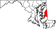 Categories:
- State highways in Maryland
- Roads in Caroline County, Maryland


Wikimedia Foundation. 2010.