- Maryland Route 306
-
Maryland Route 306
Houston Branch Road 
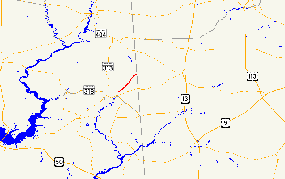
Maryland Route 306 highlighted in redRoute information Maintained by MDSHA Length: 4.13 mi[1] (6.65 km) Major junctions West end: Central Avenue in Federalsburg East end: Dublin Hill Road near Federalsburg Location Counties: Caroline Highway system Maryland highway system
Interstate • US • State • Minor • Former • Turnpikes←  MD 305
MD 307  →
→Maryland Route 306 (MD 306) is a state highway in the U.S. state of Maryland. Known as Houston Branch Road, the state highway runs 4.13 miles (6.65 km) from the town limits of Federalsburg east to the Delaware state line. MD 306 provides access to Idylwild Wildlife Management Area. The state highway was constructed in the late 1930s.
Contents
Route description
MD 306 begins at the eastern town limits of Federalsburg adjacent to Lake Chambers, an impoundment of Tanyard Branch.[1][2] The roadway continues west as Central Avenue toward an intersection with MD 315 (Liberty Road) east of downtown Federalsburg. MD 306 heads northeast, passing through a mix of farmland and forest.[2] The state highway also follows the eastern edge of Idylwild Wildlife Management Area. After crossing Houston Branch, MD 306 curves to the east and reaches its eastern terminus at the Delaware state line, where the highway continues into Sussex County as Dublin Hill Road.[1][2]
History
Approximately 1 mile (1.6 km) of Houston Branch Road from the Federalsburg end was paved as a state-aid road by 1910.[3] That short portion of highway was reconstructed and the remainder of MD 306 constructed as a modern highway in 1938 and 1939.[4][5] MD 306 originally included Central Avenue west to Liberty Road, which was originally MD 318 and became MD 315 after the completion of the Federalsburg Bypass in 1964.[6] The portion of highway within the town of Federalsburg was removed from MD 306 between 1980 and 1999.[7]
Junction list
The entire route is in Caroline County.
Location Mile
[1]Destinations Notes Federalsburg 0.00 Central Avenue west Western terminus 4.13 Dublin Hill Road east Eastern terminus; Delaware state line 1.000 mi = 1.609 km; 1.000 km = 0.621 mi References
- ^ a b c d "Highway Location Reference: Caroline County" (PDF). Maryland State Highway Administration. 2009. http://www.marylandroads.com/Location/2009_CAROLINE.pdf. Retrieved 2010-08-10.
- ^ a b c Google, Inc. Google Maps – Maryland Route 306 (Map). Cartography by Google, Inc. http://maps.google.com/maps?f=d&source=s_d&saddr=E+Central+Ave%2FMD-306+E&daddr=MD-306+E&hl=en&geocode=FV12TgIdSe17-w%3BFRQkTwIdsap8-w&mra=ls&sll=38.694571,-75.764723&sspn=0.007654,0.01929&ie=UTF8&t=h&z=13. Retrieved 2010-05-12.
- ^ Maryland Geological Survey. Map of Maryland (Map) (1910 ed.).
- ^ Report of the State Roads Commission of Maryland. 1937-1938. Baltimore: Maryland State Roads Commission. 1939-03-04. p. 392. http://www.archive.org/details/reportofstateroa1937mary. Retrieved 2010-08-10.
- ^ Maryland State Roads Commission. General Highway Map: State of Maryland (Map) (1939 ed.).
- ^ Maryland State Roads Commission. Maryland: Official Highway Map (Map) (1964 ed.).
- ^ "Highway Location Reference: Caroline County" (PDF). Maryland State Highway Administration. 1999. http://www.marylandroads.com/Location/1999_CAROLINE.pdf. Retrieved 2010-08-10.
External links
Roads in Caroline County, Maryland State highways 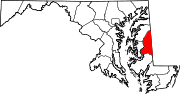 Categories:
- State highways in Maryland
- Roads in Caroline County, Maryland


Wikimedia Foundation. 2010.