- Maryland Route 314
-
Maryland Route 314

Route information Maintained by MDSHA Length: 4.93 mi[1] (7.93 km) Major junctions West end: End of state maintenance in Greensboro  MD 480 in Greensboro
 MD 313 in Greensboro
East end:  DE 12 in Whiteleysburg
Location Counties: Caroline Highway system Maryland highway system
Interstate • US • State • Minor • Former • Turnpikes← MD 313MD 315  →
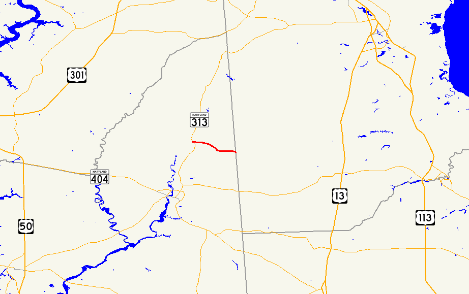
→Maryland Route 314 (MD 314) is a state highway in the U.S. state of Maryland. The state highway runs 4.93 miles (7.93 km) from the beginning of state maintenance in Greensboro east to the Delaware state line at Whiteleysburg, where the highway continues east as Delaware Route 12 (DE 12). What is now MD 314 was paved in Greensboro in the 1910s. The remainder of the state highway to Whiteleysburg was constructed in the late 1920s. MD 314 west of MD 480 was originally MD 315. When MD 313 bypassed Greensboro in 1950, MD 314 was extended west to its present terminus.
Contents
Route description
MD 314 begins in the town of Greensboro at a former railroad crossing between Cosden Street and Granby Street.[2] Sunset Avenue continues west as a municipal street.[1] MD 314 heads east toward the center of town, where the highway intersects MD 480 (Main Street). After crossing the Choptank River, the state highway meets MD 313 (Greensboro Road).[2] MD 314 continues east as Whiteleysburg Road through the eastern part of Greensboro, then leaves the town limits and passes through farmland. Immediately before the Delaware state line in the hamlet of Whiteleysburg, Burnite Mill Road, which is unsigned MD 314A, splits to the east while the main road curves southeast.[1][2] At the state line, MD 314 becomes DE 12, which immediately turns northeast onto Burnite Mill Road toward Felton while Whiteleysburg Road continues southeast toward Harrington.[2]
History
Sunset Avenue in Greensboro was paved by 1910.[3] A short stretch of Whiteleysburg Road was paved east of MD 313 by 1921.[4] Whiteleysburg Road, the original portion of MD 314, was completed in 1929.[5][6] Sunset Avenue west of Main Street was originally designated MD 315. MD 313 followed the portion of Sunset Avenue between the present intersection with MD 313 and Main Street, then headed north on Main Street toward Greensboro.[7] When the MD 313 bypass of Greensboro was completed in 1950, MD 314 was extended to its present western terminus, assuming all of old MD 315.[8][9]
Junction list
The entire route is in Caroline County.
Location Mile
[1]Destinations Notes Greensboro 0.00 Sunset Avenue west Western terminus 0.66 MD 480 (Main Street) – Ridgely1.02 MD 313 (Greensboro Road) – Denton, GoldsboroWhiteleysburg 4.83 Burnite Mill Road east Unsigned MD 314A; old alignment of MD 314 4.93 DE 12 east (Whiteleysburg Road) – Felton, DEEastern terminus; Delaware state line 1.000 mi = 1.609 km; 1.000 km = 0.621 mi Auxiliary route
MD 314A is the unsigned designation for Burnite Mill Road, a 0.10-mile (0.16 km) spur from MD 314 to the Delaware state line at Whiteleysburg, where the spur quickly encounters DE 12.[1][10] MD 314A is the old alignment of MD 314 at the Delaware state line. The present segment of MD 314 to the state line was originally MD 489, a designation that was removed by 1950.[7][9]
References
- ^ a b c d e "Highway Location Reference: Caroline County" (PDF). Maryland State Highway Administration. 2009. http://www.marylandroads.com/Location/2009_CAROLINE.pdf. Retrieved 2010-09-03.
- ^ a b c d Google, Inc. Google Maps – Maryland Route 314 (Map). Cartography by Google, Inc. http://maps.google.com/maps?f=d&source=s_d&saddr=W+Sunset+Ave&daddr=MD-314+E%2FWhiteleysburg+Rd&geocode=FQTBUgIdJSJ7-w%3BFUZvUgIdZmh8-w&hl=en&mra=ls&sll=38.977543,-75.817788&sspn=0.003828,0.009645&ie=UTF8&t=h&z=13. Retrieved 2010-09-03.
- ^ Maryland Geological Survey. Map of Maryland (Map) (1910 ed.).
- ^ Maryland Geological Survey. Map of Maryland: Showing State Road System and State Aid Roads (Map) (1921 ed.).
- ^ Report of the State Roads Commission of Maryland. 1927-1930. Baltimore: Maryland State Roads Commission. 1930-10-01. p. 201. http://www.archive.org/details/reportofstateroa1927mary. Retrieved 2010-09-03.
- ^ Maryland Geological Survey. Map of Maryland Showing State Road System: State Aid Roads and Improved County Road Connections (Map) (1930 ed.).
- ^ a b Maryland State Roads Commission. General Highway Map: State of Maryland (Map) (1939 ed.).
- ^ Report of the State Roads Commission of Maryland. 1949-1950. Baltimore: Maryland State Roads Commission. 1950-12-20. p. 110. http://www.archive.org/details/reportofstateroa1949mary. Retrieved 2010-09-03.
- ^ a b Maryland State Roads Commission. Maryland: Official Highway Map (Map) (1950 ed.).
- ^ Google, Inc. Google Maps – Maryland Route 314A (Map). Cartography by Google, Inc. http://maps.google.com/maps?f=d&source=s_d&saddr=2+State+Rd&daddr=2+State+Rd&geocode=FRBzUgIdlGJ8-w%3BFVhxUgIdNGh8-w&hl=en&mra=ls&sll=38.957298,-75.735626&sspn=0.003829,0.009645&ie=UTF8&t=h&z=19. Retrieved 2010-09-03.
External links
Roads in Caroline County, Maryland State highways 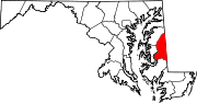 Categories:
- State highways in Maryland
- Roads in Caroline County, Maryland


Wikimedia Foundation. 2010.