- Maryland Route 577
-
Maryland Route 577
Reliance Road 
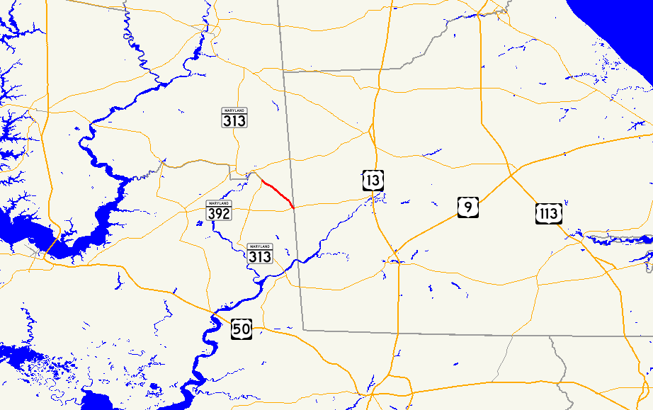
Maryland Route 577 highlighted in redRoute information Maintained by MDSHA Length: 3.70 mi[1] (5.95 km) Major junctions South end:  MD 392 in Reliance
North end:  MD 313 near Federalsburg
Location Counties: Caroline, Dorchester Highway system Maryland highway system
Interstate • US • State • Minor • Former • Turnpikes←  MD 575
MD 578  →
→Maryland Route 577 (MD 577) is a state highway in the U.S. state of Maryland. Known as Reliance Road, the state highway runs 3.70 miles (5.95 km) from MD 392 in Reliance north to MD 313 near Federalsburg. MD 577 follows the Dorchester–Caroline county line for its entire length. The state highway is considered to be in Caroline County for maintenance purposes.[2] The first section of MD 577 was paved near its northern terminus by 1910 and reconstructed as a state highway in 1935. The highway was completed south to Reliance in 1942.
Contents
Route description
MD 577 begins at an intersection with MD 392 (Finchville–Reliance Road) 0.03 mi (0.048 km) west of the Delaware state line.[1][3] The state highway heads northwest along the Caroline–Dorchester county line, passing through farmland.[1][3][4] MD 577 reaches its northern terminus at an intersection with MD 313 south of Federalsburg. Reliance Road continues toward Federalsburg as MD 313 north, while MD 313 south follows Eldorado Road into Dorchester County.[1][3]
History
The section of MD 577 for 1 mile (1.6 km) south of the MD 313 junction was paved by 1910.[5] That portion was repaved in 1935 as a state highway.[6][7] The remainder of MD 577 south to Reliance was completed in 1942.[8]
Junction list
MD 577 follows the Caroline–Dorchester county line for its entire length. The state highway is considered to be in Caroline County for maintenance purposes.[2]
Location Mile
[1]Destinations Notes Reliance 0.00 MD 392 (Finchville–Reliance Road) – Hurlock, Seaford, DESouthern terminus Federalsburg 3.70 MD 313 (Reliance Road/Eldorado Road) – Federalsburg, EldoradoNorthern terminus 1.000 mi = 1.609 km; 1.000 km = 0.621 mi References
- ^ a b c d e "Highway Location Reference: Caroline County" (PDF). Maryland State Highway Administration. 2009. http://www.marylandroads.com/Location/2009_CAROLINE.pdf. Retrieved 2010-10-20.
- ^ a b "Roads Maintained by District 2 - Caroline County". Maryland State Highway Administration. http://www.sha.maryland.gov/Index.aspx?PageId=479. Retrieved 2010-05-11.
- ^ a b c "Highway Location Reference: Dorchester County" (PDF). Maryland State Highway Administration. 2009. http://www.marylandroads.com/Location/2009_DORCHESTER.pdf. Retrieved 2010-10-20.
- ^ Google, Inc. Google Maps – Maryland Route 577 (Map). Cartography by Google, Inc. http://maps.google.com/maps?f=d&source=s_d&saddr=MD-577+N%2FReliance+Rd&daddr=MD-577+N%2FReliance+Rd&hl=en&geocode=FTiHTQId8Ml8-w%3BFfwhTgId1ht8-w&mra=ls&sll=38.675593,-75.750947&sspn=0.015311,0.038581&ie=UTF8&t=h&z=13. Retrieved 2010-05-11.
- ^ Maryland Geological Survey. Map of Maryland (Map) (1910 ed.).
- ^ Report of the State Roads Commission of Maryland. 1931-1934. Baltimore: Maryland State Roads Commission. 1934-12-28. p. 325. http://www.archive.org/details/reportofstateroa1931mary. Retrieved 2010-05-28.
- ^ Maryland Geological Survey. Map of Maryland Showing State Road System: State Aid Roads and Improved County Road Connections (Map) (1935 ed.).
- ^ Report of the State Roads Commission of Maryland. 1941-1942. Baltimore: Maryland State Roads Commission. 1943-03-15. p. 82. http://www.archive.org/details/reportofstateroa1941mary. Retrieved 2010-05-28.
External links
Roads in Caroline County, Maryland State highways 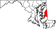
Roads in Dorchester County, Maryland State highways 
U.S. Highways Categories:- State highways in Maryland
- Roads in Dorchester County, Maryland
- Roads in Caroline County, Maryland


Wikimedia Foundation. 2010.