- National Register of Historic Places listings in St. Mary's County, Maryland
-
 Location of St. Mary's County in Maryland
This is a list of the National Register of Historic Places listings in St. Mary's County, Maryland.
This is intended to be a complete list of the properties and districts on the National Register of Historic Places in St. Mary's County, Maryland, United States. Latitude and longitude coordinates are provided for many National Register properties and districts; these locations may be seen together in a Google map.[1]
There are 31 properties and districts listed on the National Register in the county, including 3 National Historic Landmarks.
Contents: Counties in Maryland Allegany - Anne Arundel - Baltimore (city) - Baltimore County - Calvert - Caroline - Carroll - Cecil - Charles - Dorchester - Frederick - Garrett - Harford - Howard - Kent - Montgomery - Prince George's - Queen Anne's - Somerset - St. Mary's - Talbot - Washington - Wicomico - Worcester -
- This National Park Service list is complete through NPS recent listings posted November 10, 2011.[2]
Current listings
[3] Landmark name [4] Image Date listed Location City or town Summary 1 Abell house 
December 22, 2003 22530 Washington St., Maryland Route 326
38°17′20″N 76°38′16″W / 38.288889°N 76.637778°WLeonardtown Queen Anne style house constructed in 1910. 2 All Faith Church 
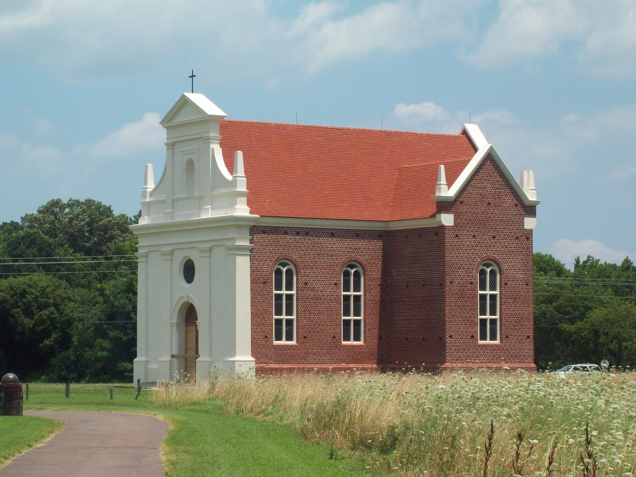
December 29, 2003 38885 New Market Turner Rd.
38°27′37″N 76°43′50″W / 38.460278°N 76.730556°WCharlotte Hall Georgian style church constructed 1766-1769. 3 Bachelor's Hope 
November 7, 1972 Off Maryland Route 238
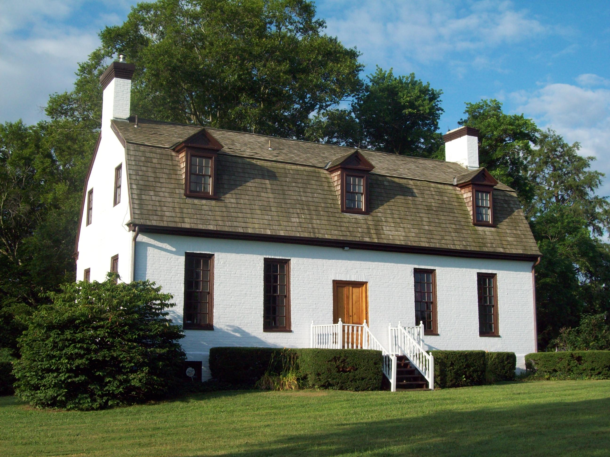
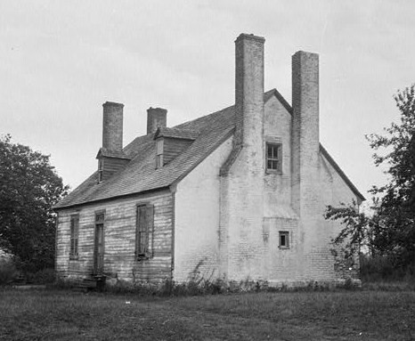
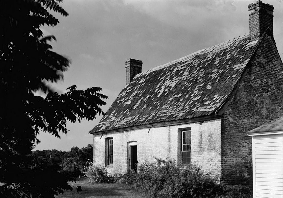
38°20′09″N 76°47′25″W / 38.335833°N 76.790278°WChaptico Brick 18th century dwelling built in the "Great Hall" plan. 4 Bard's Field 
November 7, 1976 1.2 miles (1.9 km) west of Ridge off Curleys Rd.
38°05′53″N 76°23′01″W / 38.098056°N 76.383611°WRidge Early 19th century frame dwelling with double exterior end chimneys. 5 Buena Vista August 19, 1998 Maryland Route 5, west of the junction of Maryland Routes 245 and 379
38°17′52″N 76°38′12″W / 38.297778°N 76.636667°WLeonardtown Greek Revival-style frame dwelling built between 1840 and 1850. 6 Cecil's Mill Historic District 
January 30, 1978 North of Great Mills on Indian Bridge Rd.
38°14′25″N 76°30′13″W / 38.240278°N 76.503611°WGreat Mills Consists of mill, general store, home, and abandoned Catholic church. 7 Charlotte Hall Historic District 
May 2, 1975 South of Hughesville at the junction of Maryland Routes 5 and 6
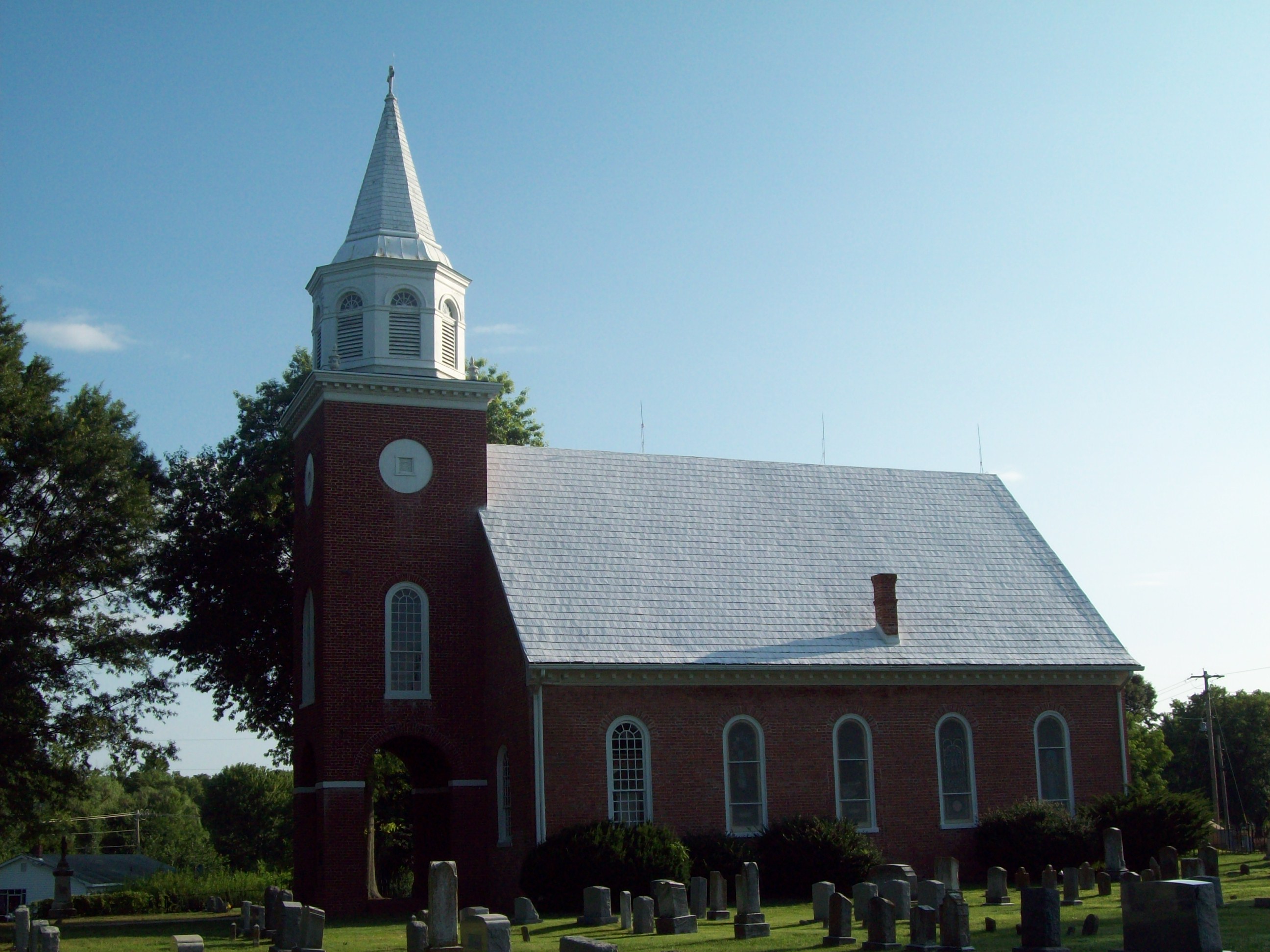
38°28′39″N 76°46′40″W / 38.4775°N 76.777778°WCharlotte Hall Consists of remains of Charlotte Hall Military Academy and local structures. 8 Christ Episcopal Church 
July 25, 1994 Maryland Route 238 (Maddox Rd.) southeast of its junction with Maryland Route 234
38°21′57″N 76°47′02″W / 38.365833°N 76.783889°WChaptico Brick church constructed in 1736. 9 Cross Manor 
October 6, 1988 Cross Manor Rd.
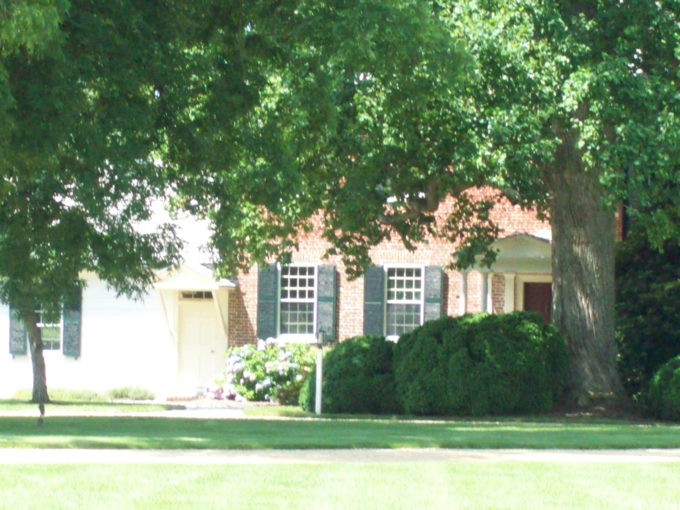
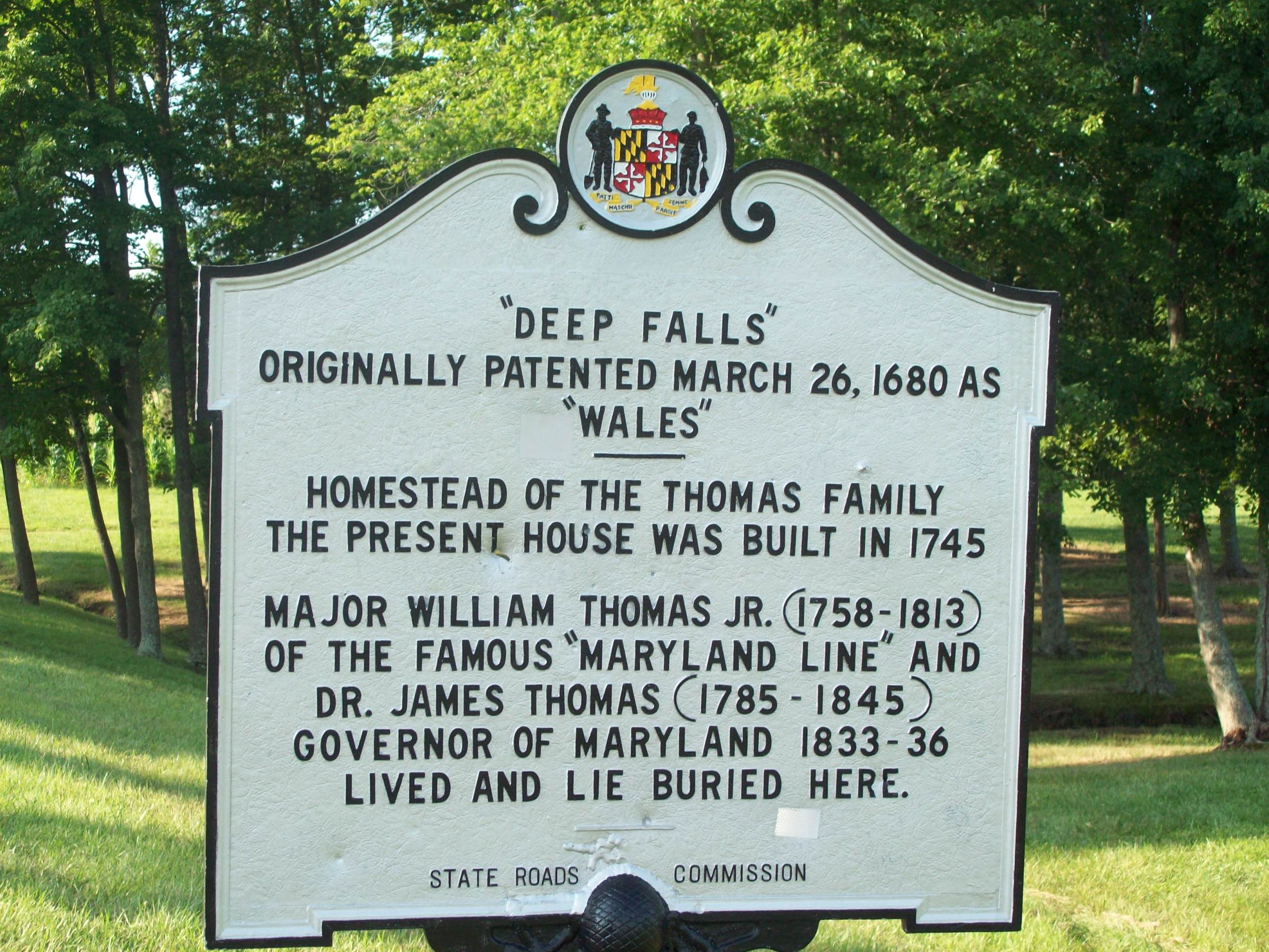
38°09′40″N 76°25′23″W / 38.161111°N 76.423056°WSt. Inigoes Dwelling built about 1789, with additions during the 19th century. 10 Deep Falls 
May 12, 1975 1-mile (1.6 km) southeast of Chaptico on the northern side of Maryland Route 234
38°21′29″N 76°45′27″W / 38.358056°N 76.7575°WChaptico Dwelling reportedly built in 1745; ancestral home of the descendents of Maryland Governor James Thomas. 11 MARY W.SOMERS (Chesapeake Bay skipjack) October 8, 1976 Southeast of St. Marys City at St. Inigoe's Creek
38°27′12″N 77°03′06″W / 38.453333°N 77.051667°WSt. Mary's City Chesapeake Bay skipjack, built in 1904. 12 Mattapany-Sewall Archeological Site 
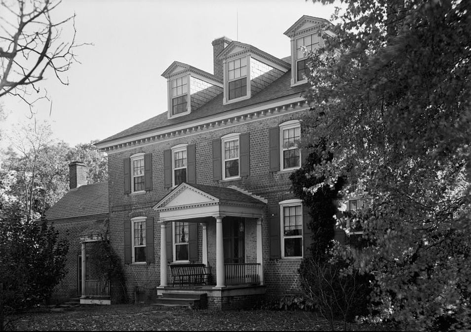
February 1, 1985 Address Restricted Lexington Park Site of Mattapany-Sewall, a manor established in 1663 and occupied from 1666 to 1684 by Charles Calvert, 3rd Baron Baltimore. 13 Mulberry Fields 
March 14, 1973 About 4.5 miles (7.2 km) southeast of Beauvue off Maryland Route 244
38°12′32″N 76°34′22″W / 38.208889°N 76.572778°WBeauvue Georgian-style "mansion-type" brick dwelling built about 1763. 14 Ocean Hall 
October 25, 1973 Bushwood Rd. off Maryland Route 239 at Bushwood Wharf
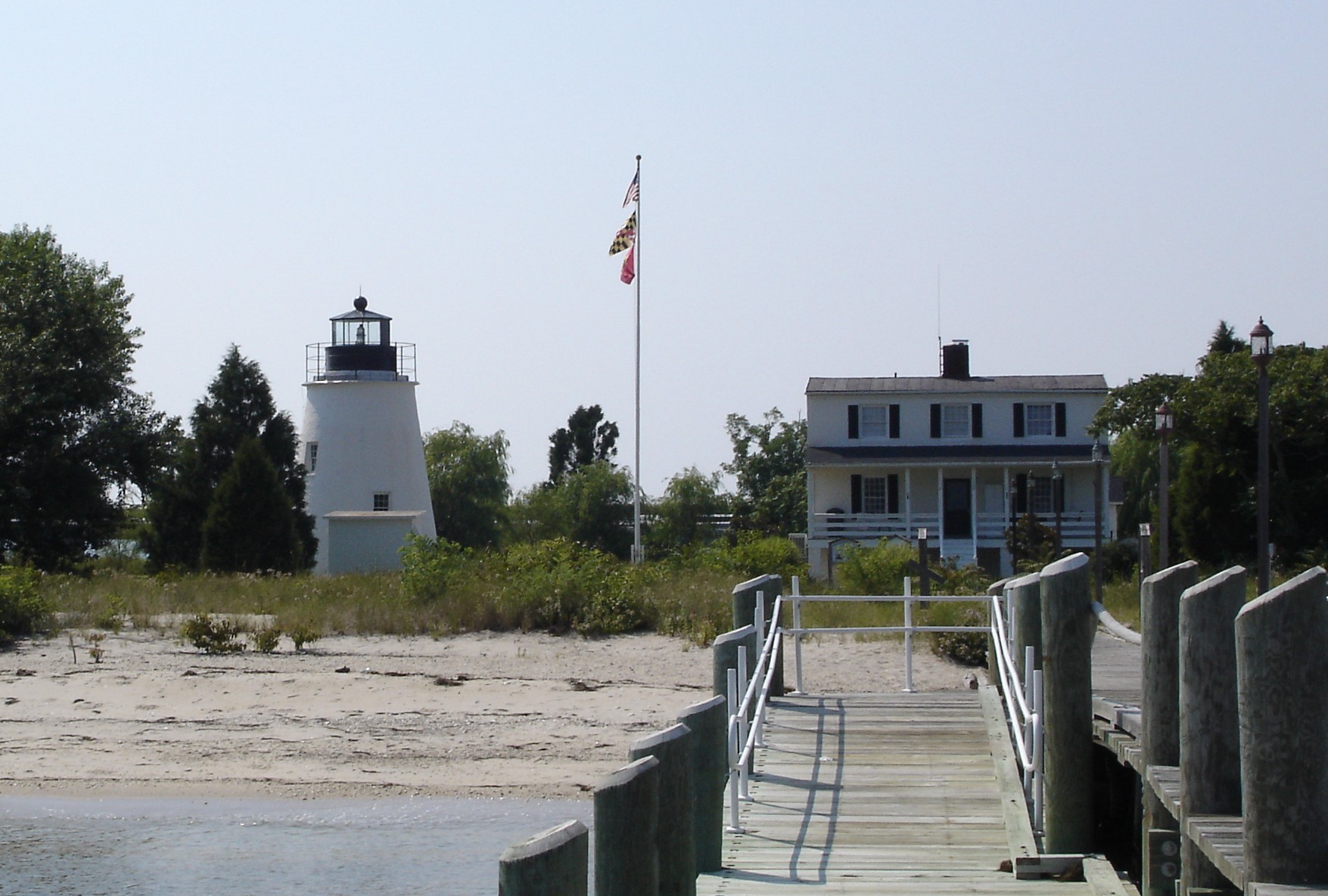
38°17′01″N 76°48′10″W / 38.283611°N 76.802778°WBushwood Dwelling believed to have been built about 1670. 15 Piney Point Coast Guard Light Station 
June 16, 1976 West of Piney Point on Maryland Route 498
38°08′06″N 76°31′47″W / 38.135°N 76.529722°WPiney Point Lighthouse built in 1836 and decommissioned in 1964; now operated as museum. 16 Point No Point Light Station 
December 2, 2002 Approximately 2 miles (3.2 km) east-southeast of Point No Point
38°07′40″N 76°17′27″W / 38.127778°N 76.290833°WDameron Lighthouse constructed in 1902; first lit in 1905; automated in 1938. 17 Porto Bello April 26, 1972 Maryland Route 244 east of Drayden
38°10′26″N 76°27′07″W / 38.173889°N 76.451944°WDrayden Brick dwelling built after 1742. 18 The River View May 4, 1976 Southeast of Oakley on Burch Rd. on Canoe Neck Creek
38°15′47″N 76°43′50″W / 38.263056°N 76.730556°WOakley Brick dwelling built by the Gardiner family in the early 18th century. 19 Sandgates On Cat Creek 
November 14, 1978 East of Oakville on Maryland Route 472, ½ mile from Patuxent River
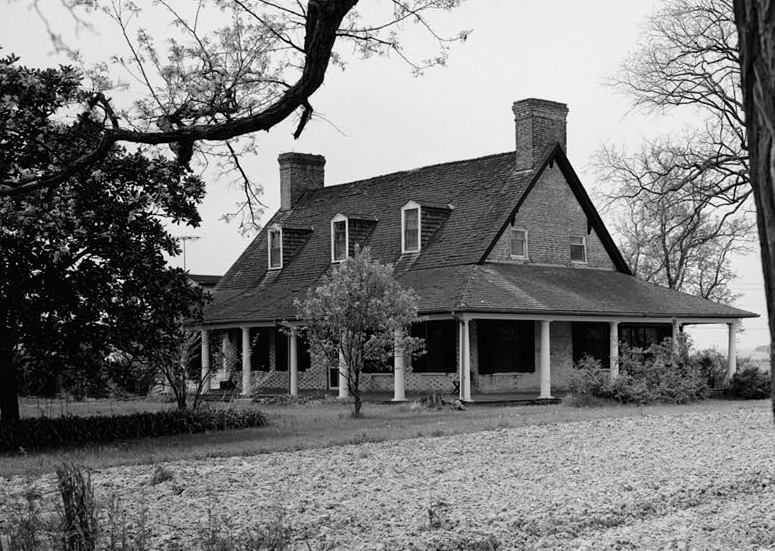
38°24′36″N 76°36′53″W / 38.41°N 76.614722°WOakville Frame dwelling with brick ends built between 1740 and 1780. 20 Sotterley 
November 9, 1972 East of the junction of Maryland Route 245 and Vista Rd.
38°22′47″N 76°32′20″W / 38.379722°N 76.538889°WHollywood National Trust owned property with original section of dwelling built in 1703. 21 St. Andrew's Church 
March 14, 1973 5 miles (8.0 km) east of Leonardtown on St. Andrew's Church Rd.
38°17′16″N 76°33′06″W / 38.287778°N 76.551667°WLeonardtown Rectangular brick box church designed in 1766. 22 St. Clement's Island Historic District 
April 10, 1972 South of Colton Point on the Potomac River
38°27′00″N 76°45′06″W / 38.45°N 76.751667°WColtons Point Landing site of original settlers of Maryland, 1634. 23 St. Francis Xavier Church and Newtown Manor House Historic District 
November 9, 1972 South of Compton on Maryland Route 243
38°15′20″N 76°42′01″W / 38.255556°N 76.700278°WCompton Site important in the 17th century ecclesiastical history of Maryland, as an example of a self-contained Jesuit community made self-supporting by the surrounding 700-acre (2.8 km2) farm. 24 St. George's Protestant Episcopal Church 
October 3, 1973 West of Valley Lee, off Maryland Route 249 on Maryland Route 244
38°11′42″N 76°31′16″W / 38.195°N 76.521111°WValley Lee Brick church built in 1799; believed to be the site of the oldest Anglican church in Maryland whose parish is still in existence. 25 St. Ignatius Roman Catholic Church 
November 3, 1975 West of St. Inigoes on Villa Rd.
38°09′02″N 76°25′25″W / 38.150556°N 76.423611°WSt. Inigoes Brick church constructed between 1785 and 1787, with the sacristy added in 1817. 26 St. Marys City Historic District 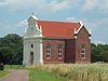
August 4, 1969 Address Restricted St. Mary's City Site of original English settlement in Maryland, 1634; provincial capital of Maryland until 1695. 27 St. Richard's Manor March 28, 1985 Millstone Landing Rd.
38°17′45″N 76°28′12″W / 38.295833°N 76.47°WLexington Park Brick dwelling constructed before 1750 on the Patuxent River. 28 Tudor Hall 
April 26, 1973 Tudor Hall Rd.
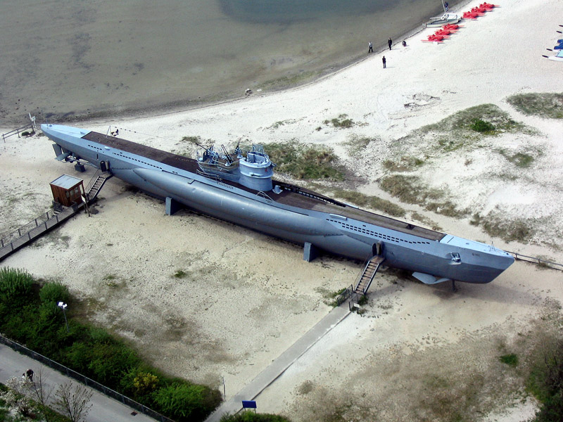
38°17′14″N 76°38′05″W / 38.287222°N 76.634722°WLeonardtown Georgian brick building built about 1798; home to the St. Mary’s County Historical Society. 29 U-1105 BLACK Panther (Type VIIC German Submarine) 
January 11, 2001 Potomac River
38°08′10″N 76°33′10″W / 38.136111°N 76.552778°WPiney Point World War II German U-Boat wreck; Maryland's first historic shipwreck preserve. 30 West St. Mary's Manor 
April 15, 1970 About 1-mile (1.6 km) east of Drayden on the St. Mary's River
38°11′10″N 76°26′54″W / 38.186111°N 76.448333°WDrayden Early Colonial-era house built between 1700 and 1730. 31 Woodlawn 
April 2, 1980 South of St. Marys on Maryland Route 252, west of Maryland Route 5
38°06′27″N 76°23′18″W / 38.1075°N 76.388333°WSt. Mary's City Federal-style, 18th century frame house. Formerly listed
[3] Landmark name Image Date listed Location City or town Summary 1 Resurrection Manor 
listed 1970; delisted February 17, 2006 Old Highway Hollywood Demolished See also
- List of National Historic Landmarks in Maryland
- National Register of Historic Places listings in Maryland
References
- ^ The latitude and longitude information provided in this table was derived originally from the National Register Information System, which has been found to be fairly accurate for about 99% of listings. For about 1% of NRIS original coordinates, experience has shown that one or both coordinates are typos or otherwise extremely far off; some corrections may have been made. A more subtle problem causes many locations to be off by up to 150 yards, depending on location in the country: most NRIS coordinates were derived from tracing out latitude and longitudes off of USGS topographical quadrant maps created under the North American Datum of 1927, which differs from the current, highly accurate WGS84 GPS system used by Google maps. Chicago is about right, but NRIS longitudes in Washington are higher by about 4.5 seconds, and are lower by about 2.0 seconds in Maine. Latitudes differ by about 1.0 second in Florida. Some locations in this table may have been corrected to current GPS standards.
- ^ "National Register of Historic Places: Weekly List Actions". National Park Service, United States Department of the Interior. Retrieved on November 10, 2011.
- ^ a b Numbers represent an ordering by significant words. Various colorings, defined here, differentiate National Historic Landmark sites and National Register of Historic Places Districts from other NRHP buildings, structures, sites or objects.
- ^ "National Register Information System". National Register of Historic Places. National Park Service. . http://nrhp.focus.nps.gov/natreg/docs/All_Data.html.
U.S. National Register of Historic Places in Maryland Lists by county Allegany • Anne Arundel • Baltimore County • Calvert • Caroline • Carroll • Cecil • Charles • Dorchester • Frederick • Garrett • Harford • Howard • Kent • Montgomery • Prince George's • Queen Anne's • Somerset • St. Mary's • Talbot • Washington • Wicomico • Worcester

Lists by city Other lists Municipalities and communities of St. Mary's County, Maryland Town 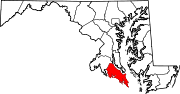
CDPs Other
communitiesAbell | Avenue | Beachville-St. Inigoes | Beauvue | Bushwood | Callaway | Chaptico | Clements | Coltons Point | Compton | Dameron | Drayden | Great Mills | Helen | Hollywood | Hopewell | Loveville | Maddox | Mechanicsville | Morganza | Oakley | Oakville | Park Hall Estates | Piney Point | Ridge | St. George Island | St. Inigoes Shores | St. Mary's City | Scotland | Spencers Wharf | Tall Timbers | Valley Lee
Categories:- National Register of Historic Places in Maryland by county
- St. Mary's County, Maryland
-


Wikimedia Foundation. 2010.