- St. Clement's Island State Park
Infobox_protected_area | name = St. Clement's Island State Park
iucn_category = V
caption =
locator_x = 171
locator_y = 121
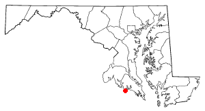
location =St. Mary's County, Maryland , USA
nearest_city = Leonardtown, Maryland
lat_degrees = 38
lat_minutes = 12
lat_seconds = 30
lat_direction = N
long_degrees = 76
long_minutes = 44
long_seconds = 40
long_direction = W
area = 40 acres (160,000 m²)
established =
governing_body =Maryland Department of Natural Resources
visitation_num =
visitation_year =St. Clement's Island lies in the
Potomac River nearColton's Point, Maryland , in theUnited States . The uninhabited island has been designated St. Clement's Island State Park.The park preserves the site of the
March 25 ,1634 , landing of Maryland's first colonists, commemorated asMaryland Day . The island served as a convenient and non-threatening temporary base of operations for the 150 settlers, as they negotiated with theYaocomico Indians for land for a permanent settlement. It was the site of perhaps the first mass celebrated in that part of the world, said by Jesuit Father Andrew White on the day of the landing. They named the island in honor of Pope Saint Clement I, patron of mariners.A water ferry leaves from the St. Clement's Island-Potomac River Museum near Colton's Point. A stone cross stands on the island, in memory of the first settlers. The park is administered by
Point Lookout State Park . The St. Clement's Island Historic District was listed on theNational Register of Historic Places onApril 10 ,1972 .For many years the island, then known as Blakistone Island, was the site of a lighthouse.
External links
* [http://www.dnr.state.md.us/publiclands/southern/stclements.html St. Clement's Island State Park]
Wikimedia Foundation. 2010.