- Crow Wing State Park
-
Crow Wing State Park Minnesota State Park 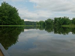
Country  United States
State  Minnesota
Counties Cass, Crow Wing, Morrison Location Brainerd - elevation 1,158 ft (353 m) [1] - coordinates 46°16′20″N 94°20′00″W / 46.27222°N 94.3333333°W Area 3,119 acres (1,262.2 ha) Founded 1959 Management Minnesota Department of Natural Resources 
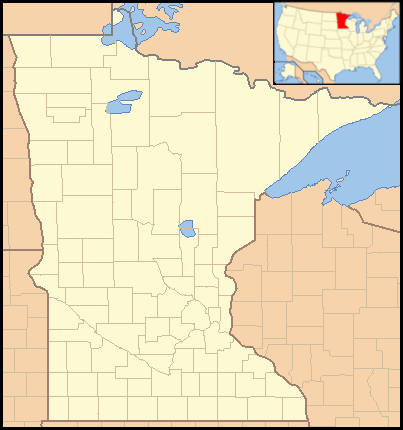
 Location of Crow Wing State Park in Minnesota
Crow Wing State Park is a 3,119 acre (12.62 km²) Minnesota state park at the confluence of the Mississippi and Crow Wing Rivers. The park interprets the site of Old Crow Wing, one of the most populous towns in the state in the 1850s and 1860s. The entire park was added to the National Register of Historic Places in 1970.
Contents
Natural history
The park lies on a sandur formed from the outwash of Glacial Lake Grantsburg. The present-day vegetation is oak forest with red, white, and jack pine; and aspen, with prairie and wetland openings.
Cultural history
-
- See also: Old Crow Wing, Minnesota
The confluence of the Crow Wing and Mississippi Rivers formed a natural crossroads, attracting humans with its easy travel routes and quality hunting. At the beginning of the historical period the region was inhabited by Dakota, who clashed with Ojibwa being displaced from farther east . It is told that in 1768 a Dakota war party raided an Ojibwa village and carried off several women in their canoes. The village's warriors, returning from their own unsuccessful raid, laid an ambush on a high bank over the river, digging shallow pits from which to fire their rifles. As the Dakota convey passed under the Ojibwa, the men opened fire, while the captured women overturned the canoes they were in and swam for shore. The Dakota regrouped and counterattacked by land, but were repulsed. The two day battle cemented Ojibwa control over the area.[2]
European fur traders began frequenting the area in the late 18th century. A trading post was opened in 1823, around which a town slowly grew. The town lay on the route of a new section of the Red River Trails blazed in 1844, and the local economy boomed. Several Crow Wing traders went on to great prominence in early Minnesota, including the men after whom Morrison County, Aitkin County, and Rice County are all named. A Métis named Clement Beaulieu ran the American Fur Company's trading post while another named William Whipple Warren wrote an early history of the Ojibwa. Three churches were established in town, including a Catholic mission by Father Francis Xavier Pierz.
Crow Wing's heyday came to a swift end. In 1868 the Ojibwa were resettled in the White Earth Indian Reservation. In 1871 railroad magnate James J. Hill decided to route his Northern Pacific Railroad over the Mississippi River in Brainerd, ten miles (16 km) to the north. By 1880 most of Crow Wing's residents had moved on.
The Crow Wing County Historical Society led efforts to establish a state park around the townsite. The park was authorized by the Minnesota Legislature in 1959. Some controversy arose when the Knights of Columbus built a chapel on the site of Father Pierz' mission. However the chapel was located on a small parcel of privately held land and no public funds were used for its construction, so legally separation of church and state was maintained.[3]
State funds and private donations enabled the park to expand by 552 acres (2.23 km2) in 2006, adding 3.13 miles (5.04 km) of frontage on the Mississippi River. There are plans to extend the Paul Bunyan State Trail through Crow Wing State Park along this section.[4]
Recreation
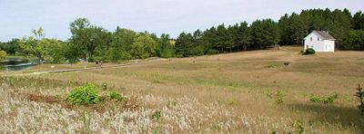 Crow Wing State Park interprets the site of Old Crow Wing, Minnesota, once the northernmost European settlement on the Mississippi River.
Crow Wing State Park offers 14 miles (23 km) of hiking trails, some of which are open to cross-country skiing or snowmobiling in winter. There is a campground with 61 sites and a camper cabin. There is also a group camp and a riverside campsite for canoeists. A boat ramp provides access to the rivers, with rental craft available.
Although most of the structures of Old Crow Wing have decayed or were moved away, some are left and interpretive signs commemorate others. Clement Beaulieu's house, with its Greek Revival architecture, was moved back to its original location in 1988. Several headstones are still visible in the Catholic cemetery. Oldest of all, the shallow depressions marked as the Indian Rifle Pits may be the vestiges of the 1768 Ojibwa ambush.
References
- ^ "Crow Wing State Park". Geographic Names Information System. United States Geological Survey. 2006-11-16. http://geonames.usgs.gov/pls/gnispublic/f?p=gnispq:3:::NO::P3_FID:2094130. Retrieved 2011-02-24.
- ^ Warren, William W. History of the Ojibway People. Minnesota Historical Society Press: St Paul, 1984.
- ^ Meyer, Roy W. Everyone's Country Estate: A History of Minnesota's State Parks. Minnesota Historical Society Press: St. Paul, 1991.
- ^ Lien, Dennis. "Land deal helps link state park to trail." St. Paul Pioneer Press December 20, 2006, B6.
- Minnesota Department of Natural Resources. Crow Wing State Park signage, brochures, and website.
External links
U.S. National Register of Historic Places Topics Lists by states Alabama • Alaska • Arizona • Arkansas • California • Colorado • Connecticut • Delaware • Florida • Georgia • Hawaii • Idaho • Illinois • Indiana • Iowa • Kansas • Kentucky • Louisiana • Maine • Maryland • Massachusetts • Michigan • Minnesota • Mississippi • Missouri • Montana • Nebraska • Nevada • New Hampshire • New Jersey • New Mexico • New York • North Carolina • North Dakota • Ohio • Oklahoma • Oregon • Pennsylvania • Rhode Island • South Carolina • South Dakota • Tennessee • Texas • Utah • Vermont • Virginia • Washington • West Virginia • Wisconsin • WyomingLists by territories Lists by associated states Other Categories:- Protected areas of Cass County, Minnesota
- Protected areas of Crow Wing County, Minnesota
- Minnesota state parks
- Protected areas of Morrison County, Minnesota
- National Register of Historic Places in Minnesota
- Native American history of Minnesota
- Protected areas on the Mississippi River
- Protected areas established in 1959
-


Wikimedia Foundation. 2010.