- Mississippi Headwaters State Forest
-
Mississippi Headwaters State Forest
Geography Location Beltrami, Clearwater, and Hubbard counties, Minnesota, United States Elevation 1,358 feet (414 m) Area 45,290 acres (183.3 km2; 70.77 sq mi) Established 1935 Governing body Counties, Minnesota DNR Website dnr.state.mn.us/state forests/sft00034/index.html Ecology WWF Classification Western Great Lakes Forests EPA Classification Northern Lakes and Forests Map 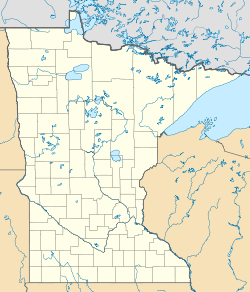
 Mississippi Headwaters State Forest
The Mississippi Headwaters State Forest is a state forest located near the town of Wilton in Beltrami County, Minnesota. Portions of the forest extend into the neighboring counties of Clearwater and Hubbard. The majority of the forest is managed by the respective counties, with the Minnesota Department of Natural Resources managing around 9,000 acres (3,600 ha). The forest is named after its location immediately downstream (north) of Lake Itasca, the headwaters of the Mississippi River.
The topography of the region, such as hills and flat outwash plains, are a result of the Wisconsinan glaciation. The sandy soil of the moraines are dominated by Eastern White Pine, Red Pine, oaks, maples, birch, and aspen; Black Spruce, Northern Whitecedar, and Tamarack are also present on the wet peat-like soils of the forest.
Popular outdoor recreational activities available revolve around the river and the 95 lakes and ponds within the forest, and include boating, canoeing, kayaking, and swimming. Trails are designated for hunting and dispersed camping. Trails are designated for hiking, mountain biking, and snowmobiling in the wintertime.[1] Coordinates: 47°26′16″N 95°03′30″W / 47.4377313°N 95.0583429°W[2]
References
Categories:- Minnesota state forests
- Protected areas of Beltrami County, Minnesota
- Protected areas of Clearwater County, Minnesota
- Protected areas of Hubbard County, Minnesota
- Protected areas established in 1935

Wikimedia Foundation. 2010.