- Sakatah Lake State Park
Geobox|Protected area
name = Sakatah Lake State Park
category =Minnesota State Park
category_iucn = V
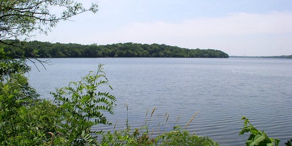
image_caption = Sakatah Lake State Park as seen from the east shore of Sakatah Lake.
country = United States
country_
state = Minnesota
state_
state_type = State
region_type = Counties
region = Le Sueur
region1 = Rice
city_type = City
city = Waterville
lat_d = 44
lat_m = 13
lat_s = 15
lat_NS = N
long_d = 93
long_m = 32
long_s = 8
long_EW = W
area_unit = acre
area_imperial = 842
area_round = 1
established = 1963
map_locator = Minnesota

management_body =Minnesota Department of Natural Resources Sakatah Lake State Park is an 842 acre (3.4 km²)
Minnesota state park on a natural widening of theCannon River near the town of Waterville. The Dakota native to the area called it "Sakatah" which means "singing hills". To honor this native heritage, some of the trails in the park have been given Dakota names. TheSakatah Singing Hills State Trail , which connects Faribault and Mankato, runs through this park.Natural history
The park sits on a thick
moraine deposited during theWisconsin glaciation , resulting in a rolling and uneven topography. Blocks of ice left behind as the glaciers melted formed the basin in which Sakatah Lake now lies.The park preserves a mixed transitional habitat where the
Big Woods (maple ,basswood ,elm ) of centralMinnesota blend into theoak barrens of the southern part of the state. During drier eras patches ofprairie arose, although they are now succeeding back to hardwood forests. The landscape is further diversified by wetlands and agricultural fields.Cultural history
The Wahpekute band of Dakota Sioux traditionally inhabited this area, using the
Cannon River as an important transportation route. Some of their burial mounds remain in the park. European settlement came in the late 1800s, and a rail line was laid between Faribault and Waterville in 1882, and extended to Mankato by 1886. By chance the forest on the south shore of Sakatah Lake was never logged, and a 1962 inquiry into making it a state park received much local support. The site was included in a bill that passed the next year which authorized fourteen state parks. Development occurred over the next few years and Sakatah Lake State Park officially opened to the public in 1967. Although there was a rail line running through the park, it was only occasionally used, and in 1976 the owners abandoned it entirely and willingly sold it to the state, which converted it into the Sakatah Singing Hills State Trail.Recreation
*Boating: The park has a public boat ramp and four rental canoes.
*Camping:
**Shaded campground with 62 sites and one camper cabin.
**Two primitive group camps accessible by road at the east end of the park.
**Camping area for travelers on the Sakatah Singing Hills State Trail.
*Fishing: There is a fishing pier near the picnic area.
*Trails: There is a total of convert|39|mi|km of trails in the park, most of them well-shaded.
**Sakatah Singing Hills State Trail (hiking/biking/roller-blading/snowmobiling)
**Oak Tree/Utahu Can Trail - Hidden Pond Trail - Sumac Trail (hiking/skiing): These three trails form a loop around the center of the park.
**Big Woods/Tanka Canwitc Loop (hiking/skiing): A 1km loop accessible from either of the trail systems listed above.
**Wahpekute Trail (hiking): The least developed trail in the park runs right along the lakeshore.
**Timber Doodle Trail (hiking/skiing): A level loop through the more exposed scrub area in the eastern part of the park.
*There is no designated swimming area in the park. The shore is quite muddy.Directions
Take exit #56 off I-35 in Faribault, MN and follow MN-60 west for convert|14|mi|km. Turn right at the sign for the park.
External links
* [http://www.dnr.state.mn.us/state_parks/sakatah_lake/narrative.html Sakatah Lake State Park website]
References
*Arthur, Anne. "Minnesota's State Parks". Adventure Publications, Inc.: Cambridge, MN, 1998.
*Meyer, Roy W. "Everyone's Country Estate: A History of Minnesota's State Parks". Minnesota Historical Society Press: St. Paul, 1991.
*Minnesota Department of Natural Resources. 2006. The Minnesota Department of Natural Resources Web Site (online).

Wikimedia Foundation. 2010.