- Tettegouche State Park
__NOTOC__Infobox nrhp
name =Tettegouche Camp Historic District
nrhp_type =hd

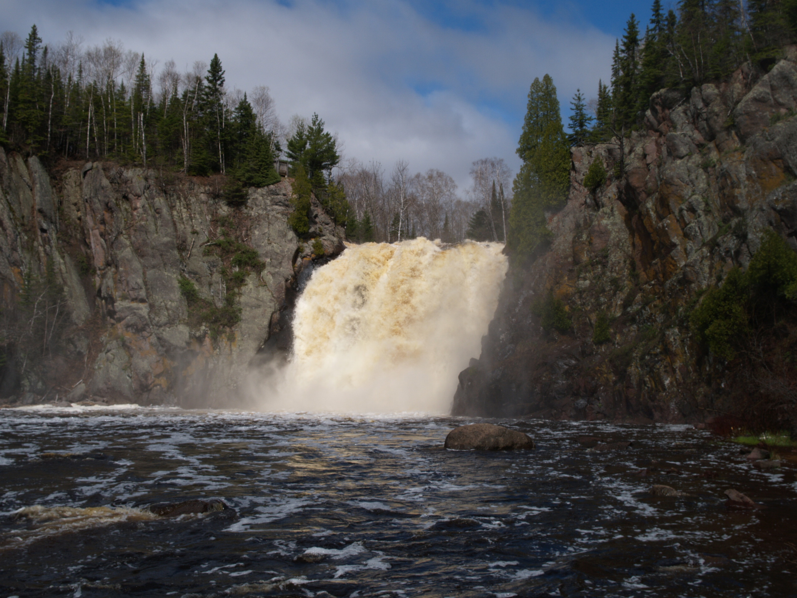
caption = Baptism River Falls
location = Off County Hwy. 4
nearest_city =Silver Bay, Minnesota
lat_degrees =47
lat_minutes =20
lat_seconds =9
lat_direction = N
long_degrees =91
long_minutes = 11
long_seconds = 58
long_direction = W
area =
built =
architect =
architecture =
added =January 17 ,1989
visitation_num =
visitation_year =
refnum = 88003084
mpsub =
governing_body = Minnesota Department of Natural ResourcesTettegouche State Park is a
Minnesota state park on the north shore ofLake Superior 58 miles (93 km) northeast of Duluth in Lake County on scenic Minnesota Highway 61. The park's name stems from the Tettegouche Club, an association of local businessmen which purchased the park in 1910 from the Alger-Smith Lumber Company. The club's members protected the area until its sale in 1971 to the deLaittres family. In 1979, the state of Minnesota acquired convert|3400|acre|km2|0 from the Nature Conservancy, including Tettegouche Camp. The land was added to Baptism River State Park, which was renamed Tettegouche State Park. [cite web | last = Gauper | first = Beth | title = Heirs to a Hideaway | publisher = St. Paul Pioneer Press, via BethGauper.com | date = 2007-02-11 | url = http://bethgauper.com/articles/2007_tettegouche.html | accessdate = 2007-08-15 ]Features
The park is 9,346 acres (37.8 km²), and contains six inland lakes (four of which support
Northern Pike and one supportsWalleye fishing), fourwaterfall s, and a beach on Lake Superior. The 70 ft (22 m) tall waterfallHigh Falls located on theBaptism River is the highest waterfall located entirely within Minnesota. [High Falls on the Pigeon River is higher, but is on the border with Ontario.] The park contains 22 miles (35 km) of hiking trails, 12 miles (19.3 km) of Ski trails, and access to theSuperior Hiking Trail . Tettegouche is bordered to the north by theFinland State Forest and shares the Red Dot motorized trail with it. The trail is for use byall-terrain vehicle s andsnowmobile s and is the only ATV trail in a state park.The park is one of only four state parks in Minnesota offering
rock climbing . Both Shovel Point andPalisade Head cliffs are popular spots offering climbing directly over Lake Superior.Wildlife
Common wildlife seen at the park includes the
white-tail deer ,hawk ,woodpecker , red squirrel,snowshoe hare ,weasel , andbeaver . Other wild life that can be seenmoose , black bear,river otter , andred fox on occasion thetimber wolf ,coyote , fisher, pine marten andnorthern flying squirrel can be seen. The park also hasperegrine falcon s that nest in the cliffs along Lake Superior.Amenities
The park contains several camping areas, with drive-in, cart-in, walk-in and
kayak -in sites. The Tettegouche Camp, on Mic Mac Lake, is listed on theNational Register of Historic Places . and features four hike-to cabins. One drive-up cabin is available at Illgen Falls. There is a visitor center open year-round. The campgrounds feature flush toilets, showers, and public phones. Firewood and ice can be purchased at the campground. The cabins and campsites can be booked through [https://www.stayatmnparks.com/ stayatmnparks.com] . Fivepicnic areas are also available with fire rings and tables.Gallery
References
External links
* [http://www.dnr.state.mn.us/state_parks/tettegouche/index.html Tettegouche State Park website]
* [http://files.dnr.state.mn.us/maps/state_parks/spk00269.pdf Tettegouche Map and Info]
Wikimedia Foundation. 2010.
