- Savanna Portage State Park
To access the relevant data, search the database by entering "Savanna Portage" in the "Name" field, and "MN" in the "Location" field.]
nrhp_type =
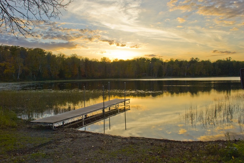
caption =Savanna Portage State Park
location= Off Co. Hwy. 5 in Savanna Portage State Park
nearest_city=McGregor, MN
lat_degrees = | lat_minutes = | lat_seconds = | lat_direction = | long_degrees = | long_minutes = | long_seconds = | long_direction =
area =
added =April 23 ,1973
refnum=73000963
governing_body =Minnesota Department of Natural Resources Savanna Portage State Park was established as a Minnesota state park in 1961 to preserve the historic Savanna Portage, a difficult six-mile (10 km) trail connecting the watersheds of the
Mississippi River andLake Superior . The park contains adrainage divide separating theWest Savanna River , which drains to the Mississippi and theGulf of Mexico , from theEast Savanna River , which flows in an opposite direction to theSaint Louis River , Lake Superior and theGreat Lakes , and theSaint Lawrence River to theAtlantic Ocean .Savanna Portage was a
canoe portage used by Native Americans for centuries before being used by European explorers,fur trade rs, voyageurs, and missionaries of the 18th and 19th centuries. It was a vital link connecting the Mississippi waterways to the west with theGreat Lakes to the east. The portage is listed in theNational Register of Historic Places . The park which now contains it is located 17 miles (27 km) north and east ofMcGregor, Minnesota , and approximately 50 miles (80 km) west of Duluth.Geology and topography
The park is located on the divide between the watersheds of the
Great Lakes and theGulf of Mexico , both of which drain to theAtlantic Ocean . The area is a low-relief plain which was once aglacial lake bed. During the last phase of the last Ice Age, the deteriorating continental glacier left behind connected lakes, known as Glacial Lakes Aitkin and Upham. Formed by the retreat of the St. Louis Sublobe of the Superior Lobe of the glacier, [Ojakangas & Matsch (1982), p. 109.] Lake Upham drained through Lake Aitkin toMississippi River . The retreating glacier and the lakes deposited sand and sediments in the lakebed. [Sansome (1983), p. 155; Waters, (1977), pp. 26, 211, 225.] As the lakes drained these sediments became the present plain.The plain at first was drained by the
Cloquet River , which then ran west to the Mississippi. By the process ofstream piracy , the smallerSaint Louis River , which runs toLake Superior , captured the Cloquet and most of its drainage basin. This left behind theEast Savanna River which drains into the St. Louis, Lake Superior, the lower Great Lakes, and theSt. Lawrence River , and to the west, theWest Savanna River , which is tributary to the Mississippi. [Ojakangas & Matsch (1982), pp. 110-111; Sansome (1983), pp. 129-31; Waters (1977), pp. 26, 28-29.]The old lake plain is part of the Tamarack Lowlands Subsection within the Northern Minnesota Drift Plains Section of the Laurentian Mixed Forest.
Lacustrine sediments deposited by the glacial lake are parent to the present soils of peats, silt, and sand; the peats are in marshes which form large parts of the park. [http://www.dnr.state.mn.us/ecs/212Nd/index.html Tamarack Lowland Subdivision, Ecological Classification System.] ] These wet lowlands adjoin rolling hills which are end moraines of the recent glaciation. These moraines are part of the St. Louis Moraines Subdivision of the Northern Minnesota Drift Plain. [http://www.dnr.state.mn.us/ecs/212Nb/index.html St. Louis Moraines Subdivision, Ecological Classification System.] ] [http://www.exploreminnesota.com/listing.aspx?EntityID=1613 Explore Minnesota Tourism.] ]avanna Portage
The plain in the old lakebed provided a low-grade but very swampy overland route across the divide between the East and West Savanna Rivers. Wolf Lake, source of the East Savanna, is only about convert|800|yd|m east of Savanna Lake on the West Savanna. [cite web | title = 209 km N of Minneapolis, Minnesota, United States | work = Topographic Map | publisher = U.S.G.S via terraserver.microsoft.com | date =
1980-07-01 | url = http://terraserver-usa.com/map.aspx?t=2&s=12&lon=-93.1737457239844&lat=46.8492247307885&w=600&h=400&opt=0&f=Tahoma,Verdana,Arial&fs=8&fc=ffffff99
accessdate = 2008-03-16 ] As Wolf Lake and the upper East Savanna are very swampy, the route selected for the portage trail departed from the river further downstream, shortening the distance to be traveled through the bog. The portage, some six miles (10 kilometers) long, starts in the swamp and then goes west in a wooded upland to reach the West Savanna.Long used by Native Americans, [ [http://www.dnr.state.mn.us/state_parks/savanna_portage/index.html Savanna Portage.] ] it became a thoroughfare between the
Great Lakes and the Mississippi Valley for explorers, missionaries, and fur traders. [Axelson (2008), pp. 51, 56-59, 63.] Travelers from the east exited Lake Superior near Fond du Lac ("head of the lake", where Duluth is now located), and ascended the steep, rocky, and difficult gorge of the lower Saint Louis River, which falls some 450 feet (137 meters) from the location ofCarlton, Minnesota through what is nowJay Cooke State Park to its outlet at the lake. [Waters (1977), pp. 25-28. Much of this journey through the gorge was made on foot by a path known as the "Grand Portage", which is not to be confused with the more famous inland route from Lake Superior at Grand Portage, the rendezvous point forNorth West Fur Company voyageurs located in extreme northeastern Minnesota. "Id."] Above Carlton travelers proceeded upstream through quieter stretches to the location ofFloodwood, Minnesota , where they turned southwest up the sluggish East Savanna River in the bed of Glacial Lake Upham. Coming to a small rise, the travelers commenced the portage, which in its eastern reaches was marshy, mosquito-infested, and among the most unpleasant and even tortuous of all the routes taken by the voyageurs. [Waters (1977), pp. 28-29; Axelson (2008); pp. 51-57.] Struggling waist-deep through the morass of the "boundless swamp", [Axelson (2008), pp. 56-59.] travelers eventually reached a hardwood forest, through which the trail ran to the West Savanna River, which drains toBig Sandy Lake and the Upper Mississippi. [Axelson (2008), pp. 61-63.]The portage likely was used by Europeans as early as 1679, when
Daniel Greysolon, Sieur du Lhut visited aSioux village at Big Sandy Lake during his exploration of the Lake Superior region and the Upper Mississippi.Upham (1908), p. 233.] Among the portage's users were fur traders who operated in the upper Mississippi valley. Some went no further than theAmerican Fur Company 's large regional trading post on Big Sandy Lake operated byWilliam Aitkin in the 1820s and 1830s, the years of peak usage of the route. [Axelson (2008), p. 59.] Explorers and scientists crossing the portage included David Thompson, British explorer of Canada and North West Fur Company cartographer, in 1798, [Axeslon (2008), p. 59.]Zebulon Pike , early explorer of the American west, in 1805, [Axeslon (2008), p. 59.]Lewis Cass , American general and explorer, in his unsuccessful 1820 search for the source of the Mississippi River, [Axelson (2008), p. 63.]Henry Schoolcraft , geologist and explorer, who accompanied Cass in 1820 and led an expedition in 1832 to find the Mississippi’s source, [ Schoolcraft was a geologist with Lewis Cass’ 1820 expedition, and led his own expedition in 1832, which reached the river’s source atLake Itasca . Schoolcraft therefore was credited with the discovery of the Mississippi’s source, although he was shown to the lake by Ozawandib, aChippewa guide. Axelson (2008), p. 63; Waters (1977), p. 201.]Joseph Nicollet , French geographer and cartographer of the Upper Mississippi, in 1836, [Axeslon (2008), p. 59.] andLaurence Oliphant , a British explorer and writer, in 1854. [Axelson (2008), p. 56; [http://www.electricscotland.com/webclans/ntor/oliphants5.htm OLIPHANT. Laurence, author of "Piccadilly"] , "Oliphants of Condie & Gask, Scottish and Irish Clans & Families", ElectricScotland.com.] Tourists such as CountFerdinand von Zeppelin , who crossed in 1863, [Axeslon (2008), p. 59.] also used the portage.When the
Northern Pacific Railroad , building west from Duluth, reached nearby McGregor in 1870, the portage fell out of use. [Axelson (2008), p. 59.] Its location was traced and marked in 1926 and in the 1940s through the 1960s, and with the use of archaeological techniques, it was more precisely marked in 1981. [Axelson (2008), pp. 59-61.] Much of the route is now maintained as a hiking trail. [ [http://www.dnr.state.mn.us/volunteer/janfeb08/vanishing_footsteps_map.html Interactive map of the Savanna Portage Trail] ,Minnesota Department of Natural Resources . This map shows the portage route superimposed on a USGS topographical map, with text describing features of the waypoints.]tate park
The interest created by investigations into the trail's route inspired creation of Savanna Portage State Park in 1961. [Axelson (2008), p. 59.] At some 14,000 acres, it became the third-largest park in the system. It included within it the "Floodwood Game Refuge"; the park in turn is nearly surrounded by the "Savanna State Forest". It is some 13.5 miles (21.6 km) long and nowhere more than four miles (6.4 km) wide, its shape being dictated in part by the portage corridor. [Meyer (1991), p. 198.]
15,818 acres (64 km²) of hills, lakes, and bogs now comprise the park. Activities include summer and winter camping, hiking, snowshoeing, and ski touring on the old portage and other trails, mountain biking, and snowmobiling, as well as swimming, fishing, canoeing, and boating on Loon Lake.
Flora and fauna
Named for its open marshy grassland, the park's peat bogs and marshes include sedges and black spruce, tamarack, and white cedar. Uplands host a mixed hardwood and conifer forest of maple, oak, aspen, birch, aspen, white pine, and red pine.
Land animals in the area include moose, bear, deer, gray wolves, coyotes, skunks, amphibians, and wood turtles. Birds include bald eages, sharp-tail grouse, warblers, boreal owls from Canada which winter in the area, sandhill cranes, trumpeter swans, and loons. [http://www.dnr.state.mn.us/state_parks/savanna_portage/narrative.html Park Info] ,
Minnesota Department of Natural Resources (2008).] [http://files.dnr.state.mn.us/assistance/nrplanning/bigpicture/cwcs/profiles/tamarack_lowlands.pdf Tamarack Lowlands Action Plan for Minnesota Wildlife.] ] [http://files.dnr.state.mn.us/assistance/nrplanning/bigpicture/cwcs/profiles/st_louis_moraines.pdf St. Louis Moraines Action Plan for Minnesota Wildlife.] ]ee also
*
Sandy Lake Band of Mississippi Chippewa References
Footnotes
ources
* Citation
last = Axelson
first = Gustave
title = In the Vanishing Footsteps of Voyageurs
journal = Minnesota Conservation Volunteer
volume = 71
issue = 416
url = http://www.dnr.state.mn.us/volunteer/janfeb08/vanishing_footsteps.html
pages = 50-63.
date = January-February 2008* Citation
last = Meyer
first = Roy Willard
title = Everyone's Country Estate: A History of Minnesota's State Parks
publisher = Minnesota Historical Society Press
date = 1991
location = St. Paul
id = ISBN 0-8735-1266-9* Citation
last = Ojakangas
first = Richard W.
author-link =
last2 = Matsch
first2 = Charles L
author2-link =
title = Minnesota's Geology
place= Minneapolis
publisher = University of Minnesota Press
year = 1982
id = ISBN 0-8166-0953-5.*
*
* Citation
last = Sansome
first = Constance Jefferson
title = Minnesota Underfoot: A Field Guide to the State's Outstanding Geologic Features
publisher = Voyageur Press
date = 1983
location = Stillwater, MN
id = ISBN 0-8965-8036-9.* cite web
title = Savanna Portage
work = State Parks
publisher =Minnesota Department of Natural Resources
date = 2008
url = http://www.dnr.state.mn.us/state_parks/savanna_portage/index.html
accessdate = 2008-01-26* cite web
title = Savanna Portage State Park
publisher = Explore Minnesota Tourism
url = http://www.exploreminnesota.com/listing.aspx?EntityID=1613
accessdate = 2007-01-29*
*
* Citation
last = Upham
first = Warren
author-link = Warren Upham
title = Minnesota in Three Centuries 1655-1908
place = Mankato, Minnesota
publisher = Publishing Society of Minnesota.
year = 1908
volume = One* Citation
last = Waters
first = Thomas F.
title = The Streams and Rivers of Minnesota
publisher = University of Minnesota Press
date = 1977
location = Minneapolis, MN
id = ISBN 0-8166-0821-0.External links
* [http://www.dnr.state.mn.us/state_parks/savanna_portage/index.html Savanna Portage State Park official website]
* [http://www.dnr.state.mn.us/volunteer/janfeb08/vanishing_footsteps_map.html Topographic map of Savanna Portage trail]
Wikimedia Foundation. 2010.