Sibley State Park

Sibley State Park

Infobox nrhp
name =Sibley State Park CCC/Rustic Style Historic District
nrhp_type = hd
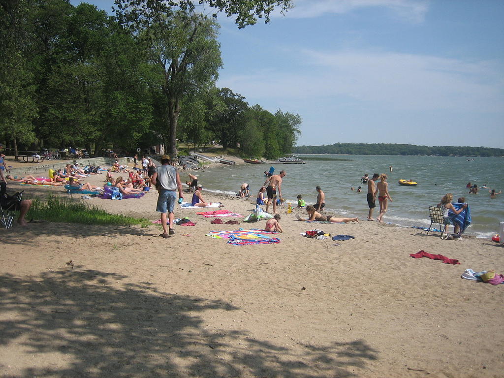


caption = Beach at Sibley State Park
location =Off US 71 W of New London
nearest_city = New London, Minnesota
lat_degrees =
lat_minutes =
lat_seconds =
lat_direction =
long_degrees =
long_minutes =
long_seconds =
long_direction =
area =
built =
architect =Civilian Conservation Corps
architecture =
added = January 22, 1992
visitation_num =
visitation_year =
refnum =89001673
mpsub = Minnesota State Park CCC/WPA/Rustic Style MPS
governing_body = Minnesota Department of Natural Resources

Sibley State Park is a Minnesota state park near New London. It was named for Henry Hastings Sibley, the first governor of the state. A city park in Mankato, Minnesota is also named for Sibley [http://www.mankatopedia.com/Sibley_Park] .

The rustic style stone structures in the park were constructed by the Civilian Conservation Corps between 1935 and 1938. These structures are now listed on the National Register of Historic Places. The layout of the park was a very functional example of master planning because it reduced congestion and overcrowding for swimmers, picnickers, and campers. It is rumored that a secret cache of memorabilia and other various items are buried underground in one of the park areas near the beach.

External links

* [http://www.dnr.state.mn.us/state_parks/sibley/narrative.html Sibley State Park website]
* [http://www.mnhs.org/places/nationalregister/stateparks/Sibley.html Sibley State Park] - Minnesota Historical Society


Wikimedia Foundation. 2010.

Игры ⚽ Поможем написать курсовую

Look at other dictionaries:

  • Monson Lake State Park — Coordinates: 45°19′14″N 95°16′13″W / 45.32056°N 95.27028°W / 45.32056; 95.27028 …   Wikipedia

  • Minneopa State Park — Coordinates: 44°9′44″N 94°6′8″W / 44.16222°N 94.10222°W / 44.16222; 94.10222 …   Wikipedia

  • Dunn State Park — Massachusetts State Park Dunn Pond Country United States …   Wikipedia

  • Maudslay State Park — For other uses, see Maudslay (disambiguation). Maudslay State Park Massachusetts State Park …   Wikipedia

  • Moore State Park — Massachusetts State Park Sawmill at Moore State Park …   Wikipedia

  • Clarksburg State Park — Massachusetts State Park …   Wikipedia

  • Maplewood State Park — Coordinates: 46°32′01″N 95°56′57″W / 46.5335703°N 95.9492193°W / 46.5335703; 95.9492193 …   Wikipedia

  • Nickerson State Park — Massachusetts State Park …   Wikipedia

  • Massasoit State Park — is a Massachusetts state park located in Taunton and Lakeville. The park is managed by the Department of Conservation and Recreation (DCR). Description Massasoit State Park is a heavily wooded multi use park principally used for hiking, fishing,… …   Wikipedia

  • Cochituate State Park — Lake Cochituate Cochituate State Park is a Massachusetts state park located in Natick. The park is managed by the Department of Conservation and Recreation. Description Cochituate State Park is a regional day use area principally used for …   Wikipedia

Share the article and excerpts

Direct link
Do a right-click on the link above
and select “Copy Link”