- National Register of Historic Places listings in Fond du Lac County, Wisconsin
-
There are 43 properties in Fond du Lac County, Wisconsin listed on the National Register of Historic Places, including buildings, sites, and districts.
This document is intended to provide a comprehensive listing of entries in the National Register of Historic Places that are located in Fond du Lac County, Wisconsin. The locations of National Register properties, at least for those having latitude and longitude coordinates below, may be seen in a Google map.[1]
-
- This National Park Service list is complete through NPS recent listings posted November 10, 2011.[2]
[3] Landmark name [4] Image Date listed Location City or town Summary 1 Aetna Station No. 5 
December 12, 1976 193 N. Main St.
43°47′03″N 88°26′46″W / 43.784167°N 88.446111°WFond du Lac 2 Baptist Church March 29, 2007 133 East Fond Du Lac St.
43°50′39″N 88°50′15″W / 43.844167°N 88.8375°WRipon 3 Brandon Village Hall and Library January 9, 2008 117 E. Main St.
43°44′06″N 88°46′57″W / 43.735°N 88.7825°WBrandon 4 Ceresco Site September 5, 1975 Bounded by North, Church, Union, and both sides of Warren Sts.
43°50′55″N 88°51′07″W / 43.848611°N 88.851944°WRipon 5 Chicago and Northwestern Railroad Depot 
August 10, 1990 182 Forest Ave.
43°46′34″N 88°27′13″W / 43.776111°N 88.453611°WFond du Lac 6 Club Harbor 
January 22, 1980 Jct. of WI 151 and WI W
43°54′51″N 88°18′50″W / 43.914167°N 88.313889°WPipe 7 William I Cole House 
March 28, 2002 303 Gillett St.
43°46′41″N 88°26′09″W / 43.778056°N 88.435833°WFond du Lac 8 George and Mary Agnes Dana House 
March 6, 2002 136 Sheboygan St.
43°46′46″N 88°26′28″W / 43.779444°N 88.441111°WFond du Lac 9 East Division Street-Sheboygan Street Historic District 
April 7, 2010 East Division St. generally bounded by Oaklawn Ave. and Amory St.; Sheboygan St. generally bounded by Everett St. and N.
43°46′44″N 88°26′16″W / 43.778806°N 88.437775°WFond du Lac 10 Rudolph and Louise Ebert House 
April 1, 2002 199 E. Division St.
43°46′52″N 88°26′21″W / 43.781111°N 88.439167°WFond du Lac 11 El Dorado Apartments 
January 22, 1992 130 Forest Ave.
43°46′37″N 88°27′07″W / 43.776944°N 88.451944°WFond du Lac 12 End of the Trail August 29, 1980 Madison St. (Shaler Park)
43°38′17″N 88°43′50″W / 43.638056°N 88.730556°WWaupun 13 First Baptist Church of Fond du Lac 
December 29, 1986 90 S. Macy St.
43°46′35″N 88°26′53″W / 43.776389°N 88.448056°WFond du Lac 14 First Congregational Church September 4, 1979 220 Ransom St.
43°50′42″N 88°50′26″W / 43.845°N 88.840556°WRipon 15 Edwin H. Galloway House 
May 28, 1976 336 E. Pioneer Rd.
43°45′17″N 88°26′07″W / 43.754722°N 88.435278°WFond du Lac 16 John Scott Horner House 
September 27, 1984 336 Scott St.
43°50′44″N 88°50′01″W / 43.845556°N 88.833611°WRipon 17 Hotel Calumet 
March 20, 1992 170 Forest Ave.
43°46′37″N 88°27′11″W / 43.776944°N 88.453056°WFond du Lac 18 Hotel Retlaw 
September 7, 1984 15 E. Division St.
43°46′46″N 88°26′02″W / 43.779444°N 88.433889°WFond du Lac 19 Kendall-Blankenburg House 
April 18, 2002 14 Sixth St.
43°46′27″N 88°26′43″W / 43.774167°N 88.445278°WFond du Lac 20 Linden Street Historic District 
April 26, 2002 253-295 and 274-304 Linden St.
43°46′22″N 88°26′54″W / 43.772778°N 88.448333°WFond du Lac 21 Little White Schoolhouse 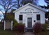
August 14, 1973 SE corner of Blackburn and Blossom Sts.
43°50′38″N 88°50′11″W / 43.843889°N 88.836389°WRipon Reputed birthplace of the U.S. Republican Party 22 Longfellow School 
April 14, 1997 221 Spaulding Ave.
43°50′53″N 88°50′00″W / 43.848056°N 88.833333°WRipon 23 Moose Temple 
April 22, 1993 17-23 Forest Ave.
43°46′39″N 88°26′51″W / 43.7775°N 88.4475°WFond du Lac 24 North Main Street Historic District 
March 6, 2002 Roughly along Main St., from Merrill to Sheboygan
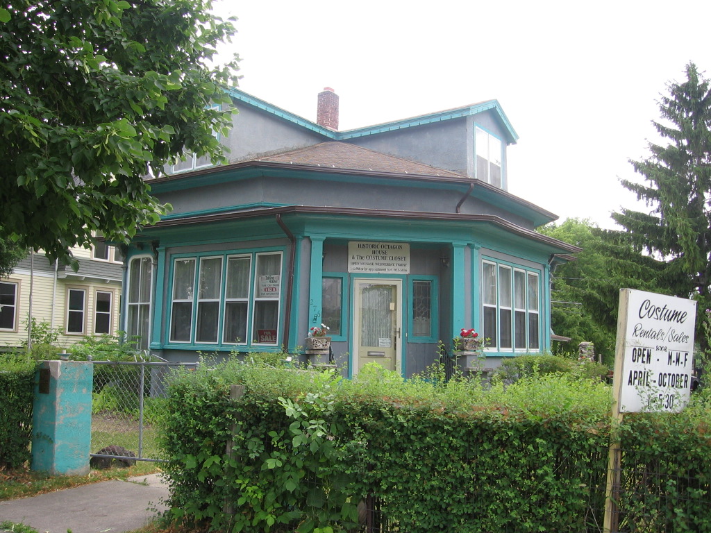
43°46′53″N 88°26′49″W / 43.781389°N 88.446944°WFond du Lac 25 Octagon House 
November 3, 1972 276 Linden St.
43°46′16″N 88°26′54″W / 43.771111°N 88.448333°WFond du Lac 26 Marcellus Pedrick House 
September 29, 1976 515 Ransom Ave.
43°50′27″N 88°50′23″W / 43.840833°N 88.839722°WRipon 27 Pipe Site December 22, 1978 NE of Fond du Lac in Pipe Fond du Lac / Pipe 28 Raube Road Site June 4, 1992 Address Restricted
43°43′49″N 88°43′53″W / 43.730278°N 88.731389°WSpringvale Two segments of an old Military Road built around 1835, which linked Fort Howard (Green Bay) with Fort Crawford (Prairie du Chien).[5] 29 The Recording Angel July 15, 1974 Forest Mound Cemetery, N. Madison St.
43°38′20″N 88°44′01″W / 43.638889°N 88.733611°WWaupun 30 Ripon College Historic District 
June 2, 1995 Jct. of Seward and Elm Sts.
43°50′39″N 88°50′34″W / 43.844167°N 88.842778°WRipon 31 Saint John Evangelical Lutheran Church 
April 15, 1986 670 County Trunk Hwy. S
43°33′52″N 88°10′59″W / 43.564444°N 88.183056°WNew Fane 32 Sisson's Peony Gardens December 22, 2006 207 N. Main St.
43°48′33″N 88°40′32″W / 43.809167°N 88.675556°WRosendale 33 South Main Street Historic District 
March 11, 1993 Roughly, 71-213 S. Main St.
43°46′32″N 88°26′48″W / 43.775556°N 88.446667°WFond du Lac 34 Southwest Historic District 
June 22, 2004 115 Belleville, parts of Grove,Lincoln,Newbury,Oak, Ransom, W. Sullivan, Thorne, Watertown, and Watson St., and Woodside
43°50′19″N 88°50′28″W / 43.838611°N 88.841111°WRipon 35 St. John the Baptist Catholic Church 
October 29, 1980 Off WI Q
43°52′36″N 88°17′26″W / 43.876667°N 88.290556°WJohnsburg 36 St. Matthias Mission 
October 13, 1988 1081 County Trunk S
43°34′44″N 88°10′29″W / 43.578889°N 88.174722°WNew Fane 37 St. Peter's Episcopal Church 
December 31, 1974 217 Houston St.
43°50′39″N 88°50′03″W / 43.844167°N 88.834167°WRipon 38 Montgomery and Nancy Tallmadge House 
April 18, 2002 225 Sheboygan St.
43°46′47″N 88°26′18″W / 43.779722°N 88.438333°WFond du Lac 39 Tygert Street Historic District February 18, 2011 Tygert St. and Spaulding Ave., generally bounded by Scott St. and E. Lane St.
43°50′51″N 88°50′04″W / 43.8475°N 88.834444°WRipon 40 Wallace-Jagdfeld Octagon House 
April 26, 2002 171 Forest Ave.
43°46′44″N 88°27′13″W / 43.778889°N 88.453611°WFond du Lac 41 Watson Street Commercial Historic District September 27, 1991 Roughly, Watson St. from Seward to Jackson Sts. and Jackson and Scott Sts. from Watson to Blackburn Sts.
43°50′41″N 88°50′18″W / 43.844722°N 88.838333°WRipon 42 Waupun Post Office October 24, 2000 400 E. Franklin St.
43°38′04″N 88°43′46″W / 43.634444°N 88.729444°WWaupun 43 Jacob Woodruff House 
December 30, 1974 610 Liberty St.
43°50′52″N 88°50′49″W / 43.847778°N 88.846944°WRipon A historic octagon house 44 Zion Congregational Church February 1, 2006 N4042 Amity Rd.
43°41′28″N 88°47′45″W / 43.691111°N 88.795833°WAlto See also
References
- ^ The latitude and longitude information provided in this table was derived originally from the National Register Information System, which has been found to be fairly accurate for about 99% of listings. For about 1% of NRIS original coordinates, experience has shown that one or both coordinates are typos or otherwise extremely far off; some corrections may have been made. A more subtle problem causes many locations to be off by up to 150 yards, depending on location in the country: most NRIS coordinates were derived from tracing out latitude and longitudes off of USGS topographical quadrant maps created under the North American Datum of 1927, which differs from the current, highly accurate WGS84 GPS system used by Google maps. Chicago is about right, but NRIS longitudes in Washington are higher by about 4.5 seconds, and are lower by about 2.0 seconds in Maine. Latitudes differ by about 1.0 second in Florida. Some locations in this table may have been corrected to current GPS standards.
- ^ "National Register of Historic Places: Weekly List Actions". National Park Service, United States Department of the Interior. Retrieved on November 10, 2011.
- ^ Numbers represent an ordering by significant words. Various colorings, defined here, differentiate National Historic Landmark sites and National Register of Historic Places Districts from other NRHP buildings, structures, sites or objects.
- ^ "National Register Information System". National Register of Historic Places. National Park Service. . http://nrhp.focus.nps.gov/natreg/docs/All_Data.html.
- ^ "Military Roads". Wisconsin Historical Society. http://www.wisconsinhistory.org/archstories/early_roads/military_roads.asp. Retrieved 2011-11-12.
U.S. National Register of Historic Places Topics Lists by states Alabama • Alaska • Arizona • Arkansas • California • Colorado • Connecticut • Delaware • Florida • Georgia • Hawaii • Idaho • Illinois • Indiana • Iowa • Kansas • Kentucky • Louisiana • Maine • Maryland • Massachusetts • Michigan • Minnesota • Mississippi • Missouri • Montana • Nebraska • Nevada • New Hampshire • New Jersey • New Mexico • New York • North Carolina • North Dakota • Ohio • Oklahoma • Oregon • Pennsylvania • Rhode Island • South Carolina • South Dakota • Tennessee • Texas • Utah • Vermont • Virginia • Washington • West Virginia • Wisconsin • WyomingLists by territories Lists by associated states Other Municipalities and communities of Fond du Lac County, Wisconsin Cities Fond du Lac | Ripon | Waupun‡

Villages Brandon | Campbellsport | Eden | Fairwater | Kewaskum‡ | Mount Calvary | North Fond du Lac | Oakfield | Rosendale | St. Cloud
Towns Alto | Ashford | Auburn | Byron | Calumet | Eden | Eldorado | Empire | Fond du Lac | Forest | Friendship | Lamartine | Marshfield | Metomen | Oakfield | Osceola | Ripon | Rosendale | Springvale | Taycheedah | Waupun
CDPs St. Peter | Taycheedah | Van Dyne
Unincorporated
communitiesArcade Acres | Ashford | Byron | Calumetville‡ | Calvary | Dexter | Dotyville | Dundee | Eldorado | Garnet | Hamilton | Johnsburg | Ladoga | Lamartine | Malone | Marblehead | Marytown | New Fane | New Prospect | Oak Center | Peebles | Pipe | Rogersville | Silica | South Byron | St. Joe | Waucousta | Woodhull
Footnotes ‡This populated place also has portions in an adjacent county or counties
Categories:- Fond du Lac County, Wisconsin
- Lists of historic places in Wisconsin
-


Wikimedia Foundation. 2010.