- Piney Point Light
Infobox Lighthouse
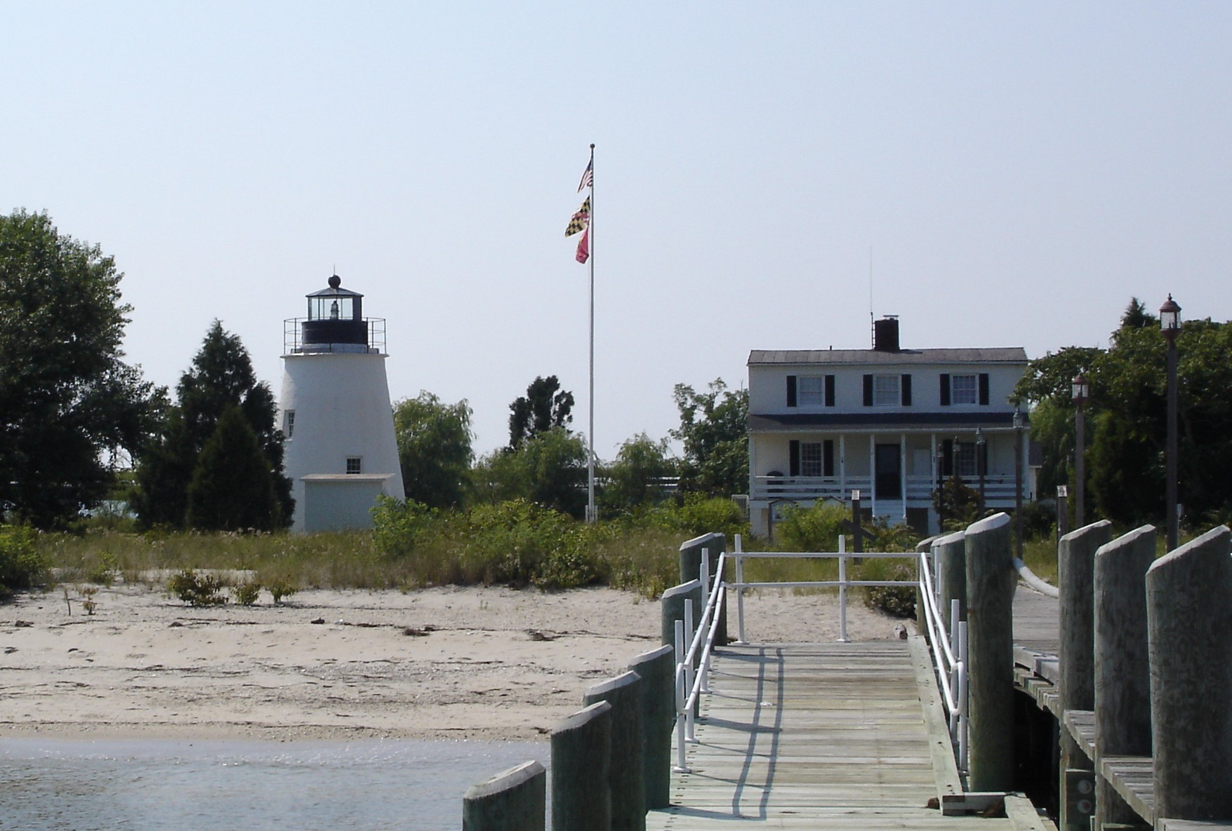
caption = Piney Point Light
location = Piney Point in St. Marys County, Maryland, about 13 miles from the mouth of the Potomac River
coordinates = coord|38.1355|N|76.5297|W|type:landmark
yearlit = 1836
automated =
yeardeactivated = 1964
construction =brick /masonry
shape = conical tower
height = 35 ft
lens = fifth-orderFresnel lens The Piney Point Light was built in 1836 located at Piney Point on thePotomac River inMaryland just up the river from the mouth of theChesapeake Bay . The Coast Guard decommissioned it in 1964 and it has since become a museum. It is known as the Lighthouse of Presidents because several early US Presidents visited or stayed on the grounds.History
Congress appropriated $5000 to build the lighthouse in 1836. The lighthouse was built by
John Donahoo and had a range of 10 miles. The lamp was replaced in 1855 with aFresnel lens upgrading the range to 11 miles.A bell tower was added in 1880 and was in service until 1954 when
Hurricane Hazel damaged it beyond repair.The federal government deeded the property to St. Mary's County in 1980 and in 1990 the Museum Division of St. Mary’s County Department of Recreation and Parks began to renovate the grounds.
Exhibits at the Piney Point Lighthouse Museum focus on the lighthouse, the United States Coast Guard, the Piney Point area, and the story of the Black Panther U-1105 German submarine sunk in the Potomac that now serves as a shipwreck dive preserve.
The Potomac River Maritime Exhibit displays four historic wooden vessels in a separate building.
Visitors can climb the lighthouse tower when the museum is open for operation.
The nearby Piney Point Elementary School in Tall Timbers, Maryland is named after the lighthouse.
References
*cite web
url=http://www.uscg.mil/hq/g-cp/history/WEBLIGHTHOUSES/LHMD.html
title=Maryland Light Stations
accessdate=October 8 | accessyear=2006
*cite web
url=http://www.co.saint-marys.md.us/recreate/museums/ppl.asp
title=Piney Point Lighthouses Museum
accessdate=October 8 | accessyear=2006
*cite web
url=http://www.cheslights.org/heritage/pineypoint.htm
title=Piney Point Lighthouse
*cite web
url=http://www.smcps.k12.md.us/schools/elem/ppes/index-ppes.htm
title=Piney Point Elementary School
publisher=St. Mary's County Public Schools
accessdate=2008-07-09
Wikimedia Foundation. 2010.