- National Register of Historic Places listings in Berkeley County, West Virginia
-
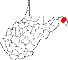 Location of Berkeley County in West Virginia
This is a list of the National Register of Historic Places listings in Berkeley County, West Virginia.
This is intended to be a complete list of the properties and districts on the National Register of Historic Places in Berkeley County, West Virginia, United States. The locations of National Register properties and districts for which the latitude and longitude coordinates are included below, may be seen in a Google map.[1]
There are 119 properties and districts listed on the National Register in the county, one of which is a National Historic Landmark.
-
- This National Park Service list is complete through NPS recent listings posted November 10, 2011.[2]
Contents: Counties in West Virginia Barbour - Berkeley - Boone - Braxton - Brooke - Cabell - Calhoun - Clay - Doddridge - Fayette - Gilmer - Grant - Greenbrier - Hampshire - Hancock - Hardy - Harrison - Jackson - Jefferson - Kanawha - Lewis - Lincoln - Logan - Marion - Marshall - Mason - McDowell - Mercer - Mineral - Mingo - Monongalia - Monroe - Morgan - Nicholas - Ohio - Pendleton - Pleasants - Pocahontas - Preston - Putnam - Raleigh - Randolph - Ritchie - Roane - Summers - Taylor - Tucker - Tyler - Upshur - Wayne - Webster - Wetzel - Wirt - Wood - Wyoming
Current listings
[3] Landmark name [4] Image Date listed Location City or town Summary 1 Abell-Kilbourn House 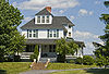
November 21, 1994 1018 Winchester Ave.
39°26′48″N 77°58′45″W / 39.446667°N 77.979167°WMartinsburg 2 Apollo Theatre 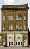
October 11, 1979 128 E. Martin St
39°27′29″N 77°57′45″W / 39.458056°N 77.9625°WMartinsburg 3 Ar-Qua Springs December 12, 1976 County Route 37
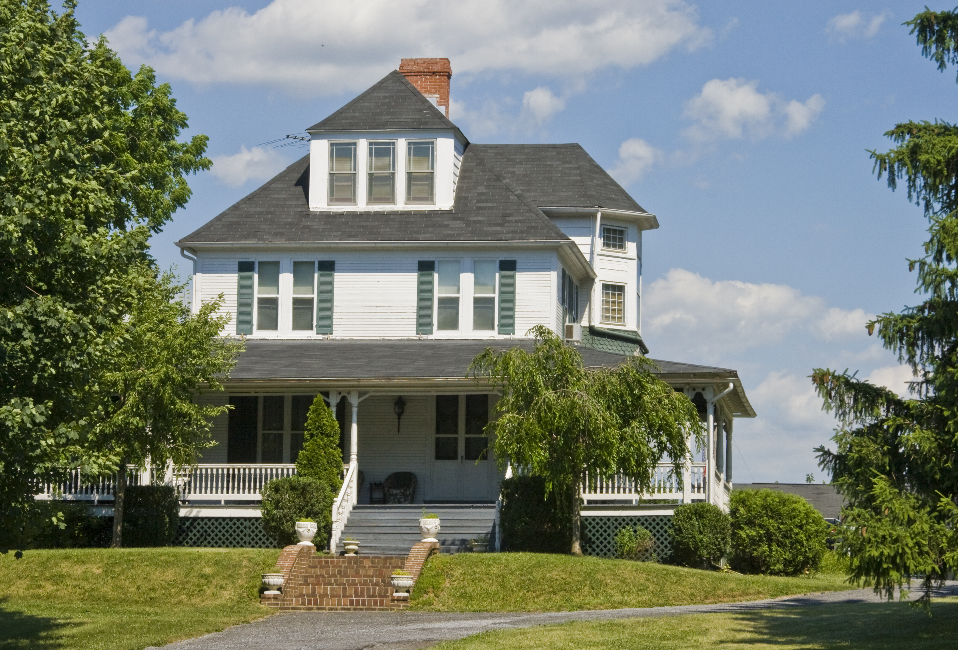
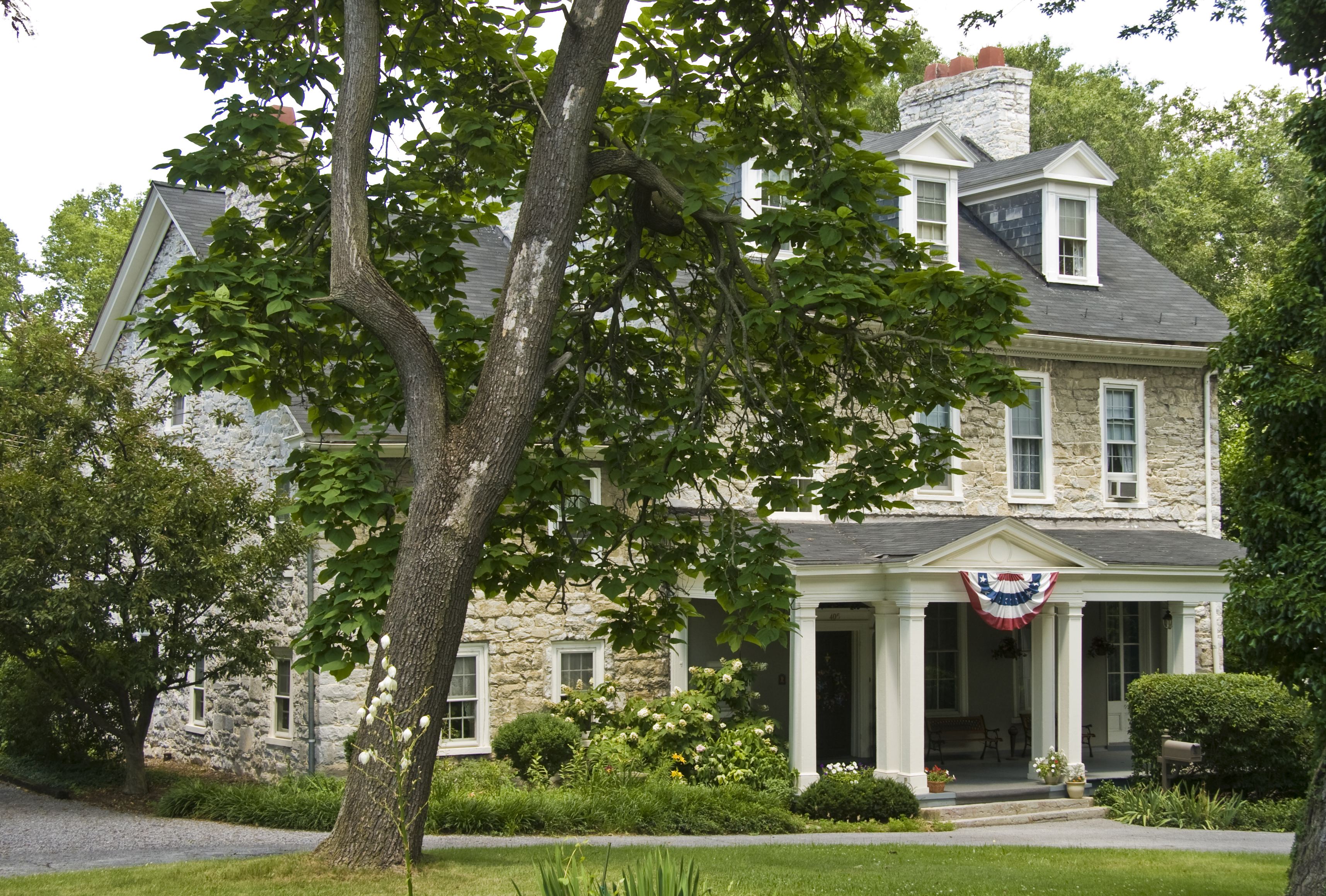
39°24′30″N 78°03′51″W / 39.408333°N 78.064167°WArden 4 Aspen Hall 
December 10, 1980 405 Boyd Ave.
39°27′46.692″N 77°57′54″W / 39.46297°N 77.965°W[5]Martinsburg 5 Baldwin-Grantham House November 21, 1994 County Route 18 east of Shanghai
39°26′14″N 78°07′08″W / 39.437222°N 78.118889°WShanghai 6 Baltimore and Ohio and Related Industries Historic District December 10, 1980 Roughly bounded by the Baltimore & Ohio railroad line from the southern side of the Burke St. underpass to the northern side of the B&O and Pennsylvania Railroad bridge
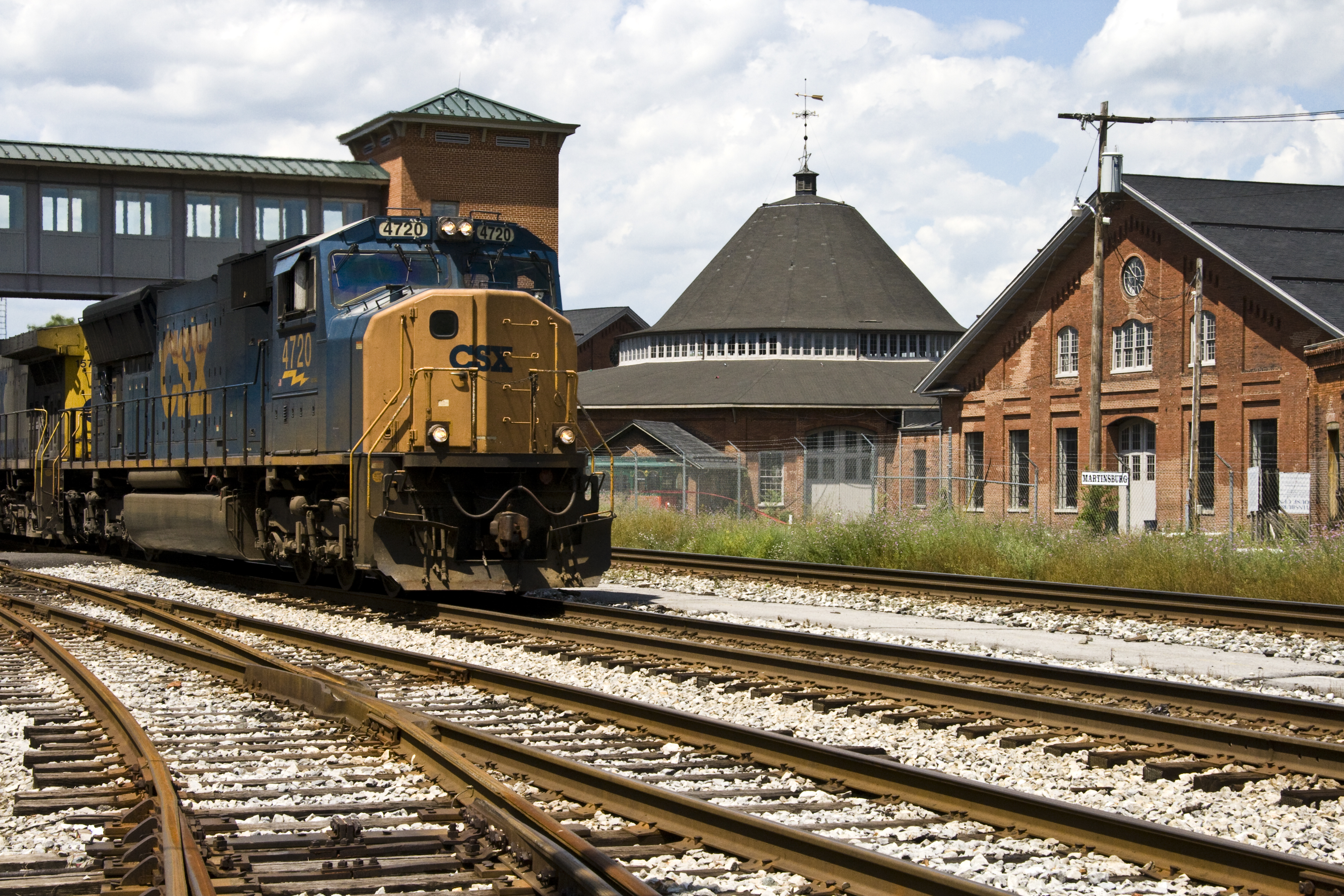
39°27′43″N 77°57′45″W / 39.461944°N 77.9625°WMartinsburg 7 Baltimore and Ohio Railroad Martinsburg Shops 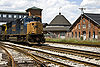
July 31, 2003 300 E. Martin St.
39°27′39″N 77°57′34″W / 39.460833°N 77.959444°WMartinsburg 8 William Boggs Farm March 7, 2001 WV 7
39°32′25″N 78°01′32″W / 39.540278°N 78.025556°WHedgesville 9 Boomtown Historic District 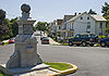
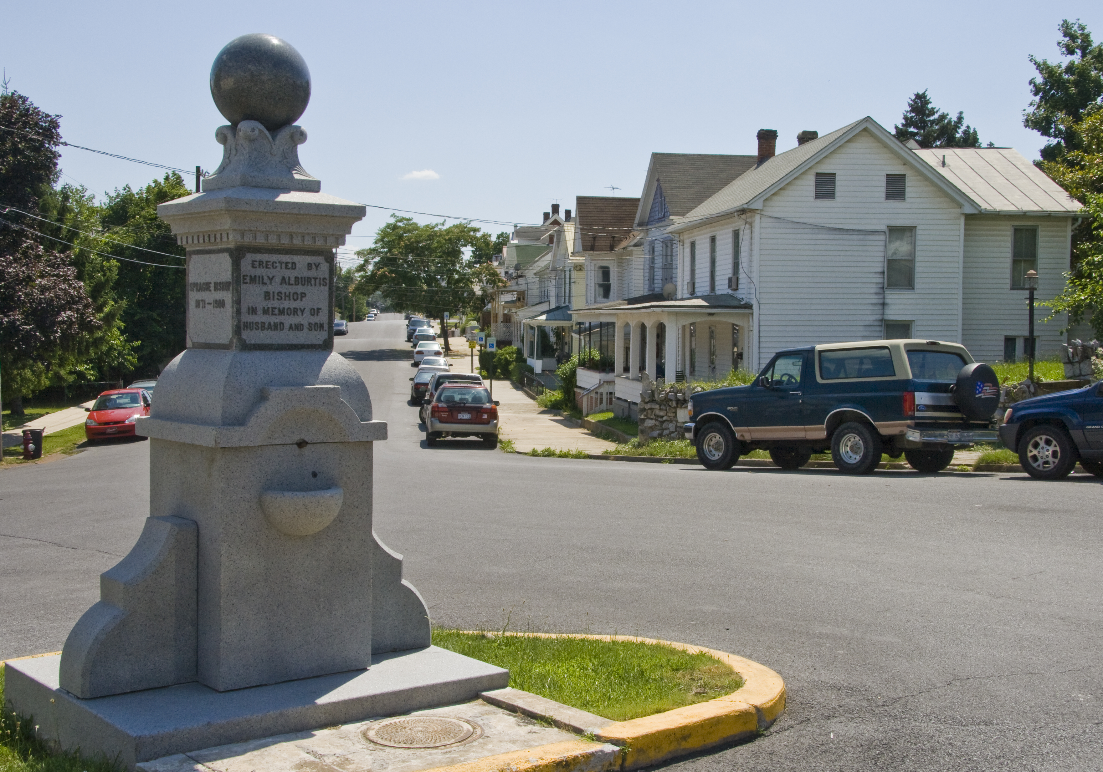
December 10, 1980 Roughly along Winchester Ave. to Arden Rd., W. King St. to Red Hill Rd., W. Stephen, W. Addition St., and Raleigh Sts.
39°27′06″N 77°58′44″W / 39.451667°N 77.978889°WMartinsburg 10 Boyd Avenue Historic District 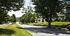
August 3, 2007 Eastern and western sides of Boyd Ave., north of Queen St.
39°27′50″N 77°57′53″W / 39.464°N 77.96475°WMartinsburg 11 Boydville October 15, 1970 601 S. Queen St.
39°27′05″N 77°58′05″W / 39.451389°N 77.968056°WMartinsburg 12 Boydville Historic District 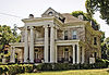
December 10, 1980 Roughly bounded by W. Stephen, S. Spring, and S. Queen Sts., including the grounds of Boydville
39°27′06″N 77°58′01″W / 39.451667°N 77.966944°WMartinsburg 13 Thomas Brown House January 16, 1986 County Route 30
39°23′40″N 78°02′55″W / 39.394444°N 78.048611°WInwood 14 Bunker Hill Historic District December 10, 1980 Junction of U.S. Route 11 and WV 26
39°19′56″N 78°03′13″W / 39.332222°N 78.053611°WBunker Hill 15 James Nathanial Burwell House May 16, 1991 East of U.S. Route 11, north of West Virginia state line
39°17′36″N 78°04′27″W / 39.293333°N 78.074167°WRidgeway 16 Campbellton December 10, 1980 Address Unknown
39°24′20″N 78°04′16″W / 39.405556°N 78.071111°WGerrardstown 17 Clary's Mountain Historic District April 15, 2004 Hammond's Mill Rd.
39°33′25″N 77°59′22″W / 39.556944°N 77.989444°WHedgesville 18 Edward Colston House May 1, 2003 1598 Tice Rd.
39°35′26″N 77°55′15″W / 39.590556°N 77.920833°WFalling Waters 19 Continental Clay Brick Plant 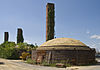
December 10, 1980 Southeast of Martinsburg on WV 9
39°25′59″N 77°57′31″W / 39.433056°N 77.958611°WMartinsburg 20 Cool Spring Farm November 21, 1994 Runnymede Rd. (WV 26) south of Gerrardstown
39°19′53″N 78°06′23″W / 39.331389°N 78.106389°WGerrardstown 21 Samuel Cunningham House December 12, 1976 Southeast of Hedgesville off WV 9
39°31′45″N 77°58′46″W / 39.529167°N 77.979444°WHedgesville 22 Darkesville Historic District December 10, 1980 U.S. Route 11 at Middle Creek
39°22′27″N 78°01′25″W / 39.374167°N 78.023611°WDarkesville 23 Charles Downs II House May 17, 1991 West Virginia Secondary Route 1, west of U.S. Route 11
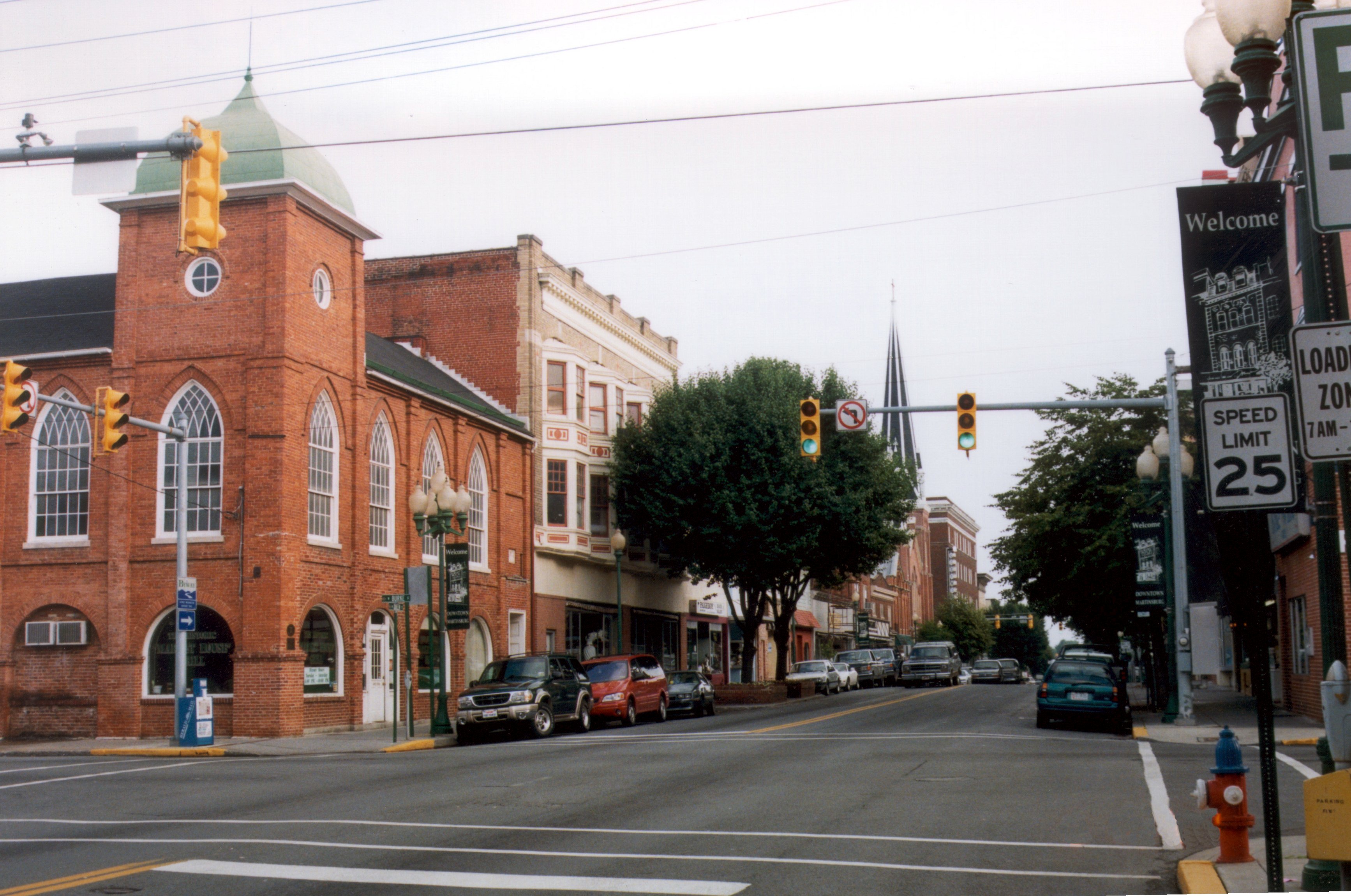
39°34′19″N 77°53′36″W / 39.571944°N 77.893333°WMarlowe 24 Downtown Martinsburg Historic District 
December 10, 1980 Roughly bounded by W. Race, Water, Stephen, and Charles Sts.
39°27′28″N 77°57′59″W / 39.457778°N 77.966389°WMartinsburg 25 John Drinker House December 10, 1980 Sam Mason Rd.
39°19′06″N 78°04′48″W / 39.318333°N 78.08°WBunker Hill 26 East Martinsburg Historic District 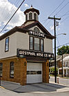
December 10, 1980 Roughly bounded by the Baltimore & Ohio railroad right-of-way, N. Queen St., Moler Ave., and High St.
39°27′40″N 77°57′19″W / 39.461111°N 77.955278°WMartinsburg 27 Edgewood December 10, 1980 Address Unknown
39°19′49″N 78°03′29″W / 39.330278°N 78.058056°WBunker Hill 28 John Evans House March 22, 2006 2298 Winchester Ave.
39°25′44″N 77°59′17″W / 39.428889°N 77.988056°WMartinsburg 29 Faraway Farm December 10, 1980 WV 8
39°32′55″N 77°56′23″W / 39.548611°N 77.939722°WMartinsburg 30 Federal Aviation Administration Records Center 
September 10, 1974 300 W. King St.
39°27′24″N 77°58′01″W / 39.456667°N 77.966944°WMartinsburg 31 Teter Myers French House December 10, 1980 Junction of Routes 1 and 3
39°33′57″N 77°58′00″W / 39.565833°N 77.966667°WHedgesville 32 Gerrardstown Historic District August 5, 1991 Roughly along WV 51 and Virginia Line Rd.
39°22′07″N 78°05′51″W / 39.368611°N 78.0975°WGerrardstown 33 Washington Gold House January 12, 1984 South of Gerrardstown on County Route 51/2
39°21′12″N 78°06′35″W / 39.353333°N 78.109722°WGerrardstown 34 Green Hill Cemetery Historic District December 10, 1980 486 E. Burke St.
39°27′13″N 77°57′20″W / 39.453611°N 77.955556°WMartinsburg 35 Harlan Spring Historic District December 10, 1980 Harlan Spring
39°32′59″N 77°57′21″W / 39.549722°N 77.955833°WHedgesville 36 Harmony Cemetery December 10, 1980 Route 1/1
39°35′13″N 77°52′54″W / 39.586944°N 77.881667°WMarlowe 37 Hays-Pitzer House November 21, 1994 Middle Creek Rd. (WV 45) north of Inwood
39°25′00″N 78°03′53″W / 39.416667°N 78.064722°WMartinsburg 38 Hays-Gerrard House September 16, 1985 Congress St.
39°22′10″N 78°05′50″W / 39.369444°N 78.097222°WGerrardstown 39 Hedges Chapel December 12, 2002 668 Mountain Lake Rd.
39°33′27″N 78°05′31″W / 39.5575°N 78.091944°WHedgesville 40 Decatur Hedges House January 12, 1984 WV 9
39°30′48″N 77°58′20″W / 39.513333°N 77.972222°WHedgesville 41 Owen Tudor Hedges House November 21, 1994 County Route 8 east of Hedgesville
39°32′22″N 77°56′44″W / 39.539444°N 77.945556°WHedgesville 42 Samuel Hedges House December 12, 1976 County Route 9/10
39°31′40″N 77°59′52″W / 39.527778°N 77.997778°WHedgesville 43 Hedges-Lemen House May 2, 1991 County Route 4, 0.7 miles north of its junction with WV 9
39°32′31″N 77°58′47″W / 39.541944°N 77.979722°WHedgesville 44 Hedges-Robinson-Myers House December 10, 1980 Route 3
39°33′27″N 77°58′27″W / 39.5575°N 77.974167°WHedgesville 45 Hedgesville Historic District December 10, 1980 Roughly bounded by N. and S. Mary St., and E. and W. Main St.
39°33′12″N 77°59′39″W / 39.553333°N 77.994167°WHedgesville 46 George Washington Hollida House February 11, 2004 4781 Scabble Rd.
39°29′03″N 77°50′02″W / 39.484167°N 77.833889°WShepherdstown 47 Hughes-Cunningham House July 8, 1985 Harlan Springs Rd.
39°32′10″N 77°57′38″W / 39.536111°N 77.960556°WHedgesville 48 Jones Mill Run Historic District December 10, 1980 Address Unknown
39°29′15″N 77°49′44″W / 39.4875°N 77.828889°WMartinsburg 49 Kearfott-Bane House July 8, 1985 WV 36/1
39°26′02″N 77°55′09″W / 39.433889°N 77.919167°WBaker Heights 50 Elizabeth Kunkel House May 17, 1991 Western side of U.S. Route 11, 2.4 mi (3.9 km) north of Martinsburg
39°29′14″N 77°56′49″W / 39.487222°N 77.946944°WMartinsburg 51 Lee-Throckmorton-McDonald House April 14, 2004 2101 Arden-Nolville Rd.
39°23′25″N 78°02′52″W / 39.390278°N 78.047778°WInwood 52 Lick Run Plantation January 12, 1984 Off U.S. Route 11
39°31′10″N 77°54′02″W / 39.519444°N 77.900556°WBedington 53 Maidstone Manor Farm December 10, 1980 County Route 1/4
39°35′14″N 77°54′32″W / 39.587222°N 77.908889°WHedgesville 54 Maidstone-on-the-Potomac 
April 15, 2004 12 Temple Dr.
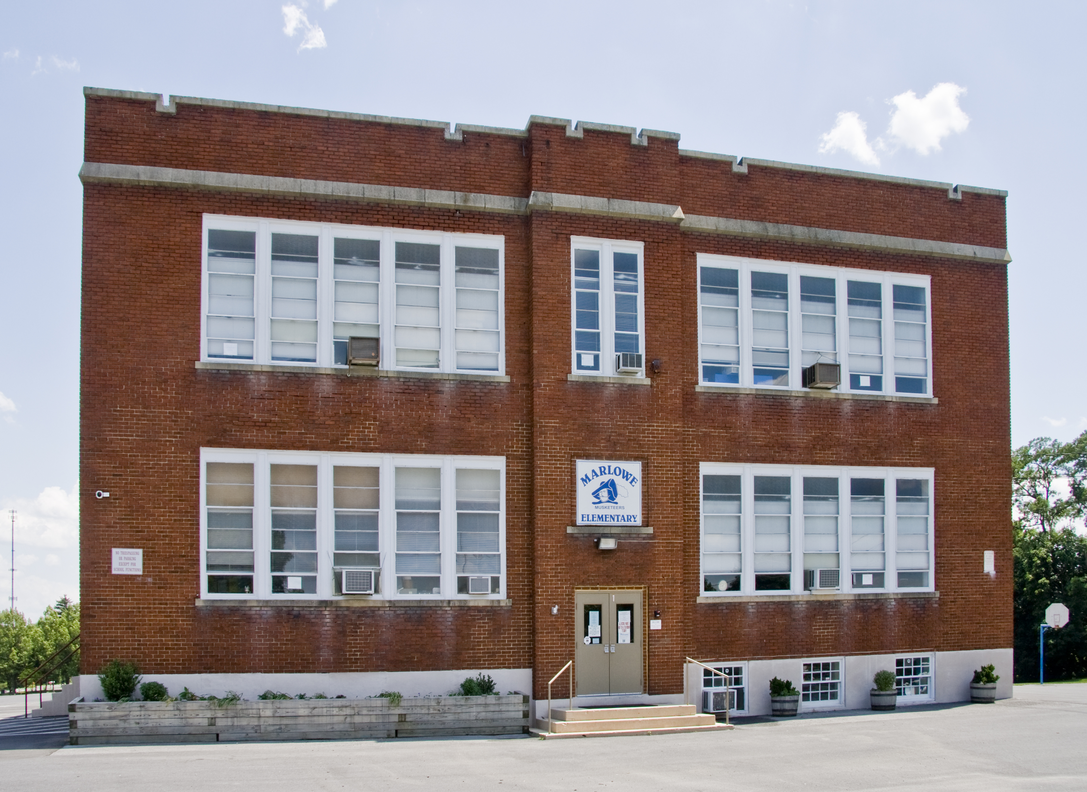
39°35′59″N 77°50′21″W / 39.599722°N 77.839167°WFalling Waters 55 Marlowe Consolidated School 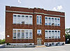
March 22, 2006 9580 Williamsport Pike
39°35′19″N 77°51′36″W / 39.588611°N 77.86°WMarlowe 56 Martinsburg Mining, Manufacturing & Improvement Co. Historic District December 16, 2002 New York, Virginia, West Virginia, Maryland, Florida, and Faulkner Avenues
39°26′59″N 77°58′26″W / 39.449722°N 77.973889°WMartinsburg 57 James Mason House and Farm November 15, 2006 856 Little Georgetown Rd.
39°34′33″N 77°57′20″W / 39.575833°N 77.955556°WHedgesville 58 Gilbert and Samuel McKown House January 12, 1984 WV 51
39°22′02″N 78°05′23″W / 39.367222°N 78.089722°WGerrardstown 59 Mill Creek Historic District December 10, 1980 Runs along Mill Creek extending both east and west of Bunker Hill
39°20′45″N 78°03′41″W / 39.345833°N 78.061389°WBunker Hill 60 Miller Tavern and Farm March 22, 2006 Eastern side of Golf Course Rd.
39°25′19″N 77°52′55″W / 39.421944°N 77.881944°WMartinsburg 61 Morgan Chapel and Graveyard January 12, 1984 Northern side of Secondary Route 26 west of its junction with U.S. Route 11
39°20′01″N 78°03′28″W / 39.333611°N 78.057778°WBunker Hill 62 William G. Morgan House January 12, 1984 On Secondary Route 24, south of its junction with Secondary Route 26
39°19′53″N 78°05′53″W / 39.331389°N 78.098056°WBunker Hill 63 Morgan-Gold House July 8, 1985 WV 26
39°19′56″N 78°04′40″W / 39.332222°N 78.077778°WBunker Hill 64 Mt. Pleasant School September 18, 2008 Abiding Way
39°21′49″N 78°07′28″W / 39.363611°N 78.124444°WGerrardstown 65 Mount Zion Baptist Church December 10, 1980 Opequon Lane
39°23′19″N 77°55′25″W / 39.388611°N 77.923611°WMartinsburg 66 George W. F. Mulliss House May 2, 1991 Western side of U.S. Route 11, 1 mi (1.6 km) south of Martinsburg
39°25′50″N 77°59′16″W / 39.430556°N 77.987778°WMartinsburg 67 Myers House December 10, 1980 Union Corner at the end of Route 37/1
39°30′17″N 77°55′25″W / 39.504722°N 77.923611°WMartinsburg 68 Moses Nadenbousch House February 11, 2004 2540 Butler's Chapel Rd.
39°32′06″N 77°59′30″W / 39.535°N 77.991667°WMartinsburg 69 Newcomer Mansion March 22, 2006 1735 Douglas Grove Rd.
39°25′13″N 77°56′17″W / 39.420278°N 77.938056°WMartinsburg 70 Opequon Golf Club April 28, 1995 Golf Club Rd. east of Opequon Creek
39°26′30″N 77°55′19″W / 39.441667°N 77.921944°WMartinsburg 71 Orndoff-Cross House July 28, 2010 6 Winebrenner Rd.
39°26′09″N 77°51′38″W / 39.435833°N 77.860556°WMartinsburg vicinity 72 Overlook April 15, 2004 2910 Harlan Spring Rd.
39°32′48″N 77°57′28″W / 39.546667°N 77.957778°WMartinsburg 73 Parks's Gap Bridge November 4, 1994 Route 6 over Back Creek
39°30′45″N 78°02′11″W / 39.5125°N 78.036389°WMartinsburg 74 Elias Pitzer House January 8, 2003 1076 Clyde Borum Rd.
39°25′29″N 78°01′15″W / 39.424722°N 78.020833°WMartinsburg 75 Power Plant and Dam No. 4 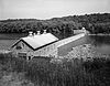
December 10, 1980 On the Potomac River north of County Route 5 at Scrabble
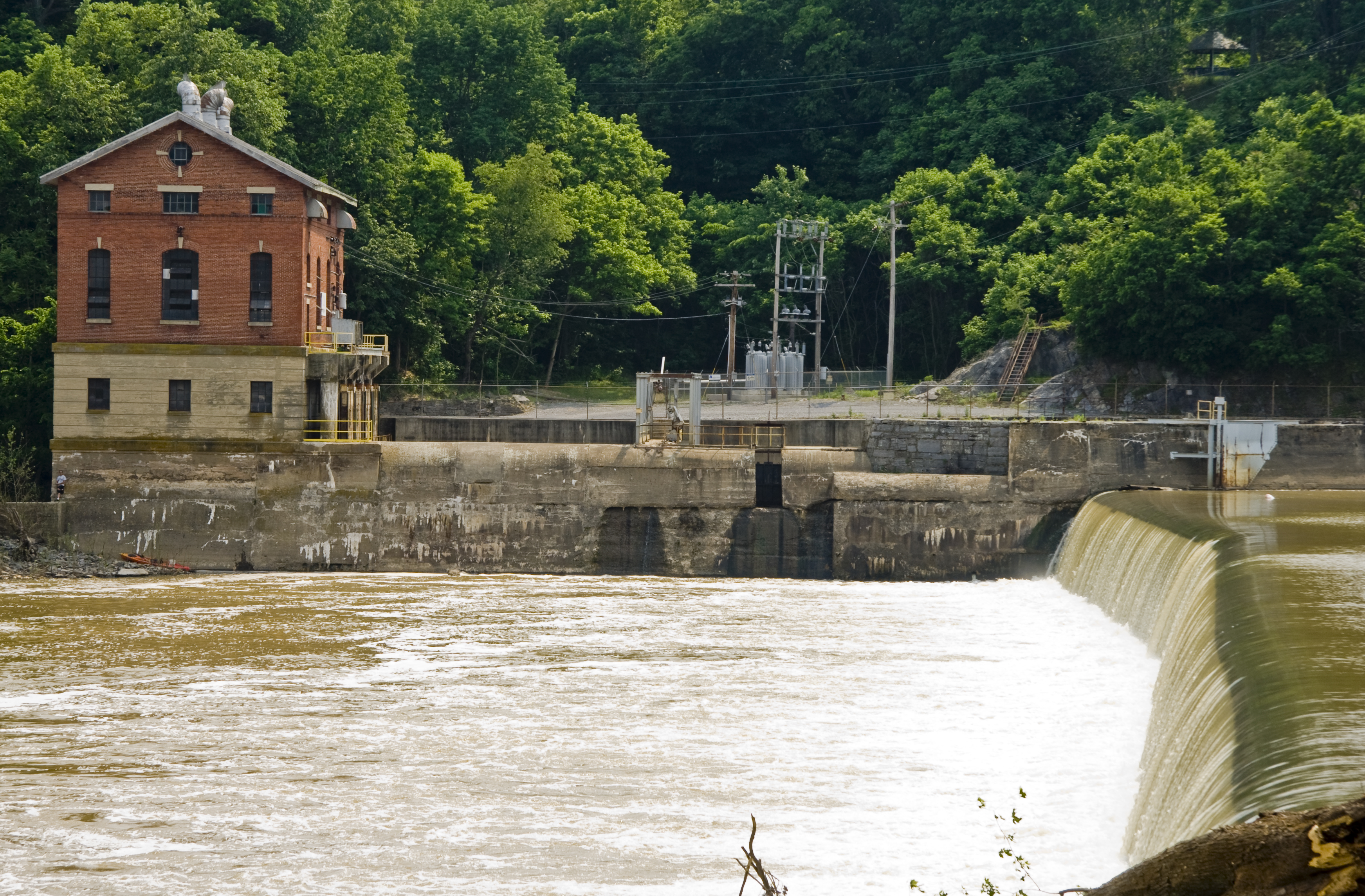
39°29′42″N 77°49′34″W / 39.495°N 77.826111°WShepherdstown 76 Power Plant and Dam No. 5 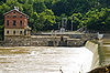
December 10, 1980 On the Potomac River west of Marlowe
39°36′22″N 77°55′23″W / 39.606111°N 77.923056°WMarlowe 77 Rauch House November 4, 1994 Off WV 9, south of Martinsburg
39°25′20″N 77°58′06″W / 39.422222°N 77.968333°WMartinsburg 78 Redbud Hollow December 10, 1980 Address Unknown
39°23′42″N 78°04′32″W / 39.395°N 78.075556°WMartinsburg 79 John, David, and Jacob Rees House January 12, 1984 Off U.S. Route 11
39°18′47″N 78°05′53″W / 39.313056°N 78.098056°WBunker Hill 80 Morris Rees III House January 8, 2003 WV 24, 0.2 mi (0.32 km) south of WV 51
39°21′26″N 78°05′06″W / 39.357222°N 78.085°WGerrardstown 81 Ridge Road Historic District December 10, 1980 South along Ridge Rd. from Nollville
39°26′23″N 78°01′59″W / 39.439722°N 78.033056°WNollville 82 Robinson-Tabb House February 11, 2004 377 Holden Dr.
39°30′50″N 77°59′07″W / 39.513889°N 77.985278°WMartinsburg 83 Baker Ropp House December 12, 2002 2301 Harlan Spring Rd.
39°32′17″N 77°56′49″W / 39.538139°N 77.946911°WMartinsburg 84 R.C. Ropp House December 12, 2002 2199 Harlan Spring Rd.
39°32′10″N 77°56′54″W / 39.536111°N 77.948333°WMartinsburg 85 Rosemont Historic District December 12, 2002 Tennessee, Illinois, Georgia, and Kentucky Aves.
39°27′27″N 77°58′39″W / 39.4575°N 77.9775°WMartinsburg 86 Rush-Miller House July 8, 1985 On WV 45
39°27′14″N 77°54′09″W / 39.453889°N 77.9025°WSmoketown 87 George Schlack House September 18, 2008 212 Speck's Run Rd.
39°17′45″N 78°03′51″W / 39.295858°N 78.064172°WRidgeway 88 Scrabble Historic District March 22, 2006 Scrabble Rd. and Dam No. 4 Rd.
39°29′11″N 77°49′59″W / 39.486389°N 77.833056°WScrabble 89 Henry J. Seibert II House July 8, 1985 Off WV 45
39°26′11″N 78°00′43″W / 39.436389°N 78.011944°WMartinsburg 90 Smoketown School December 1, 1994 County Route 45/4, east of Martinsburg
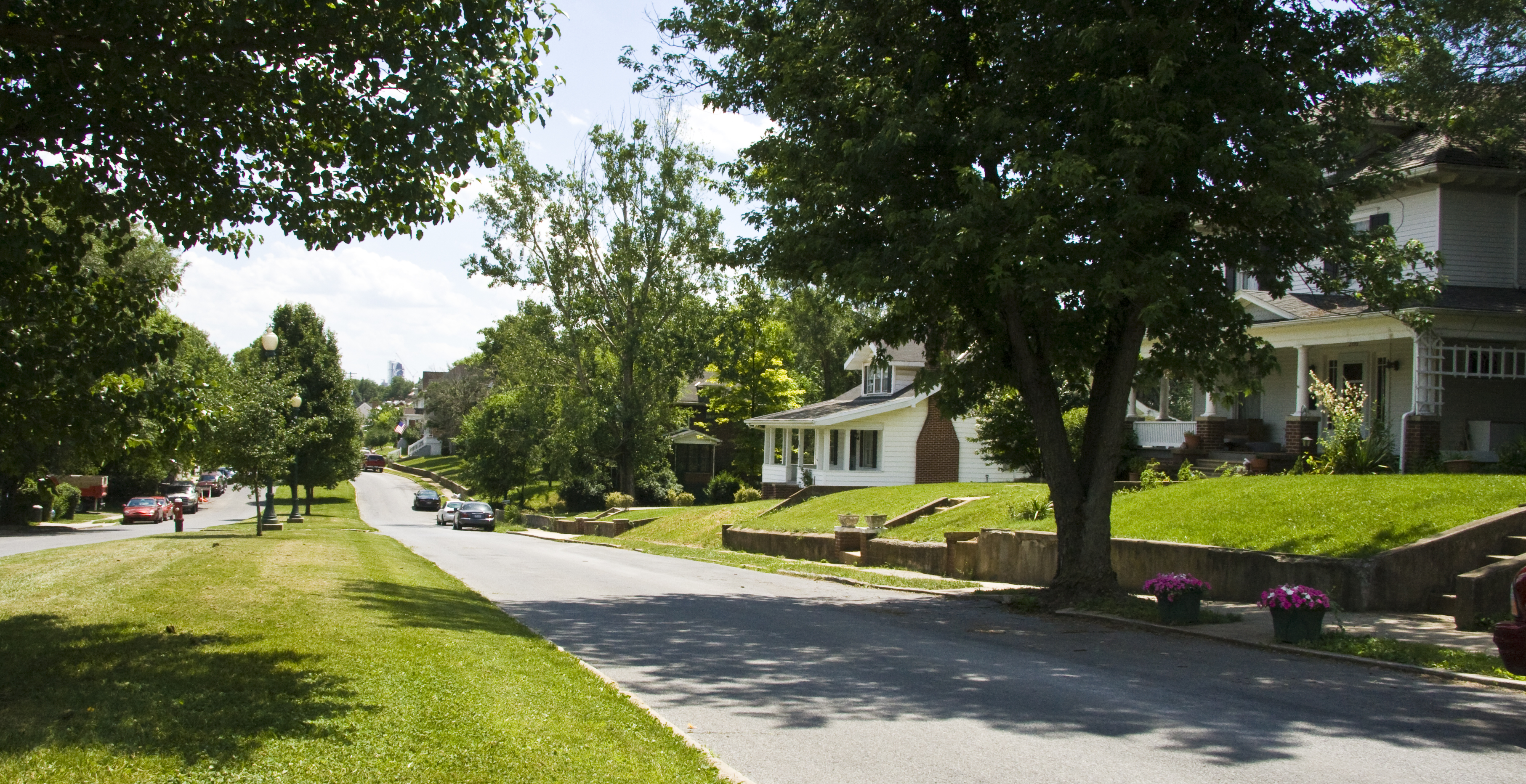
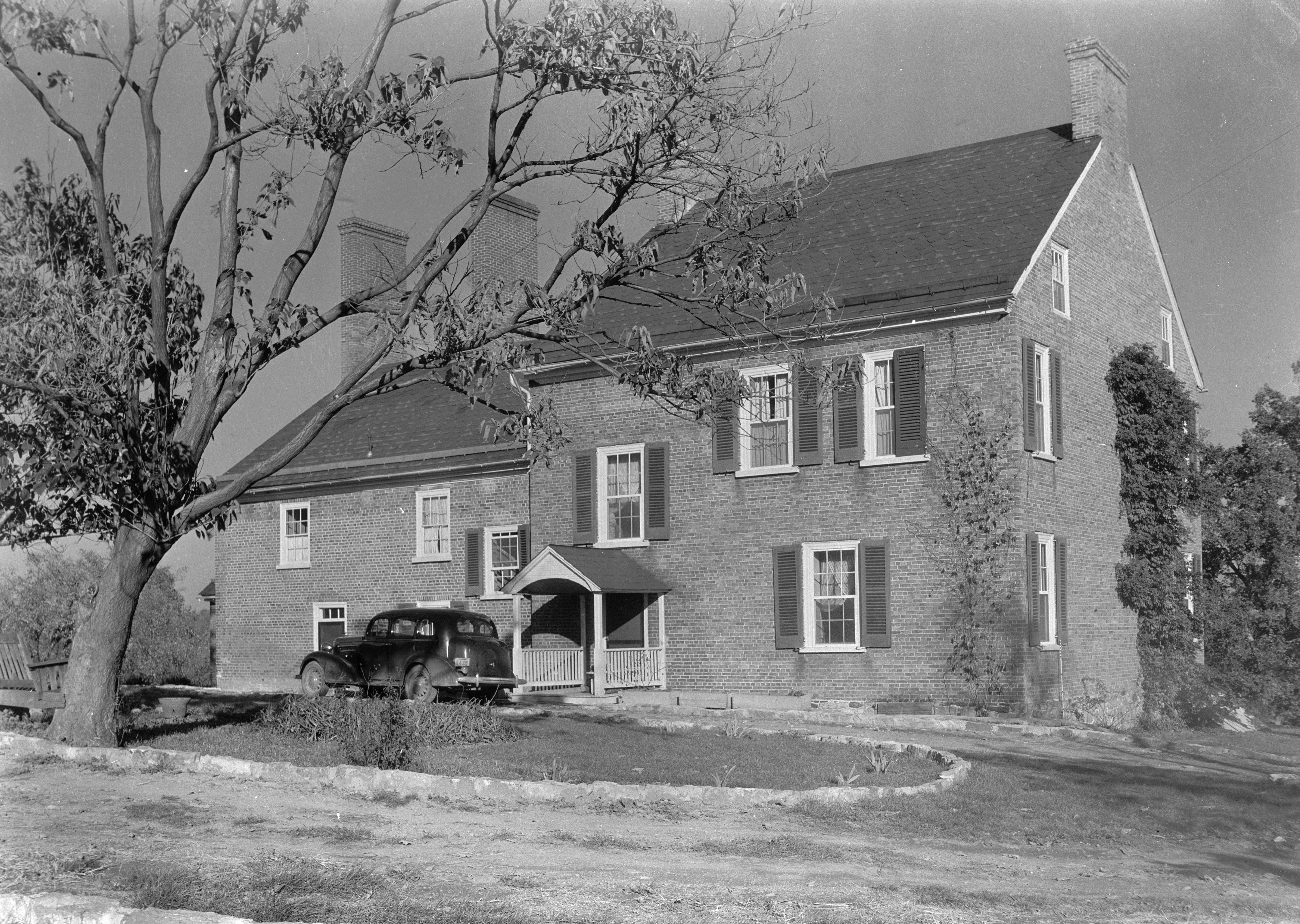
39°27′32″N 77°54′20″W / 39.458889°N 77.905556°WMartinsburg 91 Snodgrass Tavern April 24, 1973 West of Hedgesville on WV 3
39°33′25″N 78°01′00″W / 39.556944°N 78.016667°WHedgesville 92 Benjamin H. Snyder House February 11, 2004 1925 Douglas Grove Rd.
39°25′17″N 77°56′21″W / 39.421389°N 77.939167°WMartinsburg 93 South Water Street Historic District December 10, 1980 Roughly bounded by East John, South Water, and East Burke Sts., and Baltimore & Ohio railroad line
39°27′20″N 77°57′39″W / 39.455572°N 77.960731°WMartinsburg 94 Peter Speck House December 12, 2002 1149 Ben Speck Rd.
39°32′51″N 77°58′57″W / 39.5475°N 77.9825°WMartinsburg 95 Spring Mills Historic District April 15, 2004 Portions of Hammonds Mill Rd. and Harlan Spring Rd.
39°33′36″N 77°57′12″W / 39.56°N 77.953333°WMartinsburg 96 Adam Stephen House October 15, 1970 309 E. John St.
39°27′16″N 77°57′39″W / 39.454444°N 77.960833°WMartinsburg 97 Stone House Mansion November 21, 1994 Off WV 9, southeast of Martinsburg
39°23′52″N 77°55′09″W / 39.397778°N 77.919167°WMartinsburg 98 Strayer-Couchman House November 21, 1994 Warm Springs Rd. east of Martinsburg
39°26′25″N 77°54′13″W / 39.440278°N 77.903611°WMartinsburg 99 Strode-Morrison-Tabler House and Farm March 22, 2006 1270 Jacobs Rd.
39°30′42″N 77°52′34″W / 39.511667°N 77.876111°WHedgesville 100 Stuckey House May 17, 1991 County Route 7/8, along Wilson Ridge
39°29′11″N 78°05′02″W / 39.486389°N 78.083889°WJones Springs 101 Swan Pond July 29, 1977 County Route 5/3
39°28′15″N 77°52′25″W / 39.470833°N 77.873611°WMartinsburg 102 Swan Pond Manor Historic District December 10, 1980 Swan Pond
39°28′18″N 77°51′57″W / 39.471667°N 77.865833°WMartinsburg 103 Edward Tabb House January 12, 1984 On County Route 4 south of its junction with WV 9
39°30′55″N 78°00′05″W / 39.515278°N 78.001389°WHedgesville 104 Tabler's Station Historic District April 14, 2004 Portions of Tabler's Station Rd. and Carlton Dr.
39°23′56″N 78°00′39″W / 39.398889°N 78.010833°WMartinsburg 105 Thunder Hill Farm November 21, 1994 County Route 30 north of Inwood
39°22′59″N 78°03′19″W / 39.383056°N 78.055278°WInwood 106 Tomahawk Spring 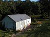
December 1, 1994 County Route 7/2
39°31′52″N 78°03′27″W / 39.531111°N 78.0575°WTomahawk 107 Priscilla Strode Turner House December 12, 2002 347 Carlyle Rd.
39°31′12″N 77°52′55″W / 39.52°N 77.881944°WBedington 108 Tuscarora Creek Historic District December 10, 1980 Roughly bounded by N. Tennessee Ave., south on Old Mill Rd., to County Route 15
39°28′10″N 77°59′08″W / 39.469583°N 77.985556°WMartinsburg 109 Union Bryarly's Mill December 10, 1980 Address Unknown
39°22′16″N 78°01′41″W / 39.371111°N 78.028056°WDarkesville 110 Van Metre Ford Stone Bridge 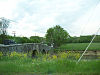
August 22, 1977 East of Martinsburg across Opequon Creek on WV 36
39°26′42″N 77°55′40″W / 39.445°N 77.927778°WMartinsburg 111 Jacob VanDoren House January 12, 1984 1 mi (1.6 km) southwest of the junction of County Routes 40 and 45/3
39°25′37″N 77°53′25″W / 39.426944°N 77.890278°WMartinsburg 112 John VanMetre House February 11, 2004 177 Elsie Dr.
39°24′58″N 77°56′13″W / 39.416111°N 77.936944°WKearneysville 113 Nathan VanMetre House November 4, 1994 Dry Run Rd. (County Route 13) north of Martinsburg
39°29′09″N 77°59′16″W / 39.485833°N 77.987778°WMartinsburg 114 Thomas VanMetre House December 30, 2009 3093 Golf Course Rd.
39°25′55″N 77°54′05″W / 39.431875°N 77.901497°WMartinsburg 115 Watkins Ferry Toll House December 10, 1980 Route 11
39°35′50″N 77°50′23″W / 39.597222°N 77.839722°WMartinsburg 116 West Martinsburg Historic District December 13, 2010 Roughly bounded by North St., N. & S. Tennessee Ave., West King St., and N. & S. Alabama Ave.
39°27′44″N 77°58′42″W / 39.462222°N 77.978333°WMartinsburg Historic Residential Suburbs in the United States, 1830-1960 MPS 117 White Bush December 10, 1980 Routes 11/3
39°34′08″N 77°52′19″W / 39.568889°N 77.871944°WFalling Waters 118 Mary Park Wilson House July 8, 1985 West Virginia Routes 2/51
39°22′18″N 78°06′30″W / 39.371667°N 78.108333°WGerrardstown 119 William Wilson House 
January 12, 1984 WV 51
39°22′33″N 78°06′20″W / 39.375833°N 78.105556°WGerrardstown See also
- List of National Historic Landmarks in West Virginia
- National Register of Historic Places listings in West Virginia
References
- ^ The latitude and longitude information provided in this table was derived originally from the National Register Information System, which has been found to be fairly accurate for about 99% of listings. For about 1% of NRIS original coordinates, experience has shown that one or both coordinates are typos or otherwise extremely far off; some corrections may have been made. A more subtle problem causes many locations to be off by up to 150 yards, depending on location in the country: most NRIS coordinates were derived from tracing out latitude and longitudes off of USGS topographical quadrant maps created under North American Datum of 1927, which differs from the current, highly accurate GPS system used by Google maps. Chicago is about right, but NRIS longitudes in Washington are higher by about 4.5 seconds, and are lower by about 2.0 seconds in Maine. Latitudes differ by about 1.0 second in Florida. Some locations in this table may have been corrected to current GPS standards.
- ^ "National Register of Historic Places: Weekly List Actions". National Park Service, United States Department of the Interior. Retrieved on November 10, 2011.
- ^ Numbers represent an ordering by significant words. Various colorings, defined here, differentiate National Historic Landmark sites and National Register of Historic Places Districts from other NRHP buildings, structures, sites or objects.
- ^ "National Register Information System". National Register of Historic Places. National Park Service. . http://nrhp.focus.nps.gov/natreg/docs/All_Data.html.
- ^ Street address derived from this community website; the NRIS lists the address as "End of Boyd Ave."
U.S. National Register of Historic Places in West Virginia Lists by county Barbour • Berkeley • Boone • Braxton • Brooke • Cabell • Calhoun • Clay • Doddridge • Fayette • Gilmer • Grant • Greenbrier • Hampshire • Hancock • Hardy • Harrison • Jackson • Jefferson • Kanawha • Lewis • Lincoln • Logan • Marion • Marshall • Mason • McDowell • Mercer • Mineral • Mingo • Monongalia • Monroe • Morgan • Nicholas • Ohio • Pendleton • Pleasants • Pocahontas • Preston • Putnam • Raleigh • Randolph • Ritchie • Roane • Summers • Taylor • Tucker • Tyler • Upshur • Wayne • Webster • Wetzel • Wirt • Wood • Wyoming

Other lists Keeper of the Register • History of the National Register of Historic Places • Property types • Historic district • Contributing property Municipalities and communities of Berkeley County, West Virginia County seat: Martinsburg City 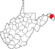
Town CDPs Other localities Allensville | Arden | Baker Heights | Baxter | Bedington | Berkeley | Bessemer | Blairton | Bunker Hill | Darkesville | Douglas Grove | Files Crossroad | Ganotown | Georgetown | Gerrardstown | Glengary | Goose Nest | Greensburg | Grubbs Corner | Hainesville | Johnsontown | Jones Springs | Little Georgetown | Marlowe | Nipetown | Nollville | North Mountain | Pikeside | Ridgeway | Scrabble | Shanghai | Spring Mills | Swan Pond | Tablers Station | Tarico Heights | Tomahawk | Union Corner | Van Clevesville | Vanville | Winebrenners Crossroad | Wynkoop Spring
-


Wikimedia Foundation. 2010.