- National Register of Historic Places listings in Mineral County, West Virginia
-
 Location of Mineral County in West Virginia
This is a list of the National Register of Historic Places listings in Mineral County, West Virginia.
This is intended to be a complete list of the properties and districts on the National Register of Historic Places in Mineral County, West Virginia, United States. The locations of National Register properties and districts for which the latitude and longitude coordinates are included below, may be seen in a Google map.[1]
There are 11 properties and districts listed on the National Register in the county.
-
- This National Park Service list is complete through NPS recent listings posted November 10, 2011.[2]
Contents: Counties in West Virginia Barbour - Berkeley - Boone - Braxton - Brooke - Cabell - Calhoun - Clay - Doddridge - Fayette - Gilmer - Grant - Greenbrier - Hampshire - Hancock - Hardy - Harrison - Jackson - Jefferson - Kanawha - Lewis - Lincoln - Logan - Marion - Marshall - Mason - McDowell - Mercer - Mineral - Mingo - Monongalia - Monroe - Morgan - Nicholas - Ohio - Pendleton - Pleasants - Pocahontas - Preston - Putnam - Raleigh - Randolph - Ritchie - Roane - Summers - Taylor - Tucker - Tyler - Upshur - Wayne - Webster - Wetzel - Wirt - Wood - Wyoming
Current listings
[3] Landmark name [4] Image Date listed Location City or town Summary 1 Burlington Historic District December 7, 1992 County Route 11 south from its junction with U.S. Routes 50/220
39°20′09″N 78°55′09″W / 39.335833°N 78.919167°WBurlington 2 Carskadon House March 20, 1987 Route 1, Box 93A, Beaver Run Rd.
39°23′22″N 78°51′01″W / 39.389444°N 78.850278°WBurlington 3 Thomas R. Carskadon House August 22, 2002 Carskadon Rd.
39°25′53″N 78°59′17″W / 39.431389°N 78.988056°WKeyser 4 Henry Glassaway Davis House December 17, 2008 15-17 Jones St. Piedmont 5 Fairview December 7, 1992 Junction of Patterson Creek Dr. and Russelldale Rds.
39°17′59″N 78°56′11″W / 39.299722°N 78.936389°WBurlington 6 Fort Ashby December 18, 1970 South St.
39°30′19″N 78°45′57″W / 39.505278°N 78.765833°WFort Ashby 7 Fort Hill January 9, 1997 Patterson Creek Rd., approximately 1.5 mi (2.4 km) south of junction with U.S. Routes 50/220
39°18′37″N 78°56′08″W / 39.310278°N 78.935556°WBurlington 8 Mineral County Courthouse September 7, 2005 150 Armstrong St.
39°03′48″N 81°23′47″W / 39.063333°N 81.396389°WKeyser 9 Stewart's Tavern July 14, 2000 Short Gap Rd.
39°32′38″N 78°48′44″W / 39.543889°N 78.812222°WShort Gap 10 Travelers Rest July 26, 2006 1 mi (1.6 km) east of Ridgeville on U.S. Route 50
39°20′24″N 78°58′38″W / 39.34°N 78.977222°WBurlington 11 Vandiver-Trout-Clause House May 29, 1979 U.S. Routes 50/220
39°20′58″N 78°59′33″W / 39.349444°N 78.9925°WRidgeville See also
- List of National Historic Landmarks in West Virginia
- National Register of Historic Places listings in West Virginia
References
- ^ The latitude and longitude information provided in this table was derived originally from the National Register Information System, which has been found to be fairly accurate for about 99% of listings. For about 1% of NRIS original coordinates, experience has shown that one or both coordinates are typos or otherwise extremely far off; some corrections may have been made. A more subtle problem causes many locations to be off by up to 150 yards, depending on location in the country: most NRIS coordinates were derived from tracing out latitude and longitudes off of USGS topographical quadrant maps created under the North American Datum of 1927, which differs from the current, highly accurate WGS84 GPS system used by Google maps. Chicago is about right, but NRIS longitudes in Washington are higher by about 4.5 seconds, and are lower by about 2.0 seconds in Maine. Latitudes differ by about 1.0 second in Florida. Some locations in this table may have been corrected to current GPS standards.
- ^ "National Register of Historic Places: Weekly List Actions". National Park Service, United States Department of the Interior. Retrieved on November 10, 2011.
- ^ Numbers represent an ordering by significant words. Various colorings, defined here, differentiate National Historic Landmark sites and National Register of Historic Places Districts from other NRHP buildings, structures, sites or objects.
- ^ "National Register Information System". National Register of Historic Places. National Park Service. . http://nrhp.focus.nps.gov/natreg/docs/All_Data.html.
U.S. National Register of Historic Places in West Virginia Lists by county Barbour • Berkeley • Boone • Braxton • Brooke • Cabell • Calhoun • Clay • Doddridge • Fayette • Gilmer • Grant • Greenbrier • Hampshire • Hancock • Hardy • Harrison • Jackson • Jefferson • Kanawha • Lewis • Lincoln • Logan • Marion • Marshall • Mason • McDowell • Mercer • Mineral • Mingo • Monongalia • Monroe • Morgan • Nicholas • Ohio • Pendleton • Pleasants • Pocahontas • Preston • Putnam • Raleigh • Randolph • Ritchie • Roane • Summers • Taylor • Tucker • Tyler • Upshur • Wayne • Webster • Wetzel • Wirt • Wood • Wyoming

Other lists Municipalities and communities of Mineral County, West Virginia City 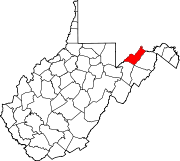
Towns Carpendale | Elk Garden | Piedmont | Ridgeley
CDPs Other
localitiesAntioch | Atlantic Hill | Barnum | Beryl | Blaine | Champwood | Claysville | Cross | Dans Run | Emoryville | Forge Hill | Fountain | Hampshire | Harrison | Hartmansville | Headsville | Keymont | Laurel Dale | Limestone | Markwood | Nethkin | New Creek | Oakmont | Patterson Creek | Reeses Mill | Ridgeville | Rocket Center | Russelldale | Short Gap | Skyline | Sulphur City | Wagoner
-


Wikimedia Foundation. 2010.