- National Register of Historic Places listings in Summers County, West Virginia
-
 Location of Summers County in West Virginia
This is a list of the National Register of Historic Places listings in Summers County, West Virginia.
This is intended to be a complete list of the properties and districts on the National Register of Historic Places in Summers County, West Virginia, United States. The locations of National Register properties and districts for which the latitude and longitude coordinates are included below, may be seen in a Google map.[1]
There are 8 properties and districts listed on the National Register in the county.
-
- This National Park Service list is complete through NPS recent listings posted November 10, 2011.[2]
Contents: Counties in West Virginia Barbour - Berkeley - Boone - Braxton - Brooke - Cabell - Calhoun - Clay - Doddridge - Fayette - Gilmer - Grant - Greenbrier - Hampshire - Hancock - Hardy - Harrison - Jackson - Jefferson - Kanawha - Lewis - Lincoln - Logan - Marion - Marshall - Mason - McDowell - Mercer - Mineral - Mingo - Monongalia - Monroe - Morgan - Nicholas - Ohio - Pendleton - Pleasants - Pocahontas - Preston - Putnam - Raleigh - Randolph - Ritchie - Roane - Summers - Taylor - Tucker - Tyler - Upshur - Wayne - Webster - Wetzel - Wirt - Wood - Wyoming
Current listings
[3] Landmark name[4] Image Date listed Location City or Town Summary 1 Cooper's Mill July 25, 2001 Off Ellison Ridge Rd. (County Route 27)
37°36′21″N 80°58′40″W / 37.605833°N 80.977778°WJumping Branch 2 Col. James Graham House 
March 16, 1976 Southwest of Lowell on WV 3
37°39′07″N 80°43′52″W / 37.651944°N 80.731111°WLowell 3 Samuel Gwinn Plantation March 8, 1989 County Route 15
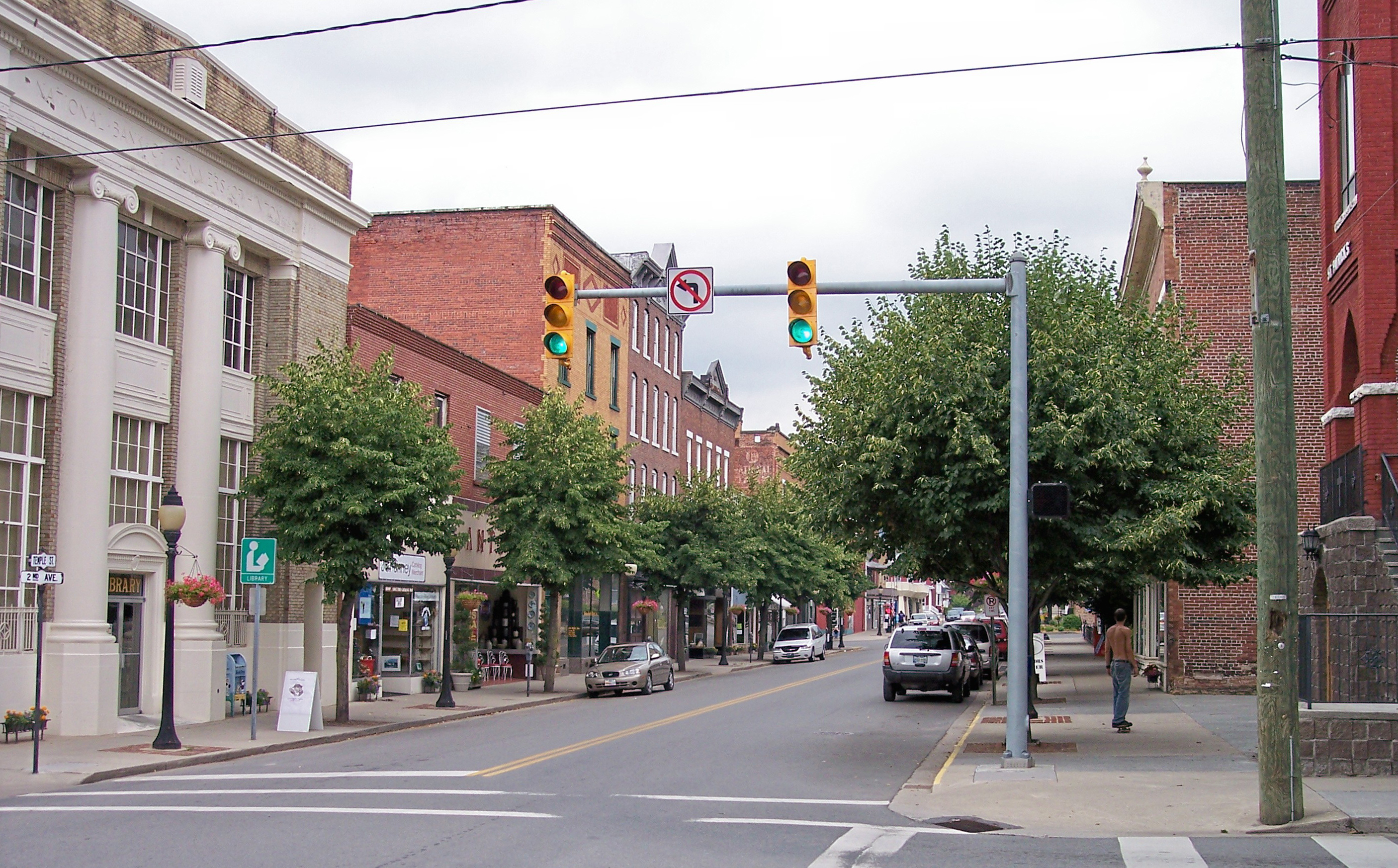
37°38′55″N 80°43′35″W / 37.648611°N 80.726389°WLowell 4 Hinton Historic District 
February 17, 1984 Roughly bounded by the Chesapeake & Ohio railroad line, James St., 5th Ave., and Roundhouse; also Hill St.
37°40′25″N 80°53′11″W / 37.673611°N 80.886389°WHinton 5 Jordan's Chapel February 22, 1980 Northwest of Pipestem on County Route 18
37°32′46″N 80°57′38″W / 37.546111°N 80.960556°WPipestem 6 Pence Springs Hotel Historic District February 27, 1985 Roughly bounded by Buggy Branch, Buggy Branch Rd., WV 3 and Pence Springs Access Rd.
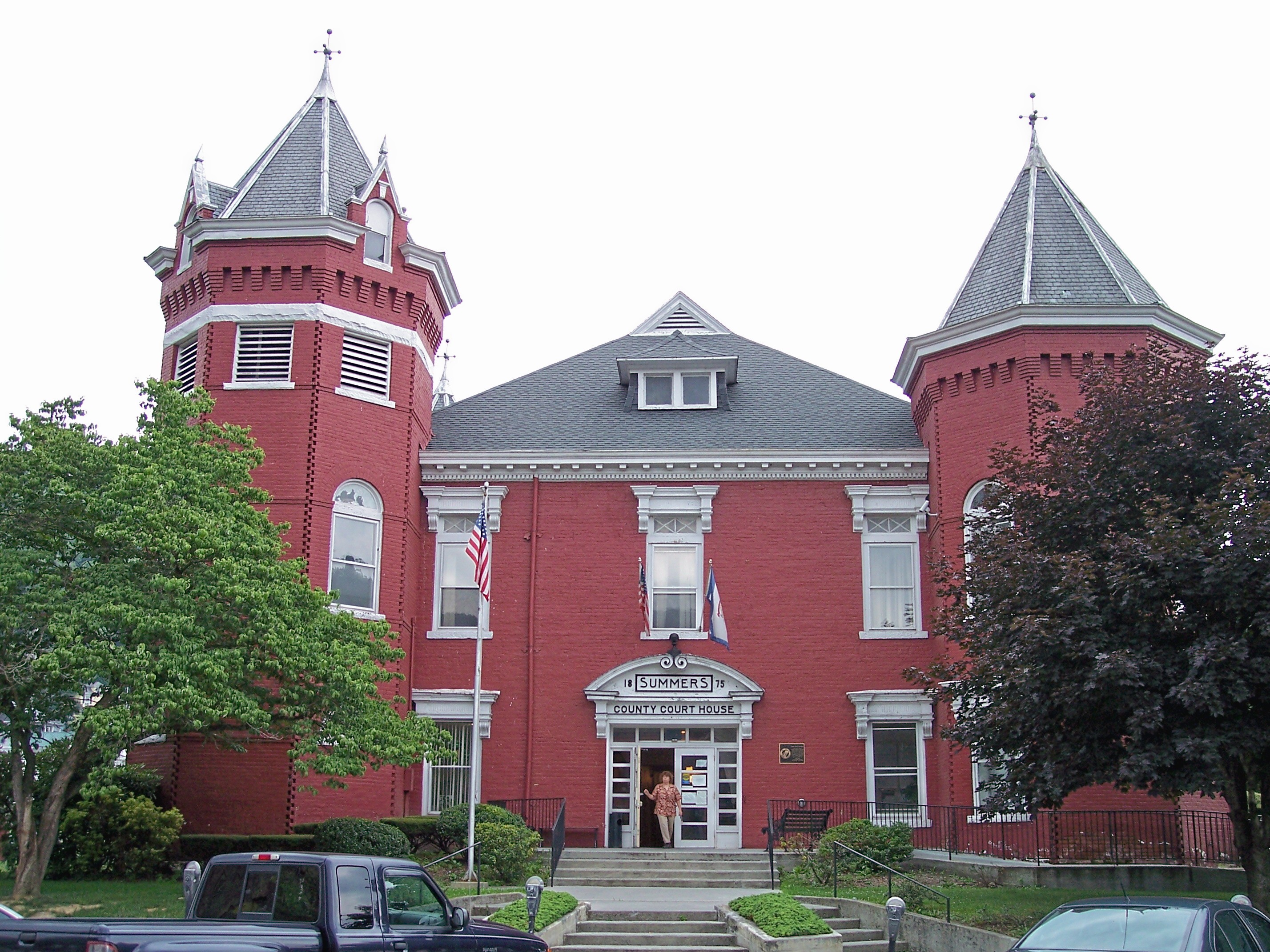
37°41′04″N 80°43′10″W / 37.684444°N 80.719444°WPence Springs 7 Summers County Courthouse 
March 2, 1981 Ballangee St. and 1st Ave.
37°40′20″N 80°53′29″W / 37.672222°N 80.891389°WHinton 8 Trump-Lilly Farmstead November 8, 1990 County Route 26/3, 2.5 miles from County Route 26
37°41′54″N 80°54′01″W / 37.698333°N 80.900278°WHinton Extends into Raleigh County See also
- List of National Historic Landmarks in West Virginia
- National Register of Historic Places listings in West Virginia
References
- ^ The latitude and longitude information provided in this table was derived originally from the National Register Information System, which has been found to be fairly accurate for about 99% of listings. For about 1% of NRIS original coordinates, experience has shown that one or both coordinates are typos or otherwise extremely far off; some corrections may have been made. A more subtle problem causes many locations to be off by up to 150 yards, depending on location in the country: most NRIS coordinates were derived from tracing out latitude and longitudes off of USGS topographical quadrant maps created under the North American Datum of 1927, which differs from the current, highly accurate WGS84 GPS system used by Google maps. Chicago is about right, but NRIS longitudes in Washington are higher by about 4.5 seconds, and are lower by about 2.0 seconds in Maine. Latitudes differ by about 1.0 second in Florida. Some locations in this table may have been corrected to current GPS standards.
- ^ "National Register of Historic Places: Weekly List Actions". National Park Service, United States Department of the Interior. Retrieved on November 10, 2011.
- ^ Numbers represent an ordering by significant words. Various colorings, defined here, differentiate National Historic Landmark sites and National Register of Historic Places Districts from other NRHP buildings, structures, sites or objects.
- ^ "National Register Information System". National Register of Historic Places. National Park Service. 2008-04-24. http://nrhp.focus.nps.gov/natreg/docs/All_Data.html.
U.S. National Register of Historic Places in West Virginia Lists by county Barbour • Berkeley • Boone • Braxton • Brooke • Cabell • Calhoun • Clay • Doddridge • Fayette • Gilmer • Grant • Greenbrier • Hampshire • Hancock • Hardy • Harrison • Jackson • Jefferson • Kanawha • Lewis • Lincoln • Logan • Marion • Marshall • Mason • McDowell • Mercer • Mineral • Mingo • Monongalia • Monroe • Morgan • Nicholas • Ohio • Pendleton • Pleasants • Pocahontas • Preston • Putnam • Raleigh • Randolph • Ritchie • Roane • Summers • Taylor • Tucker • Tyler • Upshur • Wayne • Webster • Wetzel • Wirt • Wood • Wyoming

Other lists Municipalities and communities of Summers County, West Virginia City 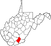
Unincorporated
communitiesBallengee‡ | Bargers Springs | Barksdale | Barnettown | Bertha | Beurytown | Brooklin | Brooks | Browning | Buck | Carew | Claypool | Clayton | Crossroads | Crumps Bottom | Ellison | Ellison Ridge | Elton | Farley | Forest Hill | Glenray | Green Sulphur Springs | Griffith Creek | Hill Top | Hilldale | Hix | Indian Mills | Judson | Jumping Branch | Lick Creek | Lockbridge | Lowell | Mandeville | Marie | Meadow Creek | Mountview‡ | Neponset | Nimitz | Pence Springs | Pipestem | Ramp | Riffe | Sandstone | Santafee | Seminole | Streeter | Suck Creek | Talcott | Tempa | True | Valley Heights | Wiggins
Ghost towns Egypt | Junta | Lilly | Mercers Saltworks | Tina | Warford
Footnotes ‡This populated place also has portions in an adjacent county or counties
Categories:- National Register of Historic Places in West Virginia by county
- Summers County, West Virginia
-


Wikimedia Foundation. 2010.