- National Register of Historic Places listings in Grant County, West Virginia
-
 Location of Grant County in West Virginia
This is a list of the National Register of Historic Places listings in Grant County, West Virginia.
This is intended to be a complete list of the properties and districts on the National Register of Historic Places in Grant County, West Virginia, United States. The locations of National Register properties and districts for which the latitude and longitude coordinates are included below, may be seen in a Google map.[1]
There are 7 properties listed on the National Register in the county.
-
- This National Park Service list is complete through NPS recent listings posted November 10, 2011.[2]
Contents: Counties in West Virginia Barbour - Berkeley - Boone - Braxton - Brooke - Cabell - Calhoun - Clay - Doddridge - Fayette - Gilmer - Grant - Greenbrier - Hampshire - Hancock - Hardy - Harrison - Jackson - Jefferson - Kanawha - Lewis - Lincoln - Logan - Marion - Marshall - Mason - McDowell - Mercer - Mineral - Mingo - Monongalia - Monroe - Morgan - Nicholas - Ohio - Pendleton - Pleasants - Pocahontas - Preston - Putnam - Raleigh - Randolph - Ritchie - Roane - Summers - Taylor - Tucker - Tyler - Upshur - Wayne - Webster - Wetzel - Wirt - Wood - Wyoming
Current listings
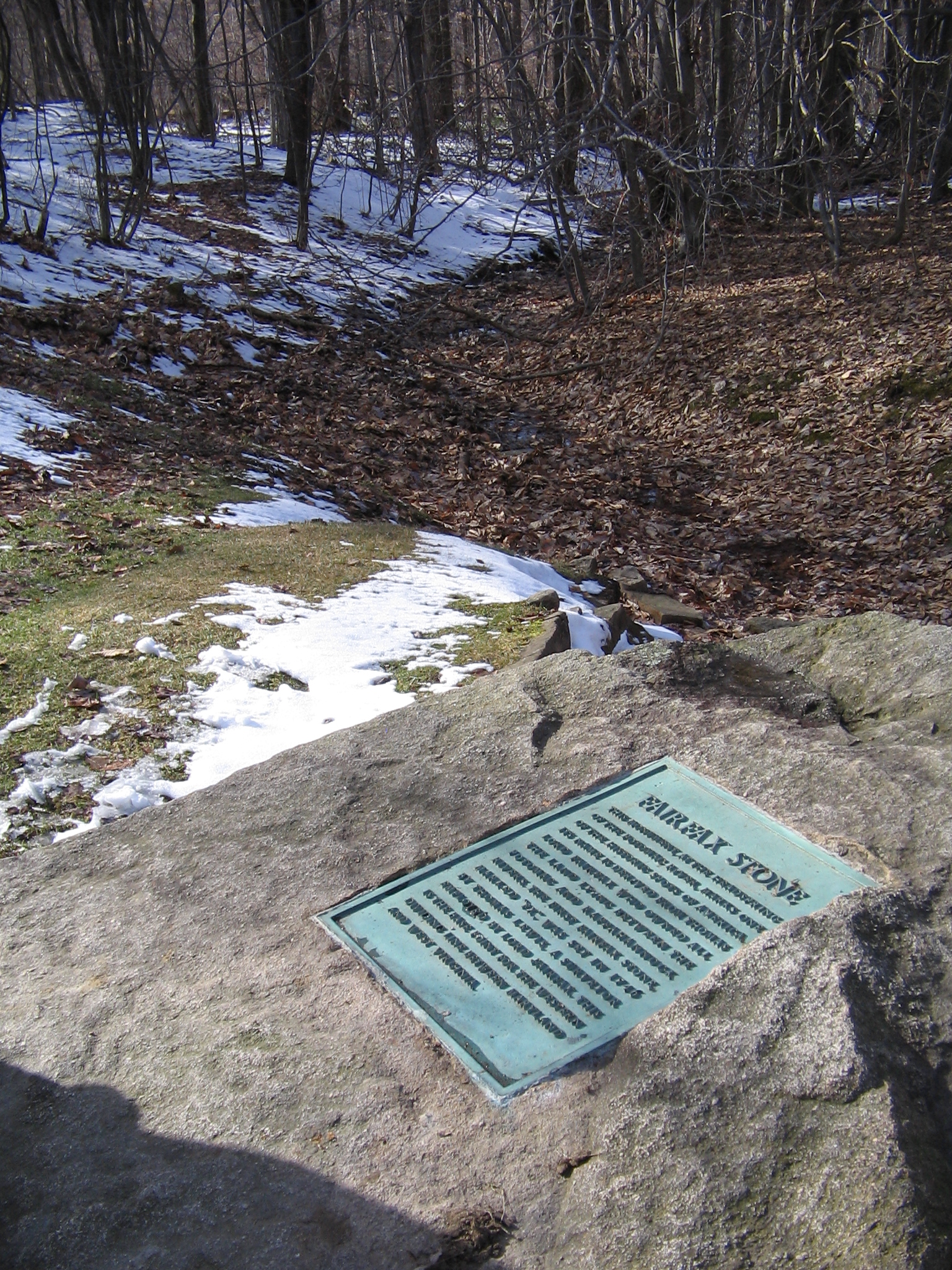
Landmark name Image Date listed Location City or Town Summary 1 Fairfax Stone Site 
January 26, 1970 North of William at corner of Grant, Preston, and Tucker counties
39°11′42″N 79°29′16″W / 39.195°N 79.487778°WWilliam 2 Gormania Presbyterian Church September 7, 2005 Mabis Ave., 0.1 miles south of U.S. Route 50
39°17′40″N 79°20′46″W / 39.294444°N 79.346111°WGormania 3 Grant County Courthouse October 26, 1979 Virginia Ave.
38°59′34″N 79°07′16″W / 38.992778°N 79.121111°WPetersburg 4 Hermitage Motor Inn January 14, 1986 Virginia Ave.
38°59′34″N 79°07′16″W / 38.992778°N 79.121111°WPetersburg 5 The Manor December 18, 1975 North of Petersburg off WV 42
39°00′36″N 79°07′40″W / 39.01°N 79.127778°WPetersburg 6 Rohrbaugh Cabin November 3, 1993 Smokehole Rd. (County Route 28/11), 3 miles south of junction with WV 28/WV 55, Monongahela National Forest
38°57′20″N 79°14′31″W / 38.955556°N 79.241944°WPetersburg 7 Noah Snyder Farm June 10, 1975 1.5 miles south of Lahmansville on County Route 5
39°06′35″N 79°05′56″W / 39.109722°N 79.098889°WLahmansville See also
- List of National Historic Landmarks in West Virginia
- National Register of Historic Places listings in West Virginia
References
- ^ The latitude and longitude information provided in this table was derived originally from the National Register Information System, which has been found to be fairly accurate for about 99% of listings. For about 1% of NRIS original coordinates, experience has shown that one or both coordinates are typos or otherwise extremely far off; some corrections may have been made. A more subtle problem causes many locations to be off by up to 150 yards, depending on location in the country: most NRIS coordinates were derived from tracing out latitude and longitudes off of USGS topographical quadrant maps created under North American Datum of 1927, which differs from the current, highly accurate GPS system used by Google maps. Chicago is about right, but NRIS longitudes in Washington are higher by about 4.5 seconds, and are lower by about 2.0 seconds in Maine. Latitudes differ by about 1.0 second in Florida. Some locations in this table may have been corrected to current GPS standards.
- ^ "National Register of Historic Places: Weekly List Actions". National Park Service, United States Department of the Interior. Retrieved on November 10, 2011.
U.S. National Register of Historic Places in West Virginia Lists by county Barbour • Berkeley • Boone • Braxton • Brooke • Cabell • Calhoun • Clay • Doddridge • Fayette • Gilmer • Grant • Greenbrier • Hampshire • Hancock • Hardy • Harrison • Jackson • Jefferson • Kanawha • Lewis • Lincoln • Logan • Marion • Marshall • Mason • McDowell • Mercer • Mineral • Mingo • Monongalia • Monroe • Morgan • Nicholas • Ohio • Pendleton • Pleasants • Pocahontas • Preston • Putnam • Raleigh • Randolph • Ritchie • Roane • Summers • Taylor • Tucker • Tyler • Upshur • Wayne • Webster • Wetzel • Wirt • Wood • Wyoming

Other lists Municipalities and communities of Grant County, West Virginia City 
Town Unincorporated
communitiesArthur | Bismarck | Cabins | Dobbin | Dorcas | Fairfax | Forman | Gormania | Greenland | Henry | Hopeville | Lahmansville | Maysville | Medley | Mount Storm | Old Arthur | Scherr | Seymourville | Williamsport | Wilsonia
-


Wikimedia Foundation. 2010.