- National Register of Historic Places listings in Jackson County, West Virginia
-
 Location of Jackson County in West Virginia
This is a list of the National Register of Historic Places listings in Jackson County, West Virginia.
This is intended to be a complete list of the properties and districts on the National Register of Historic Places in Jackson County, West Virginia, United States. The locations of National Register properties and districts for which the latitude and longitude coordinates are included below, may be seen in a Google map.[1]
There are 10 properties and districts listed on the National Register in the county.
-
- This National Park Service list is complete through NPS recent listings posted November 10, 2011.[2]
Contents: Counties in West Virginia Barbour - Berkeley - Boone - Braxton - Brooke - Cabell - Calhoun - Clay - Doddridge - Fayette - Gilmer - Grant - Greenbrier - Hampshire - Hancock - Hardy - Harrison - Jackson - Jefferson - Kanawha - Lewis - Lincoln - Logan - Marion - Marshall - Mason - McDowell - Mercer - Mineral - Mingo - Monongalia - Monroe - Morgan - Nicholas - Ohio - Pendleton - Pleasants - Pocahontas - Preston - Putnam - Raleigh - Randolph - Ritchie - Roane - Summers - Taylor - Tucker - Tyler - Upshur - Wayne - Webster - Wetzel - Wirt - Wood - Wyoming
Current listings
Landmark name Image Date listed Location City or Town Summary 1 Armstrong House February 12, 1980 315 North St.
38°49′12″N 81°42′52″W / 38.82°N 81.714444°WRipley 2 Clerc-Carson House October 29, 1992 121 North St.
38°49′43″N 81°42′31″W / 38.828611°N 81.708611°WRipley 3 Faber Double-Crib Barn September 7, 2005 1106 County Route 21
38°37′14″N 81°39′57″W / 38.620556°N 81.665833°WKenna 4 Lemley-Wood-Sayer House October 30, 1985 301 Walnut St.
38°56′55″N 81°45′37″W / 38.948611°N 81.760278°WRavenswood 5 Otterbein Church April 1, 1998 County Route 87/11, near junction with County Route 5
38°49′54″N 81°47′36″W / 38.831667°N 81.793333°WEvans 6 Rankin Octagonal Barn July 9, 1985 County Route 3
38°56′45″N 81°41′44″W / 38.945833°N 81.695556°WSilverton 7 Ravenswood "Old Town" Historic District 
March 23, 2007 Bounded by Sandy Creek, the Ohio River, Sycamore St., and adjoining properties and the city limits to the east
38°56′53″N 81°45′39″W / 38.948137°N 81.760965°WRavenswood 8 Ripley Historic District 
August 25, 2004 Portions of Charleston and Highlawn Drs., Church, Court, Main, Maple, North, 7th, and South Sts.
38°49′10″N 81°42′36″W / 38.819444°N 81.71°WRipley 9 Sarvis Fork Covered Bridge 
June 4, 1981 County Route 21/15
38°55′17″N 81°38′41″W / 38.921389°N 81.644722°WSandyville 10 Staats Mill Covered Bridge 
May 29, 1979 Off County Route 25 at Cedar Lakes
38°47′40″N 81°41′14″W / 38.794444°N 81.687222°WRipley Former listing
Landmark name Image Dates Location City or Town Summary 1 Old Ravenswood School[3] added April 16, 1984; demolished Henry St.
38°56′53.825″N 81°45′24.450″W / 38.94828472°N 81.7567917°WRavenswood Note: the National Register Information System showed it having "RN" status; it is unclear whether this place has been listed. See also
- List of National Historic Landmarks in West Virginia
- National Register of Historic Places listings in West Virginia
References
- ^ The latitude and longitude information provided in this table was derived originally from the National Register Information System, which has been found to be fairly accurate for about 99% of listings. For about 1% of NRIS original coordinates, experience has shown that one or both coordinates are typos or otherwise extremely far off; some corrections may have been made. A more subtle problem causes many locations to be off by up to 150 yards, depending on location in the country: most NRIS coordinates were derived from tracing out latitude and longitudes off of USGS topographical quadrant maps created under North American Datum of 1927, which differs from the current, highly accurate GPS system used by Google maps. Chicago is about right, but NRIS longitudes in Washington are higher by about 4.5 seconds, and are lower by about 2.0 seconds in Maine. Latitudes differ by about 1.0 second in Florida. Some locations in this table may have been corrected to current GPS standards.
- ^ "National Register of Historic Places: Weekly List Actions". National Park Service, United States Department of the Interior. Retrieved on November 10, 2011.
- ^ West Virginia Division of Culture and History: Jackson County NRHP listings
U.S. National Register of Historic Places in West Virginia Lists by county Barbour • Berkeley • Boone • Braxton • Brooke • Cabell • Calhoun • Clay • Doddridge • Fayette • Gilmer • Grant • Greenbrier • Hampshire • Hancock • Hardy • Harrison • Jackson • Jefferson • Kanawha • Lewis • Lincoln • Logan • Marion • Marshall • Mason • McDowell • Mercer • Mineral • Mingo • Monongalia • Monroe • Morgan • Nicholas • Ohio • Pendleton • Pleasants • Pocahontas • Preston • Putnam • Raleigh • Randolph • Ritchie • Roane • Summers • Taylor • Tucker • Tyler • Upshur • Wayne • Webster • Wetzel • Wirt • Wood • Wyoming

Other lists Keeper of the Register • History of the National Register of Historic Places • Property types • Historic district • Contributing property Municipalities and communities of Jackson County, West Virginia County seat: Ripley Cities 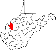
Unincorporated
communitiesAdvent | Cottageville | Duncan | Evans | Fairplain | Flatwoods | Gay | Given | Goldtown | Independence | Kenna | Kentuck | LeRoy | Liverpool‡ | Millwood | Mt. Alto | Murraysville | Rock Castle | Romance | Sandyville | Sherman | Silverton | Statts Mills
Footnotes ‡This populated place also has portions in an adjacent county or counties
-


Wikimedia Foundation. 2010.