- National Register of Historic Places listings in Wood County, West Virginia
-
 Location of Wood County in West Virginia
This is a list of the National Register of Historic Places listings in Wood County, West Virginia.
This is intended to be a complete list of the properties and districts on the National Register of Historic Places in Wood County, West Virginia, United States. The locations of National Register properties and districts for which the latitude and longitude coordinates are included below, may be seen in a Google map.[1]
There are 44 properties and districts listed on the National Register in the county.
-
- This National Park Service list is complete through NPS recent listings posted November 10, 2011.[2]
Contents: Counties in West Virginia Barbour - Berkeley - Boone - Braxton - Brooke - Cabell - Calhoun - Clay - Doddridge - Fayette - Gilmer - Grant - Greenbrier - Hampshire - Hancock - Hardy - Harrison - Jackson - Jefferson - Kanawha - Lewis - Lincoln - Logan - Marion - Marshall - Mason - McDowell - Mercer - Mineral - Mingo - Monongalia - Monroe - Morgan - Nicholas - Ohio - Pendleton - Pleasants - Pocahontas - Preston - Putnam - Raleigh - Randolph - Ritchie - Roane - Summers - Taylor - Tucker - Tyler - Upshur - Wayne - Webster - Wetzel - Wirt - Wood - Wyoming
Listings county-wide
[3] Landmark name Image Date listed Location City or town Summary 1 Avery Street Historic District April 15, 1986 Roughly bounded by Nineteenth, Spring and Quincy, Eighth, and Market Sts.
39°16′15″N 81°33′18″W / 39.270833°N 81.555°WParkersburg 2 Bethel AME Church October 8, 1998 820 Clay St.
39°15′58″N 81°33′18″W / 39.266111°N 81.555°WParkersburg 3 W. H. Bickel Estate February 11, 2004 Number One Bickel Mansion Dr.
39°14′52″N 81°35′17″W / 39.247778°N 81.588056°WParkersburg 4 Blennerhassett Hotel December 10, 1982 316 Market St.
39°15′53″N 81°33′41″W / 39.264722°N 81.561389°WParkersburg 5 Blennerhassett Island Historic District 
September 7, 1972 On the Ohio River, 1.7 miles south of Parkersburg
39°16′19″N 81°37′12″W / 39.271944°N 81.62°WParkersburg 6 Carnegie Library October 8, 1982 725 Green St.
39°15′56″N 81°33′22″W / 39.265556°N 81.556111°WParkersburg 7 Case House October 8, 1982 710 Ann St.
39°16′08″N 81°33′32″W / 39.268889°N 81.558889°WParkersburg 8 Citizens National Bank October 8, 1982 219 4th St.
39°15′55″N 81°33′41″W / 39.265278°N 81.561389°WParkersburg 9 Cook House June 7, 1978 1301 Murdoch Ave.
39°16′29″N 81°33′20″W / 39.274722°N 81.555556°WParkersburg 10 Henry Cooper House February 6, 1986 Park Ave.
39°16′18″N 81°31′48″W / 39.271667°N 81.53°WParkersburg 11 Elks Club October 8, 1982 515 Juliana St.
39°16′02″N 81°33′39″W / 39.267222°N 81.560833°WParkersburg 12 First Baptist Church December 10, 1982 813 Market St.
39°16′04″N 81°33′24″W / 39.267778°N 81.556667°WParkersburg 13 First Presbyterian Church/Calvary Temple Evangelical Church December 10, 1982 946 Market St.
39°16′08″N 81°33′16″W / 39.268889°N 81.554444°WParkersburg 14 Fort Boreman April 17, 2003 Address Restricted Parkersburg 15 Gould House/Greater Parkersburg Chamber of Commerce October 8, 1982 720 Juliana St.
39°16′05″N 81°33′29″W / 39.268056°N 81.558056°WParkersburg 16 Henderson Hall Historic District April 17, 1986 CR 21/2 off WV 14
39°22′40″N 81°28′58″W / 39.377778°N 81.482778°WWilliamstown 17 House at 10th and Avery Streets December 10, 1982 10th and Avery Sts.
39°16′10″N 81°33′12″W / 39.269444°N 81.553333°WParkersburg 18 Jackson Memorial Fountain August 23, 1984 Park Ave. and 17th St.
39°16′11″N 81°31′55″W / 39.269722°N 81.531944°WParkersburg 19 Julia-Ann Square Historic District 
May 24, 1977 Both sides of Juliana and Ann Sts. from cemetery to 9th St.
39°16′16″N 81°33′21″W / 39.271111°N 81.555833°WParkersburg 20 Henry Logan Memorial AME Church December 16, 1982 Ann and 6th Sts.
39°16′05″N 81°33′41″W / 39.268056°N 81.561389°WParkersburg 21 Masonic Temple October 8, 1982 900 Market St.
39°16′04″N 81°33′22″W / 39.267778°N 81.556111°WParkersburg 22 Mather Building/Franklin & DeHaven Jewelers October 8, 1982 405 Market St.
39°15′56″N 81°33′39″W / 39.265556°N 81.560833°WParkersburg 23 Meldahl House May 17, 1991 Washington Bottom Rd. off WV 892
39°13′28″N 81°40′57″W / 39.224444°N 81.6825°WWashington 24 George Neale, Jr., House January 10, 1980 331 Juliana St.
39°15′58″N 81°33′46″W / 39.266111°N 81.562778°WParkersburg 25 Oakland May 29, 1979 1131 7th St.
39°15′52″N 81°32′36″W / 39.264444°N 81.543333°WParkersburg 26 Oeldorf Building/Wetherell's Jewelers December 10, 1982 809 Market St.
39°16′04″N 81°33′26″W / 39.267778°N 81.557222°WParkersburg 27 Parkersburg High School-Washington Avenue Historic District 
July 16, 1992 Washington Ave. from Park Ave. to Dudley Ave., including 2101 Dudley
39°16′34″N 81°32′23″W / 39.276111°N 81.539722°WParkersburg 28 Parkersburg Women's Club October 8, 1982 323 9th St.
39°16′02″N 81°33′20″W / 39.267222°N 81.555556°WParkersburg 29 St. Francis Xavier Church December 22, 1978 532 Market St.
39°15′57″N 81°33′34″W / 39.265833°N 81.559444°WParkersburg 30 Sharon Lodge No. 28 IOOF October 8, 1982 316 5th St.
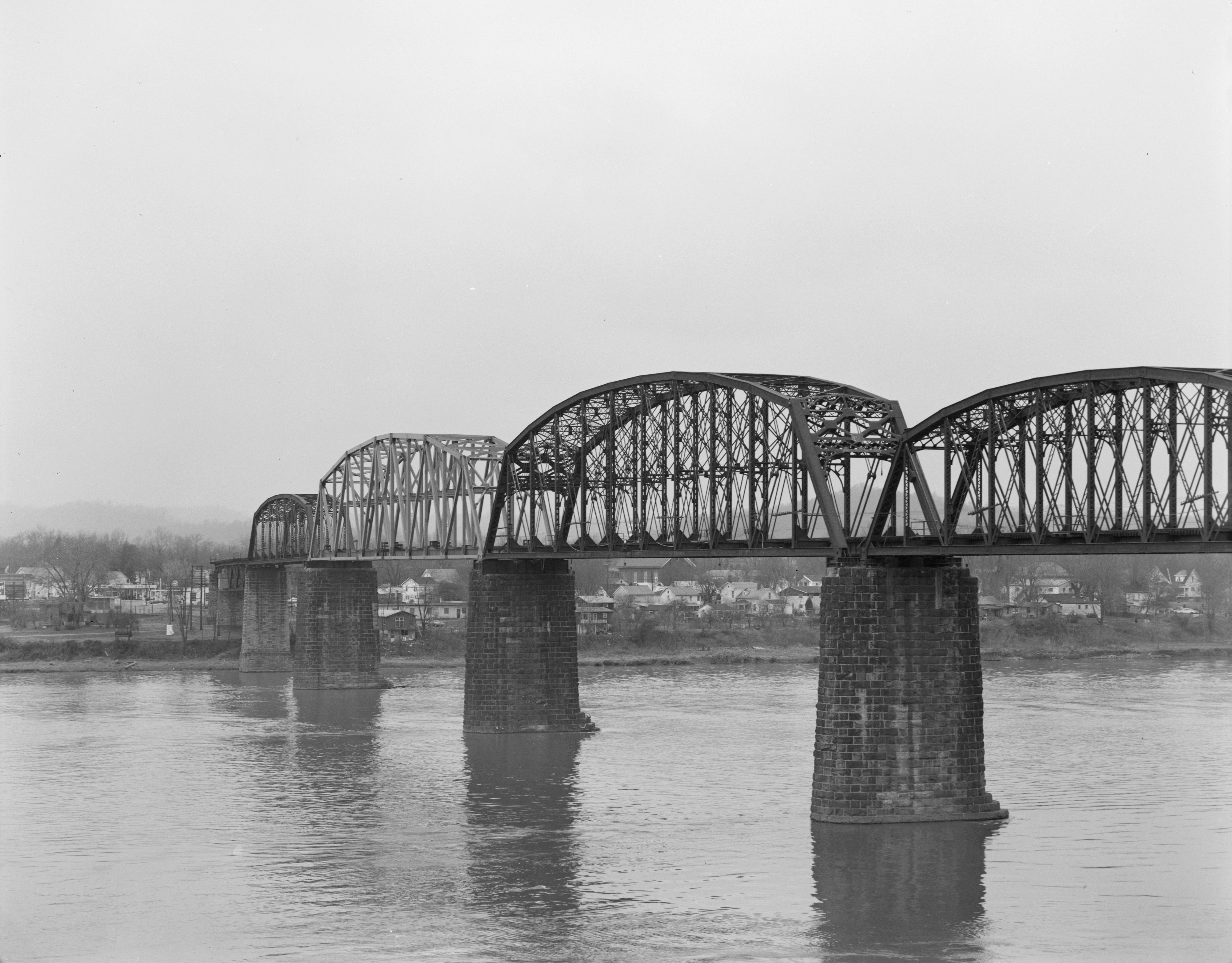
39°15′55″N 81°33′37″W / 39.265278°N 81.560278°WParkersburg 31 Sixth Street Railroad Bridge 
December 10, 1982 6th Street
39°16′15″N 81°33′54″W / 39.27079°N 81.56503°WParkersburg Extends into Washington County, Ohio 32 Smith Building December 10, 1982 310½ Market St.
39°15′52″N 81°33′42″W / 39.264444°N 81.561667°WParkersburg 33 W.H. Smith Hardware Company Building May 2, 2003 119 3rd St.
39°15′58″N 81°33′50″W / 39.266111°N 81.563889°WParkersburg 34 Smoot Theater October 8, 1982 213 5th St.
39°16′00″N 81°33′38″W / 39.266667°N 81.560556°WParkersburg 35 Tavenner House November 10, 1982 2401 Camden Ave.
39°15′19″N 81°33′04″W / 39.255278°N 81.551111°WParkersburg 36 Tomlinson Mansion July 24, 1974 901 W. 3rd St.
39°24′03″N 81°27′50″W / 39.400833°N 81.463889°WWilliamstown 37 Tracewell House April 26, 1991 WV 95 west of Gihon Rd.
39°14′54″N 81°35′24″W / 39.248333°N 81.59°WParkersburg 38 Trinity Episcopal Church Rectory December 10, 1982 430 Juliana St.
39°15′59″N 81°33′41″W / 39.266389°N 81.561389°WParkersburg 39 Trinity Protestant Episcopal Church December 10, 1982 424 Juliana St.
39°15′58″N 81°33′41″W / 39.266111°N 81.561389°WParkersburg 40 Union Trust & Deposit Co./Union Trust National Bank October 8, 1982 700 Market St.
39°16′00″N 81°33′28″W / 39.266667°N 81.557778°WParkersburg 41 Peter G. Van Winkle House October 8, 1982 600 Juliana St.
39°16′02″N 81°33′34″W / 39.267222°N 81.559444°WParkersburg 42 Walton Wait House December 10, 1982 1232 Murdoch Ave.
39°16′27″N 81°33′19″W / 39.274167°N 81.555278°WParkersburg 43 Windmill Quaker State October 8, 1982 800 Murdoch Ave.
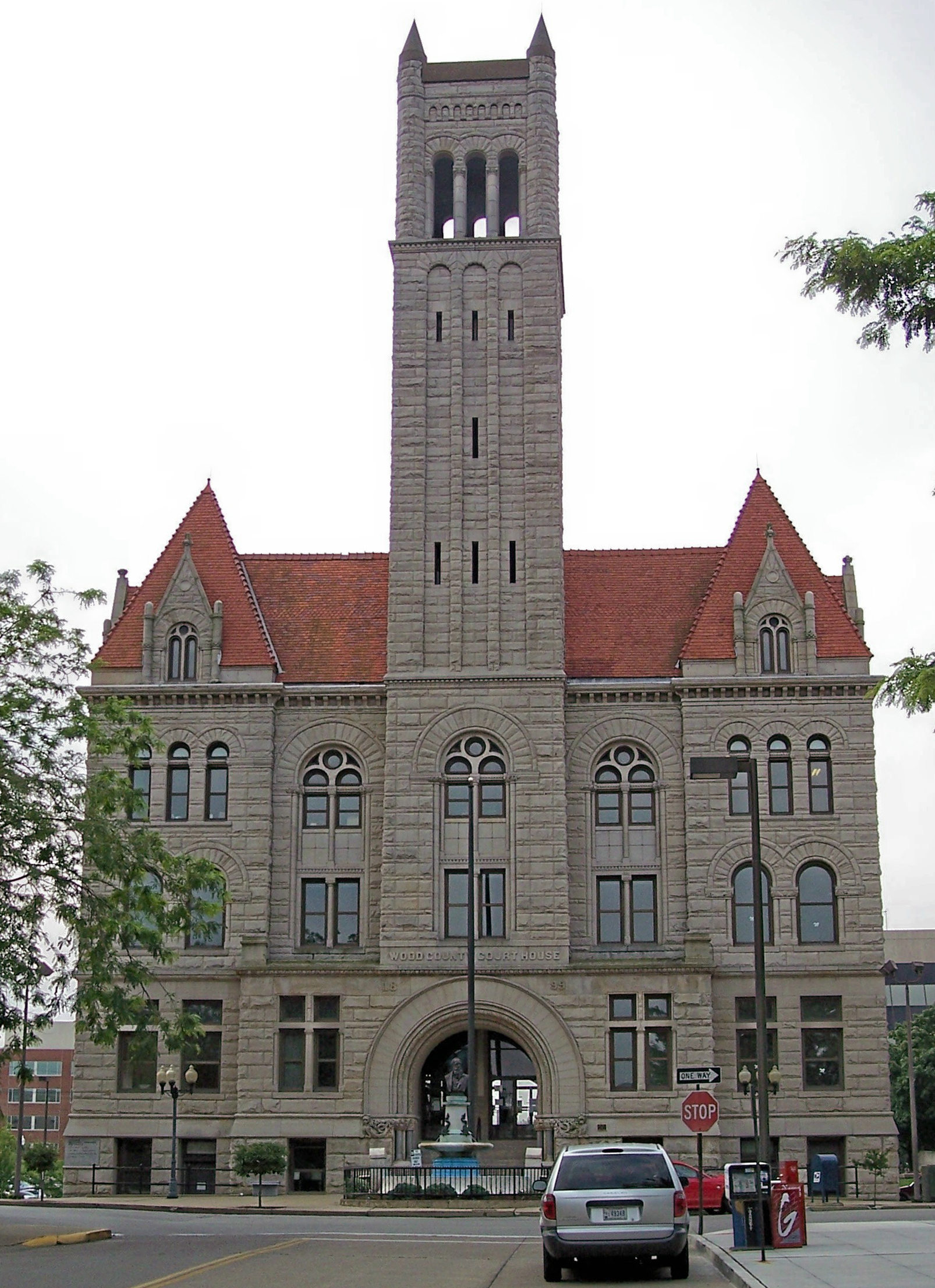
39°16′11″N 81°33′31″W / 39.269722°N 81.558611°WParkersburg 44 Wood County Courthouse 
August 29, 1979 Court Sq. at 3rd and Market St.
39°15′53″N 81°33′46″W / 39.264722°N 81.562778°WParkersburg See also
- List of National Historic Landmarks in West Virginia
- National Register of Historic Places listings in West Virginia
References
- ^ The latitude and longitude information provided in this table was derived originally from the National Register Information System, which has been found to be fairly accurate for about 99% of listings. For about 1% of NRIS original coordinates, experience has shown that one or both coordinates are typos or otherwise extremely far off; some corrections may have been made. A more subtle problem causes many locations to be off by up to 150 yards, depending on location in the country: most NRIS coordinates were derived from tracing out latitude and longitudes off of USGS topographical quadrant maps created under the North American Datum of 1927, which differs from the current, highly accurate WGS84 GPS system used by Google maps. Chicago is about right, but NRIS longitudes in Washington are higher by about 4.5 seconds, and are lower by about 2.0 seconds in Maine. Latitudes differ by about 1.0 second in Florida. Some locations in this table may have been corrected to current GPS standards.
- ^ "National Register of Historic Places: Weekly List Actions". National Park Service, United States Department of the Interior. Retrieved on November 10, 2011.
- ^ Numbers represent an ordering by significant words. Various colorings, defined here, differentiate National Historic Landmark sites and National Register of Historic Places Districts from other NRHP buildings, structures, sites or objects.
U.S. National Register of Historic Places in West Virginia Lists by county Barbour • Berkeley • Boone • Braxton • Brooke • Cabell • Calhoun • Clay • Doddridge • Fayette • Gilmer • Grant • Greenbrier • Hampshire • Hancock • Hardy • Harrison • Jackson • Jefferson • Kanawha • Lewis • Lincoln • Logan • Marion • Marshall • Mason • McDowell • Mercer • Mineral • Mingo • Monongalia • Monroe • Morgan • Nicholas • Ohio • Pendleton • Pleasants • Pocahontas • Preston • Putnam • Raleigh • Randolph • Ritchie • Roane • Summers • Taylor • Tucker • Tyler • Upshur • Wayne • Webster • Wetzel • Wirt • Wood • Wyoming

Other lists Municipalities and communities of Wood County, West Virginia Cities 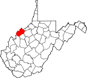
Town CDPs Blennerhassett | Boaz | Lubeck | Mineralwells | Washington | Waverly
Unincorporated
communitiesBelleville | Davisville | Deerwalk | Kanawha | Rockport | Walker
Categories:- National Register of Historic Places in West Virginia by county
- Wood County, West Virginia
-


Wikimedia Foundation. 2010.