- National Register of Historic Places listings in Wyoming County, West Virginia
-
 Location of Wyoming County in West Virginia
This is a list of the National Register of Historic Places listings in Wyoming County, West Virginia.
This is intended to be a complete list of the properties and districts on the National Register of Historic Places in Wyoming County, West Virginia, United States. The locations of National Register properties and districts for which the latitude and longitude coordinates are included below, may be seen in a Google map.[1]
There are 4 properties and districts listed on the National Register in the county.
-
- This National Park Service list is complete through NPS recent listings posted November 10, 2011.[2]
Contents: Counties in West Virginia Barbour - Berkeley - Boone - Braxton - Brooke - Cabell - Calhoun - Clay - Doddridge - Fayette - Gilmer - Grant - Greenbrier - Hampshire - Hancock - Hardy - Harrison - Jackson - Jefferson - Kanawha - Lewis - Lincoln - Logan - Marion - Marshall - Mason - McDowell - Mercer - Mineral - Mingo - Monongalia - Monroe - Morgan - Nicholas - Ohio - Pendleton - Pleasants - Pocahontas - Preston - Putnam - Raleigh - Randolph - Ritchie - Roane - Summers - Taylor - Tucker - Tyler - Upshur - Wayne - Webster - Wetzel - Wirt - Wood - Wyoming
Current listings
[3] Landmark name[4] Image Date listed Location City or Town Summary 1 Itmann Company Store and Office 
November 28, 1990 West Virginia Routes 10 and 16
37°34′26″N 81°25′04″W / 37.573889°N 81.417778°WItmann 2 Mullens Historic District 
November 16, 1993 Roughly bounded by Lusk and Highland Aves., the Norfolk Southern railroad tracks and Water St.
37°34′57″N 81°23′05″W / 37.5825°N 81.384722°WMullens 3 Wyco Church March 31, 2010 County Route 12/1, approximately 1 mile north of County Route 16
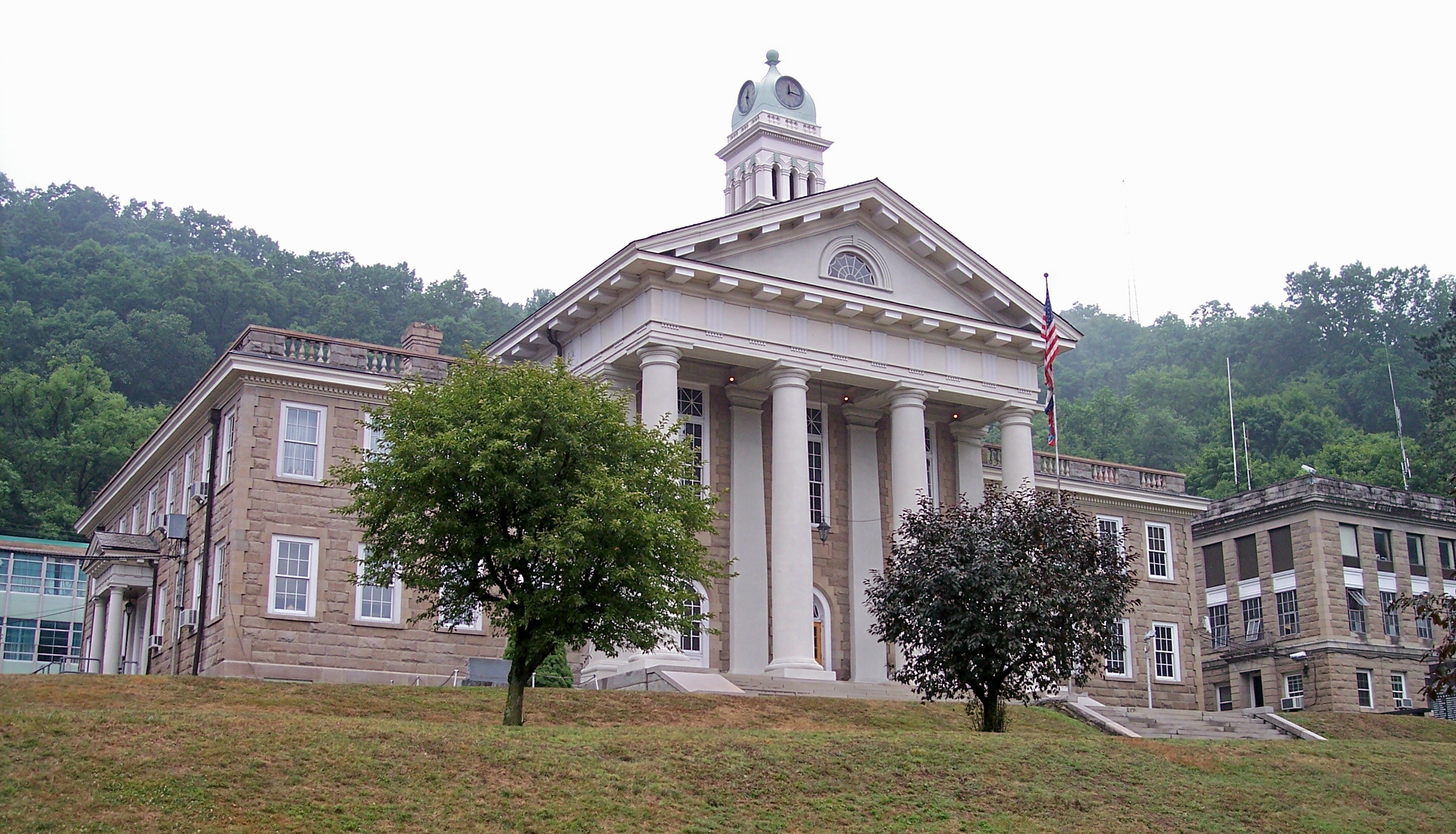
37°36′00″N 81°20′37″W / 37.599969°N 81.343681°WMullens Community church built in 1917 by coal baron W.P. Tams to serve Wyco Coal Camp C[5] 4 Wyoming County Courthouse and Jail 
November 27, 1979 Main St.
37°35′01″N 81°32′16″W / 37.583611°N 81.537778°WPineville See also
- List of National Historic Landmarks in West Virginia
- National Register of Historic Places listings in West Virginia
References
- ^ The latitude and longitude information provided in this table was derived originally from the National Register Information System, which has been found to be fairly accurate for about 99% of listings. For about 1% of NRIS original coordinates, experience has shown that one or both coordinates are typos or otherwise extremely far off; some corrections may have been made. A more subtle problem causes many locations to be off by up to 150 yards, depending on location in the country: most NRIS coordinates were derived from tracing out latitude and longitudes off of USGS topographical quadrant maps created under the North American Datum of 1927, which differs from the current, highly accurate WGS84 GPS system used by Google maps. Chicago is about right, but NRIS longitudes in Washington are higher by about 4.5 seconds, and are lower by about 2.0 seconds in Maine. Latitudes differ by about 1.0 second in Florida. Some locations in this table may have been corrected to current GPS standards.
- ^ "National Register of Historic Places: Weekly List Actions". National Park Service, United States Department of the Interior. Retrieved on November 10, 2011.
- ^ Numbers represent an ordering by significant words. Various colorings, defined here, differentiate National Historic Landmark sites and National Register of Historic Places Districts from other NRHP buildings, structures, sites or objects.
- ^ "National Register Information System". National Register of Historic Places. National Park Service. 2008-04-24. http://nrhp.focus.nps.gov/natreg/docs/All_Data.html.
- ^ Steelhammer, Rick (April 17, 2010). "Student volunteers renovating historic Wyco church". Charleston, West Virginia: Saturday Gazette-Mail. http://www.wvgazette.com/News/201004170258. Retrieved April 17, 2010.
U.S. National Register of Historic Places in West Virginia Lists by county Barbour • Berkeley • Boone • Braxton • Brooke • Cabell • Calhoun • Clay • Doddridge • Fayette • Gilmer • Grant • Greenbrier • Hampshire • Hancock • Hardy • Harrison • Jackson • Jefferson • Kanawha • Lewis • Lincoln • Logan • Marion • Marshall • Mason • McDowell • Mercer • Mineral • Mingo • Monongalia • Monroe • Morgan • Nicholas • Ohio • Pendleton • Pleasants • Pocahontas • Preston • Putnam • Raleigh • Randolph • Ritchie • Roane • Summers • Taylor • Tucker • Tyler • Upshur • Wayne • Webster • Wetzel • Wirt • Wood • Wyoming

Other lists Municipalities and communities of Wyoming County, West Virginia City 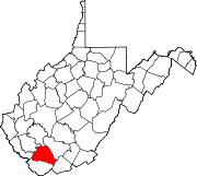
Towns CDPs Brenton | Bud | Corinne | Covel | Glen Fork | Itmann | Kopperston | Matheny | New Richmond
Unincorporated
communitiesAllen Junction | Alpoca | Beechwood | Black‡ | Black Eagle | Campus | Clear Fork | Coal Mountain | Cyclone | Fanny | Fanrock | Garwood | Glen Rogers | Glover | Hanover | Herndon | Ikes Fork | Jesse | Key Rock | Lacoma | Lamar‡ | Lillydale | Long Branch | Lynco | Maben | Marianna | McGraws | Milam | Mullensville | North Spring | Otsego | Pierpont | Ravencliff | Rock View | Sabine | Saulsville | Simon | Stephenson | Tralee | Uno | Windom | Wolf Pen | Wyco | Wyoming
Footnotes ‡This populated place also has portions in an adjacent county or counties
Categories:- National Register of Historic Places in West Virginia by county
- Wyoming County, West Virginia
-


Wikimedia Foundation. 2010.