- Pineville, West Virginia
Infobox Settlement
official_name = Pineville, West Virginia
settlement_type =Town
nickname =
motto =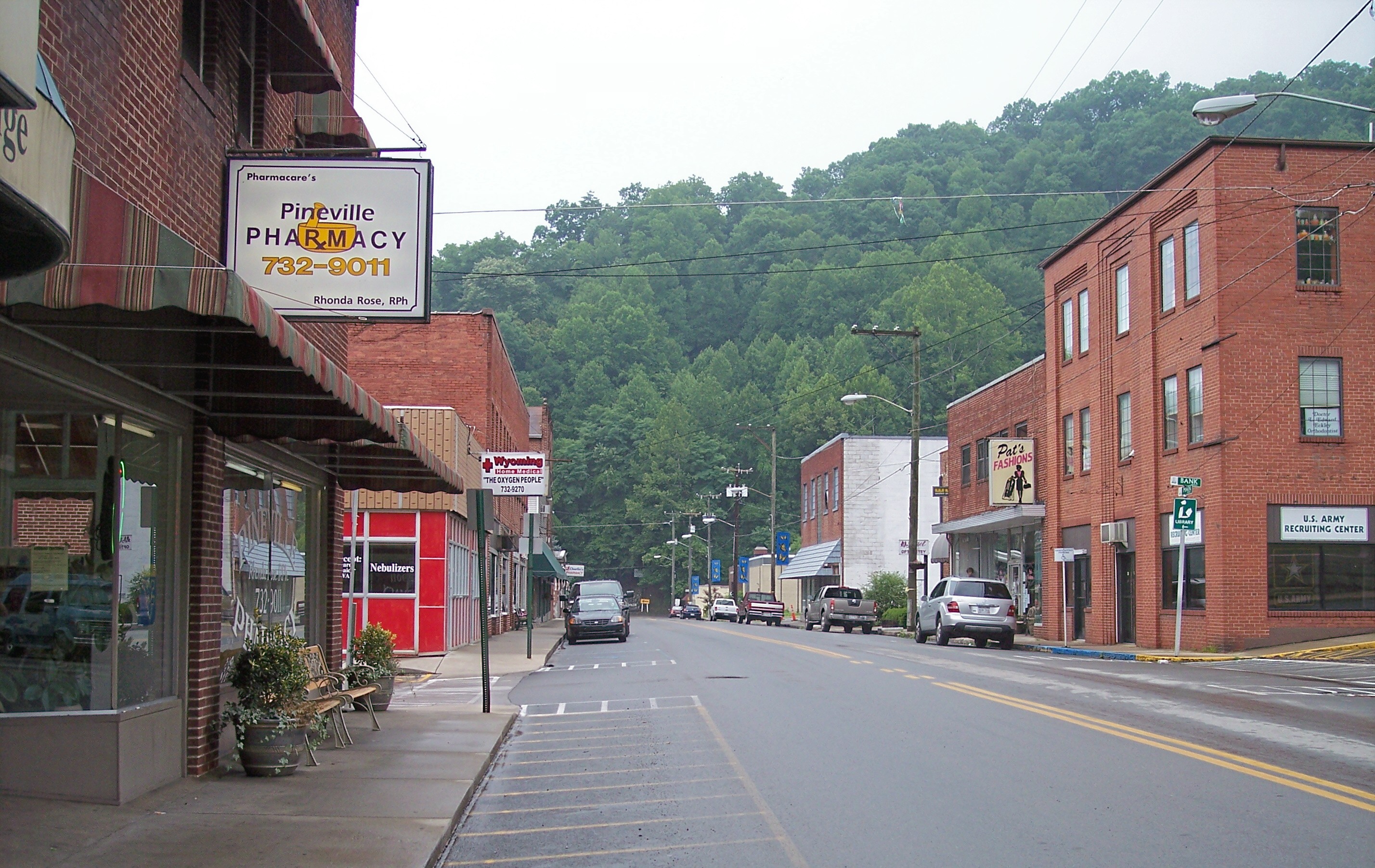
imagesize = 250px
image_caption = Main Avenue (West Virginia Route 97 ) in Pineville in 2007
image_
mapsize = 250px
map_caption = Location of Pineville, West Virginia
mapsize1 =
map_caption1 =subdivision_type = Country
subdivision_name =United States
subdivision_type1 = State
subdivision_name1 =West Virginia
subdivision_type2 = County
subdivision_name2 = Wyominggovernment_footnotes =
government_type =
leader_title =
leader_name =
leader_title1 =
leader_name1 =
established_title =
established_date =area_footnotes =
area_magnitude =
area_total_km2 = 2.0
area_land_km2 = 2.0
area_water_km2 = 0.0
area_total_sq_mi = 0.8
area_land_sq_mi = 0.8
area_water_sq_mi = 0.0population_as_of = 2000
population_footnotes =
population_total = 715
population_density_km2 = 350.8
population_density_sq_mi = 908.7timezone = Eastern (EST)
utc_offset = -5
timezone_DST = EDT
utc_offset_DST = -4
elevation_footnotes =
elevation_m = 396
elevation_ft = 1299
latd = 37 |latm = 34 |lats = 59 |latNS = N
longd = 81 |longm = 32 |longs = 7 |longEW = Wpostal_code_type =
ZIP code s
postal_code = 24859, 24874
area_code = 304
blank_name = FIPS code
blank_info = 54-63940GR|2
blank1_name = GNIS feature ID
blank1_info = 1544914GR|3
website =
footnotes =Pineville is a town in Wyoming County,
West Virginia , along theGuyandotte River . The population was 715 at the 2000 census. It is thecounty seat of Wyoming CountyGR|6. Pineville was settled by William Short in 1853. It was named because it was built on the site of a black or pitch pine forest. In 1917, Pineville was incorporated as a town.Geography
Pineville is located at coor dms|37|34|59|N|81|32|7|W|city (37.582925, -81.535302)GR|1.
According to the
United States Census Bureau , the town has a total area of 2.0km² (0.8 mi²), all land.Pineville has many subdivisions or outer areas, including the main Pineville downtown area, Key Rock, New Richmond, Skin Fork, Mullinsville, Glover, and others. Pineville used to have its own school district, but in the late 90's many school districts from adjacent towns were combined. The towns that were combined include Pineville, Mullins, Glenn Rogers, Herndon, and others. Needless to say, the children spend quite a bit of time on buses on mountainous, rural roads.
Demographics
As of the
census GR|2 of 2000, there were 715 people, 334 households, and 219 families residing in the town. Thepopulation density was 349.4/km² (908.7/mi²). There were 377 housing units at an average density of 184.3/km² (479.1/mi²). The racial makeup of the town was 98.74% White, 0.70% African American, 0.14% Native American, 0.28% Asian, and 0.14% from two or more races. Hispanic or Latino of any race were 0.14% of the population.There were 334 households out of which 23.1% had children under the age of 18 living with them, 54.2% were married couples living together, 9.0% had a female householder with no husband present, and 34.4% were non-families. 32.0% of all households were made up of individuals and 16.8% had someone living alone who was 65 years of age or older. The average household size was 2.14 and the average family size was 2.64.
In the town the population was spread out with 17.9% under the age of 18, 7.1% from 18 to 24, 21.3% from 25 to 44, 29.8% from 45 to 64, and 23.9% who were 65 years of age or older. The median age was 47 years. For every 100 females there were 86.7 males. For every 100 females age 18 and over, there were 83.4 males.
The median income for a household in the town was $31,008, and the median income for a family was $45,000. Males had a median income of $39,688 versus $29,167 for females. The
per capita income for the town was $25,184. About 5.2% of families and 10.0% of the population were below thepoverty line , including 21.3% of those under age 18 and 7.1% of those age 65 or over.Notable natives
*Heath Miller - Wrestler usually called "The Thriller Heath Miller"
*Curt Warner - NFL running back in the 1980s for theSeattle Seahawks and then theLos Angeles Rams References
External links
* [http://www.railwv.org Rural Appalachian Improvement League]
Wikimedia Foundation. 2010.