There are 74 properties and districts listed on the National Register in the county, one of which is a National Historic Landmark.
| [3] |
Landmark name |
Image |
Date listed |
Location |
City or town |
Summary |
| 1 |
Christian Allemong House |
|
02003-05-02 May 2, 2003 |
35 Hardestry Rd.
39°14′14″N 77°58′43″W / 39.23722°N 77.97861°W / 39.23722; -77.97861 (Allemong, Christian, House) |
Summit Point |
|
| 2 |
Allstadt House and Ordinary |
 |
01985-04-09 April 9, 1985 |
Junction of U.S. Route 340 and County Road 27
39°18′55″N 77°46′23″W / 39.31528°N 77.77306°W / 39.31528; -77.77306 (Allstadt House and Ordinary) |
Harper's Ferry |
|
| 3 |
Altona |
 |
01995-11-24 November 24, 1995 |
WV 51 west of Charles Town
39°17′24″N 77°52′57″W / 39.29°N 77.8825°W / 39.29; -77.8825 (Altona) |
Charles Town |
|
| 4 |
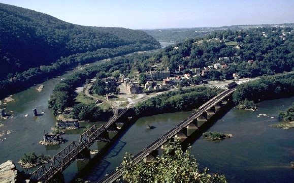
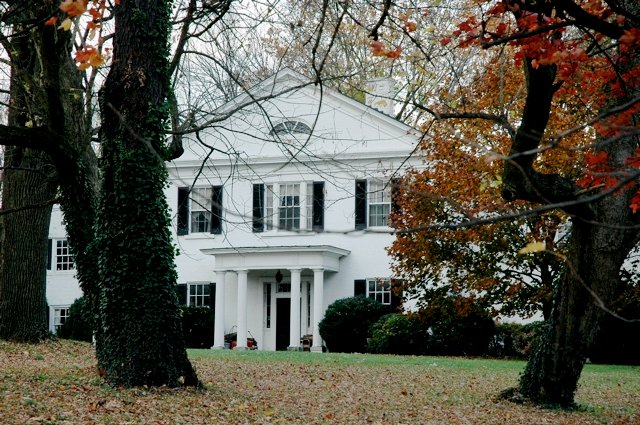
Aspen Hill |
|
01980-03-13 March 13, 1980 |
North of Charles Town on WV 9
39°19′18″N 77°51′44″W / 39.32167°N 77.86222°W / 39.32167; -77.86222 (Aspen Hill) |
Charles Town |
|
| 5 |
B & O Railroad Potomac River Crossing |
 |
01978-02-14 February 14, 1978 |
At the confluence of the Shenandoah and Potomac Rivers
39°19′27″N 77°43′43″W / 39.32417°N 77.72861°W / 39.32417; -77.72861 (B & O Railroad Potomac River Crossing) |
Harper's Ferry |
|
| 6 |
Barleywood |
|
02007-05-24 May 24, 2007 |
Ambler Rd., approximately 1 mi (1.6 km) north of WV 51
39°18′53.58″N 77°54′42.45″W / 39.3148833°N 77.9117917°W / 39.3148833; -77.9117917 (Beall-Air) |
Charles Town |
|
| 7 |
Beall-Air |
 |
01973-08-17 August 17, 1973 |
West of Halltown off U.S. Route 340
39°18′55″N 77°48′44″W / 39.31528°N 77.81222°W / 39.31528; -77.81222 (Beall-Air) |
Halltown |
|
| 8 |
Belvedere |
|
01984-01-12 January 12, 1984 |
811 Belvedere Farm Dr.
39°17′5″N 77°50′43″W / 39.28472°N 77.84528°W / 39.28472; -77.84528 (Belvedere) |
Charles Town |
|
| 9 |
Beverley |
 |
01987-03-20 March 20, 1987 |
U.S. Route 340
39°15′3″N 77°53′34″W / 39.25083°N 77.89278°W / 39.25083; -77.89278 (Beverley) |
Charles Town |
Boundary increase (listed April 12, 2010): 1 Burns Farm Rd. |
| 10 |
Blakeley |
 |
01982-04-15 April 15, 1982 |
West Virginia Routes WV 3/13
39°15′36″N 77°54′22″W / 39.26°N 77.90611°W / 39.26; -77.90611 (Blakeley) |
Charles Town |
|
| 11 |
Boidstones Place |
|
01999-11-22 November 22, 1999 |
Shepherd Grade
39°28′11″N 77°48′6″W / 39.46972°N 77.80167°W / 39.46972; -77.80167 (Boidstones Place) |
Shepherdstown |
|
| 12 |
The Bower |
|
01982-04-15 April 15, 1982 |
County Road 1/1
39°21′54″N 77°57′27″W / 39.365°N 77.9575°W / 39.365; -77.9575 (Bower, The) |
Leetown |
|
| 13 |
Peter Burr House |
 |
01982-04-09 April 9, 1982 |
Warm Springs Rd.
39°21′34″N 77°51′25″W / 39.35944°N 77.85694°W / 39.35944; -77.85694 (Burr, Peter, House) |
Shenandoah Junction |
|
| 14 |
Cedar Lawn |
 |
01974-12-04 December 4, 1974 |
3.5 mi (5.6 km) west of Charles Town off Virginia State Route 51 and south on County Road 51/1
39°17′6″N 77°55′22″W / 39.285°N 77.92278°W / 39.285; -77.92278 (Cedar Lawn) |
Charles Town |
|
| 15 |
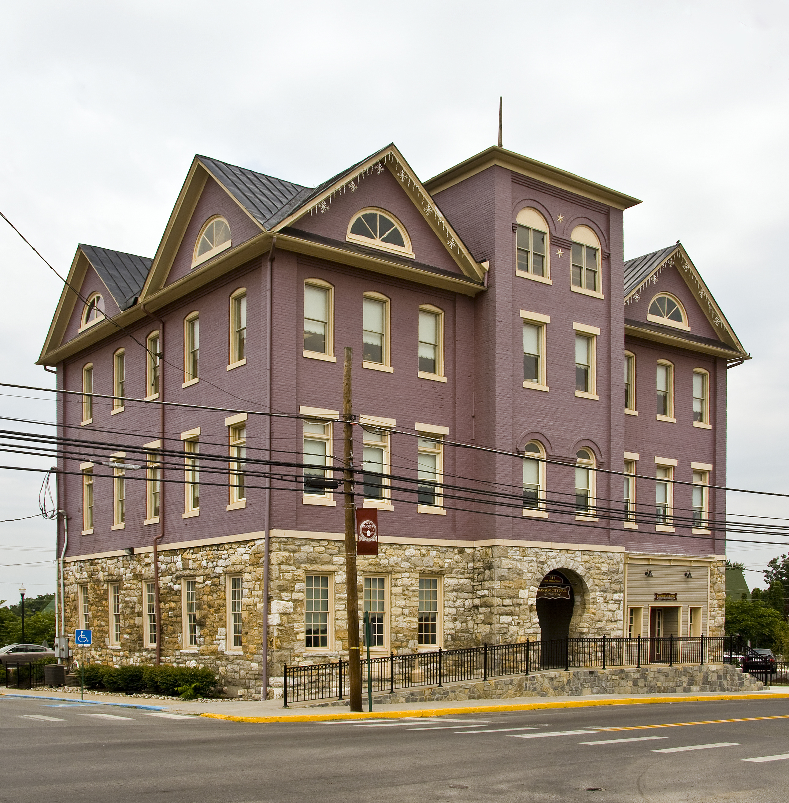
Charles Town Mining, Manufacturing, and Improvement Company Building |
 |
02001-08-02 August 2, 2001 |
312 S. Mildred St.
39°17′40″N 77°51′38″W / 39.29444°N 77.86056°W / 39.29444; -77.86056 (Charles Town Mining, Manufacturing, and Improvement Company Building) |
Ranson |
|
| 16 |
Old Charles Town Historic District |
|
02000-11-02 November 2, 2000 |
Norfolk & Western railroad line, Charles Town line, Hessey Pl., North St., U.S. Route 340, S. Charles St., Water St., and W. Washington St
39°17′14″N 77°51′43″W / 39.28722°N 77.86194°W / 39.28722; -77.86194 (Charles Town, Old, Historic District) |
Charles Town |
|
| 17 |
Claymont Court |
 |
01973-07-25 July 25, 1973 |
Southwest of Charles Town off U.S. Route 340
39°16′7″N 77°54′21″W / 39.26861°N 77.90583°W / 39.26861; -77.90583 (Claymont Court) |
Charles Town |
|
| 18 |
Cold Spring |
|
01973-08-14 August 14, 1973 |
South of Shepherdstown on County Road 17
39°23′48″N 77°49′5″W / 39.39667°N 77.81806°W / 39.39667; -77.81806 (Cold Spring) |
Shepherdstown |
|
| 19 |
Cool Spring Farm |
 |
02007-03-27 March 27, 2007 |
1735 Lloyd Rd.
39°14′31.55″N 77°55′30.53″W / 39.2420972°N 77.9251472°W / 39.2420972; -77.9251472 (Cool Spring Farm) |
Charles Town |
|
| 20 |
Downtown Charles Town Historic District |
 |
01997-03-21 March 21, 1997 |
Roughly Washington, Liberty, and Congress Sts. from the eastern town limits to Water St.
39°17′21″N 77°51′33″W / 39.28917°N 77.85917°W / 39.28917; -77.85917 (Downtown Charles Town Historic District) |
Charles Town |
|
| 21 |
Duffields Depot |
|
02007-08-03 August 3, 2007 |
45 Melvin Rd.
39°21′52″N 77°49′32″W / 39.36444°N 77.82556°W / 39.36444; -77.82556 (Duffields Depot) |
Shenandoah Junction |
|
| 22 |
Elmwood |
 |
01973-08-17 August 17, 1973 |
South of Shepherdstown off County Road 17
39°23′50″N 77°48′50″W / 39.39722°N 77.81389°W / 39.39722; -77.81389 (Elmwood) |
Shepherdstown |
|
| 23 |
Elmwood-on-the-Opequon |
|
02006-03-22 March 22, 2006 |
3898 Sulphur Springs Rd.
39°21′13″N 77°57′43″W / 39.35361°N 77.96194°W / 39.35361; -77.96194 (Elmwood-on-the-Opequon) |
Kearneysville |
|
| 24 |
Falling Spring-Morgan's Grove |
 |
01989-02-15 February 15, 1989 |
WV 480
39°25′15″N 77°48′55″W / 39.42083°N 77.81528°W / 39.42083; -77.81528 (Falling Spring--Morgan's Grove) |
Shepherdstown |
|
| 25 |
Fruit Hill |
|
01988-09-26 September 26, 1988 |
Shepherd Grade
39°26′53″N 77°49′28″W / 39.44806°N 77.82444°W / 39.44806; -77.82444 (Fruit Hill) |
Shepherdstown |
|
| 26 |
Gap View Farm |
 |
01997-01-09 January 9, 1997 |
WV 9, between Charles Town and Shenandoah Junction
39°20′32″N 77°50′58″W / 39.34222°N 77.84944°W / 39.34222; -77.84944 (Gap View Farm) |
Charles Town |
|
| 27 |
Gibson-Todd House |
 |
01983-09-01 September 1, 1983 |
515 S. Samuel St.
39°17′9″N 77°51′24″W / 39.28583°N 77.85667°W / 39.28583; -77.85667 (Gibson--Todd House) |
Charles Town |
|
| 28 |
Glenburnie |
|
01988-11-29 November 29, 1988 |
County Road 16/Ridge Rd.
39°23′27″N 77°50′42″W / 39.39083°N 77.845°W / 39.39083; -77.845 (Glenburnie) |
Shenandoah Junction |
|
| 29 |
William Grubb Farm |
|
01991-11-21 November 21, 1991 |
County Road 340/2, west of its junction with U.S. Route 340
39°14′25″N 77°54′12″W / 39.24028°N 77.90333°W / 39.24028; -77.90333 (Grubb, William, Farm) |
Charles Town |
|
| 30 |
Halltown Colored Free School |
 |
02004-08-25 August 25, 2004 |
Halltown Rd., 0.5 mi (0.80 km) northeast of U.S. Route 340
39°18′44″N 77°48′6″W / 39.31222°N 77.80167°W / 39.31222; -77.80167 (Halltown Colored Free School) |
Halltown |
|
| 31 |
Halltown Union Colored Sunday School |
 |
01984-01-12 January 12, 1984 |
Off U.S. Route 340
39°18′34″N 77°48′11″W / 39.30944°N 77.80306°W / 39.30944; -77.80306 (Halltown Union Colored Sunday School) |
Halltown |
|
| 32 |
Harewood |
 |
01973-03-14 March 14, 1973 |
West of Charles Town off WV 51
39°18′9″N 77°55′11″W / 39.3025°N 77.91972°W / 39.3025; -77.91972 (Harewood) |
Charles Town |
|
| 33 |
Harpers Ferry Historic District |
 |
01979-10-15 October 15, 1979 |
Off U.S. Route 340
39°19′35″N 77°44′29″W / 39.32639°N 77.74139°W / 39.32639; -77.74139 (Harpers Ferry Historic District) |
Harpers Ferry |
|
| 34 |
Harpers Ferry National Historical Park |
 |
01966-10-15 October 15, 1966 |
At confluence of the Shenandoah and Potomac rivers
39°18′59″N 77°43′9″W / 39.31639°N 77.71917°W / 39.31639; -77.71917 (Harpers Ferry National Historical Park) |
Harpers Ferry |
|
| 35 |
Hazelfield |
100px |
01976-12-12 December 12, 1976 |
Off County Road 48/2
39°22′25″N 77°51′36″W / 39.37361°N 77.86°W / 39.37361; -77.86 (Hazelfield) |
Shenandoah Junction |
|
| 36 |
Hillside |
|
01985-12-12 December 12, 1985 |
Old Cave Rd.
39°15′47″N 77°52′5″W / 39.26306°N 77.86806°W / 39.26306; -77.86806 (Hillside) |
Charles Town |
|
| 37 |
Hopewell |
|
01994-03-25 March 25, 1994 |
Bloomery Rd. (County Road 27) northeast of Bloomery
39°16′4″N 77°47′36″W / 39.26778°N 77.79333°W / 39.26778; -77.79333 (Hopewell) |
Charles Town |
|
| 38 |
Jacks-Manning Farm |
|
01984-01-12 January 12, 1984 |
U.S. Route 340
39°16′8″N 77°51′38″W / 39.26889°N 77.86056°W / 39.26889; -77.86056 (Jacks-Manning Farm) |
Charles Town |
|
| 39 |
Jefferson County Alms House |
|
01995-04-14 April 14, 1995 |
West Virginia Secondary Route 15 southeast of Leetown
39°20′7″N 77°54′30″W / 39.33528°N 77.90833°W / 39.33528; -77.90833 (Jefferson County Alms House) |
Leetown |
|
| 40 |
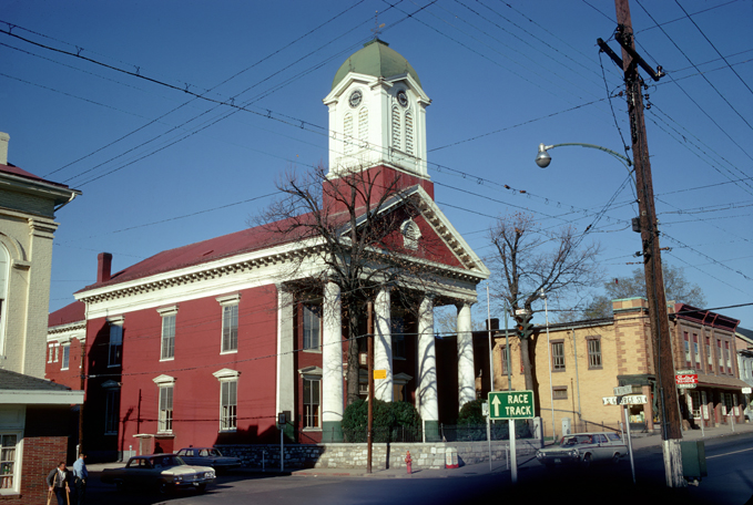
Jefferson County Courthouse |
 |
01973-07-10 July 10, 1973 |
N. George and E. Washington Sts.
39°17′21″N 77°51′37″W / 39.28917°N 77.86028°W / 39.28917; -77.86028 (Jefferson County Courthouse) |
Charles Town |
|
| 41 |
Lee-Longsworth House |
|
01985-09-23 September 23, 1985 |
1141 Washington St.
39°19′32″N 77°44′49″W / 39.32556°N 77.74694°W / 39.32556; -77.74694 (Lee-Longsworth House) |
Harpers Ferry |
|
| 42 |
Captain William Lucas and Robert Lucas House |
 |
01982-09-02 September 2, 1982 |
Southeast of Shepherdstown on WV 31
39°24′6″N 77°46′27″W / 39.40167°N 77.77417°W / 39.40167; -77.77417 (Lucas, Capt. William and Lucas, Robert, House) |
Shepherdstown |
|
| 43 |
James Marshall House |
|
01988-09-27 September 27, 1988 |
Shepherd Grade
39°27′15″N 77°49′31″W / 39.45417°N 77.82528°W / 39.45417; -77.82528 (Marshall, James, House) |
Shepherdstown |
|
| 44 |
Media Farm |
|
01994-11-10 November 10, 1994 |
Flowing Springs Rd. (County Road 17), 2 mi (3.2 km) north of Charles Town
39°19′46″N 77°50′32″W / 39.32944°N 77.84222°W / 39.32944; -77.84222 (Media Farm) |
Charles Town |
|
| 45 |
Middleway Historic District |
 |
01980-03-13 March 13, 1980 |
West Virginia Routes 1/8
39°18′13″N 77°58′58″W / 39.30361°N 77.98278°W / 39.30361; -77.98278 (Middleway Historic District) |
Middleway |
|
| 46 |
Morgan's Grove |
|
01999-03-19 March 19, 1999 |
Roughly bounded by West Virginia Routes 230 and 480, and Morgan's Grove Rd.
39°25′4″N 77°48′45″W / 39.41778°N 77.8125°W / 39.41778; -77.8125 (Morgan's Grove) |
Shepherdstown |
|
| 47 |
Morgan-Bedinger-Dandridge House |
|
01983-05-13 May 13, 1983 |
Southwest of Shepherdstown on WV 48
39°25′37″N 77°48′43″W / 39.42694°N 77.81194°W / 39.42694; -77.81194 (Morgan--Bedinger--Dandridge House) |
Shepherdstown |
|
| 48 |
New Opera House |
 |
01978-11-24 November 24, 1978 |
200-204 N. George St.
39°17′23″N 77°51′39″W / 39.28972°N 77.86083°W / 39.28972; -77.86083 (New Opera House) |
Charles Town |
|
| 49 |
Prato Rio |
|
01973-04-11 April 11, 1973 |
WV 48
39°20′49″N 77°56′12″W / 39.34694°N 77.93667°W / 39.34694; -77.93667 (Prato Rio) |
Leetown |
|
| 50 |
Rellim Farm |
|
01998-12-04 December 4, 1998 |
Leetown Rd., south of WV 9
39°22′51″N 77°53′15″W / 39.38083°N 77.8875°W / 39.38083; -77.8875 (Rellim Farm) |
Kearneysville |
|
| 51 |
Richwood Hall |
 |
01973-06-19 June 19, 1973 |
About 4 mi (6.4 km) west of Charles Town off WV 51
39°17′32″N 77°55′51″W / 39.29222°N 77.93083°W / 39.29222; -77.93083 (Richwood Hall) |
Charles Town |
|
| 52 |
Rion Hall |
 |
01982-09-20 September 20, 1982 |
East of Charles Town off U.S. Route 340
39°18′4″N 77°49′2″W / 39.30111°N 77.81722°W / 39.30111; -77.81722 (Rion Hall) |
Charles Town |
|
| 53 |
Ripon Lodge |
|
01998-08-31 August 31, 1998 |
Junction of U.S. Route 340 and Withers-Carve Rd.
39°13′21″N 77°54′30″W / 39.2225°N 77.90833°W / 39.2225; -77.90833 (Ripon Lodge) |
Rippon |
|
| 54 |
Rock Spring |
 |
02008-01-17 January 17, 2008 |
2000 Ridge Rd.
39°23′2.25″N 77°50′37.56″W / 39.3839583°N 77.8437667°W / 39.3839583; -77.8437667 (Rock Spring) |
Shepherdstown |
|
| 55 |
Rockland |
|
01990-02-05 February 5, 1990 |
WV 480
39°24′30″N 77°51′29″W / 39.40833°N 77.85806°W / 39.40833; -77.85806 (Rockland) |
Shepherdstown |
|
| 56 |
Rose Hill Farm |
|
01990-05-18 May 18, 1990 |
Off WV 48 southeast of its junction with Warm Springs Rd.
39°23′48″N 77°51′45″W / 39.39667°N 77.8625°W / 39.39667; -77.8625 (Rose Hill Farm) |
Shepherdstown |
|
| 57 |
Rumsey Hall |
 |
01973-03-30 March 30, 1973 |
German and Princess Sts.
39°25′57″N 77°48′13″W / 39.4325°N 77.80361°W / 39.4325; -77.80361 (Rumsey Hall) |
Shepherdstown |
|
| 58 |
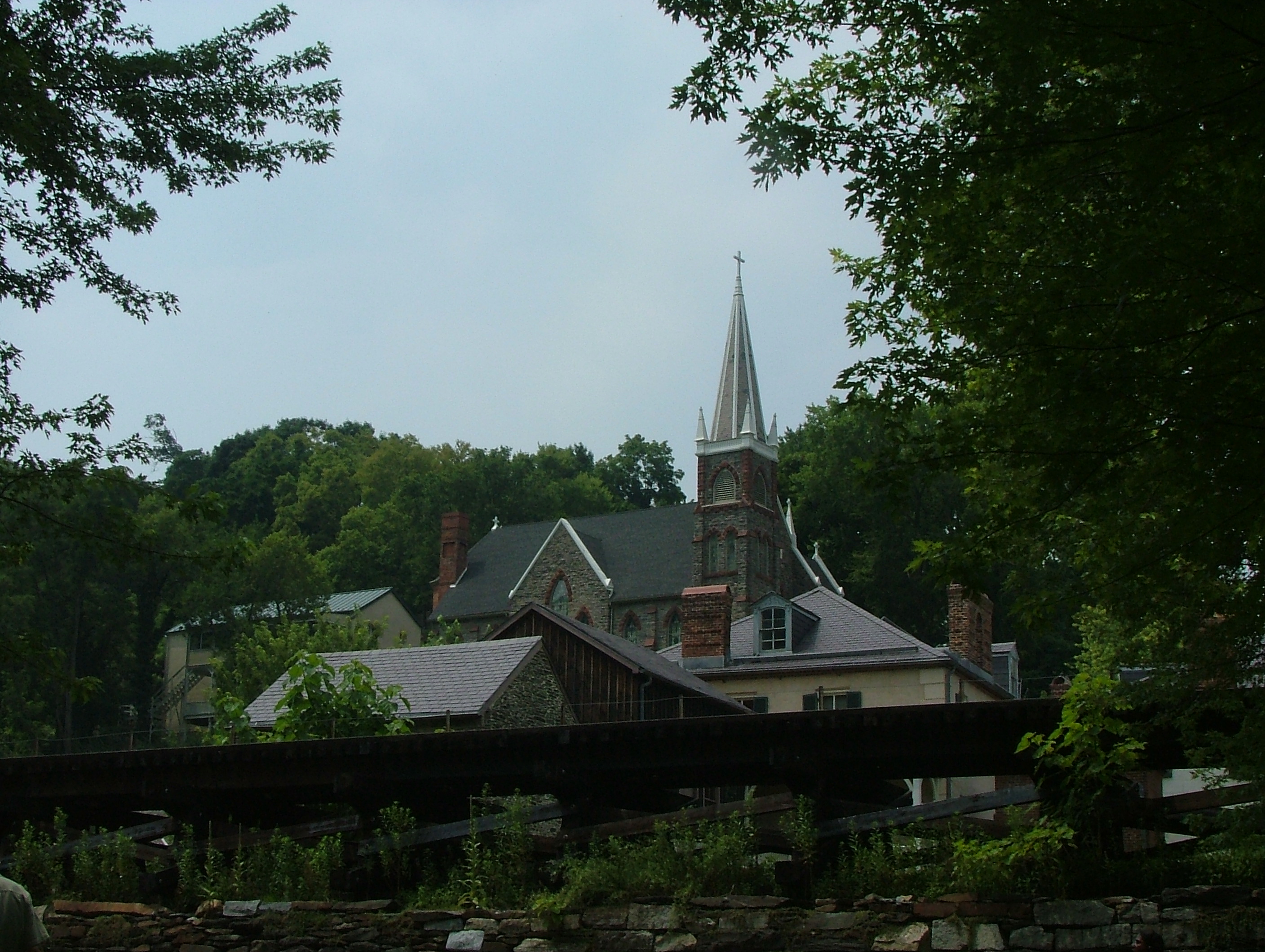
St. Peter's Roman Catholic Church |
 |
01973-03-30 March 30, 1973 |
Church St. and Jefferson Rock Trail
39°19′28″N 77°43′53″W / 39.32444°N 77.73139°W / 39.32444; -77.73139 (St. Peter's Roman Catholic Church) |
Harpers Ferry |
|
| 59 |
Shannondale Springs |
|
01998-03-31 March 31, 1998 |
Address Restricted |
Shannondale |
|
| 60 |
Shepherd's Mill |
 |
01971-05-06 May 6, 1971 |
High St.
39°26′0″N 77°48′5″W / 39.433333°N 77.80139°W / 39.433333; -77.80139 (Shepherd's Mill) |
Shepherdstown |
|
| 61 |
Shepherdstown Historic District |
 |
01973-08-17 August 17, 1973 |
Bounded roughly by Mill, Rocky, Duke, and Washington Sts.
39°25′58″N 77°48′24″W / 39.43278°N 77.80667°W / 39.43278; -77.80667 (Shepherdstown Historic District) |
Shepherdstown |
|
| 62 |
South Charles Town Historic District |
 |
02009-09-16 September 16, 2009 |
S. George, S. Mildred, S. Samuel, & S. Church Sts.
39°16′40.85″N 77°51′8.95″W / 39.2780139°N 77.8524861°W / 39.2780139; -77.8524861 (South Charles Town Historic District) |
Charles Town |
|
| 63 |
Strider Farm |
|
01988-02-01 February 1, 1988 |
WV 27
39°20′3″N 77°45′55″W / 39.33417°N 77.76528°W / 39.33417; -77.76528 (Strider Farm) |
Harpers Ferry |
|
| 64 |
Sunnyside Farm |
|
01999-03-18 March 18, 1999 |
Leetown Rd.
39°19′53.04″N 77°57′31.26″W / 39.3314°N 77.9586833°W / 39.3314; -77.9586833 (Sunnyside Farm) |
Kearneysville |
|
| 65 |
Tackley Farm |
|
01994-11-04 November 4, 1994 |
WV 9 2 mi (3.2 km) east of its junction with WV 480
39°21′54″N 77°52′1″W / 39.365°N 77.86694°W / 39.365; -77.86694 (Tackley Farm) |
Shenandoah Junction |
|
| 66 |
The Hermitage |
|
01993-12-23 December 23, 1993 |
Cabletown Rd. (County Road 25) north of its junction with Mt. Hammond Rd.
39°14′53″N 77°50′30″W / 39.24806°N 77.84167°W / 39.24806; -77.84167 (The Hermitage) |
Charles Town |
|
| 67 |
Traveller's Rest |
 |
01972-11-15 November 15, 1972 |
3.3 mi (5.3 km) northwest of Leetown on WV 480
39°23′17″N 77°54′3″W / 39.38806°N 77.90083°W / 39.38806; -77.90083 (Traveller's Rest) |
Kearneysville |
|
| 68 |
Van Swearingen-Shepherd House |
 |
01983-08-18 August 18, 1983 |
North of Shepherdstown
39°26′28″N 77°48′14″W / 39.44111°N 77.80389°W / 39.44111; -77.80389 (Van Swearingen-Shepherd House) |
Shepherdstown |
|
| 69 |
Charles Washington House |
 |
01973-07-02 July 2, 1973 |
Blakely Pl.
39°16′56″N 77°51′35″W / 39.28222°N 77.85972°W / 39.28222; -77.85972 (Washington, Charles, House) |
Charles Town |
|
| 70 |
White House Farm |
 |
01979-08-29 August 29, 1979 |
East of Summit Point of WV 13
39°15′5″N 77°56′45″W / 39.25139°N 77.94583°W / 39.25139; -77.94583 (White House Farm) |
Summit Point |
|
| 71 |
Woodbury |
 |
01974-10-09 October 9, 1974 |
On County Road 1/4
39°21′28″N 77°54′29″W / 39.35778°N 77.90806°W / 39.35778; -77.90806 (Woodbury) |
Leetown |
|
| 72 |
Woodlawn |
|
02000-03-24 March 24, 2000 |
30 Wiltshire Rd.
39°20′21″N 77°53′7″W / 39.33917°N 77.88528°W / 39.33917; -77.88528 (Woodlawn) |
Kearneysville |
|
| 73 |
Robert Worthington House |
 |
01973-07-02 July 2, 1973 |
2 mi (3.2 km) west of Charles Town off WV 51
39°17′46″N 77°53′23″W / 39.29611°N 77.88972°W / 39.29611; -77.88972 (Worthington, Robert, House) |
Charles Town |
|
| 74 |
York Hill |
|
02006-07-26 July 26, 2006 |
1583 Ridge Rd.
39°22′26″N 77°50′46″W / 39.37389°N 77.84611°W / 39.37389; -77.84611 (York Hill) |
Shenandoah Junction |
|
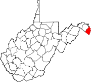
 Location of Jefferson County in West Virginia