- Shenandoah River
-
For the river in New Zealand, see Shenandoah River, New Zealand.
Shenandoah River 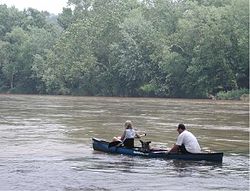
Country United States States Virginia, West Virginia Tributaries - left North Fork - right South Fork Cities Harper's Ferry, WV, Front Royal, VA, Luray, VA Source - location Front Royal, VA - elevation 1,000 ft (305 m) Mouth Potomac River - location Harpers Ferry - elevation 250 ft (76 m) - coordinates 39°19′21″N 77°43′40″W / 39.3225°N 77.727778°W Length 56 mi (90 km) Basin 2,937 sq mi (7,607 km2) 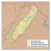 Shenandoah River Watershed
The Shenandoah River is a tributary of the Potomac River, 55.6 miles (89.5 km) long with two forks approximately 100 miles (160 km) long each,[1] in the U.S. states of Virginia and West Virginia. The principal tributary of the Potomac, the river and its tributaries drain the central and lower Shenandoah Valley and the Page Valley in the Appalachians on the west side of the Blue Ridge Mountains, in northwestern Virginia and the Eastern Panhandle of West Virginia.
Contents
Course
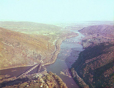
The Shenandoah River is formed northeast of Front Royal near Riverton, by the confluence of the South Fork and the North Fork. It flows northeast across Warren County, passing underneath Interstate 66 1 mile (1.6 km) from its formation. Beyond the I-66 bridge the river flows through a set of bends before turning to the northeast again, crossing into Clarke County 11 miles (18 km) below I-66. 5 miles (8.0 km) downriver from the Clarke County border, the Shenandoah passes under U.S. Route 50 and then passes through a triple bend. 14.5 miles (23.3 km) below the Route 50 bridge, the river passes underneath Virginia Route 7 and then continues northeast another 8 miles (13 km) before crossing into Jefferson County in West Virginia, in the extreme eastern tip of the state. Once in West Virginia the river completes six large bends before joining with the Potomac from the south near Harpers Ferry 20 miles (32 km), from the Virginia-West Virginia border.
Geology
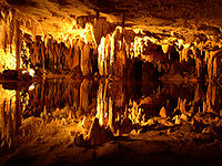 Dream Lake, inside Luray Caverns
The Shenandoah valley is underlain by limestone. The fertile soil made it a favored place for early settlement. It continues to be a major agricultural area of Virginia and West Virginia. Some karst topography is evident, and the limestone is honeycombed with caves. Several have been developed as commercial tourist attractions, including Luray Caverns, Shenandoah Caverns, and Skyline Caverns.
On the riverbank a few miles above Harper's Ferry is said to be a cave with an opening just large enough for a mounted rider to squeeze through. It widened in the interior to a spacious room where hundreds of Col. John Mosby's raiding troops are said to have hidden from pursuing Union cavalry.[2]
Environmental issues
Since 2005, the Shenandoah River has experienced a series of fish kills every spring that have affected several of its native fish species. In the spring of 2005, redbreast sunfish and smallmouth bass along 100-mile (160 km) stretch of the South Fork Shenandoah River began dying of lesions caused by bacteria and fungi. Although the fish kill eventually wiped out 80% of the adult redbreast sunfish and smallmouth bass, juvenile populations appeared to be unaffected.[3] The following year more-localized fish kills in Clarke County spread to two of the Shenandoah's three species of sucker, the shorthead redhorse and the northern hogsucker - the former suffering from similar lesions witnessed in the previous year's fish kill.[4] Virginia's Department of Environmental Quality again received reports of fish kills near Elkton and between Bentonville and Front Royal in late-April 2007 and observed fish exhibiting lesions and strange behavior.[5]
Culture
The folk song "Oh Shenandoah" has been covered by a number of different artists including Tennessee Ernie Ford, the Statler Brothers, jazz guitarist Bill Frisell, and Bruce Springsteen. The song may or may not refer to the Shenandoah River or Valley.
The Shenandoah River figures prominently in John Denver's "Take Me Home, Country Roads," which associates the river with the state of West Virginia. Only the last 20 miles (32 km) of the river are in the semi-detached Eastern Panhandle of West Virginia, with the vast majority of the river and its forks and tributaries flowing through Virginia.
Recreation
The Shenandoah River is a very popular river for canoeing, tubing, and white water rafting (class I-III in season, II-III+ during the spring run-off), and several commercial outfitters offer a variety of guided trips and rentals. Those willing to brave the colder water of spring will be rewarded with a more challenging big-water experience.
South Fork Shenandoah River
The South Fork is formed at Port Republic in southern Rockingham County, by the confluence of the North River and South River. It flows 98.5 miles (158.5 km)[1] northeast in a tight meandering course, past Elkton and Shenandoah, through Page Valley, with the Blue Ridge Mountains to the east and the Massanutten Mountain range to the west.
South Fork tributaries
- North River
- South River
- Back Creek
North Fork Shenandoah River
The North Fork is 105 miles (169 km) long[1] and rises in northern Rockingham County, along the eastern flank of Shenandoah Mountain in the George Washington National Forest. At its formation, the principal feeder on the North Fork is the German River. The North Fork flows initially southeast, down from the mountains, then northeast through a valley across Shenandoah County, along the western side of Massanutten Mountain. It flows past Woodstock and Strasburg. On the north end of the ridge it turns briefly southeast to join the South Fork from the northwest to form the Shenandoah.
North Fork tributaries
- German River
- Cedar Creek
- Smith Creek
- Toms Brook
- Passage Creek
- Linville Creek
- Shoemaker River
- Little Dry River
- Turley Creek
Shenandoah tributaries
- West Virginia
- Hog Run
- Long Marsh Run
- Bullskin Run
- Evitts Run
- Forge Run
- Cattail Run
- Flowing Springs Run
- Virginia
- Happy Creek
- Manassas Run
- Venus Branch
- Long Branch
- Spout Run
- Morgan Mill Stream
- Chapel Run
- Lewis Run
- Craig Run
- Dog Run
- Spout Run
- Wheat Spring Run
In Modern Arts
The Shenandoah River appeared in John Denver's Folk rock song of Take Me Home, Country Roads, in the 2nd sentence of the first stanza:
Almost heaven, West Virginia,
Blue Ridge Mountains, Shenandoah River.
Life is old there, older than the trees,
Younger than the mountains,
Growin' like the breeze.
See also
- List of Virginia rivers
- List of West Virginia rivers
References
- ^ a b c U.S. Geological Survey. National Hydrography Dataset high-resolution flowline data. The National Map, accessed August 15, 2011
- ^ Virgil Carrington Jones, Mosby's Rangers (Chapel Hill & University of North Carolina Press, 1944), p. 240 (The Union discovered Mosby's cave only by accident late in the war when a wandering horse fell through a trap door hidden in a burnt-out house on the bluff above the river. A curious Union soldier noticed stairs leading downward, which proved to be the second entrance to the cave. There were stalls, hay, and room enough for 200 to 300 horses).
- ^ Washington Post (Washington D.C.), 20 July 2005
- ^ Richmond Times-Dispatch (Richmond, VA), 7 June 2006
- ^ Virginia Department of Environmental Quality, "Virginia Seeks Public's Help in Fish Kill Investigation," Virginia Department of Environmental Quality, http://www.deq.state.va.us/info/srfishkill.html (accessed 20 July 2005)
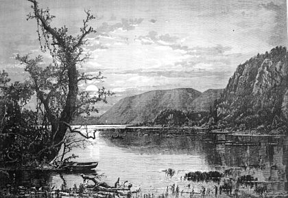
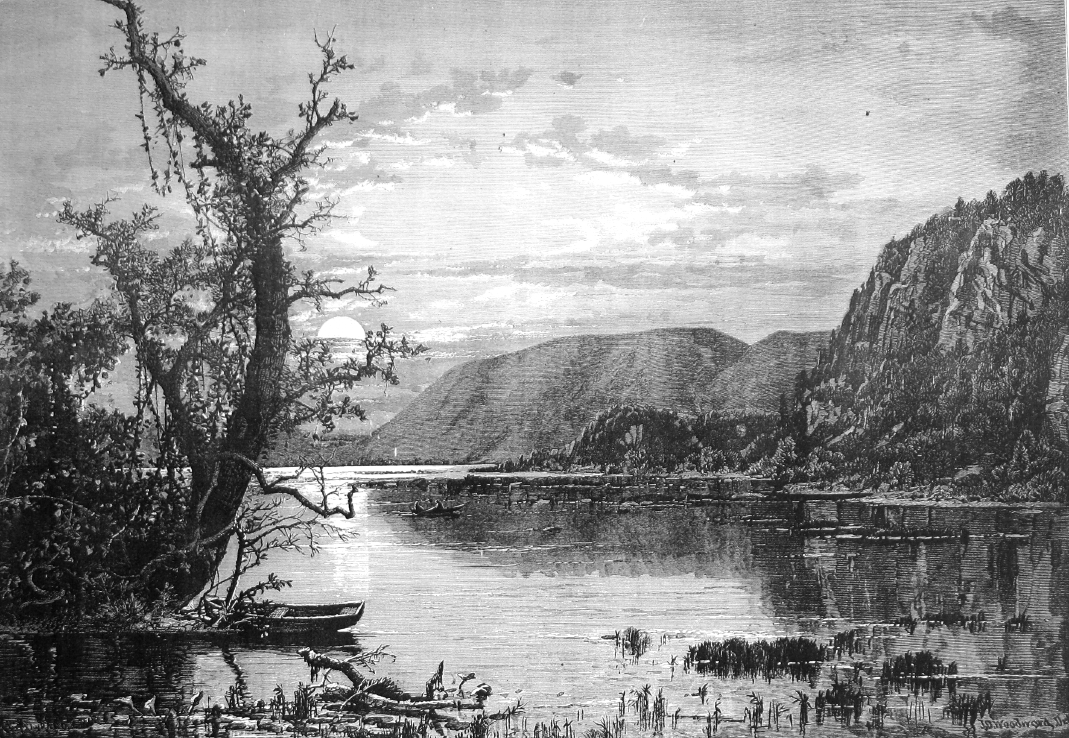
- ^ Woodward engraving reproduced from The Aldine Magazine, Vol. VI No. 7, July 1873
External links
- Virginia Department of Game and Inland Fisheries - South Fork
- Virginia Department of Environmental Quality - Fish Kill Task Force
- Shenandoah Valley Pure Water Forum
- Potomac Watershed
- Friends of the North Fork Shenandoah River
Potomac River system
Cities and towns | Bridges | Islands | Tributaries | Variant names
District of Columbia | Maryland | Pennsylvania | Virginia | West Virginia
Streams shown as: Major tributaries • subtributaries • (subsubtributaries) • (subsubsubtributaries)Shenandoah RiverLakes and reservoirsCategories:- Rivers of Virginia
- Rivers of West Virginia
- Chesapeake Bay Watershed
- Geography of Page County, Virginia
- Geography of Rockingham County, Virginia
- Geography of Warren County, Virginia
- Geography of Shenandoah County, Virginia
- Geography of Jefferson County, West Virginia
- Geography of Clarke County, Virginia
- Rivers on the Appalachian Trail
- Tributaries of the Potomac River


Wikimedia Foundation. 2010.