- Seneca Creek (North Fork South Branch Potomac River)
Geobox|River
name = Seneca Creek
native_name =
other_name =
other_name1 =
image_size = 275px
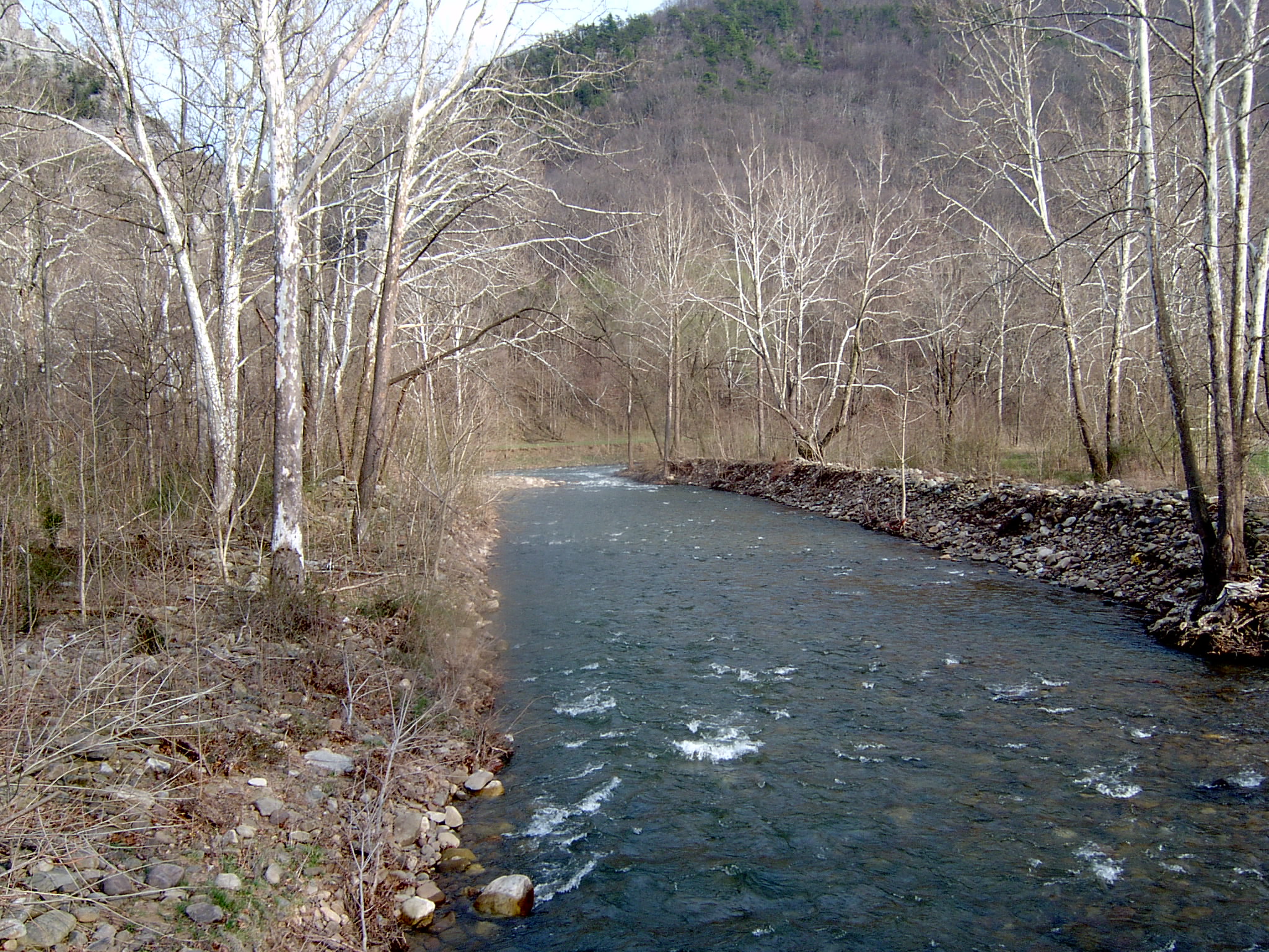
image_caption = Seneca Creek just upstream of its mouth
country = United States
country_
state = West Virginia
state_
region_type = Counties
region = Pendleton
city =
city1 =
city2 =
length_imperial =
length_note =
watershed_imperial =
watershed_note =
discharge_location =
discharge_imperial =
discharge_max_imperial =
discharge_max_note =
discharge_min_imperial =
discharge_min_note =
discharge_note =
discharge1_location =
discharge1_imperial =
discharge1_note =
source_name = Slab Camp Run
source_location = Allegheny Mountain
source_district =
source_region = Pendleton County
source_state = WV
source_country =
source_lat_d = 38
source_lat_m = 43
source_lat_s = 29
source_lat_NS = N
source_long_d = 79
source_long_m = 33
source_long_s = 23
source_long_EW = W
source_elevation_imperial = 3912
source_elevation_note = cite web
url = http://gisdata.usgs.gov/xmlwebservices2/elevation_service.asmx/getElevation?X_Value=-79.5563889&Y_Value=38.7247222&Elevation_Units=FEET&Source_Layer=-1&Elevation_Only=FALSE
title = Slab Camp Run Source
work = Elevation Query
accessdate = 2008-09-13
publisher =U.S. Geological Survey ]source_length_imperial =
source_note = cite gnis|1552909|Slab Camp Run|1980-06-27|2008-09-13]
source1_name = Trussel Run
source1_location = Spruce Mountain
source1_district =
source1_region = Pocahontas County
source1_state = WV
source1_country =
source1_lat_d = 38
source1_lat_m = 42
source1_lat_s = 47
source1_lat_NS = N
source1_long_d = 79
source1_long_m = 32
source1_long_s = 31
source1_long_EW = W
source1_elevation_imperial = 3944
source1_elevation_note = cite web
url = http://gisdata.usgs.gov/xmlwebservices2/elevation_service.asmx/getElevation?X_Value=-79.5419444&Y_Value=38.7130556&Elevation_Units=FEET&Source_Layer=-1&Elevation_Only=FALSE
title = Trussel Run Source
work = Elevation Query
accessdate = 2008-09-13
publisher =U.S. Geological Survey ]source1_length_imperial =
source1_note = cite gnis|1553275|Trussel Run|1980-06-27|2008-09-13]
source_confluence =
source_confluence_location = Pendleton County
source_confluence_district =
source_confluence_region =
source_confluence_state = WV
source_confluence_country =
source_confluence_lat_d = 38
source_confluence_lat_m = 43
source_confluence_lat_s = 04
source_confluence_lat_NS = N
source_confluence_long_d = 79
source_confluence_long_m = 32
source_confluence_long_s = 46
source_confluence_long_EW = W
source_confluence_elevation_imperial = 3747
source_confluence_elevation_note =
mouth_name = North Fork South Branch Potomac River
mouth_location = Seneca Rocks
mouth_district =
mouth_region =
mouth_state = WV
mouth_country =
mouth_lat_d = 38
mouth_lat_m = 09
mouth_lat_s = 42
mouth_lat_NS = N
mouth_long_d = 81
mouth_long_m = 11
mouth_long_s = 47
mouth_long_EW = W
mouth_elevation_imperial = 1532
mouth_note = cite gnis|1552830|Seneca Creek|1980-06-27|2008-09-13]
tributary_left =
tributary_left1 =
tributary_left2 =
tributary_right =
tributary_right1 =
free_name =
free_value =
map_size =
map_caption =Seneca Creek is a
tributary of the North Fork South Branch Potomac River in Pendleton County,West Virginia . Seneca Creek lies within theSpruce Knob-Seneca Rocks National Recreation Area of theMonongahela National Forest . Seneca Creek is formed by two spring-fed streams, Slab Camp Run and Trussel Run, on the western flanks of Spruce Mountain to the north ofSpruce Knob . It empties into the North Fork South Branch at the community of Seneca Rocks near the base of theSeneca Rocks formation.Tributaries
Tributary streams are listed from south (source) to north (mouth).
*Slab Camp Run
*Trussel Run
*Beech Run
*Lower Gulf Run
**Whites Run
*Gulf Run
*Strader Run
*Horsecamp Run
**Wamsley Run
**McIntosh Run
*Roaring Creek
*Brushy RunList of communities along the Seneca Creek
References
ee also
*
List of West Virginia rivers

Wikimedia Foundation. 2010.