- Ranson, West Virginia
-
Ranson, West Virginia — City — Location of Ranson, West Virginia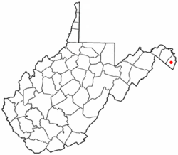
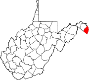
Coordinates: 39°17′55″N 77°51′40″W / 39.29861°N 77.86111°WCoordinates: 39°17′55″N 77°51′40″W / 39.29861°N 77.86111°W Country United States State West Virginia County Jefferson Government – Mayor A. David Hamill Area – Total 0.9 sq mi (2.2 km2) – Land 0.9 sq mi (2.2 km2) – Water 0.0 sq mi (0.0 km2) Population (2000) – Total 2,951 – Density 3,402.8/sq mi (1,313.8/km2) Time zone Eastern (EST) (UTC-5) – Summer (DST) EDT (UTC-4) Area code(s) 304 FIPS code 54-18040[1] Ranson (formerly Corporation of Ranson) is a city in Jefferson County, West Virginia, United States. The population was 2,951 at the 2000 census. Although the Census Bureau listed it as a town in 2000, it is classified (along with all other municipalities with populations between two and ten thousand) as a city by state law.[2]
Contents
History
The Charles Town Mining, Manufacturing, and Improvement Company played an instrumental role in creating this new town. In 1890, the company bought 850 acres (3.4 km²) adjoining the western and northern corporate limits of Charles Town and commissioned D.G. Howell, a civil engineer and architect, to lay out the town. The largest tract of land purchased was from the Ranson family. The Corporation of Ranson in Jefferson County, West Virginia, was officially incorporated in 1910 when residents decided to form their own town by a vote of 67-2. [3] It was named in honor of Dr. James Ranson, a dentist and farmer living in the area. The 2006 Census estimate claims Ranson's population is 3,957, up just over 1,000 people since 2000.[4]
The early growth and development of Ranson reflects the late 19th century boom of the Shenandoah Valley and surrounding areas associated with the rise of the railroads, mining, and manufacturing. Early photographs of Ranson show the offices of the Charles Town Mining, Manufacturing & Improvement Company and the Hotel Powhatan, along with a few residential structures nearby. The community grew north from Lancaster Circle. Some of the companies that located in Ranson early on included the Hotel Powhatan, the Goetz Saddlery, the Shenandoah Brass and Iron Works, the Elemer E. Beachley Saw and Planing Mill, the John Farrin Boiler and Machine Shop, and the Vulcan Road Machine Company.[5]
One of the most significant structures to be constructed in Ranson was Hotel Powhatan. This four-story frame Queen Anne structure was located on 3.61 acres (14,600 m2) on 3rd Avenue between Mildred and Preston. The building was designed by “Baldwin and Pennington, Architects” and was built by local contractor, Julius C. Holmes, for $46,500. The hotel opened in October 1891, but by 1900 it had become the Powhatan College for Young Women. In 1913, the college closed and in 1915 it re-opened as St. Hilda’s Hall for Girls, a Christian school opened by the Episcopal Diocese under the direction of Maria Pendleton Duval. In 1921, a dormitory was added on property across the street from the original building. This new structure was known as Peterkin Hall and currently houses the offices of Amerigas. In 1931, with the stock market crash, the school closed and was converted into apartments. The original hotel structure burned to the ground on December 11, 1937.[6]
In 1936, the town of Ranson purchased the former Charles Town Mining, Manufacturing & Improvement Company office building from Mr. Getzendauner for $3,000 for the purposes of town hall. In 2003, the City began a multi-year renovation of the entire building, bringing it into the 21st Century. By 1941, Ranson’s population was 1,171. Ranson continued to grow and by 1950, the population increased to 1,436. By 1970, the population again increased to 2,189. In 2000, Ranson had a population of 2,951. Since 2000, Ranson has experienced substantial growth and an approximate population increase of 35%. The 2006 Census estimate claims Ranson's population is 3,957, up just over 1,000 people since 2000. In the 2000’s the City Council saw a need to grow its tax and employment base after the unfortunate closings of AB&C Corporation, Dixie Narco and Kidde Fire (Badger Powhatan) and take advantage of the commercial development opportunities along the West Virginia Route 9 four-lane bypass north of Ranson. Thus, the Council annexed several thousand acres, which now host commercial, residential and agricultural uses.[7]
Today, as Ranson celebrates its centennial, the City is transitioning from a small industrial town, which boomed in the late 19th Century, to a community that blends major corporations with quiet residential neighborhoods and a developing commercial district. Many of the homes date from the turn of the century and reflect styles of that era. Most are unassuming, vernacular, frame or brick, single family, two-story dwellings or one-story cottages. Newer one-story homes, townhouses and apartment complexes have been built on vacant lots throughout Ranson with most new development being on the western and northern boundaries along the Route 9 four-lane bypass.
As in the beginning, Ranson continues to host and welcome business and industry to the community. With the construction and opening of the $425,000 Jefferson Memorial Hospital on October 3, 1948, Ranson began to develop a medical community with many doctors opening offices in and around the hospital. On April 22, 1975, Jefferson Memorial opened its current facility on Preston Street between 3rd and 5th Avenues at a cost of $4.5 million. The current facility continues to serve the residents of Jefferson County. Just outside the limits of Ranson, but extremely important to the community’s economy is Hollywood Casino at Charles Town Races. This facility provides employment to over 1200 individuals and generates millions of dollars of taxes to Jefferson County and its municipalities for capital improvements. Thanks, in part, to these proceeds, which began flowing in 2004, the City has been able to purchase police cars and equipment, complete the Mildred Street streetscape project in 2007 adding sidewalks, curb, gutter and benches; renovate and construct parks; and renovate City Hall.[8]
In 2004, the Potomac Marketplace and surrounding the residential subdivisions of Lakeland Place and Shenandoah Springs broke ground and opened. The Marketplace, when completely built, is intended to be a 1,500,000 square feet (140,000 m2) commercial development and includes national retailers and restaurants such as Home Depot, Kohl’s, Weis Markets, McDonalds, Chick-Fil-A and Petco.
Ranson is governed by a Mayor, Recorder and five-member City Council, who each serve four-year staggered terms. The City employs a City Manager who is appointed by Council to serve as the administrative head of government. The City is a fully functioning government with the Ranson Police Department providing 24 hour per day, seven days a week protection to the City’s citizens. City Hall is staffed with a Planning and Zoning department, Public Works department, Finance department and Legal department to carry out the functions of government and provide services to the residents of the City. Two volunteer fire departments, Independent Fire Company and Citizens Fire Company, serve the City and provide it with fire protection. Additionally, the City has its own municipal court system.
Geography
Ranson is located at 39°17′55″N 77°51′40″W / 39.29861°N 77.86111°W (39.298578, -77.861169)[9].
According to the United States Census Bureau, the town has a total area of 0.9 square miles (2.3 km²), all land. Since 2004, however, the City of Ranson has annexed approximately 5,000 acres (20 km2) of land into the corporate limits, expanding the total land area of the City to approximately 9 square miles (23 km2).
Demographics
As of the census[1] of 2000, there were 2,951 people, 1,208 households, and 782 families residing in the town. The population density was 3,402.8 inhabitants per square mile (1,309.6/km²). There were 1,279 housing units at an average density of 1,474.8 per square mile (567.6/km²). The racial makeup of the town was 81.80% White, 14.61% African American, 0.14% Native American, 0.37% Asian, 0.03% Pacific Islander, 1.12% from other races, and 1.93% from two or more races. Hispanic or Latino of any race were 3.15% of the population.
There were 1,208 households out of which 32.4% had children under the age of 18 living with them, 40.0% were married couples living together, 19.3% had a female householder with no husband present, and 35.2% were non-families. 26.5% of all households were made up of individuals and 8.7% had someone living alone who was 65 years of age or older. The average household size was 2.44 and the average family size was 2.93.
In the town the population was spread out with 26.1% under the age of 18, 10.4% from 18 to 24, 31.0% from 25 to 44, 21.7% from 45 to 64, and 10.8% who were 65 years of age or older. The median age was 34 years. For every 100 females there were 89.5 males. For every 100 females age 18 and over, there were 85.8 males.
The median income for a household in the town was $24,485, and the median income for a family was $30,676. Males had a median income of $26,719 versus $19,559 for females. The per capita income for the town was $12,804. About 20.9% of families and 25.2% of the population were below the poverty line, including 34.4% of those under age 18 and 14.5% of those age 65 or over.
References
- ^ a b "American FactFinder". United States Census Bureau. http://factfinder.census.gov. Retrieved 2008-01-31.
- ^ §8-1-3 of the West Virginia Code, accessed 2008-11-05.
- ^ http://cityofransonwv.net/visitorstourism/ranson-history.html
- ^ http://www.idcide.com/citydata/wv/corporation-of-ranson.htm
- ^ Ranson: A Centennial History by Bob O'Connor (2010)
- ^ Ranson: A Centennial History by Bob O'Connor (2010)
- ^ http://cityofransonwv.net/visitorstourism/ranson-history.html
- ^ http://cityofransonwv.net/visitorstourism/ranson-history.html
- ^ "US Gazetteer files: 2010, 2000, and 1990". United States Census Bureau. 2011-02-12. http://www.census.gov/geo/www/gazetteer/gazette.html. Retrieved 2011-04-23.
Municipalities and communities of Jefferson County, West Virginia Cities Charles Town | Ranson
Towns CDPs Unincorporated
communitiesBakerton | Bardane | Blair | Bloomery | Blue Ridge Acres | Browns Corner | Clips Mill | Duffields | Egypt | Engle | Franklintown | Halltown | Jamestown | Johnsontown | Kabletown | Kearneysville | Keyes Ferry Acres | Leetown | Mannings | Mechanicstown | Mechlenberg Heights | Meyerstown | Millville | Moler Crossroads | Mountain Mission | Reedson | Rippon | Riverside | Silver Grove | Skeetersville | Summit Point | Uvilla | Wheatland
Categories:- Populated places in Jefferson County, West Virginia
- Cities in West Virginia
- Populated places established in 1890


Wikimedia Foundation. 2010.