- Martinsburg, West Virginia
-
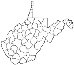
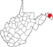
City of Martinsburg — City — Location of Martinsburg in West Virginia Coordinates: 39°27′33″N 77°58′4″W / 39.45917°N 77.96778°WCoordinates: 39°27′33″N 77°58′4″W / 39.45917°N 77.96778°W Country United States State West Virginia County Berkeley Government - Mayor George Karos Area - City 5.0 sq mi (13.1 km2) - Land 5.0 sq mi (13.0 km2) - Water 0.0 sq mi (0.1 km2) Elevation 453 ft (138 m) Population (2009) - City 17,112 - Density 3,390.8/sq mi (1,309.2/km2) - Urban 43,441 - Metro 263,753 Time zone EST (UTC-5) - Summer (DST) EDT (UTC-4) ZIP codes 25401-25405 Area code(s) 304 FIPS code 54-52060[1] GNIS feature ID 1542824[2] Martinsburg is a city in the Eastern Panhandle region of West Virginia, United States. The city's population was 14,972 at the 2000 census; according to a 2009 Census Bureau estimate, Martinsburg's population was 17,117, making it the largest city in the Eastern Panhandle and the eighth largest municipality in West Virginia.[3] Martinsburg is the county seat of Berkeley County[4] and one of the core cities in the Hagerstown-Martinsburg, MD-WV Metropolitan Statistical Area. Martinsburg and Berkeley County are growing very rapidly from the influx of people moving from Washington, D.C. and Baltimore.[citation needed]
Contents
History
Martinsburg was founded in 1778 by General Adam Stephen who named it in honor of Colonel Thomas Bryan Martin, a nephew of Thomas Fairfax, 6th Lord Fairfax of Cameron.
Aspen Hall is a Georgian mansion, the oldest part of which was built in 1745 by Edward Beeson, Sr. making it the oldest house in the city. Aspen Hall and the people who lived there played important roles in the agricultural, religious, transportation, and political heritage of the region. Significant events related to the British, French, and Indian War; the Revolution, and the Civil War took place on the property. Three original buildings are still standing including the rare blockhouse of Mendenhall's Fort.
The first post office in what is now West Virginia was established at Martinsburg in 1792.
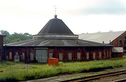
The Baltimore and Ohio (B&O) Railroad reached Martinsburg in 1842. The B&O Roundhouse and Station Complex was first constructed in 1849.
In 1863, Isabelle “Belle” Boyd, a famous spy for the Confederacy, was arrested in Martinsburg by the Union Army and imprisoned.
The city of Martinsburg was incorporated by an act of the West Virginia Legislature on March 30, 1868.
The Great Railroad Strike of 1877 began July 14, 1877 in Martinsburg and spread nationwide.
Telephone service first began in Martinsburg in 1883.
In 1889, electricity began to be furnished to Martinsburg as part of a franchise granted to the United Edison Manufacturing Company of New York.
The Interwoven mills began operations in Martinsburg in 1891 and grew to be the largest manufacturer of men's hosiery in the world.
Construction of the "Apollo Civic Theatre" was completed in 1913.
Over one thousand (1,039) men from Berkeley County participated in World War I. Of these, forty-one were killed and twenty-one were wounded in battle. A monument to those who fell in battle was erected in 1925.
During World War II, the Newton D. Baker Hospital in Martinsburg treated thousands of soldiers wounded in the war. In 1946 this military hospital became a part of the Veterans Administration (VA). The VA Medical Center in Martinsburg is still in service providing care to United States veterans.
Beginning in the late 1940s and through the 1950s, many of the mills and factories operating in Martinsburg shut down and went out of business, dealing a major blow to the local economy.
Demographics
As of the census[1] of 2000, there were 14,972 people, 6,684 households, and 3,689 families residing in the city. The population density was 2,977.4 people per square mile (1,149.2/km²). There were 7,432 housing units at an average density of 1,478.0 per square mile (570.5/km²). The racial makeup of the city was 83.90% White, 11.63% African American, 0.40% Native American, 0.63% Asian, 0.02% Pacific Islander, 1.26% from other races, and 2.17% from two or more races. Hispanic or Latino of any race were 2.91% of the population.
In the city the population was spread out with 23.1% under the age of 18, 9.6% from 18 to 24, 28.7% from 25 to 44, 22.3% from 45 to 64, and 16.4% who were 65 years of age or older. The median age was 37 years. For every 100 females there were 91.0 males. For every 100 females age 18 and over, there were 88.6 males.
The median income for a household in the city was $29,495, and the median income for a family was $36,954. Males had a median income of $29,697 versus $22,212 for females. The per capita income for the city was $16,314. About 14.7% of families and 20.0% of the population were below the poverty line, including 28.8% of those under age 18 and 15.1% of those age 65 or over.
Historical populations Census Pop. %± 1990 14,073 — 2000 14,972 6.4% Est. 2009 17,112 14.3% Geography
Location and topography
Martinsburg is located at 39°27′33″N 77°58′4″W / 39.45917°N 77.96778°W (39.459207, -77.967814)[5]. As per MapQuest, Martinsburg is approximately 92 miles (148 km) driving distance northwest of Washington, D.C.. U.S. Route 11 runs through the center of town, and Interstate 81 passes along the northern side of the town.
According to the United States Census Bureau, the city has a total area of 5.1 square miles (13.1 km²), of which, 5.0 square miles (13.0 km²) of it is land and 0.04 square miles (0.1 km²) of it (0.40%) is water.
Climate
Climate data for Martinsburg Month Jan Feb Mar Apr May Jun Jul Aug Sep Oct Nov Dec Year Record high °F (°C) 80
(27)83
(28)87
(31)96
(36)100
(38)106
(41)112
(44)108
(42)103
(39)98
(37)86
(30)78
(26)112
(44)Average high °F (°C) 41
(5)46
(8)55
(13)66
(19)75
(24)84
(29)88
(31)86
(30)79
(26)68
(20)57
(14)46
(8)65.9
(18.8)Average low °F (°C) 23
(−5)25
(−4)33
(1)42
(6)51
(11)60
(16)65
(18)63
(17)55
(13)43
(6)35
(2)27
(−3)43.5
(6.4)Record low °F (°C) −18
(−28)−10
(−23)−3
(−19)19
(−7)26
(−3)36
(2)41
(5)40
(4)29
(−2)17
(−8)6
(−14)−12
(−24)−18
(−28)Precipitation inches (mm) 2.73
(69.3)2.40
(61)3.51
(89.2)3.14
(79.8)4.19
(106.4)3.49
(88.6)3.73
(94.7)3.40
(86.4)3.52
(89.4)3.40
(86.4)3.14
(79.8)2.74
(69.6)39.39
(1,000.5)Source: The Weather Channel[6] Commerce
Major private employers in and around Martinsburg include Quad/Graphics, EcoLab, Orgill, World Color, Sino-Swearingen, General Motors, and FedEx.
The city also has numerous federal government employers including the Internal Revenue Service, U.S. Coast Guard Operations Systems Center, U.S. Coast Guard National Maritime Center, Bureau of Alcohol, Tobacco, Firearms, and Explosives, and the Veteran Administration Center.
The Martinsburg IRS Facility is one of the two Enterprise Computing Centers of the Internal Revenue Service (the other is in Memphis, Tennessee). The Martinsburg facility processes most of the country's electronically filed tax documents from businesses, and about one-third of electronically-filed tax returns.
The area is also home to the 167th Airlift Wing of the West Virginia Air National Guard, based in Eastern WV Regional Airport.
Martinsburg had its own automobile company from 1912 to 1922, called Norwalk. The cars that were assembled here are the longest-made known cars to be built in the state of West Virginia.[7]
Healthcare
- West Virginia University Hospitals - East (an affiliate of West Virginia University Hospitals, formerly City Hospital)
- Veterans Affairs Medical Center
Shopping
Martinsburg has one Shopping Mall
- Martinsburg Mall: 551,351 square feet (51,222.2 m2) with approximately 50 stores and anchored by Walmart, JCPenney, and The Bon-Ton. Opened in 1991. Location: Foxcroft Avenue, Interstate 81 Exit 12 & 13.
Other retail centers/areas in Martinsburg include:
- The Commons Shopping Center: 400,000 square feet (37,000 m2) anchored by Target, Dick's Sporting Goods, Best Buy, TJ Maxx, Staples, Books A Million, Bed Bath and Beyond, Michaels, Petsmart, and Five Below. Opened in 2009. Location: Retail Commons Parkway, Interstate 81 Exit 12.
- Old Courthouse Square: 201,350 square feet (18,706 m2) anchored by Food Lion, Schewels, and Auto Zone. Opened in 1987. Location: Edwin Miller Blvd.
- Apple Harvest Drive: K-Mart, Food Lion, Lowes, and Advance Auto.
- North Queen Street: Weis Markets, Tractor Supply, Big Lots, and Aarons.
- Other shopping areas in the city are the Berkeley Plaza on Williamsport Pike and Martinsburg Plaza on Winchester Ave.
Education
Middle Schools
- North Middle School
- South Middle School
- Spring Mills Middle SchoolBold text
High Schools
Musselman High School Hedgesville High School
Colleges and universities
- Blue Ridge Community and Technical College, Martinsburg
- James Rumsey Technical Institute, Martinsburg
- Mountain State University, Martinsburg Campus - located on the western fringe of town offers a handful of 4-year degree offerings including Nursing, Leadership, and Forensics.
- Valley College of Technology, Martinsburg Campus
Transportation
Major highways
 Interstate 81
 U.S. Route 11
 West Virginia Route 9
 West Virginia Route 45
 West Virginia Route 51
 West Virginia Route 901
Mass transportation
Amtrak provides service to Martinsburg. The city's passenger rail station is located downtown at 229 East Martin Street. MARC, Maryland's commuter rail system, operates trains on weekdays on its Brunswick Line which terminates in Martinsburg. Service is provided to Union Station in Washington, D.C.
Eastern Panhandle Transit Authority, known more popularly as "Pan Tran," operates bus routes in Martinsburg, surrounding Berkeley County, and neighboring Jefferson County, West Virginia.
Eastern WV Regional Airport, south of the city, handles general aviation. The closest airport with commercial air service is Hagerstown Regional Airport, that is about 25 miles (40 km) driving distance north. The closest international airport is Washington Dulles International Airport, which is about 60 miles (97 km) driving distance east.
Media
Print
- Martinsburg has one daily community newspaper, The Journal.
- Martinsburg has a bi-monthly magazine, Around the Panhandle Magazine. www.aroundthepanhandle.com
Radio
- The city is home to WRNR/740 AM, WEPM/1340 AM, WICL/95.9 FM, WLTF/97.5 FM, and WVEP/88.9 FM radio stations. The following box details all of the radio stations in the Eastern Panhandle market.
Radio stations in the Eastern Panhandle of West Virginia By FM frequency By AM frequency By callsign West Virginia Radio Markets: Beckley • Bluefield • Charleston • Elkins-Buckhannon-Weston • Huntington • Morgantown-Clarksburg-Fairmont • Parkersburg • Wheeling
Other West Virginia Radio Regions: Cumberland, MD • East-Central • Eastern Panhandle • Kingwood • Southern • West-Central
Television
- Martinsburg is home to W44AA Channel 44 (WV Educational Broadcasting) and (WWPX 60 (ION), all part of the Hagerstown sub-market that is further grouped under the Nielsen-designated Washington, D.C.-Hagerstown, Md. market, the ninth largest market in the nation.[8] The box below lists television stations available in the region.
Broadcast television in the greater Washington, D.C. area Local stations Public television Spanish language Cable channels CN8 • Comcast SportsNet Mid-Atlantic • NewsChannel 8 • FPA • AIM • PACDC • MASN
Hagerstown Adjacent locals Reception may vary by location and some stations may only be viewable with cable television Baltimore, MD: WMAR (2.1 ABC, 2.3 WX) • WBAL (11.1 NBC, 11.2 WX) • WJZ (13.1 CBS) • WUTB (24.1 MNTV) • WBFF (45.1 Fox) • WNUV (54.1 CW) • WMPB (67.1 PBS/MPT, 67.2 MPT2, 67.3 V-me)
Winchester, VA: WHSV1-DT (3.1 ABC, 3.2 Fox, 3.3 ABC/This, 3.4 MNTV) • WAZT-CA 10/WAZC-LP 16/WAZF-CA 28/WAZW-CA 48 (TBN) • WVPY (21.1 PBS, 21.2 Create, 21.3 V-me) • WDWA 23 (DS)
West Virginia: W07DN-D / W08EE-D / W09CT-D / W23DR-D / W41DK-D (24.1/24.3 PBS/WVPB SD/HD, 24.2 Create) • WWPX (60.1 ION, 60.2 Qubo, 60.3 ION Life)Silent station ATSC-M/H
(Mobile DTV)
encrypted channels
are italicizedVirginia Broadcast television: Bristol • Bluefield • Charlottesville • Hampton Roads • Harrisonburg • Richmond • Roanoke • Washington, DC
West Virginia Broadcast television: Bluefield • Clarksburg/Weston • Huntington/Charleston • Parkersburg • Washington, DC • Wheeling
Maryland Broadcast television: Baltimore • Pittsburgh, PA • Salisbury • Washington, D.C.Pennsylvania Broadcast television: Binghamton, NY • Buffalo, NY • Elmira, NY • Erie • Johnstown/Altoona/State College • New York City • Philadelphia • Pittsburgh • Scranton/Wilkes-Barre • Susquehanna Valley (Harrisburg) • Washington, DC • Youngstown, OH
Martinsburg, WV was the setting of the X-Files episode "Small Potatoes" (Season 4, episode 20). However, the filming did not take place in the vicinity.Notable natives and residents
- Newton D. Baker, Secretary of War
- Belle Boyd, Confederate spy in the American Civil War
- Scott Bullett, Former outfielder for the Pittsburgh Pirates, Chicago Cubs
- Vicky Bullett, Olympic gold medalist in women's basketball
- Harry Flood Byrd, Sr., United States Senator and Governor of Virginia
- Robert Lee Castleman, Grammy-winning singer/songwriter
- Charles James Faulkner, United States Representative from Virginia
- Karl Hess, former D.C. insider turned Libertarian and appropriate technology activist, relocated to the Martinsburg area in the 1970s.
- Shannon Larkin, drummer for the hard rock band Godsmack
- Walter Dean Myers, author
- Bruce Van Wyk, notable entrepreneur, married to health activist Mikki Van Wyk
- John Quincy Adams Nadenbousch, colonel in Confederate States Army
- Ronald Radosh, ex-New Left, ex-libertarian, now neoconservative author
- Absalom Willis Robertson, United States Senator from Virginia
- David Hunter Strother (aka Porte Crayon), artist
- Hack Wilson, Hall of Fame baseball player
- Fulton Walker, former football player for the Miami Dolphins
- Zachary Stubbs A.K.A Zacarias, Indie Hip Hop Artist
- Darrell W. Sanders, Professional Bluegrass musician; formerly played banjo, guitar, and dobro for Bill Harrell & the Virginians and Charlie Moore & the Dixie Partners. Current member of Stoney Creek Bluegrass Band.
- Mary Elizabeth Price, (1877-1965), impressionist painter
- Bob Keller (american Professional Wrestler) Listed in Pro Wrestling Illustrated Top 500 Wrestlers 4 times, Former Host for American Pro Wrestlings Power Hour Agent and Manager for many former WCW and WWE Superstars...Most Noted for teaming with Hagerstown Native Shane Heimburger(Shadows) to form the Team of The Mega Rockers
References
- ^ a b "American FactFinder". United States Census Bureau. http://factfinder.census.gov. Retrieved 2008-01-31.
- ^ "US Board on Geographic Names". United States Geological Survey. 2007-10-25. http://geonames.usgs.gov. Retrieved 2008-01-31.
- ^ Table 4: Annual Estimates of the Resident Population for Incorporated Places in West Virginia, Listed Alphabetically: April 1, 2000 to July 1, 2008, U.S. Census Bureau. 2009-07-01. Retrieved 2009-07-01]
- ^ "Find a County". National Association of Counties. http://www.naco.org/Counties/Pages/FindACounty.aspx. Retrieved 2011-06-07.
- ^ "US Gazetteer files: 2010, 2000, and 1990". United States Census Bureau. 2011-02-12. http://www.census.gov/geo/www/gazetteer/gazette.html. Retrieved 2011-04-23.
- ^ "Average Weather for Martinsburg, WV - Temperateure and Precipitation". August 2011. http://www.weather.com/weather/wxclimatology/monthly/graph/25401?from=36hr_bottomnav_undeclared. Retrieved July 29, 2008.
- ^ The Norwalk: Martinsburg's Motor Car
- ^ Local Television Market Universe Estimates, Nielsen, 27 September 2008. Retrieved 02 November 2008.
External links
- Chamber of Commerce of Martinsburg and Berkeley County
- Martinsburg High School
- Martinsburg-Berkeley County Public Library
- WEPM Radio station, established 1946
- Martinsburg Community Website
- Eastern Panhandle Transit Authority "Pan Tran"
- Martinsburg, Virginia, During the Civil War in Encyclopedia Virginia
Municipalities and communities of Berkeley County, West Virginia County seat: Martinsburg City Martinsburg
Town CDPs Other localities Allensville | Arden | Baker Heights | Baxter | Bedington | Berkeley | Bessemer | Blairton | Bunker Hill | Darkesville | Douglas Grove | Files Crossroad | Ganotown | Georgetown | Gerrardstown | Glengary | Goose Nest | Greensburg | Grubbs Corner | Hainesville | Johnsontown | Jones Springs | Little Georgetown | Marlowe | Nipetown | Nollville | North Mountain | Pikeside | Ridgeway | Scrabble | Shanghai | Spring Mills | Swan Pond | Tablers Station | Tarico Heights | Tomahawk | Union Corner | Van Clevesville | Vanville | Winebrenners Crossroad | Wynkoop Spring
 State of West Virginia
Charleston (capital) Topics Cities · Towns · Villages · Census-designated places · History · Geography · People · Governors · Delegations · Colleges and universities · Visitor Attractions
Regions Allegheny Mountains · Allegheny Plateau · Baltimore-Washington Metropolitan Area · Blue Ridge · Charleston Metropolitan Area · Cumberland Plateau · Cumberland Mountains · Eastern Panhandle · Huntington Metropolitan Area · North-Central West Virginia · Northern Panhandle · Potomac Highlands · Ridge-and-valley Appalachians · Shenandoah Valley · Southern West Virginia · Western West Virginia
Major cities Smaller cities Counties Barbour · Berkeley · Boone · Braxton · Brooke · Cabell · Calhoun · Clay · Doddridge · Fayette · Gilmer · Grant · Greenbrier · Hampshire · Hancock · Hardy · Harrison · Jackson · Jefferson · Kanawha · Lewis · Lincoln · Logan · Marion · Marshall · Mason · McDowell · Mercer · Mineral · Mingo · Monongalia · Monroe · Morgan · Nicholas · Ohio · Pendleton · Pleasants · Pocahontas · Preston · Putnam · Raleigh · Randolph · Ritchie · Roane · Summers · Taylor · Tucker · Tyler · Upshur · Wayne · Webster · Wetzel · Wirt · Wood · Wyoming
Categories:- Populated places in Berkeley County, West Virginia
- Cities in West Virginia
- County seats in West Virginia
Wikimedia Foundation. 2010.


