- Marlowe, West Virginia
-
Marlowe — Unincorporated town — Location within the state of West Virginia
 Marlowe
Coordinates: 39°35′18″N 77°51′34″W / 39.58833°N 77.85944°WCoordinates: 39°35′18″N 77°51′34″W / 39.58833°N 77.85944°W Country United States State West Virginia County Berkeley Time zone Eastern (EST) (UTC-5) – Summer (DST) EDT (UTC-4) ZIP codes FIPS code GNIS feature ID U.S. Geological Survey Geographic Names Information System: Marlowe, West Virginia Marlowe is an unincorporated town on U.S. Route 11 in Berkeley County, West Virginia, United States.
Sites on the National Register of Historic Places located near Marlowe are: the Charles Downs II House, Harmony Cemetery, Marlowe Consolidated School, and Power Plant and Dam No. 5.[1]
References
- ^ "National Register Information System". National Register of Historic Places. National Park Service. 2009-03-13. http://nrhp.focus.nps.gov/natreg/docs/All_Data.html.
Municipalities and communities of Berkeley County, West Virginia City 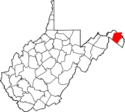
Town CDPs Other localities Allensville | Arden | Baker Heights | Baxter | Bedington | Berkeley | Bessemer | Blairton | Bunker Hill | Darkesville | Douglas Grove | Files Crossroad | Ganotown | Georgetown | Gerrardstown | Glengary | Goose Nest | Greensburg | Grubbs Corner | Hainesville | Johnsontown | Jones Springs | Little Georgetown | Marlowe | Nipetown | Nollville | North Mountain | Pikeside | Ridgeway | Scrabble | Shanghai | Spring Mills | Swan Pond | Tablers Station | Tarico Heights | Tomahawk | Union Corner | Van Clevesville | Vanville | Winebrenners Crossroad | Wynkoop Spring
Categories:- Eastern Panhandle geography stubs
- Populated places in Berkeley County, West Virginia
- Unincorporated communities in West Virginia


Wikimedia Foundation. 2010.