- Clarksburg, West Virginia
-
City of Clarksburg — City — Downtown Clarksburg in 2006
Nickname(s): Jewel of the Hills Motto: Proud Past....Unlimited Future Location in Harrison County in the State of West Virginia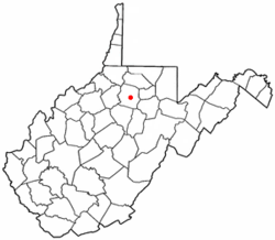
Coordinates: 39°17′0″N 80°20′13″W / 39.283333°N 80.33694°WCoordinates: 39°17′0″N 80°20′13″W / 39.283333°N 80.33694°W Country United States State West Virginia County Harrison Established 1785 Government - Mayor Margaret Bailey Area - City 9.5 sq mi (24.7 km2) - Land 9.5 sq mi (24.7 km2) - Water 0.0 sq mi (0.0 km2) Elevation 994 ft (303 m) Population (2010) - City 16,578 - Density 1,701.1/sq mi (671.2/km2) - Metro 68,652 Time zone EST (UTC-5) - Summer (DST) EDT (UTC-4) Area code 304 FIPS code 54-15628[1] GNIS feature ID 1537358[2] Website www.cityofclarksburgwv.com Clarksburg is a city in and the county seat of Harrison County, West Virginia, United States, in the north-central region of the state. It is the principal city of the Clarksburg, WV Micropolitan Statistical Area. The population of the city was 16,578 at the 2010 census.
Contents
History
The first documented visitor to the area now known as Clarksburg was John Simpson,[3] a trapper, who in 1764 located his camp on the West Fork River opposite the mouth of Elk Creek at approximately 39°16′53″N 80°21′05″W / 39.28128°N 80.35145°W (39.28128, -80.35145)[4]
As early as the year 1772, settlers began locating their lands near where Clarksburg now stands, and in 1773 Daniel Davisson took up 400 acres (1.6 km2), upon which the principal part of the town is now located. The year 1774 found the following persons settled in the neighborhood of Clarksburg, Daniel Davisson, Thomas Nutter, Samuel Cottrill, Sotha Hickman, Samuel Beard, Andrew Cottrill, Obadiah Davisson, John Nutter, Matthew Nutter and Amaziah Davisson. There were no doubt others located on public lands of which no official record was made.[3]
Clarksburg was formed in 1785 in Virginia. The city is named for General George Rogers Clark, who gained fame on the frontier by his many expeditions against the British and Indians in the Indian Wars and the war of the American Revolution, particularly by his capture of Fort of Vincennes, now in the State of Indiana, in 1778.[5]
The first Court House, which was built in 1787, stood on what is now the North East Corner of Second and Main Streets and the jail stood on the opposite side of Main Street near where the Presbyterian church now stands.
In 1824, Thomas J. "Stonewall" Jackson was born in Clarksburg.[5]
The Northwestern Turnpike, now known as U.S. Route 50, chartered in 1827, and begun in 1831, reached Clarksburg in 1836 and was macadamized from the Tygarts Valley River to Parkersburg in 1848.
In 1840 a daily line of stages and a regular mail service was established that connected with the Ohio River steamers at Parkersburg.
The Baltimore and Ohio Railroad reached Clarksburg from Grafton in 1856.
During the Civil War, it served as a supply depot of the Union Army from 1861 to 1865. General George B. McClellan headquartered in the area from 1861 until the Battle of Bull Run.
The historic district of Clarksburg is mainly outlined by Hewes Avenue on the north, Main Street on the south, Chestnut Street on the west, and E. B. Saunders Way [formerly Water Street] on the east.
On October 11, 1996, seven men having connections with the Mountaineer Militia, a local anti-government paramilitary group, were arrested on charges of plotting to blow up the Federal Bureau of Investigation's Criminal Justice Information Services Division complex in Clarksburg. While members of the group had been assembling large quantities of explosives and blasting caps, militia leader Floyd Raymond Looker obtained blueprints of the FBI facility from a Clarksburg firefighter. Plastic explosives were confiscated by law enforcement officials at five locations in West Virginia, Pennsylvania, and Ohio. Looker was taken into custody after arranging to sell the blueprints for $50,000 to an undercover FBI agent, whom he believed to be a representative of an international terrorist group. In 1998 Looker was sentenced to 18 years in prison. Two other defendants were sentenced on explosives charges, and the firefighter drew a year in prison for providing blueprints.[6]
Geography
Clarksburg is located at 39°16′53″N 80°21′05″W / 39.28128°N 80.35145°W, along the West Fork River and Elk Creek.[7]
According to the United States Census Bureau, the city has a total area of 9.5 square miles (24.7 km2), all land.
Clarksburg is located in West Virginia's North-Central region.
Clarksburg is the home to the FBI's National Crime Information Center.
Transportation
Clarksburg is at the crossroads of U.S. Route 50 (Corridor D), the main arterial route for Clarksburg, and Interstate 79. Other major highways include West Virginia Route 20, West Virginia Route 58, U.S. Route 19, and West Virginia Route 98.
 Interstate 79
 U.S. Highway 50
 U.S. Highway 19
 West Virginia Route 20
 West Virginia Route 58
 West Virginia Route 98
Landmarks And Attractions
- Oak Mounds
- Waldomore
- Edgewood Manor
- Washington Irving High School
- Liberty High School
- Kelly Miller High School
- Victory High School
Demographics
Historical populations Census Pop. %± 1880 2,307 — 1890 3,008 30.4% 1900 4,050 34.6% 1910 9,201 127.2% 1920 27,869 202.9% 1930 28,866 3.6% 1940 30,579 5.9% 1950 32,014 4.7% 1960 28,112 −12.2% 1970 24,864 −11.6% 1980 22,371 −10.0% 1990 18,059 −19.3% 2000 16,743 −7.3% 2010 16,578 −1.0% As of the census[1] of 2000, there were 16,743 people, 7,447 households, and 4,378 families residing in the city. The population density was 1,758.3 people per square mile (679.0/km2). There were 8,662 housing units at an average density of 909.7 per square mile (351.3/km2). The racial makeup of the city was 93.86% White, 3.83% African American, 0.13% Native American, 0.36% Asian, 0.05% Pacific Islander, 0.44% from other races, and 1.34% from two or more races. Hispanic or Latino were 1.06% of the population.
There were 7,447 households out of which 25.0% had children under the age of 18 living with them, 41.6% were married couples living together, 13.4% had a female householder with no husband present, and 41.2% were non-families. 36.7% of all households were made up of individuals and 17.3% had someone living alone who was 65 years of age or older. The average household size was 2.20 and the average family size was 2.87.
In the city the population was spread out with 21.1% under the age of 18, 8.3% from 18 to 24, 27.3% from 25 to 44, 22.7% from 45 to 64, and 20.7% who were 65 years of age or older. The median age was 40 years. For every 100 females there were 86.2 males. For every 100 females age 18 and over, there were 81.6 males.
The median income for a household in the city was $27,722, and the median income for a family was $35,075. Males had a median income of $30,194 versus $22,388 for females. The per capita income for the city was $17,587. About 14.8% of families and 19.8% of the population were below the poverty line, including 28.5% of those under age 18 and 11.9% of those age 65 or over.
Commerce
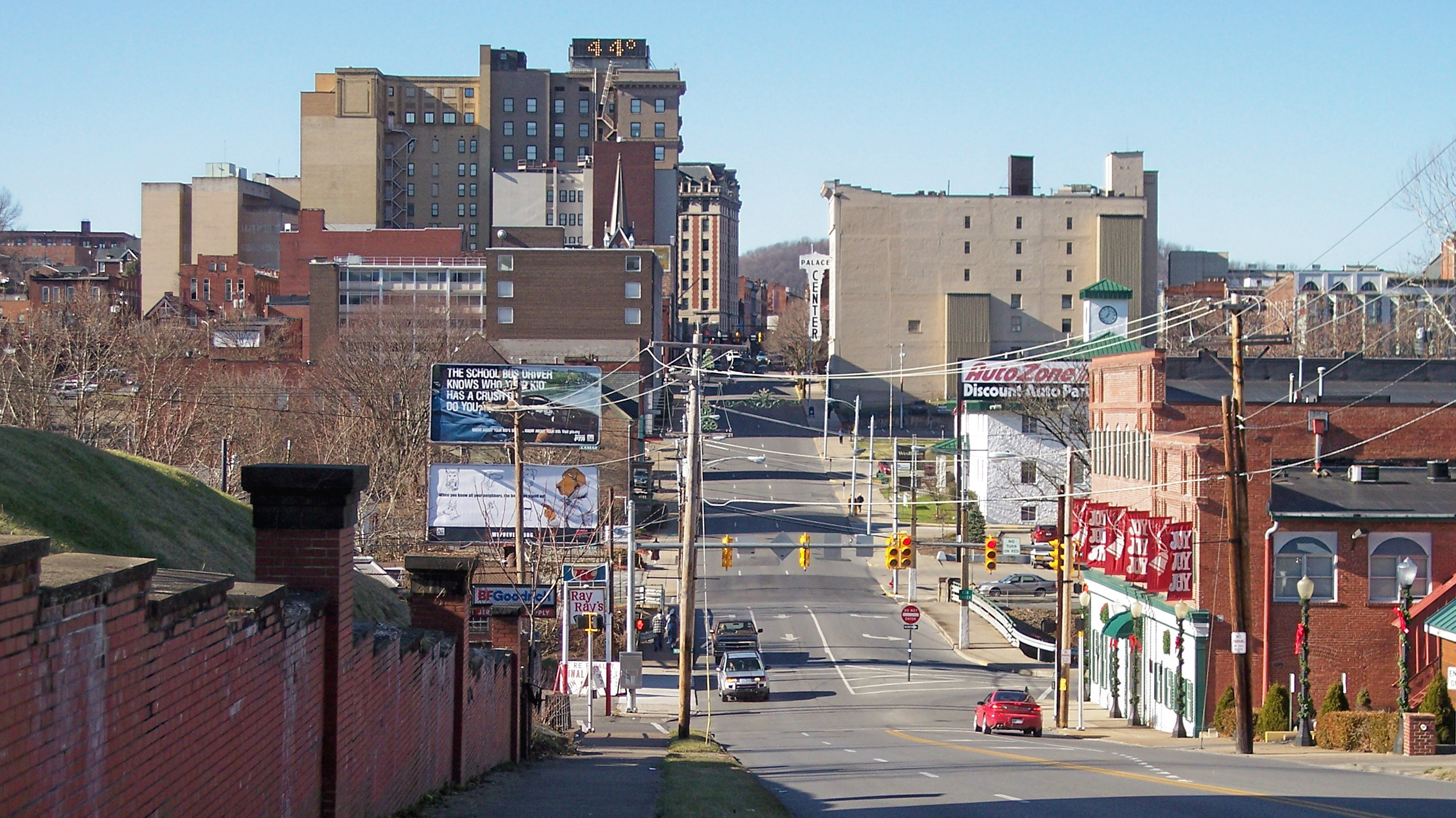
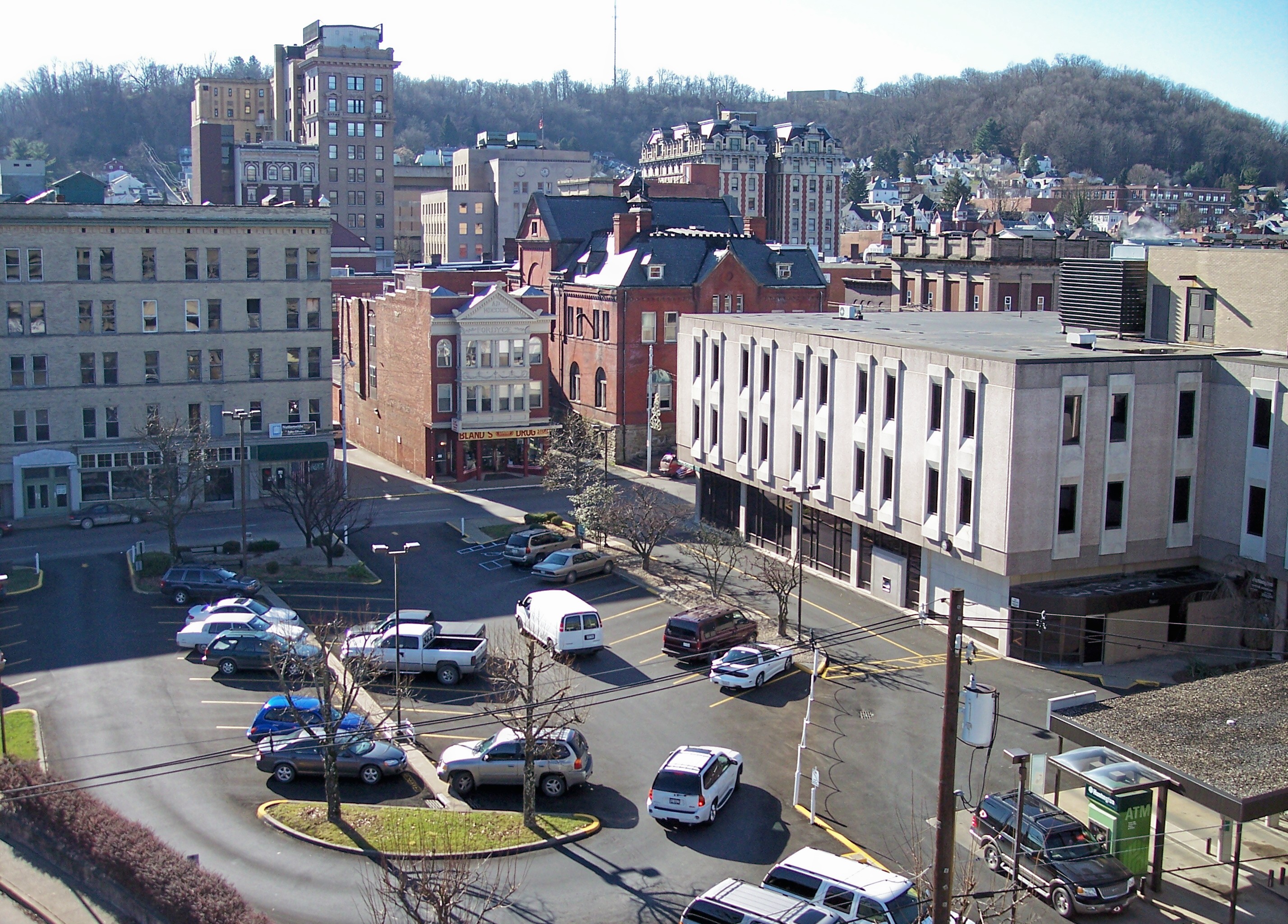
 Downtown Clarksburg in 2006
During most of the 20th century, Clarksburg was an industrial and manufacturing center, particularly in the glass industry. The coal industry also played a major role in the first half of the 20th century.
Since 1995, Clarksburg has been the location of the Federal Bureau of Investigation's Criminal Justice Information Services Division, the largest division of the FBI.[8] The Integrated Automated Fingerprint Identification System, a national fingerprint and criminal history system, became operational in July 1999 at the division's complex. The National Instant Criminal Background Check System, used to screen individuals attempting to receive a firearm, is operated from the facility.[9]
Clarksburg is home to Eastpointe and Newpointe, the largest strip mall in West Virginia, adjacent to Interstate 79. Most of Clarksburg's retail has relocated to the strip malls, and downtown is now home to many professional services.[10]
Events
Clarksburg is a cultural center of the north-central West Virginia region and hosts many events and festivals. Since 1979 Clarksburg has hosted the annual West Virginia Italian Heritage Festival held during Labor Day weekend. Every September since 1991 the city has been the site of the West Virginia Black Heritage Festival. Since 2006 Clarksburg has hosted the annual Glen Elk Wine, Music and Arts festival, and Jesusfest. Since 1997 Clarksburg has also hosted the Greater Clarksburg 10K race, the official WV 10K State Championship. In 2007 the race was renamed the Jarvis Greater Clarksburg 10K.
Notable natives and residents
- Kelly Lea Anderson: 4th runner-up, Miss World 1984
- Tony Anthony: actor, producer, director, and screenwriter
- Hugh Aynesworth: author and journalist
- Babe Barna: Major League Baseball Player 1937-1943
- Rex Bumgardner: professional football player, Buffalo Bills (1948–1949) and Cleveland Browns (1950–1952)
- John S. Carlile: American merchant, lawyer, and politician, including a United States Senator.
- William W. Chapman: United States politician Iowa and Oregon
- Harry Courtney: professional baseball pitcher and Professional Football Player 1919-1922
- Phyllis Curtin: opera soprano
- John W. Davis: Democratic Party nominee for President of the United States in 1924
- Jimbo Fisher: American college coach and former player who was the NCAA Division III National Player of the Year as a senior. He served as the Offensive Coordinator and Quarterbacks Coach for the LSU Tigers football team from 2000–2006 and is currently the head coach of the Florida State Seminoles football team.
- Nathan Goff, Jr.: congressman and United States Secretary of the Navy
- Guy D. Goff: son of Nathan Goff, Jr., Served as a US senator and the US DA for the eastern district of Wisconsin
- Howard Mason Gore: United States Secretary of Agriculture under president Calvin Coolidge
- Mabel Grouitch: American surgical nurse who worked with the Red Cross during World War I
- Robert Graetz: Lutheran clergyman who, as the white pastor of a black congregation in Montgomery, Alabama, Civil Rights Activist
- Bert Hamric Major League Baseball Player
- William S. Haymond US House of Representative, representing Indiana. Civil War surgeon in the Union Army.
- Samuel Lewis Hays 19th Century United States Senator
- Lynn Hornor: represented West Virginia in the United States House of Representatives
- Stonewall Jackson: Confederate lieutenant-general during the American Civil War
- Edward B. Jackson: Member of the 16th Congress to fill the vacancy caused by the resignation of James Pindall and reelected to the 17th Congress, served from October 23, 1820, to March 3, 1823
- John David Jamerson: Standout NCAA basketball player for Ohio University and NBA player selected by the Miami Heat in the 1st round (15th overall) of the 1990 NBA Draft.
- Louis A. Johnson: United States Secretary of Defense
- Tuffy Knight: former coach in Canadian university football, and a member of the Canadian Football Hall of Fame
- Charles S. Lewis: member of the 33rd Congress to fill the vacancy caused by the death of John F. Snodgrass
- Pare Lorentz: film director
- Frank Loria: Virginia Tech Hokies football All American player. He later died in the Southern Airlines Flight 932 airplane crash, that killed most of Marshall University's football team, on November 14, 1970
- Lloyd Lowndes, Jr.: Governor of Maryland
- Frank Marra: businessman, engineer, chairman of The Plastics Academy, received International Award for Business Management from Society of Plastics Engineers and Distinguished Service Award from the Society of the Plastics Industry
- Joseph M. Minard: Democratic member of the West Virginia Senate
- Frederick Mosteller: founding chairman of Harvard's statistics department
- Elliott Northcott: Federal Judge appointed by President Calvin Coolidge on April 6, 1927
- Dave Nutter: Virginia House of Delegates
- Mike Patrick: ESPN sportscaster
- Jay Randolph: sportscaster, son of senator Jennings Randolf
- Stuart F. Reed: politician who represented West Virginia in the United States House of Representatives
- Cindy Taylor: fashion model, born in Paraguay, her father was a United States citizen, relocated the family to Clarksburg immediately after Taylor was born
- Natalie Tennant: WV Secretary of State, in 1990 Tennant was the first female to represent West Virginia University as the Mountaineer Mascot
- Cyrus Vance: United States Secretary of State
- Mark Waggamon: Noted law enforcement official, WV State Police, Clarksburg PD, (1984-present)
- Patty Weaver: actress, The Young and the Restless (1982–present), Days of our Lives (1974–1982)
- Sam Wetzel US Army General
- Sherilyn Wolter: actress who has appeared television soap operas.
- Kirsten Wyatt: Broadway actress, Grease (2007–present)
- Thomas Thomas: heavyweight boxer, Once rated #6 in the world
- Cecil Jarvis: newspaperman and philanthropist
- Tim Miley: politician and lawyer
- Greg Bradley-Popovich: professor at Wesleyan College, physical therapist, artist, and writer
References
- ^ a b "American FactFinder". United States Census Bureau. http://factfinder.census.gov. Retrieved 2008-01-31.
- ^ "US Board on Geographic Names". United States Geological Survey. 2007-10-25. http://geonames.usgs.gov. Retrieved 2008-01-31.
- ^ a b "History of Clarksburg, WV". Genealogytrails.com. 2008-04-10. http://genealogytrails.com/wva/harrison/clarksburg.html. Retrieved 2011-06-02.
- ^ "US Gazetteer files: 2010, 2000, and 1990". United States Census Bureau. 2011-02-12. http://www.census.gov/geo/www/gazetteer/gazette.html. Retrieved 2011-04-23.
- ^ a b [1][dead link]
- ^ "Special Report #1: The Mountaineer Militia's Long, Slippery Slope". Adl.org. 1996-10-21. http://www.adl.org/mwd/mountain.asp. Retrieved 2011-06-03.
- ^ West Virginia Atlas & Gazetteer. DeLorme. 1997. p. 25. ISBN 0899332463.
- ^ "Federal Bureau of Investigation - Overview of CJIS". Fbi.gov. http://www.fbi.gov/hq/cjisd/about.htm. Retrieved 2011-06-03.
- ^ "Federal Bureau of Investigation - CJIS-National Instant Criminal Background Check System Fact Sheet". Fbi.gov. 1998-11-30. http://www.fbi.gov/hq/cjisd/nics/nicsfact.htm. Retrieved 2011-06-03.
- ^ "EZNET - West Virginia Cities - Clarksburg". Ezwv.com. 1999. http://www.ezwv.com/clarksburg.html. Retrieved 2011-06-03.
External links
- City of Clarksburg official web site
- West Virginia Italian Heritage Festival official web site
- WV Black Heritage Festival website
- Harrison County website
- The Exponent Telegram (Clarksburg Newspaper)
- Discover Mountaineer Country, A Community Website for North Central WV
Municipalities and communities of Harrison County, West Virginia County seat: Clarksburg Cities Bridgeport | Clarksburg | Salem | Shinnston | Stonewood

Towns CDPs Despard | Enterprise | Gypsy | Spelter | Wolf Summit
Other
localitiesArlington | Dawmont | Dixie | East Salem | Glen Falls | Haywood | Hepzibah | Jimtown | McWhorter | Meadowbrook | Mount Clare | Peora | Pine Bluff | Quiet Dell | Reynoldsville | Wallace | Wilsonburg | Wyatt
Categories:- Clarksburg, West Virginia
- Cities in West Virginia
- Populated places in Harrison County, West Virginia
- Northwestern Turnpike
- County seats in West Virginia
- Clarksburg micropolitan area


Wikimedia Foundation. 2010.