- Nutter Fort, West Virginia
-
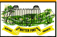
Nutter Fort, West Virginia — Town — 
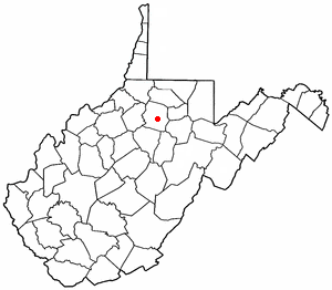
SealMotto: Progress With a Small Town Atmosphere Location of Nutter Fort, West Virginia
Coordinates: 39°15′44″N 80°19′21″W / 39.26222°N 80.3225°WCoordinates: 39°15′44″N 80°19′21″W / 39.26222°N 80.3225°W Country United States State West Virginia County Harrison Government – Mayor Donald L. Webster – Police Chief R.W. Godwin Area – Total 0.9 sq mi (2.3 km2) – Land 0.9 sq mi (2.3 km2) – Water 0.0 sq mi (0.0 km2) Elevation 1,056 ft (322 m) Population (2000) – Total 1,686 – Density 1,902.9/sq mi (734.7/km2) Time zone Eastern (EST) (UTC-5) – Summer (DST) EDT (UTC-4) ZIP code 26301 Area code(s) 304 FIPS code 54-59836[1] GNIS feature ID 1555248[2] Nutter Fort is a town in Harrison County, West Virginia, United States, incorporated in 1923. The town is a southeastern suburb of Clarksburg, West Virginia. Since 1996, Nutter Fort has held the West Virginia Blackberry Festival during the first weekend of August. The population was 1,686 at the 2000 census. The town is also home to the Harrison County Sheriffs Department and the Harrison County Bureau of Emergency Services.
Contents
History
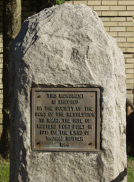
 Nutter's Fort Monument
Arriving in the early 1770s, the families of brothers Thomas, Matthew, and Christopher Nutter were early European settlers to western Virginia. Thomas Nutter had received a land grant for 1,400 acres (5.7 km²) of land along Elk Creek in what was then Monongalia County. Together with the settlers Obadiah and Daniel Davisson, the Nutters constructed a fort in 1772, later known as Nutter's Fort, said to have been one of the strongest forts south of Fort Pitt. Located on the eastern side of Elk Creek, the fort was used by the Virginia state militia from 1776-1780 in conflicts with Native Americans. Thomas Nutter served as a Captain in the Revolutionary Army and died in early August 1808. When the community was incorporated in 1923, it took its name to honor both Nutter and the original settlement. A marker at the Nutter Fort campus of West Virginia Business College (formerly the location of Roosevelt-Wilson High School) indicates where the fort was located.[3]
Geography
Nutter Fort is located at 39°15′44″N 80°19′21″W / 39.26222°N 80.3225°W (39.262163, -80.322389),[4] along Elk Creek.[5]
According to the United States Census Bureau, the town has a total area of 0.9 square miles (2.3 km²), all land.
Demographics
As of the census[1] of 2000, there were 1,686 people, 793 households, and 470 families residing in the town. The population density was 1,902.9 inhabitants per square mile (731.4/km²). There were 860 housing units at an average density of 970.6 per square mile (373.1/km²). The racial makeup of the town was 97.75% White, 0.89% African American, 0.06% Native American, 0.30% Asian, and 1.01% from two or more races. Hispanic or Latino of any race were 1.01% of the population.
There were 793 households out of which 21.7% had children under the age of 18 living with them, 44.9% were married couples living together, 11.1% had a female householder with no husband present, and 40.7% were non-families. 35.6% of all households were made up of individuals and 16.6% had someone living alone who was 65 years of age or older. The average household size was 2.12 and the average family size was 2.72.
In the town the population was spread out with 18.2% under the age of 18, 8.1% from 18 to 24, 27.5% from 25 to 44, 26.3% from 45 to 64, and 20.0% who were 65 years of age or older. The median age was 42 years. For every 100 females there were 88.6 males. For every 100 females age 18 and over, there were 85.6 males.
The median income for a household in the town was $30,163, and the median income for a family was $39,318. Males had a median income of $26,855 versus $18,816 for females. The per capita income for the town was $18,431. About 11.6% of families and 14.3% of the population were below the poverty line, including 24.5% of those under age 18 and 1.5% of those age 65 or over.
References
- ^ a b "American FactFinder". United States Census Bureau. http://factfinder.census.gov. Retrieved 2008-01-31.
- ^ "US Board on Geographic Names". United States Geological Survey. 2007-10-25. http://geonames.usgs.gov. Retrieved 2008-01-31.
- ^ http://members.iolinc.net/nutterfort/history.htm
- ^ "US Gazetteer files: 2010, 2000, and 1990". United States Census Bureau. 2011-02-12. http://www.census.gov/geo/www/gazetteer/gazette.html. Retrieved 2011-04-23.
- ^ DeLorme (1997). West Virginia Atlas & Gazetteer. Yarmouth, Maine: DeLorme. p.36. ISBN 0-89933-246-3.
External links
- Town of Nutter Fort official website
- West Virginia Blackberry Festival
- Harrison County Bureau of Emergency Services
- Harrison County Website
Municipalities and communities of Harrison County, West Virginia Cities Bridgeport | Clarksburg | Salem | Shinnston | Stonewood

Towns Anmoore | Lost Creek | Lumberport | Nutter Fort | West Milford
CDPs Despard | Enterprise | Gypsy | Spelter | Wolf Summit
Other
localitiesArlington | Dawmont | Dixie | East Salem | Glen Falls | Haywood | Hepzibah | Jimtown | McWhorter | Meadowbrook | Mount Clare | Peora | Pine Bluff | Quiet Dell | Reynoldsville | Wallace | Wilsonburg | Wyatt
Categories:- Populated places in Harrison County, West Virginia
- Towns in West Virginia
- Populated places established in 1772
- Clarksburg micropolitan area

Wikimedia Foundation. 2010.