- Oak Mounds
-


The Oak Mounds is a large prehistoric earthwork mound, and a smaller mound to the west. They are located outside Clarksburg, in Harrison County, West Virginia.
Contents
Mounds
These mounds have never been totally excavated but they were probably built between 1 and 1000 CE by the Hopewell culture mound builders, prehistoric indigenous peoples of eastern North America. The larger mound is about 12 feet high and 60 feet in diameter. A number of burials of important persons of the culture probably occurred in these mounds. [1]
Site
An incorrectly worded historical marker sign is located on County Rt. 98 near the Veterans Administration Hospital. The sign errounously states the direction the mounds are in relative to the sign itself, however the mounds are actually to the west, on the far side of the West Fork River, and not "Directly to the east..." The sign's entire inscription reads: "Oak Mounds - Directly to the east are two earthen, domed burial mounds. The larger mound is some sixty feet in diameter and twelve feet high. Excavations in 1969 revealed flint tools, pottery shards and skeletal remains of two individuals. Site dates to about 100 BC, late Woodland Period."[2]
See also
- Mound
- Mound builder (people)
- Effigy mound
- Earthwork (archaeology)
- Tumulus - burial mound
- List of Hopewell sites
References
Coordinates: 39°15′48″N 80°21′56″W / 39.26334°N 80.36556°W
 Hopewellian peoplesWoodland period · List of Hopewell sites · Mound builder (people) · List of archaeological periods (North America)
Ohio Hopewell Beam Farm · Benham Mound · Cary Village Site · Cedar-Bank Works · Dunns Pond Mound · Ellis Mounds · Ety Enclosure · Ety Habitation Site · Fort Ancient · Fortified Hill Works · Great Hopewell Road · High Banks Works · Hopeton Earthworks · Hopewell Culture National Historical Park · Indian Mound Cemetery · Keiter Mound · Marietta Earthworks · Moorehead Circle · Mound of Pipes · Nettle Lake Mound Group · Newark Earthworks · Oak Mounds · Perin Village Site · Portsmouth Earthworks · Seip Earthworks and Dill Mounds District · Shawnee Lookout · Tremper Mound and Works · Williamson Mound Archeological District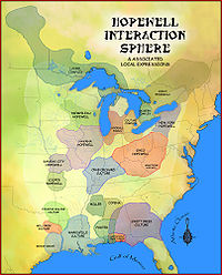
Crab Orchard culture Goodall Focus Goodall Site · Norton Mound GroupHavana Hopewell culture Kansas City Hopewell Marksville culture Miller culture Point Peninsula Complex Swift Creek culture Etowah Indian Mounds · Leake Mounds · Kolomoki Mounds Historic Park · Miner's Creek site, · Nacoochee Mound · Swift Creek mound site · Yearwood siteOther Hopewellian peoples Armstrong culture · Copena culture · Fourche Maline culture · Laurel Complex · Saugeen Complex · Old Stone Fort (Tennessee)Exotic trade items Related topics · Ancient Monuments of the Mississippi Valley · Black drink · burial mound · Calumet (pipe) · Effigy mound · Hopewell pottery · Horned Serpent · Eastern Agricultural Complex · Underwater panther Late Woodland culturesSites Baytown Site · Beattie Park Mound Group · Book Site · Bowen Site (12 MA 61) · Brinsfield I Site · Brokaw Site · Clampitt Site (12-LR-329) · Fisher Site · Hoye Site · Little Maquoketa River Mounds State Preserve · Memorial Park Site · Mott Mounds · Nottingham Site · Ormond Mound · Sommerheim Park · Troyville Earthworks · University of Tennessee Agriculture Farm Mound ·Cultures Alachua culture · Baytown culture · Clemson Island culture · Coles Creek culture · Manahoac · Monongahela culture · Oliver Phase · Plum Bayou culture · Springwells Phase · Troyville culture · Weeden Island culture ·Related topics · Steuben point · Belle Glade culture · Extreme weather events of 535–536 · Fort Ancient culture · Mississippian culture · Oneota · St. Johns culture ·Categories:- Hopewellian peoples
- Woodland period of North America
- Native American history of West Virginia
- Archaeological sites in West Virginia
- Mounds of West Virginia
- Native American archeology
- Geography of Harrison County, West Virginia


Wikimedia Foundation. 2010.