- Oak Ridge, Tennessee
-
Oak Ridge, Tennessee — City — 
SealNickname(s): The Atomic City
The Secret CityLocation within the state of Tennessee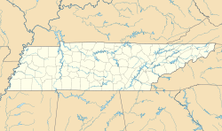
 Oak Ridge, Tennessee
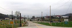
Coordinates: 36°0′48″N 84°15′45″W / 36.01333°N 84.2625°WCoordinates: 36°0′48″N 84°15′45″W / 36.01333°N 84.2625°W Country United States State Tennessee Counties Anderson, Roane Established 1942 Incorporated 1959 Government – Type Council-manager (under home-rule charter) – Mayor Tom Beehan – City manager Mark Watson Area – Total 89.9 sq mi (232.9 km2) – Land 85.5 sq mi (221.6 km2) – Water 4.4 sq mi (11.3 km2) Elevation 850 ft (259 m) Population (2000) – Total 27,387 – Density 320.1/sq mi (123.6/km2) Time zone EST (UTC-5) – Summer (DST) EDT (UTC-4) ZIP codes 37830-37831 Area code(s) 865 FIPS code 47-55120[1] GNIS feature ID 1296156[2] Website oakridgetenn.org Oak Ridge is a city in Anderson and Roane counties in the eastern part of the U.S. state of Tennessee, about 25 miles (40 km) west of Knoxville. Oak Ridge's population was 27,387 at the 2000 census. The portion of the city located in Anderson County is included in the Knoxville Metropolitan Area, while the portion located in Roane County is included in the Harriman, Tennessee Micropolitan Statistical Area; both of these areas are components of the Knoxville-Sevierville-La Follette, TN Combined Statistical Area. Oak Ridge's nicknames include the Atomic City,[3] the Secret City,[4] the Ridge and the City Behind the Fence.[5]
Oak Ridge was established in 1942 as a production site for the Manhattan Project—the massive U.S. government operation that developed the atomic bomb. Scientific development still plays a crucial role in the city's economy and culture in general.
Contents
History
The earliest substantial occupation of the Oak Ridge area occurred during the Woodland period (c. 1000 B.C.–1000 A.D.), although artifacts dating to the Paleo-Indian period have been found throughout the Clinch Valley.[6] Two Woodland mound sites—the Crawford Farm Mounds and the Freels Farm Mounds—were uncovered in the 1930s as part of the Norris Basin salvage excavations. Both sites were located just southeast of the former Scarboro community.[7] The Bull Bluff site, which was occupied during both the Woodland and Mississippian (c. 1000–1600 A.D.) periods, was uncovered in the 1960s in anticipation of the construction of Melton Hill Dam.[8] Bull Bluff is a cliff located immediately southeast of Haw Ridge, opposite Melton Hill Park. The Oak Ridge area was largely uninhabited by the time Euro-American explorers and settlers arrived in the late 18th century, although the Cherokee claimed the land as part of their hunting grounds.
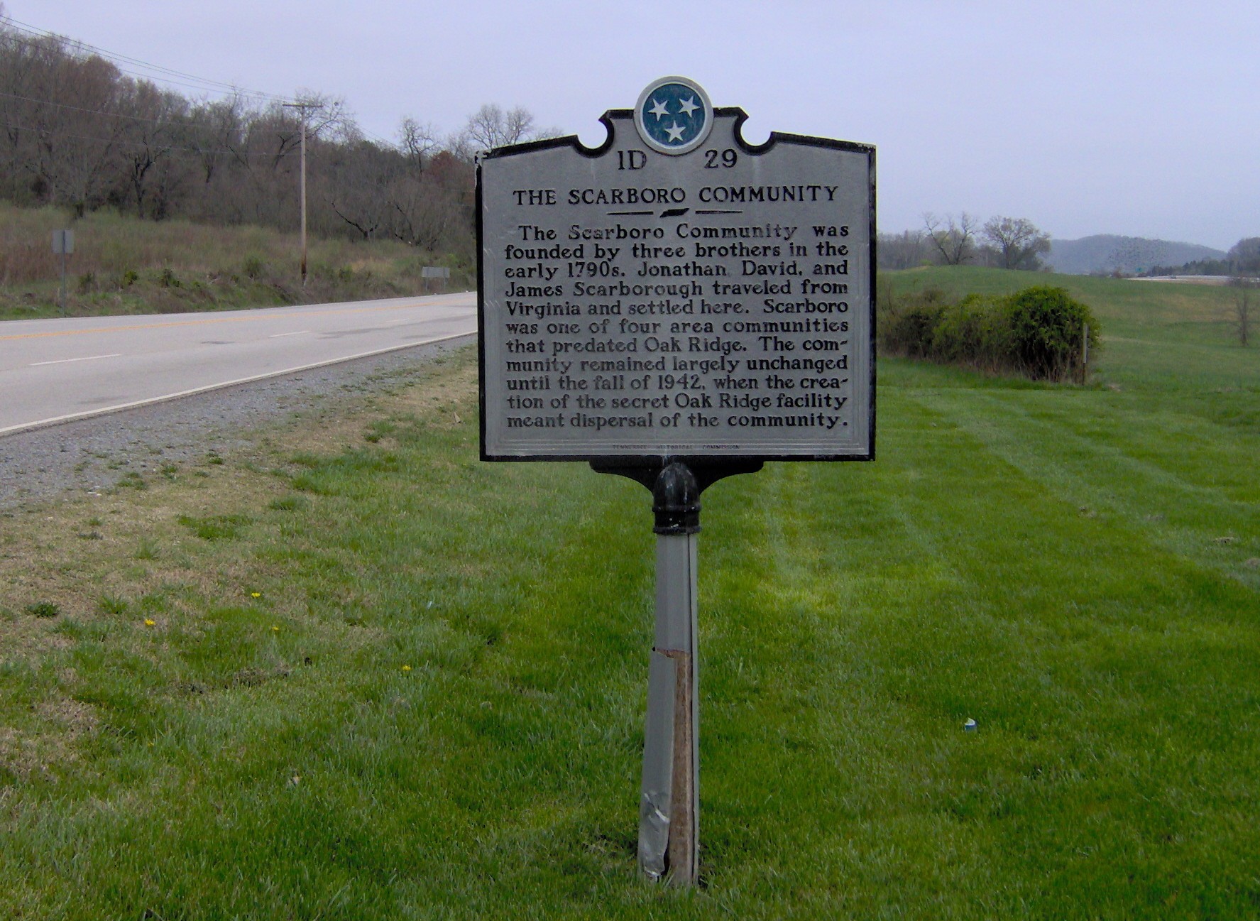
 Historical marker recalling the now-defunct community of Scarboro
In the 19th century, the Oak Ridge area saw the development of several rural farming communities, namely Edgemoor and Elza in the northeast, East Fork and Wheat in the southwest, Robertsville in the west, and Bethel and Scarboro in the southeast. The settlers who founded these communities first arrived in the late 1790s, when the Cherokee signed the Treaty of Holston, ceding what is now Anderson County to the United States.
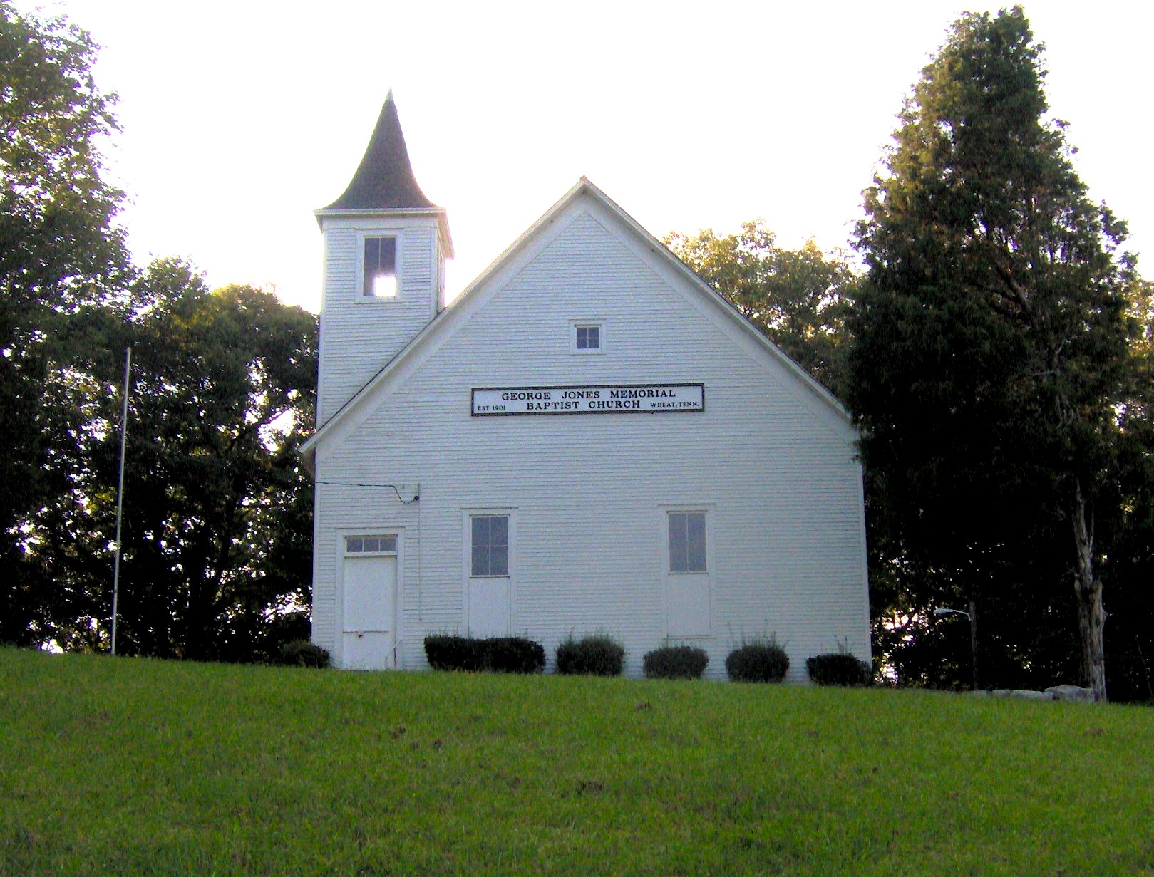
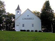 George Jones Memorial Baptist Church, built by the residents of Wheat in 1901
According to local tradition, John Hendrix (1865–1915), an eccentric local resident regarded as a mystic, prophesied the establishment of Oak Ridge some 40 years before construction began. Upset by the death of his young daughter and the subsequent departure of his wife and remaining family, he became religious and told his neighbors he was seeing visions. When he described his visions, people thought he was insane; for this reason, he was institutionalized for a time. According to several published accounts,[9] one vision that he described repeatedly was an uncannily accurate description of the city and production facilities that were built 28 years after his death. The version recalled by neighbors and relatives has been reported as follows:
"In the woods, as I lay on the ground and looked up into the sky, there came to me a voice as loud and as sharp as thunder. The voice told me to sleep with my head on the ground for 40 nights and I would be shown visions of what the future holds for this land.... And I tell you, Bear Creek Valley someday will be filled with great buildings and factories, and they will help toward winning the greatest war that ever will be. And there will be a city on Black Oak Ridge and the center of authority will be on a spot middle-way between Sevier Tadlock’s farm and Joe Pyatt’s Place. A railroad spur will branch off the main L&N line, run down toward Robertsville and then branch off and turn toward Scarborough. Big engines will dig big ditches, and thousands of people will be running to and fro. They will be building things, and there will be great noise and confusion and the earth will shake. I've seen it. It's coming."[9]
Starting in October 1942, the United States Army Corps of Engineers began acquiring the Oak Ridge area for the Manhattan Project. Unlike TVA's land acquisitions for Norris Dam—which were still fresh on the minds of many Anderson Countians—the Corps' "declaration of taking" was much more swift and final. Many residents came home to find eviction notices tacked to their doors. Most were given six weeks to evacuate, although several had as little as two weeks. Some were even forced out before they received compensation. By March 1943, the area's pre-Manhattan Project communities had been removed, and fences and checkpoints had been established. Anderson County lost one-seventh of its land and $391,000 in annual property tax revenue. The manner with which the Oak Ridge area was acquired created a tense, uneasy relationship between Oak Ridge and the surrounding towns that lasted throughout the Manhattan Project.[10]
Manhattan Project
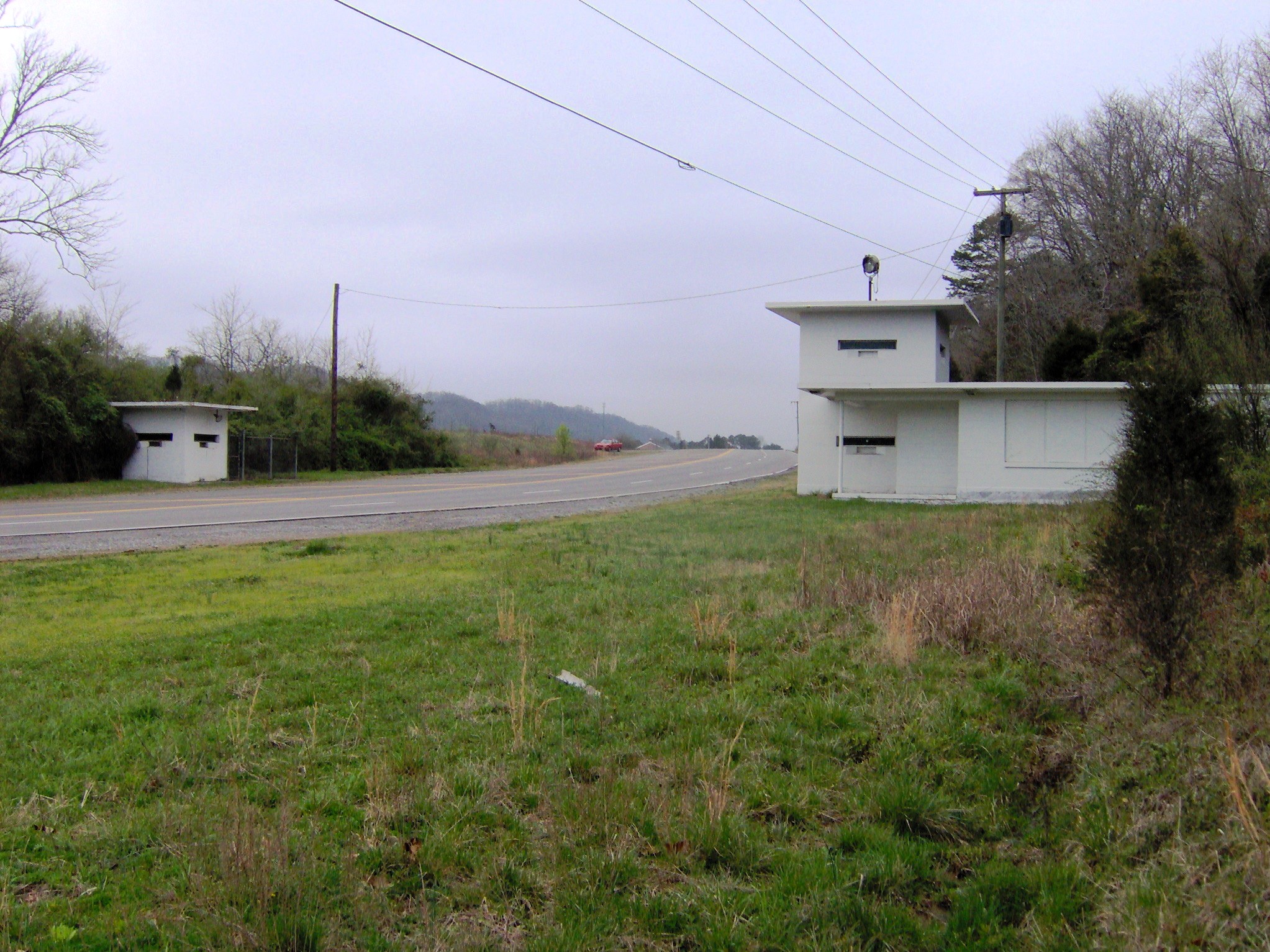
 The Bethel Valley Checking Station
In 1942, the United States Federal Government chose the area as a site for developing materials for the Manhattan Project. Maj. Gen. Leslie Groves, military head of the Manhattan Project, liked the area for several reasons. Its relatively low population made acquisition affordable, yet the area was accessible by both highway and rail, and utilities such as water and electricity were readily available due to the recent completion of Norris Dam. Finally, the project location was established within a 17-mile (27-km) long valley, and the valley itself was linear and partitioned by several ridges, providing natural protection against disasters between the four major industrial plants—so they wouldn't blow up "like firecrackers on a string."[11]
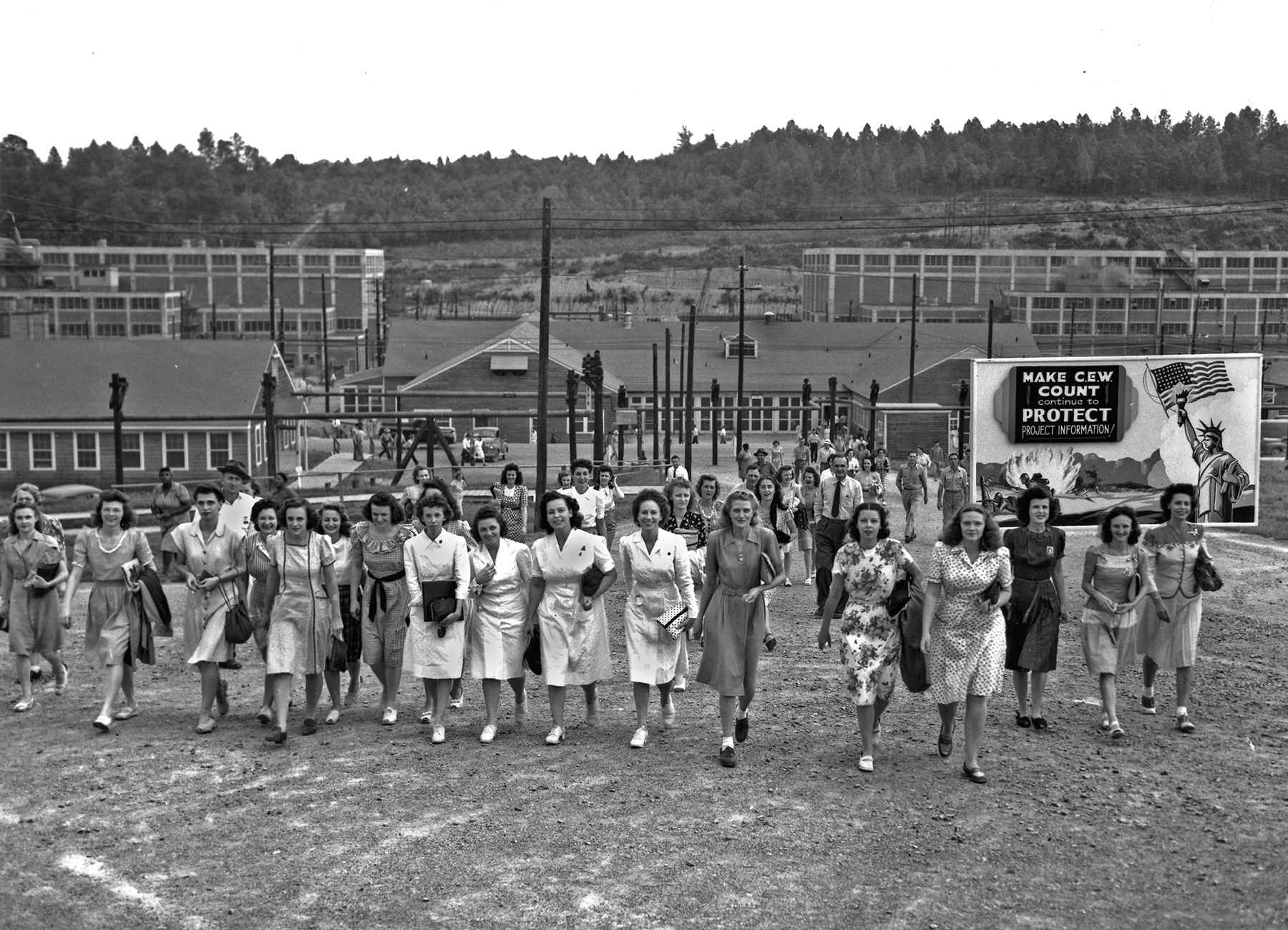
 Workers leaving the Manhattan Project's Y-12 plant at shift changing time, 1945 (US government photo by Ed Westcott)
The location and low population also helped keep the town a secret. Although the population of the settlement grew from about 3,000 in 1942 to about 75,000 in 1945, and despite the fact that the K-25 uranium-separating facility by itself covered 44 acres (0.178 km²) and was the largest building in the world at that time, Oak Ridge was kept an official government secret. It did not appear on maps, and wasn't formally named until 1949, only being referred to as the Clinton Engineer Works (CEW). All workers wore badges, and the town was surrounded by guard towers and a fence with seven gates.
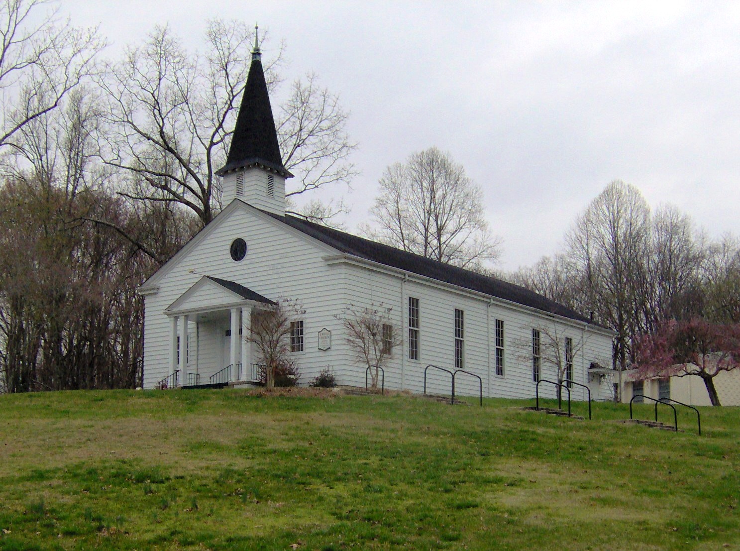
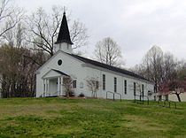 United Church, The Chapel on the Hill, built for Manhattan Project employees
Beginning in late 1942, the United States Army Corps of Engineers began acquiring more than 60,000 acres (240 km²) for the CEW under authority of the Corps' Manhattan Engineer District (MED). The K-25, S-50, and Y-12 plants were each built in Oak Ridge to separate the fissile isotope uranium-235 from natural uranium, which consists almost entirely of the isotope uranium-238. During construction of the magnets which were required for the process that would separate the uranium at the Y-12 site, a shortage of copper forced the MED to borrow 14,700 tons of silver bullion from the United States Treasury to be used for electrical conductors for the electromagnet coils as a substitute.[12] The X-10 site, now the location of Oak Ridge National Laboratory, was established as a pilot plant for production of plutonium using the Graphite Reactor.
Because of the large number of workers recruited to the area for the Manhattan Project, the Army planned a town for project workers at the eastern end of the valley. The time required for the project's completion caused the Army to opt for a relatively permanent establishment rather than a camp of enormous size.
The architecture firm Skidmore, Owings and Merrill (SOM) was contracted to provide a layout for the town and house designs.[13] SOM Partner John O. Merrill moved to Tennessee to take charge of designing the secret buildings at Oak Ridge, Tennessee.[14] He directed the creation of a town.[15] Prefabricated modular homes, apartments, and dormitories, many made from cemesto (bonded cement and asbestos) panels, were quickly erected. Streets were laid out in the manner of a "planned community." Main arteries were generally named for states (e.g., "Pennsylvania Avenue"), and smaller streets running off of these all began with the same letter (e.g., Pelham Rd., Pocono La.). A "lane" could be expected to be a dead-end way, while a "road" usually went through to another street.[16] This made it considerably easier for the city's new residents to find each other.
Housing for families was constructed according to a series of templates, identified by letters. Thus an "A" house was the smallest lettered design, with one bedroom. A "B" house featured two bedrooms, a "D" house three bedrooms with a larger living space, an "E" was a two-story four-unit structure, and an "F" was the largest type home. The smallest homes were called "flat tops"; originally intended to be only temporary structures, they proliferated atop the ridges in the west end of town.
More spacious homes were awarded by the government based upon family size and the status of the worker.[17] If a couple became divorced, they would usually be "demoted" in terms of their housing allocation, and a worker who became unemployed would usually lose his or her home altogether.[18]
Oak Ridge was developed by the federal government as a segregated community. Black residents lived only in an area known as Gamble Valley and lived predominantly in government-built "hutments" (one-room shacks) on the south side of what is now Tuskegee Drive. Oak Ridge elementary education prior to 1954 was totally segregated; black children could only attend the Scarboro Elementary School. Oak Ridge High School was closed to black children, who had to be bussed out to Knoxville for an education. Starting in 1950, Scarboro High School operated for African American students at Scarboro Elementary School. It operated until Oak Ridge High School was desegregated in the fall of 1955. In 1953, an abortive attempt had made by the Oak Ridge Town Council to encourage the desegregation of Oak Ridge High School; this resulted in an unsuccessful attempt to recall one of the Council members, Waldo Cohn. It took the Supreme Court decision in Brown v. Board of Education to change the federal government's stance in this matter.After the Brown decision, the nearby high school in Clinton, TN was desegregated in the fall of 1956 and later bombed, closing it down. To its credit, Oak Ridge then provided space for the education of high school students from Clinton for two years while Clinton High School was being rebuilt at its Linden Elementary School. Robertsville Junior High School, serving the west half of Oak Ridge, was desegregated at the same time as the high school. Elementary schools in other parts of the city and Jefferson Junior High School, serving the east half of the city, were desegregated slowly as African American families moved into housing outside of Gamble Valley until, in 1967, Scarboro Elementary School was closed and African American Students from Gamble Valley were bused to other schools around the city. In the years after Brown, public accommodations in Oak Ridge were also integrated, although this took a number of years. In the early 1960's, Oak Ridge experienced briefly protest picketing against racial segregation in public accommodations, notably outside a local cafeteria and a laundromat.[19]
Construction personnel swelled the wartime population of Oak Ridge to as much as 70,000. That dramatic population increase, and the secret nature of the project, meant chronic shortages of housing and supplies during the war years. The town was administered by Turner Construction Company through a subsidiary named the Roane-Anderson Company.[20] For most residents, however, their "landlord" was known as "MSI" (Management Services, Inc.).
The news of the use of the first atomic bomb against Japan on August 6, 1945 revealed to the people at Oak Ridge what they had been working on.
Since World War II
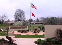
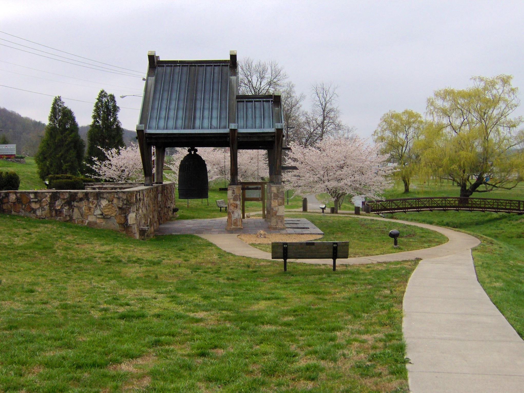
 The "International Friendship Bell" (colloquially, the Peace Bell) at the Oak Ridge Civic Center
Two years after World War II ended, Oak Ridge was shifted to civilian control, under the authority of the U.S. Atomic Energy Commission (AEC). The Roane Anderson Company administered most community functions under a government contract.[21] In 1959 the town was incorporated and a city manager and City Council form of government was adopted by the community rather than direct federal control. Three of the four major facilities created for the wartime bomb production are still standing today:
- K-25, where uranium was enriched by the gaseous diffusion process until 1985, is now being decommissioned and decontaminated.
- Y-12, originally used for electromagnetic separation of uranium, is still in use for nuclear weapons processing and materials storage.
- X-10, site of a test graphite reactor, is now the site of Oak Ridge National Laboratory.
- The S-50 liquid thermal diffusion plant was demolished soon after the war.
In 1983, the Department of Energy declassified a report showing that significant amounts of mercury had been released from the Oak Ridge Reservation into East Fork Poplar Creek between 1950 and 1977. A federal court ordered the DOE to bring the Oak Ridge Reservation into compliance with federal and state environmental regulations.[22]
Currently, the Department of Energy runs a nuclear and high-tech research establishment at the site and performs national security work. Tours of parts of the original facility are available to American citizens from June through September. The tour is so popular that there is a waiting list for seats.[23]
Oak Ridge's scientific heritage is explored in the American Museum of Science and Energy.
Jaguar, a supercomputer at Oak Ridge National Laboratory, was the world's fastest computer until October 2010, when it was surpassed by China's Tianhe-I.
Geography
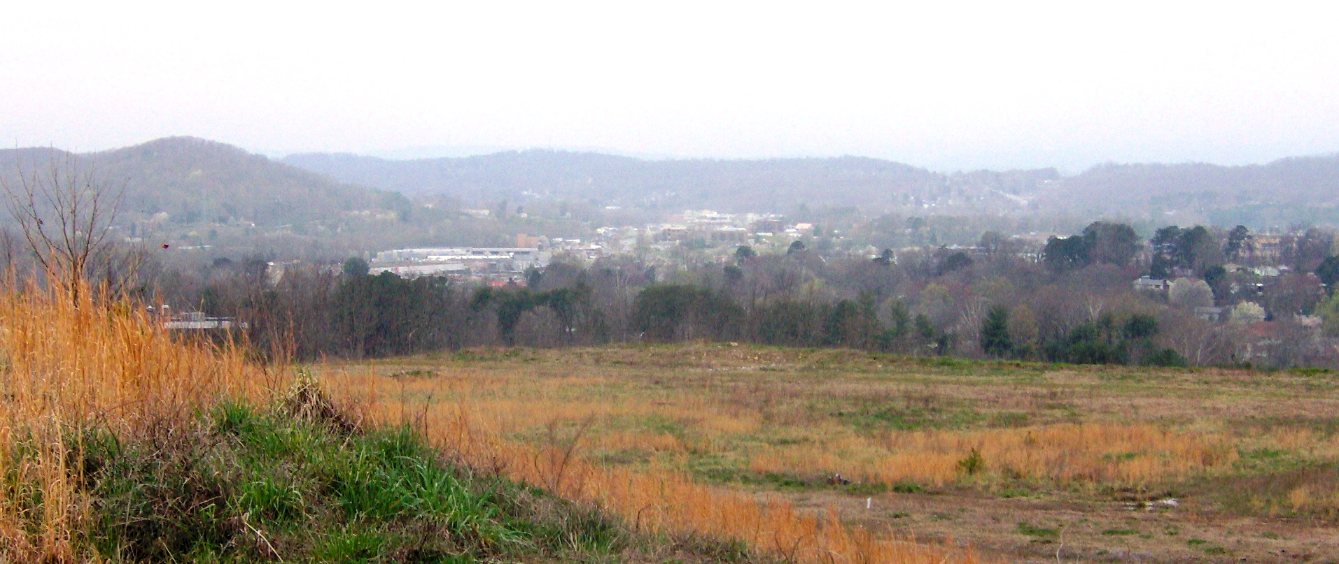
 View from the Oak Ridge Summit, a barren knob on the north slope of Pine Ridge. East Fork Ridge is on the left, Blackoak Ridge spans the horizon
Immediately northeast of Oak Ridge, the southwestward-flowing Clinch River bends sharply to the southeast for roughly 6 miles (9.7 km) toward Solway, where it turns again to the southwest. After flowing for approximately 17 miles (27 km), the river bends sharply to the northwest at Copper Ridge, and continues in this direction for nearly 7 miles (11 km). At the K-25 plant, the Clinch turns southwest again and flows for another 11 miles (18 km) to its mouth along the Tennessee River at Kingston. This series of bends creates a half-rectangle formation—surrounded by water on the northeast, east, and southwest—in which Oak Ridge is situated.
The Oak Ridge area is striated by five elongate ridges that run roughly parallel to one another in a northeast-to-southwest direction. In order from west-to-east, the five ridges are Blackoak Ridge—which connects the Elza and K-25 bends of the Clinch and thus "walls off" the half-rectangle—East Fork Ridge, Pine Ridge, Chestnut Ridge, and Haw Ridge. The five ridges are divided by four valleys—East Fork Valley (between Blackoak and East Fork Ridge), Gamble Valley (between East Fork Ridge and Pine Ridge), Bear Creek Valley (between Pine Ridge and Chestnut), and Bethel Valley (between Chestnut and Haw). These ridges and valleys are part of the Appalachian Ridge-and-Valley Physiographic Province. The main section of the city is located in the northeast, where East Fork and Pine Ridge give way to low, scattered hills. Many of the city's residences are located along the relatively steep northeastern slope of Blackoak Ridge.
The completion of Melton Hill Dam (along the Clinch near Copper Ridge) in 1963 created Melton Hill Lake, which borders the city on the northeast and east. The lakefront on the east side of the city is a popular recreation area with bicycling trails and picnic areas lining the shore. The lake is also well-known as a venue for rowing competitions. Watts Bar Lake—an impoundment of the Tennessee River which covers the lower 23 miles (37 km) of the Clinch, borders Oak Ridge to the south and southwest.
According to the United States Census Bureau, the city has a total area of 89.9 square miles (232.9 km²), of which, 85.6 square miles (221.6 km²) of it is land and 4.4 square miles (11.3 km²) of it (4.86%) is water.
Climate
Monthly Normal and Record High and Low Temperatures Month Jan Feb Mar Apr May Jun Jul Aug Sep Oct Nov Dec Rec High °F 75 79 86 92 93 101 105 103 102 90 85 78 Norm High °F 45.9 51.6 61 70.5 77.8 84.9 88.1 87.2 81.1 71.1 59 49 Norm Low °F 27.2 29.5 36.6 43.8 53.4 61.7 66.4 65.2 58.8 45.7 36.4 29.8 Rec Low °F -17 -13 1 20 30 39 49 50 33 21 0 -7 Precip (in) 5.13 4.5 5.72 4.32 5.14 4.64 5.16 3.39 3.75 3.02 4.86 5.42 Source: USTravelWeather.com Demographics
As of the census[1] of 2000, there were 27,387 people, 12,062 households, and 7,695 families residing in the city. The population density was 320.1 people per square mile (123.6/km²). There were 13,417 housing units at an average density of 156.8 per square mile (60.6/km²). The racial makeup of the city was 86.96% White, 8.18% African American, 0.30% Native American, 2.10% Asian, 0.02% Pacific Islander, 0.76% from other races, and 1.68% from two or more races. Hispanic or Latino of any race were 1.93% of the population.
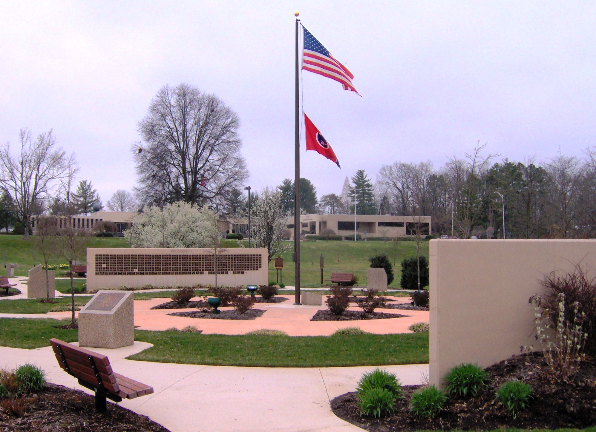
 The Oak Ridge Commemorative Walk at the Civic Center
There were 12,062 households out of which 26.8% had children under the age of 18 living with them, 49.7% were married couples living together, 11.1% had a female householder with no husband present, and 36.2% were non-families. 32.7% of all households were made up of individuals and 15.0% had someone living alone who was 65 years of age or older. The average household size was 2.24 and the average family size was 2.83.
In the city the population was spread out with 22.4% under the age of 18, 6.6% from 18 to 24, 23.6% from 25 to 44, 26.3% from 45 to 64, and 21.1% who were 65 years of age or older. The median age was 43 years. For every 100 females there were 88.1 males. For every 100 females age 18 and over, there were 83.4 males.
The median income for a household in the city was $41,950, and the median income for a family was $57,087. Males had a median income of $45,149 versus $27,500 for females. The per capita income for the city was $24,793. About 8.0% of families and 10.9% of the population were below the poverty line, including 17.5% of those under age 18 and 5.5% of those age 65 or over.
Economy
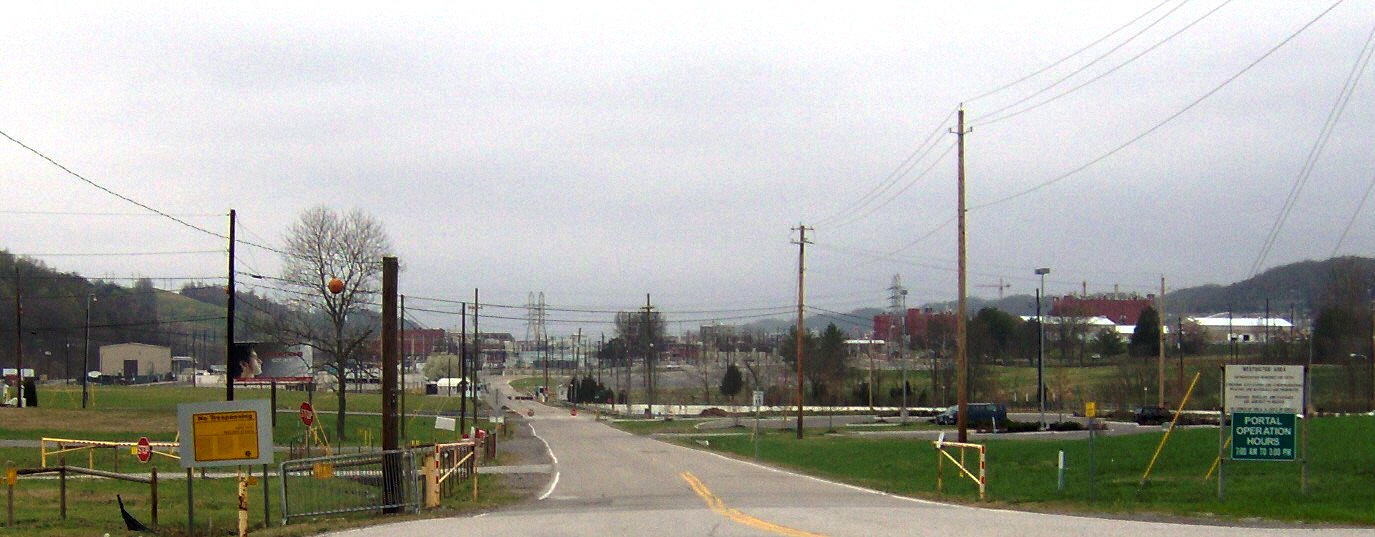
 The entrance to Y-12
The federal government projects at Oak Ridge are reduced in size and scope, but are still the city's principal economic activity and one of the biggest employers in the Knoxville metropolitan area. The Department of Energy owns the federal sites and maintains a major office in the city. Oak Ridge National Laboratory is the largest multipurpose lab in the Department of Energy's National Laboratory system, and is also home to the Spallation Neutron Source, a 1.4 billion dollar project completed in 2006, and "Jaguar", one of the world's most powerful scientific supercomputers that has peak performance of more than one quadrillion operations per second. The Y-12 National Security Complex is a component of the U.S. nuclear weapons complex. Bechtel Jacobs is the Department of Energy's primary contractor conducting an extensive program of decontamination and decommissioning, environmental cleanup, and waste management that aims to remove or stabilize the residues remaining from decades of government production and research activities. The Department of Energy Office of Scientific and Technical Information, which disseminates government research and development information and operates the Science.gov Web site, is located in the city. The Oak Ridge Institute for Science and Education, operated by Oak Ridge Associated Universities, conducts research and education programs for the Department of Energy, Department of Homeland Security, and other federal agencies. The Atmospheric Turbulence and Diffusion Division (ATDD), one of several field divisions of the National Oceanic and Atmospheric Administration (NOAA) Air Resources Laboratory, is also located in the city. ATDD began under AEC sponsorship in 1948 as a Weather Bureau research office providing meteorological information and expertise for the AEC. Currently its main function is to perform air quality-related research directed toward issues of national and global importance.
Boeing operated a manufacturing plant in the city beginning in the early 1980s, but closed in 2007. IPIX, Remotec (now a subsidiary of Northrop Grumman), and several other technology-based companies have been founded in Oak Ridge. Wackenhut provides security services for DOE's local facilities, employing about 900 people. Several radioactive waste processing companies, including EnergySolutions, have operations in Oak Ridge.
The infrastructure that was new in the 1940s is aging, and the once-isolated city is now incorporated into the Knoxville metropolitan area. Oak Ridge, a proud city with historic international implications, is now challenged to blend into the suburban orbit of Knoxville while its heritage as a "super secret" government installation subsides. Changing economic forces have led to continuing changes in the commercial sector. For example, the Oak Ridge City Center, a shopping center built in the 1950s and converted to an indoor shopping mall in the 1980s by Crown American, is largely empty in preparation for its partial demolition and redevelopment into a more open type of shopping development.[24]
Education
 The ORISE building at Oak Ridge Associated Universities
The city operates a preschool, four elementary schools enrolling kindergarten through grade 4, two middle schools enrolling grades 5 through 8, and one high school enrolling grades 9 through 12.
In an August 2004 referendum, city voters approved an increase in local sales taxes to fund a 55 million dollar "rebuilding" project for Oak Ridge High School. Following demolition of one wing of the main building, construction on the first wall of the new building began in April 2005. Temporary classrooms were set up to house science classes; they will continue to be used for different purposes as the multi-year project progresses.
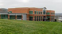
Roane State Community College has a branch campus in Oak Ridge. Other higher education organizations present in the community, but not offering classes locally, include the Oak Ridge Institute for Science and Education, Oak Ridge Associated Universities, and the University of Tennessee Forestry Stations and Arboretum.
Independent schools in the city include the Montessori School of Oak Ridge (preschool and kindergarten), St. Mary's School (Roman Catholic, pre-kindergarten through grade 8), and several preschools. The Oak Ridge Institute for Continued Learning offers a diverse array of educational opportunities for adults.[25]
Notable people
The following are notable people who were born, educated, resided, or worked in Oak Ridge:
- E. Riley Anderson, Tennessee Supreme Court justice
- Jennifer Azzi, former WNBA player and Olympic gold medalist
- General B.B. Bell, general in command of U.S. Forces Korea since 2006 and previously in command of United States Army, Europe and NATO's Joint Command
- Manson Benedict, nuclear engineering pioneer
- Nikki Caldwell, women's basketball head coach (formerly at UCLA, now at LSU), grew up in Oak Ridge.[26] [27]
- Kenneth Lee Carder, United Methodist Church bishop
- Lee Clayton, country-rock singer/songwriter best known as the writer of "Ladies Love Outlaws"[28]
- Sheldon Datz, chemist[29]
- Charlie Ergen, co-founder and CEO of EchoStar Communications Corporation, the parent company of Dish Network
- Megan Fox, actress, was born in Oak Ridge.[30]
- John H. (Jack) Gibbons, Director of the Office of Technology Assessment and White House Office of Science and Technology Policy
- Eugene Guth, physicist
- Elaine Hendrix, actress
- Otis Howard, former NBA player
- Philip M. Jardine, Soil Scientist, won 10 Outstanding Young Americans on January 17, 1998[31]
- Alston Scott Householder, mathematician who invented the Householder transformation
- Rick Jacobs, former assistant to Armand Hammer, President and Chief Executive Officer of Newstar, chairman and cofounder of Brave New Films, founder of the Courage Campaign, and Huffington Post blogger[32]
- Kai-Fu Lee, Google executive
- Randy McNally, Tennessee State Senator
- John O. Merrill[33]
- Edgar Meyer, Grammy Award-winning bassist
- Sarah Monette, author
- Benjamin Feldman, author and NYC historian
- Karl Z. Morgan, health physics pioneer
- Ward Plummer, physicist
- William G. Pollard, nuclear physicist and Episcopal priest who was the first director of the Oak Ridge Institute of Nuclear Studies (now Oak Ridge Associated Universities) and the author of many works on the topic of Christianity and science.
- Mitch Rouse, actor, director and screenwriter
- William Shepherd, American astronaut who served as commander of Expedition 1, the first crew on the International Space Station
- Clifford Shull, Nobel Prize-winning physicist
- Gore Verbinski, film director best known for his direction of Pirates of the Caribbean series
- Viper (born Stephanie Green), porn actress
- Alvin Weinberg, nuclear physicist
- Ed Westcott, only authorized photographer in Oak Ridge during the Manhattan Project
- Richard White, actor, voice of Gaston in Beauty and the Beast
- Eugene Wigner, Nobel Prize-winning physicist
- Herbert York, nuclear physicist
Points of interest
- Oak Ridge National Laboratory
- University of Tennessee Arboretum
- East Tennessee Technology Park, formerly known as the K-25 Site
- United Church, The Chapel on the Hill
- Children's Museum of Oak Ridge
- US DOE Office of Scientific and Technical Information (OSTI)
- American Museum of Science and Energy
- The Oak Ridge Playhouse
Sister cities
Oak Ridge has two sister cities, as designated by Sister Cities International:
References
- ^ a b "American FactFinder". United States Census Bureau. http://factfinder.census.gov. Retrieved 2008-01-31.
- ^ "US Board on Geographic Names". United States Geological Survey. 2007-10-25. http://geonames.usgs.gov. Retrieved 2008-01-31.
- ^ Olwell, Russell, At Work in the Atomic City: A Labor and Social History of Oak Ridge, Tennessee (Knoxville, Tenn.: University of Tennessee Press, 2004).
- ^ Warren Resen, "The Secret City: Oak Ridge, Tennessee," The Observer News, 3 August 2010. Retrieved: 9 November 2011.
- ^ Charles Johnson and Charles Jackson, City Behind a Fence: Oak Ridge, Tennessee, 1942-1946 (Knoxville, Tenn.: University of Tennessee Press, 1981).
- ^ Beverly Burbage, "Paleo-Indian Points and Uniface Material from the Clinch River Valley." Tennessee Archaeologist 28, no. 1 (Spring of 1962), 47-50.
- ^ William Webb, An Archaeological Survey of the Norris Basin in Eastern Tennessee (Washington, D.C.: U.S. Government Printing Office, 1938), 180-189.
- ^ Glyn DuVall, "A Phase I Archaeological Survey of Proposed Potable Water Storage and Force Main Facilities, Y-12 National Security Complex Site, Anderson County, Tennessee" (August of 2005), p. 4. Retrieved: 3 April 2008.
- ^ a b See ORNL, Swords to Plowshares: A Short History of Oak Ridge National Laboratory (1943-1993); David Ray Smith, John Hendrix and the Y-12 National Security Complex; and D. Ray Smith, John Hendrix - Oak Ridge Prophet, The Oak Ridger, March 15, 2006. The first written record of the vision is reported to have been in The Oak Ridge Story, by George O. Robinson, 1950.
- ^ Johnson and Jackson, City Behind a Fence, pp. 41-47.
- ^ Johnson and Jackson, City Behind a Fence, 6-8.
- ^ [1][dead link]
- ^ Johnson and Jackson, City Behind a Fence, 14.
- ^ Westcott, Ed. (2005). Westcott, Ed. (2005). Oak Ridge, Charleston, South Carolina: Arcadia Publishing. 10-ISBN 0738541702; 13-ISBN 9780738541709; OCLC 62511041, page 61
- ^ Lehman College Art Gallery, Skidmore, Owings and Merrill (SOM), Merrill bio notes
- ^ Local lore had it that a committee of the wives of the U.S. Army Engineers were put in charge of naming the streets.
- ^ Homes in the most scenic ridge-top locations were generally awarded only to top officials at the labs or in the AEC bureaucracy.
- ^ In the late 1950s, the government began selling Oak Ridge residences to the public, with the current occupants receiving priority for the houses they lived in. A tremendous burst of renovation and new construction then ensued, as owners remodeled their homes (often still according to standardized designs) and vast areas of town that had been undeveloped were built upon.
- ^ Much of this history is documented in The Oak Ridger, particularly in Historically Speaking columns by D. Ray Smith.
- ^ Francis Sill Wickware, Oak Ridge, Life Magazine, September 9, 1946, page 4
- ^ "Carson v. Roane-Anderson Co., 342 U.S. 232 (1952)". Supreme.justia.com. 1946-12-31. http://supreme.justia.com/us/342/232/case.html. Retrieved 2011-07-26.
- ^ The Tennessee Department of Environment and Conservation, "Status Report to the Public," December 1998. Retrieved: 20 March 2008.
- ^ Gates, Verna. "Secret World War Two nuclear city open to tours". Reuters.com. http://www.reuters.com/article/newsOne/idUSN2335392520070803?sp=true. Retrieved 2011-07-26.
- ^ "Oak Ridge City Center - News & Events." Retrieved: 19 June 2008.
- ^ Oak Ridge Institute for Continued Learning website.
- ^ "Nikki Caldwell accepts UCLA head coaching job". Wate.com. http://www.wate.com/Global/story.asp?s=8183081. Retrieved 2011-07-26.
- ^ "Nikki Caldwell Bio- LSUsports.net". http://www.lsusports.net/ViewArticle.dbml?SPSID=28701&SPID=2167&ATCLID=205128989&DB_OEM_ID=5200. Retrieved 2011-09-09.
- ^ Lee Clayton biography, allmusic.com
- ^ Sheldon Datz, 74, Pioneer in Molecular Chemistry, Dies, New York Times, September 6, 2001
- ^ Megan Fox at The Insider
- ^ ORNL.com Retrieved December 20, 2009
- ^ "Rick Jacobs". Huffingtonpost.com. http://www.huffingtonpost.com/rick-jacobs. Retrieved 2011-07-26.
- ^ Westcott, p. 61. at Google Books; see photo
External links
- City of Oak Ridge official website
- Oak Ridge Convention and Visitors Bureau
- Oak Ridge, Tennessee at the Open Directory Project
- Historic photos of Oak Ridge during the Manhattan Project
Municipalities and communities of Anderson County, Tennessee Cities 
Towns Unincorporated
communitiesAndersonville | Briceville | Claxton | Devonia | Fork Mountain | Fraterville | Marlow
Footnotes ‡This populated place also has portions in an adjacent county or counties
Municipalities and communities of Roane County, Tennessee Cities 
Town Unincorporated
communitiesFootnotes ‡This populated place also has portions in an adjacent county or counties
Categories:- Cities in Tennessee
- Oak Ridge, Tennessee
- Planned cities in the United States
- Populated places established in 1942
- Populated places in Anderson County, Tennessee
- Populated places in Roane County, Tennessee
- Manhattan Project
- Knoxville metropolitan area
- Company towns in Tennessee

Wikimedia Foundation. 2010.