- Jackson County, West Virginia
-
Jackson County, West Virginia 
Location in the state of West Virginia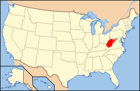
West Virginia's location in the U.S.Founded 1831 Seat Ripley Area
- Total
- Land
- Water
472 sq mi (1,222 km²)
466 sq mi (1,207 km²)
6 sq mi (16 km²), 1.23%Population
- (2010)
- Density
29,211
60/sq mi (23/km²) The Jackson County Courthouse in Ripley in 2007
Jackson County is a county located in the U.S. state of West Virginia. As of 2010, the population was 29,211. Its county seat is Ripley[1] and its largest municipality is Ravenswood. Jackson County was formed in 1831 from parts of Kanawha, Wood, and Mason Counties, and named for Andrew Jackson, seventh President of the United States.
Contents
Geography
According to the U.S. Census Bureau, the county has a total area of 472 square miles (1,222.5 km2), of which 466 square miles (1,206.9 km2) is land and 6 square miles (15.5 km2) (1.23%) is water. The Ohio River forms part of Jackson County's western border. Sandy Creek and Mill Creek, tributaries of the Ohio, flow through the northern and central portions of the county.[2]
Major highways
 Interstate 77
 U.S. Highway 33
 West Virginia Route 2
 West Virginia Route 34
 West Virginia Route 62
 West Virginia Route 68
 West Virginia Route 87
Adjacent counties
- Wood County (north)
- Wirt County (northeast)
- Roane County (east)
- Kanawha County (south)
- Putnam County (southwest)
- Mason County (west)
- Meigs County, Ohio (northwest)
National protected area
Demographics
Historical populations Census Pop. %± 1840 4,890 — 1850 6,544 33.8% 1860 8,306 26.9% 1870 10,300 24.0% 1880 16,312 58.4% 1890 19,021 16.6% 1900 22,987 20.9% 1910 20,956 −8.8% 1920 18,658 −11.0% 1930 16,124 −13.6% 1940 16,598 2.9% 1950 15,299 −7.8% 1960 18,541 21.2% 1970 20,903 12.7% 1980 25,794 23.4% 1990 25,938 0.6% 2000 28,000 7.9% 2010 29,211 4.3% As of the census[3] of 2000, there were 28,000 people, 11,061 households, and 8,207 families residing in the county. The population density was 60 people per square mile (23/km²). There were 12,245 housing units at an average density of 26 per square mile (10/km²). The racial makeup of the county was 98.75% White, 0.08% Black or African American, 0.21% Native American, 0.23% Asian, 0.01% Pacific Islander, 0.10% from other races, and 0.62% from two or more races. 0.29% of the population were Hispanic or Latino of any race.
There were 11,061 households out of which 31.90% had children under the age of 18 living with them, 61.60% were married couples living together, 9.40% had a female householder with no husband present, and 25.80% were non-families. 22.70% of all households were made up of individuals and 10.30% had someone living alone who was 65 years of age or older. The average household size was 2.50 and the average family size was 2.92.
In the county, the population was spread out with 24.10% under the age of 18, 7.90% from 18 to 24, 27.70% from 25 to 44, 24.90% from 45 to 64, and 15.30% who were 65 years of age or older. The median age was 39 years. For every 100 females there were 94.80 males. For every 100 females age 18 and over, there were 91.40 males.
The median income for a household in the county was $32,434, and the median income for a family was $38,021. Males had a median income of $32,991 versus $20,253 for females. The per capita income for the county was $16,205. About 12.20% of families and 15.20% of the population were below the poverty line, including 21.60% of those under age 18 and 9.00% of those age 65 or over.
Localities
Cities
Other places
- Advent
- Cottageville
- Evans
- Flatwoods
- Fletcher
- Gay
- Given
- Independence
- Kenna
See also
- Frozen Camp Wildlife Management Area
- National Register of Historic Places listings in Jackson County, West Virginia
References
- ^ "Find a County". National Association of Counties. http://www.naco.org/Counties/Pages/FindACounty.aspx. Retrieved 2011-06-07.
- ^ West Virginia Atlas & Gazetteer. Yarmouth, Me.: DeLorme. 1997. pp. 32–33. ISBN 0-89933-246-3.
- ^ "American FactFinder". United States Census Bureau. http://factfinder.census.gov. Retrieved 2008-01-31.
External links

Meigs County, Ohio Wood County Wirt County Mason County 
Roane County  Jackson County, West Virginia

Putnam County Kanawha County Municipalities and communities of Jackson County, West Virginia Cities 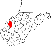
Unincorporated
communitiesAdvent | Cottageville | Duncan | Evans | Fairplain | Flatwoods | Gay | Given | Goldtown | Independence | Kenna | Kentuck | LeRoy | Liverpool‡ | Millwood | Mt. Alto | Murraysville | Rock Castle | Romance | Sandyville | Sherman | Silverton | Statts Mills
Footnotes ‡This populated place also has portions in an adjacent county or counties
Categories:- West Virginia counties
- Jackson County, West Virginia
- Ohio River counties
- 1831 establishments in the United States
- Populated places established in 1831


Wikimedia Foundation. 2010.