- Marshall County, West Virginia
-
Marshall County, West Virginia 
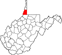
Location in the state of West Virginia
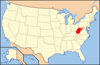
West Virginia's location in the U.S.Founded 1835 Seat Moundsville Area
- Total
- Land
- Water
312 sq mi (808 km²)
307 sq mi (795 km²)
5 sq mi (13 km²), 1.66%Population
- (2000)
- Density
35,519
117/sq mi (45/km²)Marshall County is a county located in the U.S. state of West Virginia. It is part of the Wheeling, West Virginia, Metropolitan Statistical Area. As of 2010, the population was 33,107. [1] Its county seat is Moundsville.[1] Its southern border is the Mason-Dixon line. Marshall County is home to the largest conical burial mound in North America, at Moundsville.[2] Marshall County was formed in 1835 from Ohio County by act of the Virginia Assembly. In 1852, on Christmas Eve, workers completed the Baltimore & Ohio railroad at Rosby's Rock in Marshall County.[3] It is home to the New Vrindaban community of Hare Krishnas, and Prabhupada's Palace of Gold.
Contents
Geography
According to the U.S. Census Bureau, the county has a total area of 312 square miles (809 km²), of which 307 square miles (795 km²) is land and 5 square miles (13 km²) (1.66%) is water.
Major Highways
 U.S. Highway 250
 West Virginia Route 2
 West Virginia Route 86
 West Virginia Route 88
 West Virginia Route 891
Adjacent Counties
- Ohio County (north)
- Washington County, Pennsylvania (northeast)
- Greene County, Pennsylvania (east)
- Wetzel County (south)
- Monroe County, Ohio (southwest)
- Belmont County, Ohio (northwest)
National protected area
Demographics
Historical populations Census Pop. %± 1840 6,937 — 1850 10,138 46.1% 1860 12,997 28.2% 1870 14,941 15.0% 1880 18,840 26.1% 1890 20,735 10.1% 1900 26,444 27.5% 1910 32,388 22.5% 1920 33,681 4.0% 1930 39,831 18.3% 1940 40,189 0.9% 1950 36,893 −8.2% 1960 38,041 3.1% 1970 37,598 −1.2% 1980 41,608 10.7% 1990 37,356 −10.2% 2000 35,519 −4.9% As of the census[5] of 2000, there were 35,519 people, 14,207 households, and 10,101 families residing in the county. The population density was 116 people per square mile (45/km²). There were 15,814 housing units at an average density of 52 per square mile (20/km²). The racial makeup of the county was 98.40% White, 0.43% Black or African American, 0.11% Native American, 0.25% Asian, 0.03% Pacific Islander, 0.12% from other races, and 0.67% from two or more races. 0.64% of the population were Hispanic or Latino of any race.
There were 14,207 households out of which 29.50% had children under the age of 18 living with them, 56.80% were married couples living together, 10.80% had a female householder with no husband present, and 28.90% were non-families. 25.60% of all households were made up of individuals and 12.90% had someone living alone who was 65 years of age or older. The average household size was 2.44 and the average family size was 2.91.
In the county, the population was spread out with 22.80% under the age of 18, 7.30% from 18 to 24, 27.10% from 25 to 44, 26.40% from 45 to 64, and 16.30% who were 65 years of age or older. The median age was 40 years. For every 100 females there were 94.80 males. For every 100 females age 18 and over, there were 91.60 males.
The median income for a household in the county was $30,989, and the median income for a family was $39,053. Males had a median income of $31,821 versus $19,053 for females. The per capita income for the county was $16,472. About 12.40% of families and 16.60% of the population were below the poverty line, including 24.30% of those under age 18 and 11.30% of those age 65 or over. 0% of those under age 18 and 11.30% of those age 65 or over.
Cities and towns
Incorporated communities
- Benwood
- Cameron
- Glen Dale
- McMechen
- Moundsville
- Wheeling (mostly in Ohio County)
Zip codes
- 26003 - Wheeling
- 26031 - Benwood
- 26033 - Cameron
- 26036 - Dallas
- 26038 - Glen Dale
- 26039 - Glen Easton
- 26040 - McMechen
- 26041 - Moundsville
- 26055 - Proctor
Telephone information
Prefixes in Marshall County, WV(1)(2)
- Wheeling Zone 1 (serves north-west and north-central area of county)
- Wheeling Citywide - 215, 218, 230, 280, 281, 312, 331, 551, 639, 650, 780, 830, 905, 907
- Benwood/McMechen area - 214, 231, 232, 233, 234, 559,
- Sherrard/Mt.Olivet area - 238, 242, 243, 966
- Wheeling Zone 3 (serves north-east area of county)
- Dallas/Sand Hill - 219, 547, 909
- Wheeling Zone 5
- Moundsville/Glen Dale - 221, 810, 843, 845
- Cameron Zone
- Cameron/Loudenville - 686
(1) Source: West Virginia Public Service Commission
(2) Due to Local Number Portability there is no longer a difference between Land-Line, Coaxial, and Wireless exchanges or prefixes. They are now interchangeable when a customer takes their number with them to a different telephone service provider.See also
- Burches Run Wildlife Management Area
- Cecil H. Underwood Wildlife Management Area
- Dunkard Fork Wildlife Management Area
- National Register of Historic Places listings in Marshall County, West Virginia
References
- ^ "Find a County". National Association of Counties. http://www.naco.org/Counties/Pages/FindACounty.aspx. Retrieved 2011-06-07.
- ^ http://www.wvculture.org/museum/GraveCreekmod.html
- ^ Marshall County Historical Society. History of Marshall County, West Virginia. Marceline, Mo., Walsworth, 1984.975.416 M367m.
- ^ Comins, Linda S. (2006). "Moundsville". In Ken Sullivan (ed.). The West Virginia Encyclopedia. Charleston, W.Va.: West Virginia Humanities Council. pp. 505. ISBN 0-9778498-0-5.
- ^ "American FactFinder". United States Census Bureau. http://factfinder.census.gov. Retrieved 2008-01-31.

Belmont County, Ohio Ohio County Washington County, Pennsylvania 

Greene County, Pennsylvania  Marshall County, West Virginia

Monroe County, Ohio Wetzel County Municipalities and communities of Marshall County, West Virginia Cities Unincorporated
communitiesBig Run | Dallas | Georgetown | Glen Easton | Limestone | Mount Olivet | Mozart‡ | New Vrindaban | Sherrard
Footnotes ‡This populated place also has portions in an adjacent county or counties
The Northern Panhandle of West Virginia Counties 
Communities Beech Bottom | Benwood | Bethlehem | Bethany | Cameron | Chester | Clearview | Follansbee | Glen Dale | McMechen | Moundsville | New Cumberland | New Vrindaban | Triadelphia | Valley Grove | Weirton | Wellsburg | West Liberty | Wheeling | Windsor Heights
Attractions Bethany College | Capitol Theatre | Chester Teapot | Grave Creek Mound | Mountaineer Casino, Racetrack and Resort | Oglebay Park | Palace of Gold | Tomlinson Run State Park | West Liberty University | West Virginia Independence Hall | West Virginia Northern Community College | West Virginia State Penitentiary | Wheeling Island | Wheeling Island Hotel-Casino-Racetrack | Wheeling Jesuit University | Wheeling Suspension Bridge | The Highlands Shopping, Dining & Entertainment Complex
Categories:- West Virginia counties
- Marshall County, West Virginia
- Ohio River counties
- 1835 establishments in the United States
- Populated places established in 1835
- Wheeling metropolitan area
Wikimedia Foundation. 2010.


