- Dunkard Fork Wildlife Management Area
-
Dunkard Fork Wildlife Management Area West Virginia Wildlife Management Area  Dunkard Fork Lake
Country United States State West Virginia County Marshall Elevation 835 ft (254.5 m) [1] Coordinates 39°57′08″N 80°31′27″W / 39.95222°N 80.52417°W Area 470 acres (190.2 ha) [2] Management West Virginia Division of Natural Resources Owner Wheeling Creek Watershed Commission Nearest town Moundsville, West Virginia 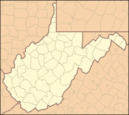
 Location of Dunkard Fork Wildlife Management Area in West Virginia
Dunkard Fork Wildlife Management Area is located on 470 acres (190 ha) in Marshall County near Moundsville, West Virginia.[2] Mixed hardwoods cover most of the former strip mine site,[2] whose major focus is a flood control lake on Dunkard Fork Wheeling Creek. The rolling terrain is punctuated with a few highwalls and ponds. Dunkard Fork WMA is located in northeast Marshall County along the Pennsylvania line on County Route 15.
Contents
Hunting and Fishing
Hunting opportunities are limited by the small size of the area. Available hunting can include deer, grouse, squirrel, turkey and waterfowl. Fishing opportunities in the 49-acre (20 ha) Dunkard Fork Lake include tiger musky, black bass, hybrid striped bass, bluegill and channel catfish, as well as stocked trout. A small portion of the lake headwaters extend into Pennsylvania.
Camping is prohibited on the Dunkard Fork WMA land. Only electric motors may be used on boats.
See also
- Animal conservation
- Fishing
- Hunting
- List of West Virginia wildlife management areas
References
- ^ Acme Mapper 2.0, Dunkard WMA, retrieved September 5, 2008
- ^ a b c "Dunkard Fork WMA page". WV Division of Natural Resources. http://www.wvdnr.gov/Hunting/D1WMAareas.shtm#8d1. Retrieved 2008-09-01.
External links
- West Virginia DNR District 1 Wildlife Management Areas
- West Virginia Hunting Regulations
- West Virginia Fishing Regulations
Categories:- Wildlife Management Areas of West Virginia
- Protected areas of Marshall County, West Virginia


Wikimedia Foundation. 2010.