- Audra State Park
Geobox|Protected Area
name = Audra State Park
native_name =
other_name =
other_name1 =
category = West Virginia State Park
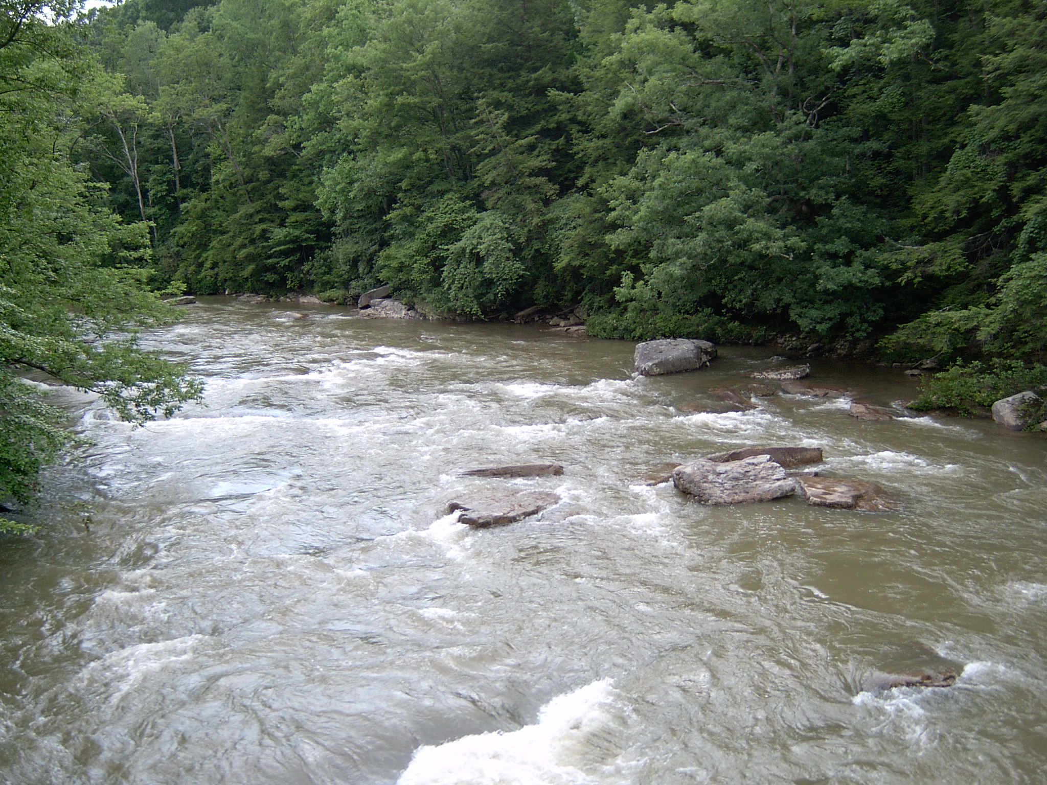
image_caption =Middle Fork River
etymology_type =
etymology =
country = United States
country_
state = West Virginia
state_
region_type = Counties
region = Barbour
region1 = Upshur
district_type =
district =
district1 =
district2 =
city =
city1 =
location =
lat_d = 39
lat_m = 02
lat_s = 25
lat_NS = N
long_d = 80
long_m = 03
long_s = 55
long_EW = W
elevation_imperial = 1811
elevation_round = 1
area_unit = acre
area_imperial = 355
area_round = 1
area1_imperial =
area1_type =
length_imperial =
length_orientation =
width_imperial =
width_orientation =
highest =
highest location =
highest_lat_d =
highest_lat_m =
highest_lat_s =
highest_lat_NS =
highest_long_d =
highest_long_m =
highest_long_s =
highest_long_EW =
highest_elevation_imperial =
lowest =
lowest_location =
lowest_lat_d =
lowest_lat_m =
lowest_lat_s =
lowest_lat_NS =
lowest_long_d =
lowest_long_m =
lowest_long_s =
lowest_long_EW =
lowest_elevation_imperial =
biome =
biome_share =
biome1 =
biome1_share =
geology =
geology1 =
plant =
plant1 =
animal =
animal1 =
established_type = Established
established = 1950
established_note = cite book|title=Where People and Nature Meet: A History of the West Virginia State Parks|publisher=Pictorial Histories Publishing Company|location=Charleston,West Virginia |date=April 1988|isbn=0-933126-91-3]
established1_type = Opened
established1 = 1954
established1_note =
owner =West Virginia Division of Natural Resources
management_location =
management_lat_d =
management_lat_m =
management_lat_s =
management_lat_NS =
management_long_d =
management_long_m =
management_long_s =
management_long_EW =
management_elevation =
visitation =
visitation_year =
free_type = Nearest city
free_label = Nearest city
free = Belington,West Virginia
free1_type =
free1 =

map_caption = Location of Audra State Park in West Virginia
map_locator = West Virginia
map_first =
website = [http://www.audrastatepark.com Audra State Park]Audra State Park is a
West Virginia state park located on convert|355|acre|km2 [Carrol, S. and Miller, M., "Hiking West Virginia", p.92, Globe Pequot Press, Guilford, CT (2003).] in southwestern Barbour County. It was established around the remnants of an earlynineteenth century gristmill and the tiny community of Audra. A gristmill spillway is still visible in the river. [ [http://www.audrastatepark.com/recreation.html Audra State Park web page, accessed March 16, 2008.] ]The park is a hilly, secondary forest area bisected by the
Middle Fork River . The deep pools, large, flat rocks, and riverside beach have provided generations of campers, local teens and college students a place to swim or work on their tans. [Crockett, M., "Jewels in our Crown", Pictoria Histories, Charleston, WV, 2004. ISBN 1-891852-35-3] Audra State Park is the site ofAlum Cave , which is accessible by aboardwalk built along this overhanging sandstone ledge.The park serves as the put-in point for a 6.6 mile
kayak run along about 2.8 miles the Middle Fork River and about 3.8 miles of theTygart Valley River to the confluence of the latter with theBuckhannon River . [ [http://www.americanwhitewater.org/rivers/id/2455/ American Whitewater web site, Middle Fork River page, accessed July 19, 2006.] ]Features
* 65 camp sites
* Swimming in the Middle Fork River
* Hiking trails
* Kayaking in the Middle Fork River
* Picnic areaAccessibility
Accessibility for thedisable d was assessed byWest Virginia University . The assessment found the campground, picnic area, and park offices to be accessible. [ [http://www.cedwvu.org/programs/realchoice/recreation/ "Guide to Accessible Recreation and Travel in WV", WVU Center for Excellence in Disabilities web site, accessed July 31, 2006] ] The main swimming hole (just below the site of the former gristmill), with wet, slippery rocks and unpaved approaches is not considered accessible.ee also
*
List of West Virginia state parks References
External links
* [http://www.audrastatepark.com/ Official site]

Wikimedia Foundation. 2010.