- Middle Fork River
-
For the Middle Fork in east central IL, USA, see Middle Fork Vermilion River.
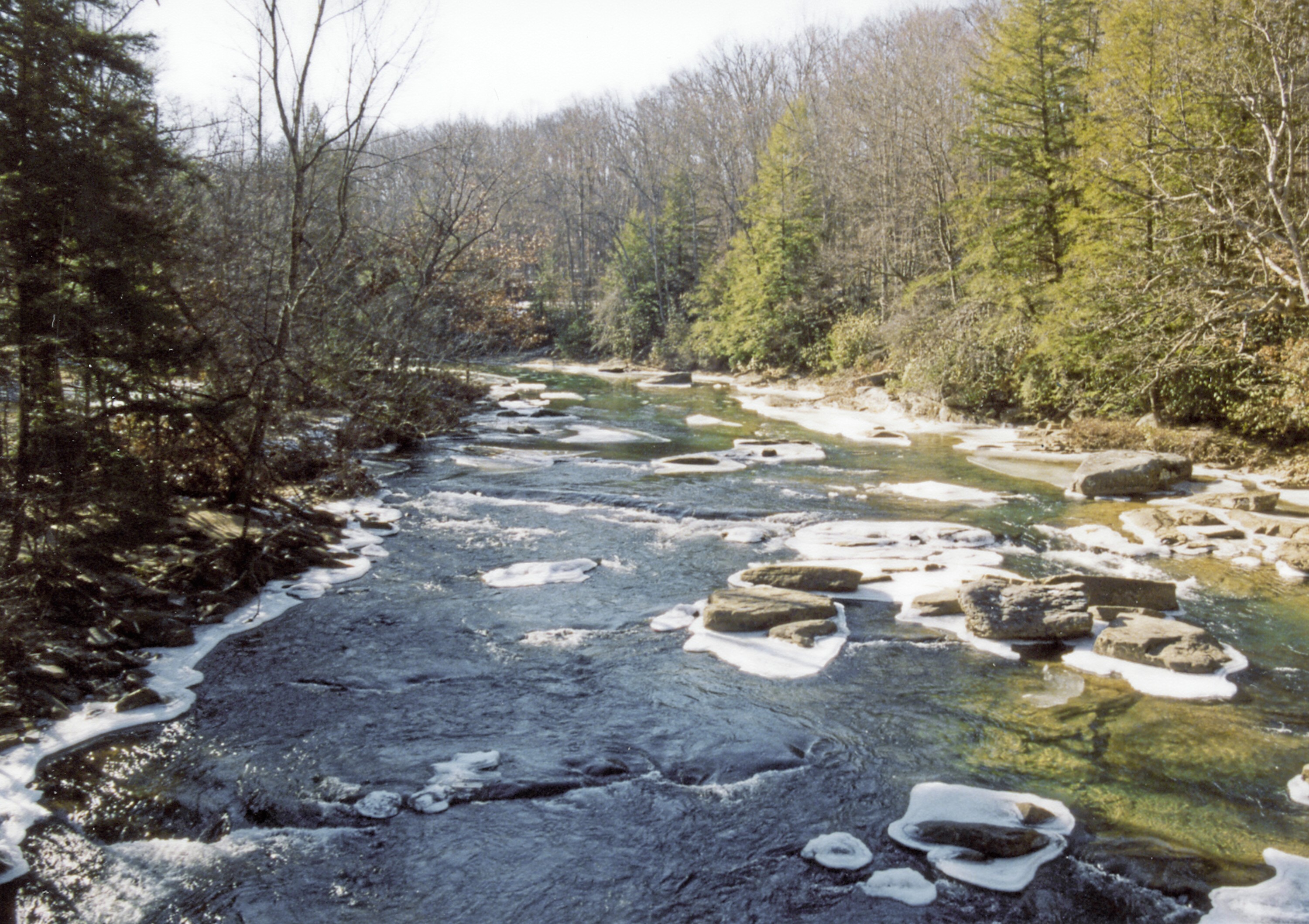
Middle Fork River River 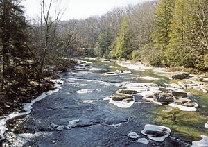 The Middle Fork River in Audra State Park in 2005
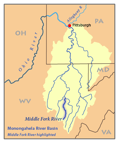
Country United States State West Virginia Source Kittle Creek - location Rich Mountain, Randolph County - elevation 3,639 ft (1,109 m) [1] - coordinates 38°40′03″N 80°04′45″W / 38.6675°N 80.07917°W [2] Secondary source Birch Fork - location Rocky Ridge, Randolph County - elevation 3,493 ft (1,065 m) [1] - coordinates 38°40′47″N 80°05′58″W / 38.67972°N 80.09944°W [3] Source confluence - location Adolph, West Virginia, Randolph County - elevation 2,303 ft (702 m) [2] - coordinates 38°44′44″N 80°02′47″W / 38.74556°N 80.04639°W [4] Mouth Tygart Valley River - location Barbour County - elevation 1,483 ft (452 m) [4] - coordinates 39°03′41″N 80°02′51″W / 39.06139°N 80.0475°W [4] Length 35 mi (56 km) [5] Basin 152 sq mi (394 km2) [6] Discharge for Audra State Park - average 356 cu ft/s (10 m3/s) [7] - max 16,700 cu ft/s (473 m3/s) - min 0.2 cu ft/s (0 m3/s)  Map of the Monongahela River basin, with the Middle Fork River highlighted
The Middle Fork River is a 35.4-mile-long (57.0 km)[5] tributary of the Tygart Valley River in north-central West Virginia, USA. Via the Tygart Valley, Monongahela and Ohio rivers, it is part of the watershed of the Mississippi River, draining an area of 152 square miles (390 km2) on the easternmost part of the unglaciated portion of the Allegheny Plateau. According to the Geographic Names Information System, the Middle Fork River has also been known simply as "Middle Fork" and as "Middlefork."[4]
Contents
Geography
The Middle Fork River is formed at the community of Adolph in western Randolph County by the confluence of the headwaters tributaries Kittle Creek and Birch Fork, each approximately 6.5 miles (10.5 km) in length, which rise just north of Kumbrabow State Forest and flow northwardly. Kittle Creek rises on the western slope of Rich Mountain, considered to be part of the westernmost ridge of the Allegheny Mountains and the eastern boundary of the Allegheny Plateau.[2][3][8][9]
From Adolph, the Middle Fork River flows generally northwardly, roughly in parallel to Rich Mountain. The river's course defines part of the boundary between Randolph and Upshur counties, and then between Upshur and Barbour counties, before flowing into southern Barbour County, where it joins the Tygart Valley River, approximately 5 miles (8 km) south of Philippi and a few miles upstream of the mouth of the Buckhannon River.[8] Near its mouth it passes through Audra State Park, which was established in the mid-20th century and provides campsites and a swimming beach along the river.[10] In Upshur County it collects a tributary known as the Right Fork Middle Fork River,[11] which rises in southwestern Randolph County and flows northwardly into eastern Upshur County.[8]
For most of its course, the Middle Fork forms whitewater rapids of Class I to Class IV on the International Scale of River Difficulty. From Audra State Park downstream to its mouth, it forms Class IV rapids.[12] According to the West Virginia Department of Environmental Protection, approximately 94% of the Middle Fork River's watershed is forested, mostly deciduous, and approximately 4% is used for agriculture and pasture.[6]
Flow rate
At the United States Geological Survey's stream gauge in Audra State Park, the annual mean flow of the river between 1942 and 2005 was 356 ft³/s (10 m³/s). The highest recorded flow during the period was 16,700 ft³/s (473 m³/s) on May 17, 1996. The lowest recorded flow was 0.2 ft³/s (0 m³/s) on several days in October 1953.[7]
See also
- List of West Virginia rivers
References
- ^ a b Google Earth elevation for GNIS source coordinates. Retrieved on 2007-03-26.
- ^ a b c Geographic Names Information System. "Geographic Names Information System entry for Kittle Creek (Feature ID #1551657)". http://geonames.usgs.gov/pls/gnispublic/f?p=gnispq:3:::NO::P3_FID:1551657. Retrieved 2007-03-26.
- ^ a b Geographic Names Information System. "Geographic Names Information System entry for Birch Fork (Feature ID #1550360)". http://geonames.usgs.gov/pls/gnispublic/f?p=gnispq:3:::NO::P3_FID:1550360. Retrieved 2007-03-26.
- ^ a b c d Geographic Names Information System. "Geographic Names Information System entry for Middle Fork River (Feature ID #1552064)". http://geonames.usgs.gov/pls/gnispublic/f?p=gnispq:3:::NO::P3_FID:1552064. Retrieved 2007-03-26.
- ^ a b U.S. Geological Survey. National Hydrography Dataset high-resolution flowline data. The National Map, accessed August 15, 2011
- ^ a b West Virginia Department of Environmental Protection. "Watershed Atlas Project.". pp. Tygart Valley River watershed. Archived from the original on 2006-05-07. http://web.archive.org/web/20050404165853/www.dep.state.wv.us/watershed/. Retrieved 2007-03-26.
- ^ a b Ward, S. M.; G. R. Crosby. "Water Resources Data, West Virginia, Water Year 2005". United States Geological Survey. pp. Monongahela River Basin. http://pubs.usgs.gov/wdr/2005/wdr-wv-05-1/. Retrieved 2007-05-20.
- ^ a b c West Virginia Atlas & Gazetteer. Yarmouth, Me.: DeLorme. 1997. pp. 36–37, 46–47. ISBN 0-89933-246-3.
- ^ Adkins, Howard G. (2006). "Allegheny Mountains". In Ken Sullivan (ed.). The West Virginia Encyclopedia. Charleston, W.Va.: West Virginia Humanities Council. pp. 10. ISBN 0-9778498-0-5.
- ^ Ken Sullivan (ed.), ed (2006). "Audra State Park". The West Virginia Encyclopedia. Charleston, W.Va.: West Virginia Humanities Council. pp. 31. ISBN 0-9778498-0-5.
- ^ Geographic Names Information System. "Geographic Names Information System entry for Right Fork Middle Fork River (Feature ID #1552662)". http://geonames.usgs.gov/pls/gnispublic/f?p=gnispq:3:::NO::P3_FID:1552662. Retrieved 2007-03-26.
- ^ Davidson, Paul; Ward Eister, Dirk Davidson, Charlie Walbridge (1995). Wildwater West Virginia (4th ed. ed.). Birmingham, Ala.: Menasha Ridge Press. pp. 133–136. ISBN 0-89732-156-1.
Categories:- Rivers of West Virginia
- Geography of Randolph County, West Virginia
- Geography of Upshur County, West Virginia
- Geography of Barbour County, West Virginia
- Tributaries of the Monongahela River
Wikimedia Foundation. 2010.