- Mill Creek Wildlife Management Area
-
Mill Creek Wildlife Management Area West Virginia Wildlife Management Area 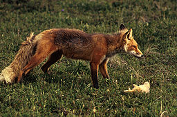 Red Fox (Vulpes vulpes) may be found in the Mill Creek WMA
Country United States State West Virginia Counties Cabell Elevation 613 ft (186.8 m) [1] Coordinates 38°27′50″N 82°06′57″W / 38.46389°N 82.11583°W Area 1,470 acres (594.9 ha) [2] Management Wildlife Resources Section, WV Division of Natural Resources Owner WVDNR IUCN category IV - Habitat/Species government Area Nearest town Milton, West Virginia 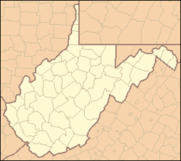
 Location of Mill Creek Wildlife Management Area in West Virginia
Mill Creek Wildlife Management Area is 1,470 acres (590 ha) of steeply forested woodlands located near Milton, West Virginia in Cabell County. Mill Creek WMA can be accessed from Johns Creek Road about three miles north from the Milton exit of I-64.[2]
Contents
Hunting and Fishing
Hunting opportunities include deer, fox, grouse, rabbit, raccoon, squirrel.[2]
Camping is not available in the WMA. Camping is available at nearby Fox Fire Resort.[3]
See also
- Animal conservation
- Hunting
- List of West Virginia wildlife management areas
References
- ^ Acme Mapper 2.0, Mill Creek WMA, retrieved December 13, 2008
- ^ a b c "Mill Creek WMA page". West Virginia DNR website. WV Division of Natural Resources. http://www.wvdnr.gov/Hunting/D5WMAareas.shtm#65d5. Retrieved December 13, 2008.
- ^ "Fox Fire Resort Home Page". 2008. http://www.foxfirewv.com/. Retrieved 2008-12-13.
External links
- West Virginia DNR District 5 Wildlife Management Areas
- West Virginia Hunting Regulations
- West Virginia Fishing Regulations
Categories:- Wildlife Management Areas of West Virginia
- Protected areas of Cabell County, West Virginia


Wikimedia Foundation. 2010.